My Journey

BigDawwg.....cool stuff there BD.....


We headed south on Highway 191 out of Jackson, Wyoming, followed the meanders of the Snake River, and at the "Y" in the road (which is now actually a traffic circle), we took the highway to the left and continued down Highway 191.....my goal here was simple.....I wanted to view the Wind River Mountain Range.....

20211102_103319_copy_1600x2844.jpg

20211102_103328_copy_1600x2844.jpg

The problem that we faced was the rain and the low cloud level.....

20211102_103251_copy_1600x2844.jpg

Highway 191 follows the flow of the Hoback River as it passes through Hoback Canyon.....

20211102_105724_copy_1600x900.jpg

I spotted what appeared to me to be caves along a cliff on the north side of the highway.....we stopped to have a look.....

20211102_105607_copy_1600x2844.jpg

20211102_105713_copy_1600x2844.jpg

An interesting roadside sign was located at our stopping point.....

20211102_104626_copy_1600x900.jpg

I believe the entire canyon was maybe ten miles.....

20211102_105456_copy_1600x900.jpg

20211102_105502_copy_1600x900.jpg

We stopped once more as we exited the canyon.....sure wish we could have seen more.....

20211102_111747_copy_1600x900.jpg
 
My desire to see the snow covered Wind River Mountain Range was strong so I decided that we needed to slow down and wait for the bad weather to pass us by.....

20211102_123648_copy_1600x2844.jpg

We spent the afternoon here watching the sky as it finally began to clear just a bit.....

20211102_121332_copy_1600x900.jpg

20211102_121327_copy_1600x900.jpg

We hiked up the forest service road and we hiked along several trails that we happened upon.....this was elk country.....and that meant that the hunters were here.....not the best place to be out wandering.....

20211102_121615_copy_1600x388.jpg

20211102_121552_copy_1600x2844.jpg

It was late in the afternoon when we stopped at the BLM office in Pinedale, Wyoming to enquire about Freemont Lake.....our home for the next three days.....this place was crawling with mule deer.....

20211103_094045_copy_1600x2844.jpg

20211103_094031_copy_1600x2844.jpg

The following day brought us blue skies.....

20211103_133045_copy_1600x503.jpg

20211103_092750_copy_1600x900.jpg

This was a good place.....

20211103_102140_copy_1600x900.jpg
 
Jbynum.....sure thing.....


So the first thing we did after setting up camp at at Freemont Lake was to jump into the Jeep and go hiking .....

20211103_130832_copy_1600x900.jpg

I decided to hike on a trail along Half Moon Lake.....a lake to the northeast that was much more remote than Freemont Lake.....

20211103_123942_copy_1600x2844.jpg

This was Grizzly country.....and once we got out onto the trail I could easily see why.....this place was pristine.....the kind of place that makes you think there's a bear in every valley.....

20211103_123950_copy_1600x2844.jpg

Of course we didn't actually see any bears that day.....

20211103_124602_copy_1600x900.jpg

20211103_124715_copy_1600x2844.jpg

It was a great day of hiking with amazing views and finally.....the perfect weather was here.....

20211103_125220_copy_1600x351.jpg

20211103_125251_copy_1600x2844.jpg

The next three photos brought a smile to my face.....I had not expected to see Trapper in any of my landscape photos.....but there she was.....

20211103_125210_copy_1600x398.jpg

20211103_124420_copy_1600x900.jpg

20211103_125140_copy_1600x900.jpg
 

pkripper

Member
Teton Mountaineering and Images of Nature are my two favorite shops in Jackson. Great to see the team out and about again. Safe journeys!!!
 

Foy

Explorer
I'd wager the caves you found were paleokarst horizon features within the Madison Group, the very same thick limestones in which the ice cave in the Big Snowy Range, the nearby cascade, and the Big Spring near Lewistown emanated. The Madison Group is regionally extensive--(under different stratigraphic names it is exposed and occurs in the subsurface down through CO and into NM and AZ. In MT and WY, Madison Group rocks normally form resistant ridges and cliffs of massive gray thick-bedded limestone appearing a lot like the rocks in the sequence you photographed in Hoback Canyon.
It was enjoyable to follow the cabin build and just as enjoyable to follow the present trip south. Thanks for taking the time.

Foy
 
pkripper.....thank you.....

Foy.....I thought about you just yesterday as I was driving along Highway 191 in northeast Utah. The BLM has signs along the highway depicting what was in the ground. The last sign I saw was right before a massive open mine just north of Vernal, Utah.....that sign said something about phosphate.....I'm guessing that was the mineral that they were extracting ? Thanks for chiming in.....more caves coming.....


We took the Jeep as far up the mountain as we possibly could.....the road ends at the boundary to the Bridger Wilderness Area.....the views along the way looking back across Freemont Lake and beyond to the Salt River Mountain Range were stellar.....

20211103_132827_copy_1600x352.jpg

Sometimes I share my viewpoint with Trapper.....

20211103_133234_copy_1600x900.jpg

Either way.....like I said.....the views from up there were stellar.....

20211103_133045_copy_1600x503.jpg

20211103_132910_copy_1600x900.jpg

20211103_132901_copy_1600x900.jpg

At 9,200 feet in elevation there's a pull out to view the Wind River Mountain Range.....

20211103_134128_copy_1600x900.jpg

We parked the Jeep and walked until we came to the roads end.....

20211103_134222_copy_1600x900.jpg

20211103_134211_copy_1600x900.jpg

For me.....there's just something so mystical about the Wind River Mountain Range.....the jagged snow covered peaks, the stunning beauty, and its remoteness all factor in.....

20211103_134149_copy_1600x390.jpg

20211103_134753_copy_1600x900.jpg
 

Foy

Explorer
Yessir, Jerry, phosphate is mined out of the Phosphoria Formation near Vernal, UT. Like the Madison Group limestones, the Phosphoria Formation is present over a huge part of the West, outcropping in MT, ID, UT, and WY. Phosphate mines occur at many locations in the Phosphoria Fm. It also includes highly organic shales which are petroleum source rocks. Some of the Phosphoria Fm has uranium and vanadium values but to the best of my knowledge little production comes from it.
Foy
 

BigDawwg

-[Gettin-it Done]-
Jerry,,,,, Ok, I've been meaning to ask you,,,, when your in high-density Bear Country with the Dog's, One on a Leash, or both, and is there a Leash-law in Yellowstone, just curious, as here in Alaska, there are Leash-laws in the Anchorage, and Mat-Su area's, but when I'm out and about here in Alaska,,,,,, Murphy's not on a "Leash".... !!!

So,,,,, there was a situation a few yr's back, up off of the Denali-Hiway, up the McClaren River a couple were out walking with their dog on a leash, trail got alittle narrow, they were single-file, Dog in the lead of course, had an encounter with a Sow and cubs, Dog got loose, leash flapping in the wind behind the Dog, Dog leash got wrapped around some pucker brush, Dog was staked-out as Bait at that point,,,,, the Sow was coming back for the Dog, and or the Guy which had just caught-up to where the Dog was wrapped-up, pulled his Hand-Gun and was ready, his wife had Bear-Spray, she was ready, the Sow ended-up Bluff Charging,,,,,, the Dog was taken of the leash at that point, and they worked their way back down the Trail......
My thoughts,,,,,, they got Lucky......
BD in Alaska.... :cool:
 
Foy.....open mining sure does suck.....

BigDawwg.....I only carry bear spray with me in Grizzly country cause I prefer people saying "that damn fool even had bear spray and the bear still got him" as opposed to "that damn fool didn't even have bear spray no wonder the bear got him".....I wouldn't stand a chance with two dogs on leash.....

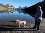
In that last photo of Trapper swimming in Freemont Lake she actually has a sixteen foot retractable leash attached to her. It slipped through my fingers as she lunged for the lake water. I was stressing that the leash would snag on a submerged branch or stump and then I'd be up to my neck (literally) with trouble.....


The Forest Service was in the middle of a controlled burn while we were up there.....

20211103_135232_copy_1600x900.jpg

So these places that my mind was telling me would be teeming with Grizzly Bears were not.....

20211103_134540_copy_1600x900.jpg

20211103_134411_copy_1600x900.jpg

20211103_134405_copy_1600x900.jpg

We turned around at the trailhead at the end of the road.....we had done enough for one day.....

20211103_134753_copy_1600x900.jpg

20211103_135734_copy_1600x2844.jpg

.....and we made a few more stops as we descended the mountain and returned to our campsite.....

20211103_150727_copy_1600x900.jpg

Tanner so loves the life on the road.....this really is all he knows.....well, maybe a little cabin building too.....

20211103_145018_copy_1600x900.jpg

20211103_145022_copy_1600x900.jpg
 
Last edited:

longhorn1

Observer
We loved the Winds, coming from the South. A long and bumpy road to a beautiful view of the lake and Winds. The campground (USFS) was empty and free. The Continental Divide Trail works it's way along the lake.
 
Last edited:

longhorn1

Observer
Coming from the south in 2016, we stopped at the brewery in Pinedale for lunch and beers, then headed through Cora up around the North end of the Winds to Green River Lakes, camping at the Forest Service campground. The drive out of Cora was 7766.jpeg7771.jpegbumpy and maybe 1/1/2 hours. For one night the views were worth it. Next time we will stay 3-4 days. One of my favorite pictures is Square Top above the fog as we left Great pictures as usual. Love seeing the dogs swimming. Driving on the East side of the Winds, through the reservation, is supposed to be a good drive.
 
Last edited:
JD.....it's an amazing place.....i always wished that I had taken the time to climb Gannett Peak (13,804').....Wyoming's highest peak. It's a 40 to 50 mile roundtrip hike usually taking at least 3 days to summit. No doubt it would have been epic.....


Back at the campsite the dogs shared a single antler that they'd found along the banks of Half Moon Lake.....

20211104_140432_copy_1600x900.jpg

20211103_170714_copy_1600x900.jpg

They also kept watch for Grizzlies.....here they are mesmerized by a lone chipmunk.....

20211104_111331_copy_1600x900.jpg

I chose to stay in the campground during our stay at Freemont Lake.....simple reason.....50 mostly secluded campsites along over two miles of shoreline and we were the only ones there.....

20211104_115226_copy_1024x1820.jpg

The campground was closed for the season which simply meant no toilets and no water which meant no problem for us.....it was free (typically $12 per night).....

20211104_071726_copy_1600x900.jpg

This place was a paradise.....

20211104_095547_copy_1600x265.jpg

20211104_071431_copy_1600x900.jpg

20211103_185128_copy_1600x900.jpg

.....and it was difficult to leave.....

20211104_095535_copy_1600x900.jpg

20211104_095529_copy_1600x900.jpg
 
We had some great skies during our stay.....waves over the Wind River Range.....

20211104_122453_copy_1600x900.jpg

We caught every sunrise & every sunset.....

20211104_154707_copy_1600x287.jpg

20211104_180052_copy_1600x900.jpg

20211104_180135_copy_1600x2844.jpg

And everything in between.....

20211104_180005_copy_1600x210.jpg

20211104_182232_copy_1600x900.jpg

Magical place in every way.....

20211104_181927_copy_1600x287.jpg

My favorite moment in time here was without a doubt this sunrise.....

20211104_081504_copy_1600x900.jpg

20211104_081340_copy_1600x900_1.jpg

.....and my favorite photo during our 3 day stay was without a doubt this one.....

20211104_081318_copy_1600x357.jpg
 

longhorn1

Observer
Another photo of the Winds. Having the campground to yourself is the best. We sold our camper Sunday and take delivery of an Oliver Travel Trailer with off road capability, but not like the Four Wheel Camper. Our F250 will become your jeep.
 

Attachments

  • 7772_copy_1632x918.jpeg
    7772_copy_1632x918.jpeg
    393 KB · Views: 33

Forum statistics

Threads
188,214
Messages
2,903,886
Members
229,665
Latest member
SANelson
Top