My Journey

Riversdad

Active member
Black Butte (6,119') certainly was not a difficult climb although we did face a few challenges. First off, climbing in Grizzly country is a bit challenging cause you're constantly on the watch. The picture below shows a portion of the Greater Yellowstone Ecosystem.....and it is within this area that this entire trip took place. The dark green area indicates the Total Grizzly Bear Occupied Area. The individual black bears indicate sightings of Grizzly Bears that have wandered beyond their normal range. The brown line indicates Interstate 90 and Black Butte lies just south (below) Interstate 90 (the brown line).....

View attachment 849428

Our other challenge, while not significant, was picking our route to the summit. This was yet another mountain that had no trails.....complete bushwacking.....

View attachment 849429

We hiked up the road maybe a bit more than a mile, then headed straight up the western slope of the mountain.....

View attachment 849430

We had to stay clear of a north south running rock band along the saddle.....

View attachment 849431

And then made our way to the actual summit.....

View attachment 849432

I had packed myself a lunch (which of course I had to share with my best friends) and brought along a bag of dog treats. We sat in the rocks, kicked back, and enjoyed our meal as well as the fantastic views.....

View attachment 849433

View attachment 849434

Before leaving, of course, I needed to get my pictures of the dogs on the summit.....it's probably a tradition by now.....

View attachment 849435

View attachment 849436

"It's not what we have in life, but who we have in our lives that matters".....

View attachment 849437
You and your friends are certainly living the good life. Thanks for taking us along and giving me ideas for places to take my furry family.
 

ITTOG

Well-known member
Beautiful pictures and life. I always enjoy the summit pic's.

I have a backpacking trip in bear country coming up soon. The national park does not allow bear spray. Crazy. I guess I will need to take my pistol? That probably isn't allowed either. Do they notify the bears that attacking humans are not allowed?
 

fisher205

Explorer
Beautiful pictures and life. I always enjoy the summit pic's.

I have a backpacking trip in bear country coming up soon. The national park does not allow bear spray. Crazy. I guess I will need to take my pistol? That probably isn't allowed either. Do they notify the bears that attacking humans are not allowed?
What National Park doesn't allow bear spray? Carry it all the time in Grand Teton and Yellowstone.
 
Riversdad.....more to come ! It's my pleasure.....

fisher205.....I wondered the same thing.....

ITTOG.....I too love the summit pics. I have quite the collection. Regarding black bears (for what it's worth), I wouldn't stress over black bears. You can pet them safely.....you just have to be gentle. It's them Grizzlies that will eat you. Good luck and stay safe and post a trip report with lots of pictures (please !).....


We spent another night along that random forest service road, then we awoke early and got back onto the road. We returned to Big Timber, Montana, took Interstate 90 east, left the interstate at Columbus, Montana, and then drove south, back into the Absaroka Mountain Range.....

20240811_155512_copy_1600x747.jpg

Somewhere south of Fishtail, Montana we left the paved road behind, then drove along some of the worst washboard Forest Service Roads that I've ever driven on.....
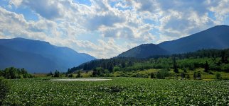
20240811_155715_copy_1600x747.jpg

I actually considered turning around.....aborting our newly laid out plans. But we were headed for a place named Mystic  Lake.....we just had to go on.....and so it was that we suffered onward.....
20240811_115254_copy_1600x747.jpg

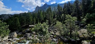
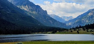
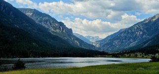
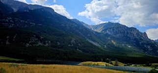
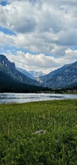
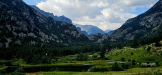
There were actually three sensational lakes in a row.....feeding off the same mountain stream.....the first two.....Emerald Lake & West Rosebud Lake were easily accessible by the Forest Service Road. But the third.....the lake that we wanted to visit.....was only accessible by foot.....
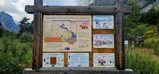
20240811_120338_copy_1600x747.jpg

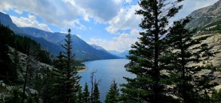
It was the name that I saw on the map that caught my eye the night before.....was this the "truly majestic place" that we were looking for ? Well, initially it didn't look that way. I mean everything was spectacular here except for there was this huge white pipe & rail line running off the mountainside.....
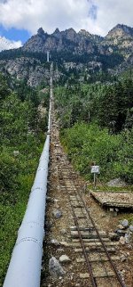
20240811_121356_copy_349x747.jpg

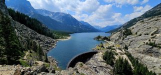
How bad could it be ? Apparently Mystic Lake had a manmade dam built at it's lower end.....I couldn't help wonder how much damage man had done.....
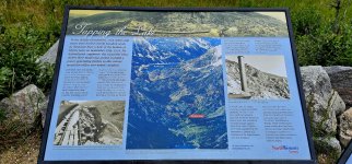
20240811_121420_copy_1600x747.jpg

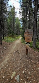
We hit the trail with the most optimistic hopes in our hearts.....the hike in was amazing.....but honestly I just struggled with ignoring that massive white pipe running along the mountainside.....the trail, it paralleled the creek that flowed downward from Mystic Lake.....

20240811_150325_copy_1600x747.jpg

20240811_122814_copy_1600x747.jpg

Eventually the trail climbed higher, departing the creek, yet still pretty much paralleling it.....
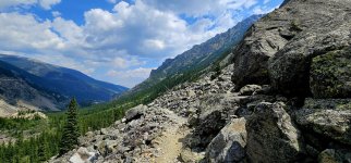
20240811_125929_copy_1600x747.jpg

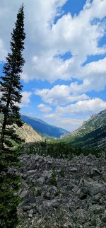
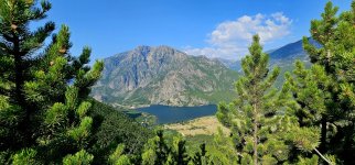
The views from up high were breathtaking.....I looked at the surrounding mountains and thought that I wanted to climb everyone of them.....
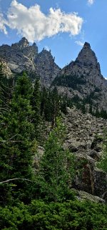
20240811_143553_copy_349x747.jpg
 
Last edited:
Arjan.....well put.....sometimes it's a better fit than others. This lake seemed to be too remote for these manmade "improvements"......at least that's how I see it.....

fisher205.....just one more reason to stay out of bars.....


At the highest point in the trail.....maybe two or three hundred feet above Mystic Lake.....

20240811_141916_copy_349x747.jpg

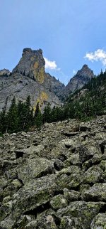
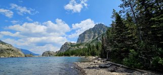
.....we saw this absolutely majical scene.....to our left were the towering rock cliffs.....

20240811_142407_copy_349x747.jpg

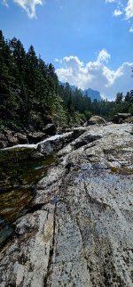
Down below we could hear the roar of the water as it tumbled across the rocks in the stream.....
20240811_150312_copy_349x747.jpg

.....and from that vantage point, we looked straight ahead.....and we possibly "witnessed something truly majestic".....I guess everyone that sees this can judge for themselves.....
20240811_140633_copy_1600x747.jpg

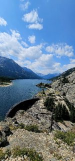
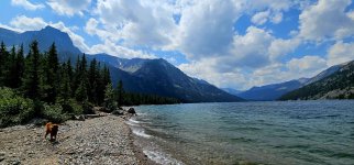
We continued down the trail and got our first views of the dam that was constructed in 1924.....hmmmm.....I thought it almost had this artistic look about it......somehow it didn't seem to ruin the views.....
20240811_131834_copy_1600x747.jpg

20240811_131841_copy_349x747.jpg

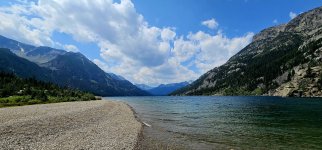
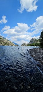
The trail continued along the left side of the lake.....along that beach that was covered in small peebles.....
20240811_132941_copy_1600x747.jpg

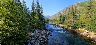
We continued on hiking along the shoreline.....along the left side of the lake. The dogs, of course, jumped right in.....I didnt.....
20240811_133456_copy_1600x747.jpg

20240811_133057_copy_1600x747.jpg

20240811_133026_copy_349x747.jpg
 
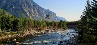
I suspect we walked a mile or so up the shoreline before deciding to turn around.....
20240811_134416_copy_1600x747.jpg

20240811_134225_copy_349x747.jpg

20240811_134214_copy_349x747.jpg

I gave thought to hiking up a side trail which appeared to go into the rocky cliffs but the day was no longer young.....so we turned back after hiking it for less than a mile or so.....

20240811_123620_copy_1200x2570.jpg

We backtracked down the main trail, returned to the rig, and on our way out we decided to visit both Emerald Lake & West Rosebud Lake.....

20240811_114435_copy_1600x747.jpg

20240811_114322_copy_1600x747.jpg

20240811_114841_copy_1600x747.jpg

20240811_114330_copy_349x747.jpg

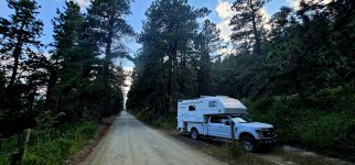
That evening we pulled off to the side of that horrible washboard Forest Service road and spent a quite night in the wilderness......where it too could be described as pure bliss.....

20240811_184311_copy_1600x747.jpg
 
ITTOG.....thanks.....I agree on the similarities.....love having these places in my backyard.....

Ace.....it is an amazing sequence of lakes.....I agree.....


Our next little adventure consisted of a climb to the summit of Crow Mountain (9,695').....and afterwards, we adventured just a little bit more.....

20240812_075948_copy_1600x747.jpg

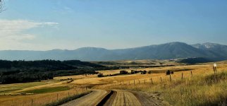
We backtracked, once again, through Fishtail, Montana.....drove more backroads, connected with Highway 78.....passed through Roscoe, Montana.....then drove south on yet another back road.....

20240812_080145_copy_1600x747.jpg

I'm not sure if the timing could have been more perfect.....perfect weather and the motor grader was just passing through.....

20240812_080259_copy_1600x747.jpg

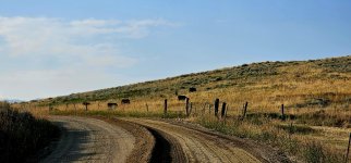
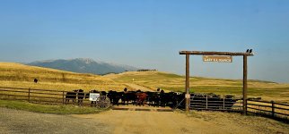
It was a welcomed sight to see (even the cattle were into it).....especially after having been beat to death just a few days prior on that washboard Forest Service road.....

20240812_080841_copy_1600x747.jpg

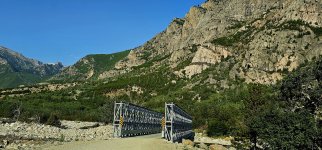
As we neared the trailhead & Alpine Lake, we passed over this kind of cool looking bridge.....

20240812_083846_copy_1600x747.jpg

.....that spanned over the East Rosebud Creek.....

20240812_084842_copy_1600x747.jpg

20240812_084833_copy_1600x747.jpg

The trailhead was located right next to Alpine Lake.....just the name made me think that this lake would be sensational.....it wasn't.....rustic log cabins built years ago, and dirt roads surrounded the entire one side of the lake.....

20240812_095217_copy_1600x747.jpg

The trailhead, at roughly 6,200' above sea level, was located in some really thick underbrush and dwarf pine trees.....you couldn't see more than ten feet either side of the trail. We hadn't gone more than a quarter mile up that trail before seeing our first pile of bear scat.....one of many piles of scat seen that day.....

20240812_091851_copy_349x747.jpg

I would have to say that this was one of the finest trails that I've hiked on in a very long time.....and I think that's saying a lot cause I do spend a good bit of time hiking the trails.....

20240812_101739_copy_1600x747.jpg
 
There was one tell tale sign from inspecting the bear scat.....it was Huckleberry season. As we got up higher, I began to notice that the trail wound through many Huckleberry patches.....

20240812_151920_copy_1200x2570.jpg

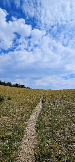
As we neared a saddle on the mountain, the trail passed through an area mostly bare of trees.....

20240812_113032_copy_1600x747.jpg

Then we finally reached the saddle.....after about 3 or 4 miles of hiking.....now at an elevation of roughly 9,500' above sea level.....

20240812_113441_copy_349x747.jpg

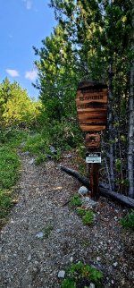
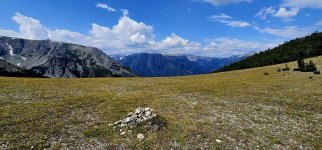
The trail continued on.....marked by stone cairns.....wandered down the other side of the mountain.....

20240812_113728_copy_1600x747.jpg

But for us.....wanting to summit the mountain.....we departed the trail and now bushwacked our way through this amazing pine forest. I swear that every step we took here, I thought that we would awaken a Grizzly Bear.....

20240812_123901_copy_1600x747.jpg

20240812_122446_copy_1600x747.jpg

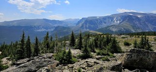
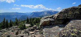
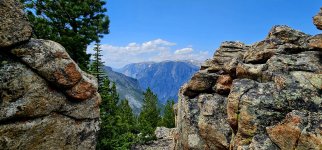
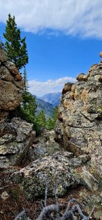
We came across astonishing rock formations and we seemed to stop at everyone to have a look at the mountains and valleys beyond.....

20240812_120004_copy_1600x747.jpg

20240812_115935_copy_349x747.jpg

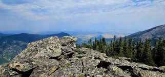
We sat on a stone pile at the unmarked summit.....some stones as big as my Ford truck.....

20240812_122453_copy_1600x747.jpg

We ate our lunch here and quenched our thirst.....and thought.....should we go down.....or should we go on.....

20240812_123616_copy_349x747.jpg
 

Forum statistics

Threads
188,342
Messages
2,905,815
Members
229,959
Latest member
bdpkauai
Top