Our version of the Coast Mountain route September 2018

Been meaning to share this for some time, so here it is. Took this trip on a whim last September. We (me, my wife, 16 year old daughter and 9 year old son) originally planned to head out to one of our usual sites to hunt the youth season with our daughter, but craziness at work and life meant we had little time to plan. Instead, at 5PM on Friday, we made a decision to load the truck and take a back country route we've always wanted to see. Food was purchased, supplies and tent packed in the truck, and at 6:00 AM Saturday morning we were off. About two hours later we found ourselves heading north on Hwy 12 from Lytton to Lillooet.
IMG_0161.JPG


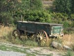
Lots of stops for photos on the way (our daughter had just received her first DSLR as a birthday gift so she had lots of opportunity to use it. A beautiful wagon along the side of the road in someones front yard
IMG_0094.JPG


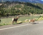
Wild sheep crossed the road right in front of the truck. Our 9 year old son thought this was fantastic.
1550525696760.png

After passing through the vineyards in Lillooet
IMG_0047.JPG

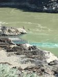
We were fascinated by the First Nations fishers using traditional dipnetting practises on the Fraser River. We stayed here and watched for quite a while, gain respect for the amount of effort it took to land a single fish. Drying racks held salmon in the hot Lillooet sun. Sorry the picture is blurry, it was quite a distance away
IMG_0057.JPG

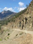
Realizing we had many miles (kilometres) to cover yet, we moved on and crossed the Bridge River on to the start of the Lillooet Pioneer Road. For the rest of the day we would be on gravel and out of cell service.
zx36abPlRKGEnBEaQpsG4g.jpg
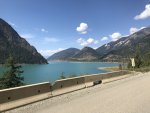
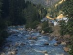
The Bridge River was an incredible hue of blue that mesmerized us as we travelled along it for quite some time.
lfAiXWTfS%iYJSUbKUY9xA.jpg
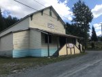
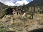
An abandoned cabin along the Pioneer Road. Spent some time here taking pictures.
lr1RVCeGTkuELDZThBFm6g.jpg
wf8BfatoT+CGJbFGDfQ4OQ.jpg
 

Attachments

  • IMG_0016.JPG
    IMG_0016.JPG
    940.7 KB · Views: 20
Carrying on, more pics of the river.a5t5WIzMTMi2ziRYCWiN8A.jpg
The Lillooet Pioneer Road. Road was in great shape, minimal traffic (car every 10 minutes maybe).
IMG_0122.JPG
Coming up to the Carpenter Lake Dam
pe4MLtq9T1aNwyv7Px6VRw.jpg
View from the top of the dam. We didn't actually take the route to Seton Portage on this day, kids just wanted to go through the tunnel, so we drove through, then returned to continue on to Goldbridge.
Gfk+7nlfTIGw+cTq+38TlQ.jpg
The tunnel
IMG_0102.JPG
Entering Goldbridge. Didn't get any pics in Goldbridge, ended up dealing with a nauseous dog so we were distracted.
IMG_0158.JPG

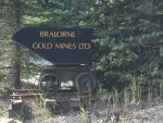
And Braelorne. Unfortunately they were ripping up most of main street so we had to detour around it. Didn't get to see much of town, but I have to say after all the hype it was somewhat disappointing. Maybe I built it up too much.

Gzd5XkYyQzmOSJnQH9lclg.jpg
IMG_0134.JPGIMG_0070.JPG

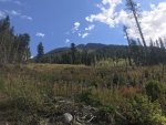
When the kids asked in the morning where we were going, my answer was 'I'm not sure, but I'd like to see Lillooet and Braelorne and we'll take it from there'. Throughout the day the plan became a little more certain and we decided to make a full loop via the Hurley to Pemberton, then D'arcy, Seton Portage via the High Line Road and back to Lillooet. All routes I had heard of for years but never travelled. So, after checking out the charms of Braelorne, we hit the Hurley Road to Pemberton. This seasonal road is closed during the winter, but was in decent shape this time of year. The alpine meadows were beautiful even though it was late in the season. We kept looking for bear but no luck.
yO37HavZQRa%Ku%sUD7RqA.jpg
 
The Hurley Road looking into the Pemberton Valley.
Z7wKZJV3Q4qX%iu3tG82pw.jpg
The lighting as we entered Pemberton was incredible. We finally saw a large black bear in this field but it was too far away to capture on camera.
KN%ufH61RLyi7tX01mhFZA.jpg
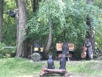
At this point it was after 4 in the afternoon and we need to make a decision where to camp. Because it was the Labour Day weekend, we knew it might be challenging, but we decided to continue on to D'arcy and try camp there. Unfortunately when we arrived there, all campsites were full so plan B was to take the High Line road to Seton Portage, fairly confident we'd find a clearing along the way to set up camp. Whimsical carvings beside the road in D'arcysLnJYizzQeyKZKI2CxR7Dg.jpg
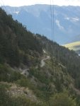
The Highline road had been in an active forest fire earlier in the summer, but my research seemed to indicate it was now safe. When we hit the start of it however, it was guarded so we were unsure if we'd be able to continue. But the guard simply warned us not to stop between kilometer marker 6 to 14 as it was still too dangerous in that area. Along the way there were miles of firehose at the edge of the road, and we could see the crews working several hundred yards to the side. The view from the High Line Road over Anderson Lake
IMG_0147.JPG
IMG_0006.JPGnCCjTzwXROa4uRdWq0ZlFA.jpg
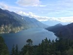
The Highline Road as it snakes along Anderson Lake
IMG_0080.JPG
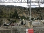
Entering the BC Hydro Power station at Seton Portage. It is powered by water from Carpenter Lake which is at a much higher elevation than Anderson Lake which it drains into. large pipes carry water down from Carpenter Lake
IMG_0165.JPGwbuaS5KQTf213r3CYGbfJg.jpg
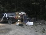
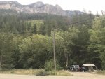
At this point it was close to 7 PM and we were all getting a little tired and ready to park the truck. Signs in Seton Portage seemed to indicate several campsites, but each led to dead ends, so in frustration we finally decided to continue on to Lillooet in the hopes we'd find somewhere to park along the way. After climbing the pass from SP to Carpenter Lake, we found ourselves back at the Carpenter Lake dam, where earlier in the day we'd taken some pics off the top of the dam. Just north of the dam was a small unserviced Forest Rec site (a pullout along the road). Close to 9 PM at this point, it seemed as good a place as any.
3iC1P76tTtqsKFFO6JtAJw.jpg
 
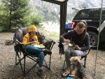
Dinner was made and we settled in for some rest.
134eTW5BQTSuRDGOU5wOwQ.jpg
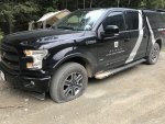
The next morning after a somewhat disturbed night of sleep (cars with boisterous passengers drove by at all hours of the night, often honking as they passed), we awoke to find a flat tire on the truck. Guess stock Goodyears weren't meant for these gravel roads.
eLlPyxfGT3u3N7ChB49+fg.jpg
After a leisurely breakfast and putting the spare tire on, we crossed the road for a better perspective on our campsite. While I've grown up in the coastal mountains, their majesty and grandeur still take my breath away
MqJfn3WWRvihTF5%3wa1Tg.jpg
5enPvg4MRnWYtfnXrGlmBQ.jpg
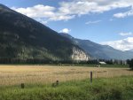
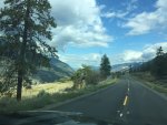
Back on the road to Lillooet. The layers in the mountains were very clear and we stopped for multiple pictures.
IMG_0113.JPG
After arriving back in Lillooet we decided to take Hwy 99 through Pavilion and over to Cache Creek, then Merritt and back home. I'll share those pics later. We thoroughly enjoyed this trip (even the kids) and are looking forward to more adventures.
 

Attachments

  • IMG_0113.JPG
    IMG_0113.JPG
    1.3 MB · Views: 13

Forum statistics

Threads
188,178
Messages
2,903,429
Members
229,665
Latest member
SANelson
Top