Mumbaki1037
Observer
Cool. Thanks. Good to know.
Sent from my iPhone using Tapatalk
Sent from my iPhone using Tapatalk


Hey all,
I found a lot of helpful info here and around the web and thought I'd condense what I found and now use for my trip planning into a video. Most of what I found was specific to a particular app or piece of hardware, so this is more of an end to end overview. Surely it's not the best solution for everyone, but it works perfectly for me. Hopefully it helps someone!
EDIT: Source link for viewing outside browser - http://youtu.be/cGkFGfdp27g
Thanks very much for putting this together. It was very helpful.
Do you mind sharing a little more info about how you imported the multiple map types into Google Earth Pro?
Nice post!
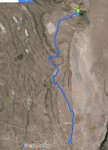
Perhaps you considered this, but for the route planning stage I use the My-Maps feature of Google maps to create routes. Create the route by using driving direction paths and the route will stick to roads. Its quite a bit quicker and much more accurate than creating a manual point to point route. You can then export the route to KML. Below is a screen capture of your route using My Maps.
One last question. When the KMZ file is brought into Garmin Basecamp it needs to be adjusted and it has way too many edit points. Is this normal? If I spend time fixing this whats to say it doesn't get messed up again when I export it as a GPX file?
View attachment 363690
Thanks!
I'm going to try to install a map for Garmin Basecamp.
I have downloaded the North America OpenStreetMap extract (8GB) but it is a .PBF file.
Has anyone installed an OpenStreetMap on Garmin Basecamp?
Garmin MapManager doesn't seem to recognize it.
C
A .PBF file is an OSM specific XML file and you can't import into BaseCamp without converting first. Two options - convert it your self using some software (for example http://www.mapwel.net/osm/osm.html) or download an already converted data set (for example https://www.gpsfiledepot.com/)
kfmeyers, Thank you for posting this. I use a combination of MotionX on my iPAD and Delorme Topo on my laptop and Delorme PN-60 GPS. I am toying around with the idea of getting a new laptop/ tablet and trying to get satellite imagery downloaded. I see that Basecamp has a feature to utilize satellite imagery from BirdsEye with an annual subscription. Have you tried this? If so, how are the images when zoomed in? Shame you can't just take portions of Google Earth offline, but I'm wondering if BirdsEye and Basecamp would be the next best thing? Since Garmin bought Delorme, they're sunsetting the Topo North America product and the satellite subscription ends June of 2017...so, there's that too that's pushing me to try something else.
