Overland Navigation - Overview and Tutorial

KellyM

Adventurer
Thanks for taking the time to put this together. I found it helpful, particularly on GE.

I too have a several different devices and programs including an inReach, iPad and Motion X. I also am thinking of getting a Garmin handheld since my current handheld is from the early 90s! I will download Base Camp now to get a feel for it.
 

Edroid

New member
Check out Rever. http://rever.co

They say they are for motorcycles, but I find it to be invaluable for planning and overland driving.

Great for planning, downloading map routes to your ipad or iphone, exporting to other apps. . .
 

Charlie56

Adventurer
Nice post!

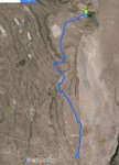
Perhaps you considered this, but for the route planning stage I use the My-Maps feature of Google maps to create routes. Create the route by using driving direction paths and the route will stick to roads. Its quite a bit quicker and much more accurate than creating a manual point to point route. You can then export the route to KML. Below is a screen capture of your route using My Maps.
My Map screen Capture.jpg

Also here is another route planning method.
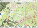
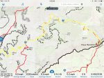
For US Forrest Service lands, the Forest Service makes Motor Vehicle Use Maps. By themselves they can be difficult at best to use because there are almost no landmarks or features on the maps except for the forest service roads. You can turn these MVUM's into digital maps that can be loaded into GAIA (I don’t know about Motion-X) The visibility of the MVUM layer can then be adjusted to highlight or fade the open roads. The process uses a program called map warper. Its time consuming, but the results are that you know what forest service roads are open or closed. Below is a iPad screen capture of just the Topo, and one with the MVUM overlay turned on.

IMG_0057.jpg
IMG_0056.jpg
 

gaap master

SE Expedition Society
Hey all,

I found a lot of helpful info here and around the web and thought I'd condense what I found and now use for my trip planning into a video. Most of what I found was specific to a particular app or piece of hardware, so this is more of an end to end overview. Surely it's not the best solution for everyone, but it works perfectly for me. Hopefully it helps someone!

EDIT: Source link for viewing outside browser - http://youtu.be/cGkFGfdp27g

Thanks very much for putting this together. It was very helpful.

Do you mind sharing a little more info about how you imported the multiple map types into Google Earth Pro?
 

kfmeyers

New member
Thanks very much for putting this together. It was very helpful.

Do you mind sharing a little more info about how you imported the multiple map types into Google Earth Pro?

You can visit CalTopo.com and register a user account. The free account gives you all the basic functionality, but to get the maps into Google Earth, you sign up for the $20/yr option.

To do that, you click on your name in the upper left corner and I believe you can do it on the "Account" tab on your profile. Then once you're done upgrading your account, they provide a link to a .kml file on the Account tab.

That might be a little vague, but I don't recall the step by step exactly.
 

Tiktaalik

Supporting Sponsor
Thanks for the tip! I am in the process of planning a trip to Baja and I am very much in the process of trying to figure out which route planning process works best for me. Any suggestions are appreciated. I have laid out the overall route using My-Maps and I have exported it to a KMZ file. There was a couple of small dirt-road destinations that didn't show up so I am hoping I can manually add those later. Is that possible?

I was planning to add my KMZ file into Garmin Basecamp as OP suggested in his video but I do not have a Garmin device. I have a Delorme Explorer and was planning to rely on either the Motion X app or HEMA Explorer app (North America) for navigating the route. Does this sound like good plan? I also downloaded Google Earth Pro. Do I need it or can I take the route directly into Basecamp? Does Basecamp offer ways to add notes about locations and will those transfer when I export the route?

Everyone seem to be relying on a combination of software so any suggestions for how I can simplify this process are highly appreciated. I could also bring the map into Earthmate (Delormes navigation app) because I already own the Delorme Explorer already and I suspect its going to have better GPS reception than using the built in GPS reciever in my iPhone but I don't think Earthmate's maps is as good as HEMA or Motion X. What do you think?

Also, I don't have any maps installed into Garmin Basecamp. What map do you recommend I install? Does anyone have the E32 Topo Map (Baja & Mexico)?

Nice post!

Perhaps you considered this, but for the route planning stage I use the My-Maps feature of Google maps to create routes. Create the route by using driving direction paths and the route will stick to roads. Its quite a bit quicker and much more accurate than creating a manual point to point route. You can then export the route to KML. Below is a screen capture of your route using My Maps.
 
Last edited:

Tiktaalik

Supporting Sponsor
One last question. When the KMZ file is brought into Garmin Basecamp it needs to be adjusted and it has way too many edit points. Is this normal? If I spend time fixing this whats to say it doesn't get messed up again when I export it as a GPX file?

Screen Shot 2016-08-28 at 3.24.38 PM.jpg
 

kfmeyers

New member
I've had the same result with MyMaps. You can get a rough track created in MyMaps, and then edit it in either Google Earth Pro (GEP) or Basecamp.

To edit in GEP, refer to the video.

I believe editing works similarly in Basecamp (in fact, removing large portions of a track is easier because you can 'shift + click' and select whole sections at a time...it will highlight that section on the map so you can be sure you're not deleting the wrong selection). Without owning a Garmin device, the Basecamp map is too plain to see any roads on it and you won't be able to load any maps into Basecamp. This is why I keep using GEP (Caltopo is also another great tool, however it doesn't have the geotagged photos and all the other great info that GEP provides).

In any solution, I'm not sure about adding notes and transferring them unless they are part of a waypoint. Whatever you choose to use, just create a folder and be sure all your tracks and waypoints are in that folder. When you export/import the folder, everything inside it will work...tracks and waypoints with notes.
 

kfmeyers

New member
One last question. When the KMZ file is brought into Garmin Basecamp it needs to be adjusted and it has way too many edit points. Is this normal? If I spend time fixing this whats to say it doesn't get messed up again when I export it as a GPX file?

View attachment 363690

I've found it pretty easy to get my edited routes mixed up in Basecamp. Editing is pretty easy. But keeping track of the different versions or even accidentally deleting the tracks makes it a little confusing...to me anyway.
 

Tiktaalik

Supporting Sponsor
Thanks!

I'm going to try to install a map for Garmin Basecamp.

I have downloaded the North America OpenStreetMap extract (8GB) but it is a .PBF file.

Has anyone installed an OpenStreetMap on Garmin Basecamp?

Garmin MapManager doesn't seem to recognize it.

C
 

flashkiwi

New member
Thanks!

I'm going to try to install a map for Garmin Basecamp.

I have downloaded the North America OpenStreetMap extract (8GB) but it is a .PBF file.

Has anyone installed an OpenStreetMap on Garmin Basecamp?

Garmin MapManager doesn't seem to recognize it.

C

A .PBF file is an OSM specific XML file and you can't import into BaseCamp without converting first. Two options - convert it your self using some software (for example http://www.mapwel.net/osm/osm.html) or download an already converted data set (for example https://www.gpsfiledepot.com/)
 

Tiktaalik

Supporting Sponsor
Thank you.

GPS Depot does not seem to have much available for Mexico and everything is split up. Their North America map is 6 years old. The PBF file I downloaded is the very latest North America map so I will try to convert that first. Does anyone already have Mapwel and would be up for converting my file? To satisfy my curiosity I will probably download the North America map from GPSfiledepot as well so I can compare the two if I get the other one successfully converted.

A .PBF file is an OSM specific XML file and you can't import into BaseCamp without converting first. Two options - convert it your self using some software (for example http://www.mapwel.net/osm/osm.html) or download an already converted data set (for example https://www.gpsfiledepot.com/)
 

tdesanto

Expedition Leader
kfmeyers, Thank you for posting this. I use a combination of MotionX on my iPAD and Delorme Topo on my laptop and Delorme PN-60 GPS. I am toying around with the idea of getting a new laptop/ tablet and trying to get satellite imagery downloaded. I see that Basecamp has a feature to utilize satellite imagery from BirdsEye with an annual subscription. Have you tried this? If so, how are the images when zoomed in? Shame you can't just take portions of Google Earth offline, but I'm wondering if BirdsEye and Basecamp would be the next best thing? Since Garmin bought Delorme, they're sunsetting the Topo North America product and the satellite subscription ends June of 2017...so, there's that too that's pushing me to try something else.
 

1Louder

Explorer
kfmeyers, Thank you for posting this. I use a combination of MotionX on my iPAD and Delorme Topo on my laptop and Delorme PN-60 GPS. I am toying around with the idea of getting a new laptop/ tablet and trying to get satellite imagery downloaded. I see that Basecamp has a feature to utilize satellite imagery from BirdsEye with an annual subscription. Have you tried this? If so, how are the images when zoomed in? Shame you can't just take portions of Google Earth offline, but I'm wondering if BirdsEye and Basecamp would be the next best thing? Since Garmin bought Delorme, they're sunsetting the Topo North America product and the satellite subscription ends June of 2017...so, there's that too that's pushing me to try something else.

Why not put Earthmate on your iPad? Maps are decent for Mexico. Also an app like GaiaGPS will let you download maps/layers for offline use. A number a bunch of satellite options. There are many map choices available. https://help.gaiagps.com/hc/en-us/articles/219073507

PocketEarth and Maps.me are also good options for your phone or tablet.
 

Forum statistics

Threads
188,342
Messages
2,905,813
Members
229,959
Latest member
bdpkauai
Top