You are using an out of date browser. It may not display this or other websites correctly.
You should upgrade or use an alternative browser.
You should upgrade or use an alternative browser.
Overland Navigator
- Thread starter craig
- Start date
Ray_G
Explorer
Figured I should post back a review of the Mid Atlantic Region maps; the software itself is, as one would expect, awesome and I've definitely enjoyed playing with the maps. I'm still learning all the functionalities of it but that's a matter of getting out and playing with it.
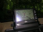
Here's an obligatory in motion shot from Shoe Creek a couple weeks ago.

Very happy with the whole setup.
r-
Ray
Here's an obligatory in motion shot from Shoe Creek a couple weeks ago.

Very happy with the whole setup.
r-
Ray
Hi, I just ordered the software and central and north CA maps. I will be using it on my toshiba tablet. My intention is this is a backup to my Lowrance Baja GPS. I had the antenna die last time I went out.
Any chance you will be offering 1m or better satellite imagery similar to Terrain Navigator Pro?
Can I create routes while sitting at home so I can follow them as I travel? I have numerous travel books with GPS coordinates given along the route.
P/S What version will I receive?
Any chance you will be offering 1m or better satellite imagery similar to Terrain Navigator Pro?
Can I create routes while sitting at home so I can follow them as I travel? I have numerous travel books with GPS coordinates given along the route.
P/S What version will I receive?
craig
Supporting Sponsor, Overland Certified OC0018
Hi, I just ordered the software and central and north CA maps. I will be using it on my toshiba tablet. My intention is this is a backup to my Lowrance Baja GPS. I had the antenna die last time I went out.
Any chance you will be offering 1m or better satellite imagery similar to Terrain Navigator Pro?
Can I create routes while sitting at home so I can follow them as I travel? I have numerous travel books with GPS coordinates given along the route.
P/S What version will I receive?
I don't have any immediate plans for 1m or better satellite/aerial imagery. My first priority is to have map-packs put together for all of North America.
Overland Navigator will display any GPX file you store in your "My Tracks" folder or that is on a removable media such as a USB stick. Right now you can't create your own tracks at home with our product, but you can create it with another program. Almost all programs support GPX output, and you can even convert a Google Earth KML file to GPX with yhe free GPS Babel utility.
Right now I'm shipping version 2.0. I'm about 2 weeks from beta testing a patch release 2.0.1 that fixes a few minor bugs and adds a couple of small features. It will be available as a download from the website when it is released. 2.1 is the next "big" release and isn't due until the fall.
Craig
craig
Supporting Sponsor, Overland Certified OC0018
I just returned from a week in Hells Canyon. I'll try and get a couple of screenshots for you tomorrow.
The satellite imagery isn't suitable for locating roads or other ground features. They are at the "State Map" scale. They are useful for:
- Panning across an entire state
- Viewing the general location of a GPX track that is outside of the area for which you've installed maps
- Viewing long routes
- Determining where the map is centered if you've panned outside the area for which you've installed maps.
Craig
craig
Supporting Sponsor, Overland Certified OC0018
Thanks,
Is there a way to decrease the size of the arrow that represents my position? It is about 3 times too big.
Not right now, but I'll add it to the next release.
krebsatm02
Observer
are the updates going to be free or will there be a whole new edition?
Similar threads
- Replies
- 10
- Views
- 4K
- Replies
- 2
- Views
- 2K
- Replies
- 2
- Views
- 1K
- Replies
- 2
- Views
- 3K


