ramblinChet
Well-known member
Cheeseburger Loop
by Chet Szymecki
by Chet Szymecki
On my way to spend the winter in the south west I decided to have some fun and combine two trails into one larger one. The first is known as South Cotton Lake Road to SHNF (120 mi) while the other is the infamous Cheeseburger Loop (170 mi). This should have provided me with 290+ miles of fun in east Texas along with some quality time in Sam Houston National Forest (SHNF). If you suspect things did not go quite as expected, you are correct. I am simply happy I did not end up being shot or thrown in jail. My lesson learned is that I must perform more research before downloading a GPX file and hitting the trail.
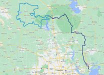
The southern half of South Cotton Lake Road to SHNF from Beach City to Cleveland, Texas, was mostly paved roads, contained a few errors, and locked me into an uncomfortable situation. Just north of Cleveland you will immediately jump into the Sam Houston National Forest so I would recommend adding that to the Cheeseburger Loop if you are coming up from Houston.
Dark blue is South Cotton Lake Road to SHNF whereas medium blue is Cheeseburger Loop.
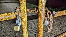
This is northbound on Texaco Road where it breaks off FM686. Of course, I always enjoy traveling at night in unfamiliar places, and to add a bit of excitement, I passed through a gate with a dozen locks and about as many "NO TRESPASSING" and "PRIVATE PROPERTY" signs hanging on it. Most of the property in Texas is privately owned although many of these same properties have public easements or roads which pass through which are perfectly legal to drive on.
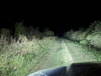
It is possible that either I am wrong or some of the land owners feel differently since occasionally you come across a locked gate which technically is prohibiting use of a public road. I need to perform more research on this subject so I keep myself out of trouble but this evening went from bad to really bad in within thirty minutes. In short, I passed through an unlocked gate, drove two miles north, then drove another two miles to the east and came upon a locked gate. I then decided the best thing to do would be to drive back out and find a go around. Unfortunately, when I returned to the gate that was previously unlocked, it was not locked. It was around 2100 local, I was locked inside an area with mostly grassy roads and the occasional dirt one.
I stopped my vehicle and though about what I was doing and began trying to come up with a plan to get back to a main road. It was confusing that the gate that was unlocked maybe thirty minutes earlier was not locked and I was not sure if someone working had left or if someone was aware that I was on the property and was planning to confront me, or was calling local law enforcement. I was sure this was a public road but then again, I was locked in. Here is an example of a gate that I found on the north end of Texaco Road where it crosses a canal and then turns west. It was unlocked although the map showed this road being a dead end.
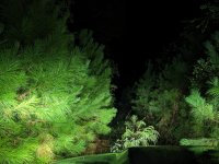
Here are some of the "roads" I began to explore while attempting to escape. I wish I had taken other pictures but I it was getting late and my primary mission was to get back onto a paved public road. While exploring I came upon what appeared to be an abandon grain storage facility (30.10116881152415, -94.96113447759215) that was dilapidated and surrounded with old tractors that themselves were overgrown with weeds. It looked pretty bad since every road I explored ended up with a locked gate or it was impassible.
Fortunately, I happened upon a place where I reclusive man lived - I turned off my bright lights, honked the horn, and when he came out I immediately said I am trying to get back to the main road and all the gates were locked. I felt bad when he said he could see the bright lights roaming that fields and he was scared because he was not sure what was going on. This man was kind and understanding and after I explained my predicament he shared with me a way to sneak out where there was no gate. In the end I drove east across a large field towards a farm and did not feel too comfortable doing what I was doing, but I saw the pavement ahead and got out of Dodge!
This is the beautiful Shell Road Hunter Camp just north of Cleveland, Texas. A few local trucks circled through early in the morning and then local law enforcement did also but no one gave me any problems. It is a large flat area with enough room for at least a dozen vehicles to park. It felt good to know I was in a National Forest at a legitimate camp. The entire scenario which had me locked in was still confusing and my lesson learned was to try to stick to more commonly explored trails while performing additional research.
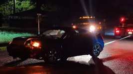
This is an example of me coming upon an accident out in a rural area which took place just as I was driving up. As soon as I realized what happened I slowed down, kicked on my four-ways, and began to slowly approach the scene. As I was pulling up a few other trucks appeared from two other directions and by the time I parked and got out, they were already hooking up a strap and ready to pull the car out of the ditch. The girl was out and walking around and even though air bags were deployed she said she was fine and did not require any medical attention. Within a minute or two the car was pulled out and phone calls were being made. It all happened a bit too fast for my liking but I was not in charge.
A lesson learned long ago it that when something bad happens it is common for folks to set their own safety aside and rush in only to make matters worse. This is why I purposely slow down the process and make many observations before entering an accident scene. A good thing is that I had a winch, full recovery kit, and fire extinguisher available. I failed through since I do not have a basic medical kit on board with me. I must perform some research and pack one in my cab just in case.
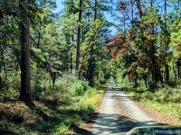
Here is a shot from the eastern section of the Cheeseburger Loop while traveling through the Sam Houston National Forest. This was a really nice area and perfect time of the year.
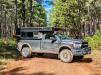
Another well maintained road that was part of the Cheeseburger Loop. I am not sure who at Adventure Riders was responsible for this loop but it is a nice one. If you download the GPX file make sure to select the most currently on that can be found here.
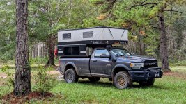
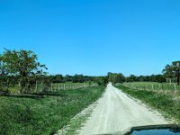
The western half of the loop is mostly farm country - still some beautiful riding. I like how the east half is in the forest with trees while the west half open up to farm country and that big Texas sky. There are also approximately four fuel stops equally spaced around the loop.
Here is why the trail is named Cheeseburger Loop - it's because of Yankee's Tavern and more specifically, their famous 1/2 pound Wide Glide burger which is "served on our signature jalapeno bun topped with crispy bacon, three different types of cheese, and finished off with grilled jalapenos, mushrooms, and onions. Perfectly paired with an order of our tavern chips." It does not get any better than this men and the sisters behind the bar were collared and dressed to kill. The funny thing is, that is not how they normally dress, it was Halloween and I had no idea. The burger and service were great though and so was the trail.
For me, the entire trip was 305 miles long and took 10.25 hours for an average speed of 30 mph. If you are in the Houston area or just passing through on Interstate 10, head up to Cleveland, jump on the last half of South Cotton Lake Road to SHNF and knock out the Cheeseburger Loop. Do not attempt this at night and make sure to think twice before passing through a gate with locks that is covered with signs.

Last edited:
