Lord Al Sorna
Harebrained Scheming
Cold, snow, wind, sun, rain… all at the same time. These are the descriptors used for the weather in northern Utah for spring 2013, and with the skiing no longer worth mentioning or pursuing, it was time to perform the ritual known as the “spring thaw.” This involves either:
A) Applying face paint, burning incense, dancing erratically to nonsensical chants and eating Naga Ghost Chiles until you hallucinate a conversation with the sun. OR
B) Driving south where it is warmer.
We choose option B (this year).
We figured out that the weather was to be quite nice the weekend of April 26th, and saddled up for our first four wheel driving adventure of the season, which was a very exciting prospect for all parties. This includes my girlfriend and co-pilot Lauren, and out two dogs Molly (yellow lab) and Tristen (great dane/greyhound). I had just finished a lot of prep work for the season on my Tacoma, and had things tuned-up, dialed-in, and ready to go. With the anticipation and excitement of the first trip running strong, and we set the plans in motion:
We left Park City for the Green River / I-70 area on Thursday afternoon, and drove down to the Hanksville exit off of I-70. We camped for the evening off of the county dirt road a few miles to the North of the exit. Not glamorous, but it was quiet and convenient. This set up up the next day for the main mission of the trip: driving down Poison Springs Canyon to hike and photograph Happy Canyon.
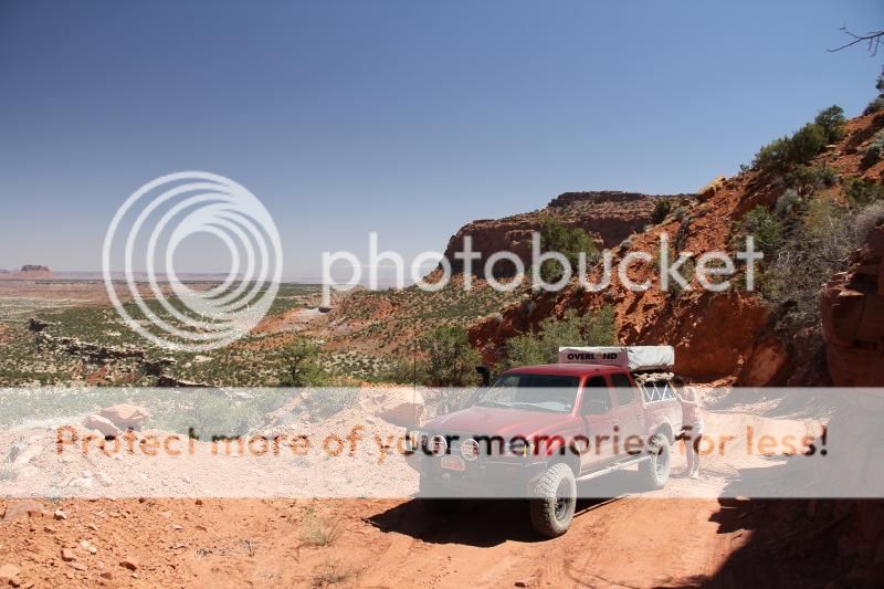
Friday morning we drove South past Hanksville, UT and made the right turn onto Poison Springs Canyon Road. I aired down the tires after pulling off of the road, not because of any challenging terrain but more to make the truck ride like a luxury sedan over rough roads and corrugation. We drove 16 miles down Poison Springs Canyon to a side road that would take us the closest to our destination. The canyon had water flowing through it and criss-crossing the road, and was very dramatic as it made its decent down to the Dirty Devil River. This portion in itself was a great drive.


The road took us along the canyon rim of the Dirty Devil River, and offered a very scenic overlook to the canyons and terrain below and across. You look at four separate geologic layers when you are here, and it is a very striking effect.

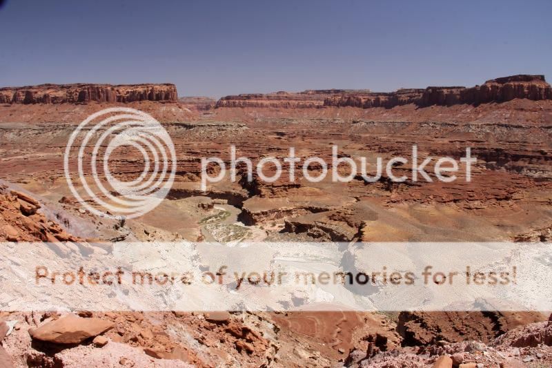
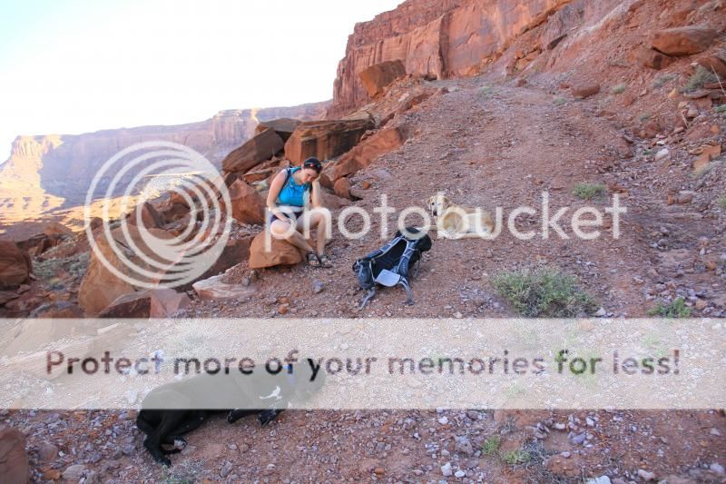
The primitive road took us to a large bench, where we parked and geared up for our big hike into Happy Canyon. The hike involves walking 4 miles along the remnants of a mining road, and then taking a steep and challenging trail down to the mouth of the canyon (shown bottom center of this photo):
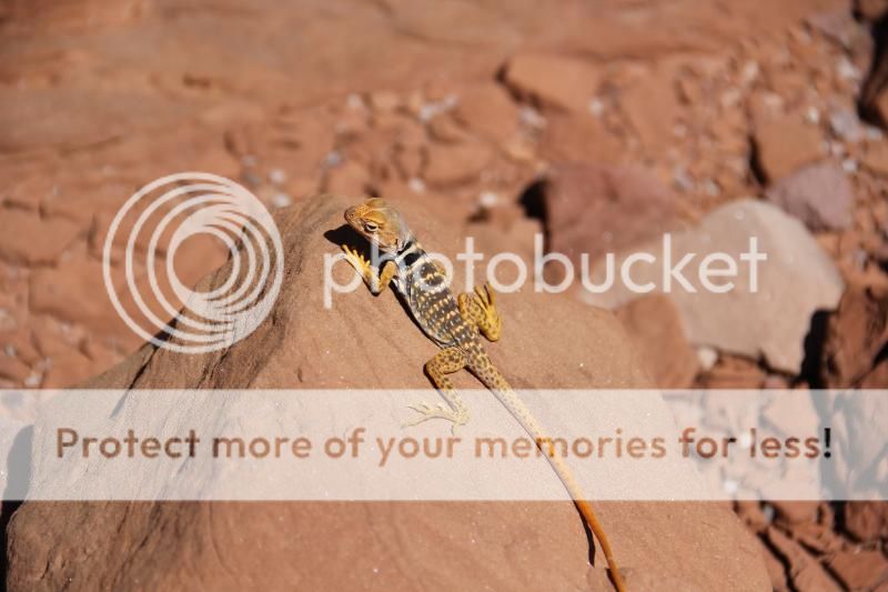
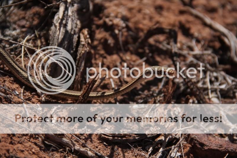
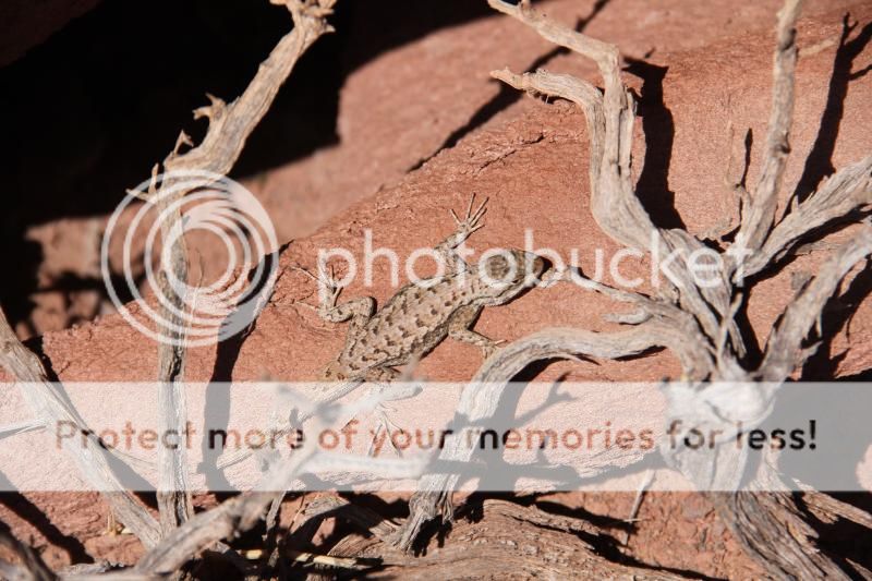
This area was great for spotting lizards and even one whip snake, who were basking in the sun and enjoying their own spring thaw. Lauren and I followed suit, and enjoyed the perfect 75 degree weather for a hike in the desert.
We hiked down and waded across the river, which was very refreshing by this point. Then we reached our goal: Happy Canyon. Photos do all the talking here…


We spent some time and enjoyed the cool breeze coming through the canyon, and then prepared ourselves mentally for the challenging hike back to our vehicle. This was a difficult concept for us, as we were both getting pretty tired at this point. Nonetheless, we climbed back up onto the shelf-road and hiked back to the very welcoming sight that was the Taco. Ice cold drinks never tasted so good! Our hike was 12 miles round-trip, and took us 6 hours. We considered this a good achievement for “Team Utah.”
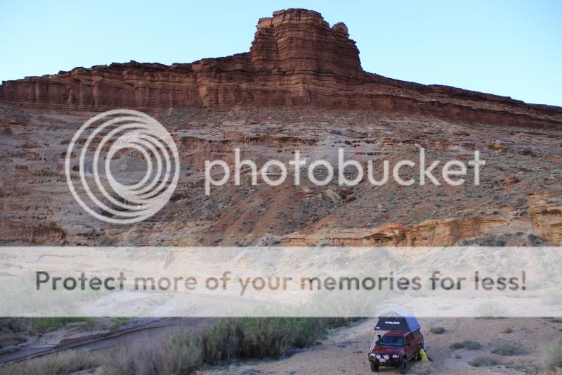
The original plan was to camp on the bench above the river, but after our long hike we wanted to be by the water. With this, we drove back down to Poison Springs Road and found a very nice spot by the river to set up shop.
We had grand plans of a steak dinner for this evening, but motivation and energy level dictated that we ate our lunch of salami, cheese, and crackers planned for the next day instead. It was so delicious, and enjoyed in perfect night air.
Saturday morning took us across the river:
The road twisted and turned us through the wide-open and dramatic Hatch Canyon, which ended at Sunset Pass. The view of the snow-covered Henry Mountains in the background contrasted by the red rock cliffs and canyons in the foreground was quite striking.

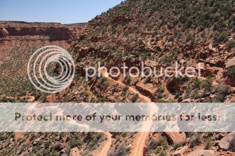
Sunset Pass dropped us down close to the Maze District of Canyonlands. We really had no plan at this point, and had moments of awe-inspiring surprise based on the best decision of the trip. We turned North onto Rec Rd 663. This was a BEAUTIFUL drive that overlooked the Maze District and followed along red rock cliffs.

The road intersected with the Flint Trail, and we followed the switchbacks up out of the canyon.

We then drove 60 miles with the throttle open back out to Highway 24 which completed our backcountry loop.
This was a great trip into a beautiful and remote area, and taking the Happy Poison gave us a huge dose of exactly what we needed.
A) Applying face paint, burning incense, dancing erratically to nonsensical chants and eating Naga Ghost Chiles until you hallucinate a conversation with the sun. OR
B) Driving south where it is warmer.
We choose option B (this year).
We figured out that the weather was to be quite nice the weekend of April 26th, and saddled up for our first four wheel driving adventure of the season, which was a very exciting prospect for all parties. This includes my girlfriend and co-pilot Lauren, and out two dogs Molly (yellow lab) and Tristen (great dane/greyhound). I had just finished a lot of prep work for the season on my Tacoma, and had things tuned-up, dialed-in, and ready to go. With the anticipation and excitement of the first trip running strong, and we set the plans in motion:
We left Park City for the Green River / I-70 area on Thursday afternoon, and drove down to the Hanksville exit off of I-70. We camped for the evening off of the county dirt road a few miles to the North of the exit. Not glamorous, but it was quiet and convenient. This set up up the next day for the main mission of the trip: driving down Poison Springs Canyon to hike and photograph Happy Canyon.
Friday morning we drove South past Hanksville, UT and made the right turn onto Poison Springs Canyon Road. I aired down the tires after pulling off of the road, not because of any challenging terrain but more to make the truck ride like a luxury sedan over rough roads and corrugation. We drove 16 miles down Poison Springs Canyon to a side road that would take us the closest to our destination. The canyon had water flowing through it and criss-crossing the road, and was very dramatic as it made its decent down to the Dirty Devil River. This portion in itself was a great drive.
The road took us along the canyon rim of the Dirty Devil River, and offered a very scenic overlook to the canyons and terrain below and across. You look at four separate geologic layers when you are here, and it is a very striking effect.
The primitive road took us to a large bench, where we parked and geared up for our big hike into Happy Canyon. The hike involves walking 4 miles along the remnants of a mining road, and then taking a steep and challenging trail down to the mouth of the canyon (shown bottom center of this photo):
This area was great for spotting lizards and even one whip snake, who were basking in the sun and enjoying their own spring thaw. Lauren and I followed suit, and enjoyed the perfect 75 degree weather for a hike in the desert.
We hiked down and waded across the river, which was very refreshing by this point. Then we reached our goal: Happy Canyon. Photos do all the talking here…
We spent some time and enjoyed the cool breeze coming through the canyon, and then prepared ourselves mentally for the challenging hike back to our vehicle. This was a difficult concept for us, as we were both getting pretty tired at this point. Nonetheless, we climbed back up onto the shelf-road and hiked back to the very welcoming sight that was the Taco. Ice cold drinks never tasted so good! Our hike was 12 miles round-trip, and took us 6 hours. We considered this a good achievement for “Team Utah.”
The original plan was to camp on the bench above the river, but after our long hike we wanted to be by the water. With this, we drove back down to Poison Springs Road and found a very nice spot by the river to set up shop.
We had grand plans of a steak dinner for this evening, but motivation and energy level dictated that we ate our lunch of salami, cheese, and crackers planned for the next day instead. It was so delicious, and enjoyed in perfect night air.
Saturday morning took us across the river:
The road twisted and turned us through the wide-open and dramatic Hatch Canyon, which ended at Sunset Pass. The view of the snow-covered Henry Mountains in the background contrasted by the red rock cliffs and canyons in the foreground was quite striking.
Sunset Pass dropped us down close to the Maze District of Canyonlands. We really had no plan at this point, and had moments of awe-inspiring surprise based on the best decision of the trip. We turned North onto Rec Rd 663. This was a BEAUTIFUL drive that overlooked the Maze District and followed along red rock cliffs.
The road intersected with the Flint Trail, and we followed the switchbacks up out of the canyon.
We then drove 60 miles with the throttle open back out to Highway 24 which completed our backcountry loop.
This was a great trip into a beautiful and remote area, and taking the Happy Poison gave us a huge dose of exactly what we needed.
Last edited:
") . Great photos...did u like the murals out there? Crazy!
. Great photos...did u like the murals out there? Crazy! 