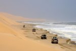
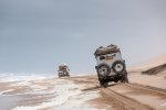
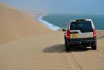
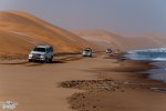
TerraLiner:12 m Globally Mobile Beach House/Class-A Crossover w 6x6 Hybrid Drivetrain

biotect

Designer
.
CONTINUED FROM PREVIOUS POST

****************************************


And the driest of those deserts is the Atacama, because of a particular combination of especially cool offshore waters, and the rain-shadow effect:


atacama-weather-bbc.jpg atacama_geomorhology.jpg


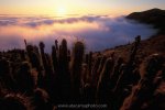
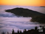
Even though the Atacama desert decidedly does not have a mediterranean climate, fog seems to arrive seasonally in much the same way as rainfall does in Chile’s Mediterranean zone further south – see https://en.wikipedia.org/wiki/Atacama_Desert . In the Atacama fog is most prominent during the winter, from July to October, when humidity is also the highest:


Camanchacah.jpg F2X8464h.jpg AirKueste3h.jpg
CamanchacaAbendh.jpg joel-sartore-dense-coastal-fog-or-camanchaca-nourishes-atacama-desert-life_i-G-30-3026-JHJBF00Z.jpg


Apparently, fog in the Atacama is not densest directly on the ocean, but rather, slightly higher up. In Lima, Peru, the lower fog boundary is between 150 to 300 m, and the upper boundary between 500 – 700 m. Along the central fog desert of the south American coast, the fog tends to lie between 500 m – 800 m. And in northern Chile, in the very heart of the Atacama, the fog base begins at around 650 m, and the maximum fog elevation is 850 m – see https://books.google.co.uk/books?id=fqussIGJ0NcC&pg=PA207&lpg=PA207&dq=atacama+desert+fog+season&source=bl&ots=aiaTmWAIST&sig=qhMO00GPoO6ZG41J0jjbpUE4qQ0&hl=en&sa=X&ved=0CCwQ6AEwADgKahUKEwj73KGCj43IAhUIcRQKHc9fDxE#v =onepage&q=atacama desert fog season&f=false .

Fog is so dense in some parts of the Atacama desert, that there are significant clusters of vegetation – even small remnant forests – called
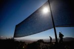
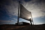
“vegetación de lomas”, or “fog oases” – see http://www.ann-geophys.net/27/3571/2009/angeo-27-3571-2009.pdf . These “fog oases” thick with vegetation are generally found between 650 – to 1200 meters above sea level, in the zone that is also the most humid. Local people, who call the dense fog camanchaca, have recently begun the practice of harvesting the fog with nets – see https://en.wikipedia.org/wiki/Camanchaca , http://www.nydailynews.com/news/world/world-driest-desert-chile-harvests-water-fog-article-1.1304082 , http://ngm.nationalgeographic.com/ngm/0308/feature3/ , https://www.newscientist.com/articl...ers-pull-water-from-air-in-chiles-dry-fields/ , http://www.bbc.com/news/world-latin-america-32515558 , http://www.nature.org/ourinitiatives/regions/southamerica/peru/explore/fog-catchers.xml , https://books.google.co.uk/books?id=voHlAP-l860C&pg=PA100&lpg=PA100&dq=dry+life+without+water+coastal+fog+desert&source=bl&ots=3bpMjJhNvs&sig=VmS6cxUxIsCVGjivgAYeJxBQHxo&hl=en&sa=X&ved=0CCYQ6AEwAWoVChMI1YidjMiOyAIVS3AaCh2yKAp0#v=on epage&q=dry life without water coastal fog desert&f=false , http://www.bnamericas.com/en/news/w...atching-project-in-chiles-arid-atacama-desert , and http://www.dailymail.co.uk/news/art...arvest-moisture-huge-nets-Chilean-desert.html :


1image-1-1304081.jpg image-1-1304073.jpg


I guess I figure that if Chileans can harvest fog in the Atacama with nets, then the TerraLiner should certainly be able to harvest the same with a pair of AWGs…..
:sombrero:


****************************************

CONTINUED IN NEXT POST

..
 

Attachments

  • D2X4621h.jpg
    D2X4621h.jpg
    565.9 KB · Views: 2
Last edited by a moderator:

biotect

Designer
.
CONTINUED FROM PREVIOUS POST

****************************************


48095528.jpg namib-desert-photography-01.jpg where-the-namib-desert-meets-the-sea.jpg
748-902.jpg 4534145_orig.jpg namib-desert-fog.jpg
Corbis-42-43723120.jpg clearing_fog_bank_over_sand_dunes_near_gobabeb_namib_desert_namibia.jpg
1237810.jpg uktv-david-attenborough-africa-episode-1-1.jpg


****************************************

CONTINUED IN NEXT POST
..
 
Last edited:

biotect

Designer
.
CONTINUED FROM PREVIOUS POST

****************************************


namib-desert-fog-red-dunes.jpg 4649942256_64ed1f4428_b copy.jpg Oceanic_fog_sossusvlei4.jpg
c01_namib_fog.jpg pic_01.jpg WAir-Namibia-3-11-379e.jpg


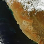
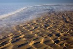
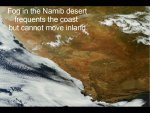
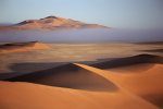
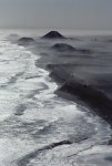
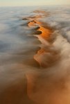
Paradoxically the Namib desert is one of the driest places on earth, but on the coast specifically, and a few miles inland from the coast, the Namib desert is also one of the most consistently humid places on earth. In effect, the TerraLiner could camp on the Skeleton Coast, completely surrounded by sand dunes, and never need to replenish with water from a ground source even once, totally reliant on fog and humidity feeding the AWGs instead. It would almost never rain, and further inland above the enormous dunes of the Namibian desert, the sky might be clear and blue. Again, this is not something commonly known, but it suggests the possibility of glamping for months in the middle of a desert, if the TerraLiner were suitably equipped with AWGs.


****************************************

CONTINUED IN NEXT POST
..
 
Last edited:

biotect

Designer
.
CONTINUED FROM PREVIOUS POST

****************************************


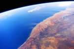
From the air the Namibian coast looks formidable, perhaps impassible, especially the section in the south known as the "Lange Wand" (translation: the "Long Wall" -- see https://en.wikipedia.org/wiki/Sperrgebiet , http://www.namibiahc.org.uk/resources/content/park_brochures/Sperrgebiet National Park.pdf , http://www.namibiahc.org.uk/resourc...et National Park - Fact sheet Sperrgebiet.pdf , https://en.wikipedia.org/wiki/Namib-Naukluft_National_Park , http://www.namibiahc.org.uk/resources/content/park_brochures/NNP.pdf , http://namibnaukluftpark.com , and http://edition.cnn.com/2012/05/18/travel/namibia-sossusvlei-dunes-travel/ ):


18372329.jpg 060411_044506_wolwedans3130_std.jpg 5326894.jpg
EBC6PNc.jpg GMA_7843-1000x1000.jpg ATWS-northern-Sand-Sea-of-the-Namib.jpg
814-361.jpg


In the last five videos, the coastal scenery unfolds towards the middle and the end, so just skip ahead. The video with paragliding sequences above the coast is especially recommended.....:sombrero:


****************************************

CONTINUED IN NEXT POST
..
 
Last edited:

biotect

Designer
.
CONTINUED FROM PREVIOUS POST

****************************************


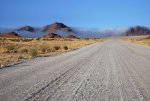
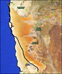
However, heading north from Swakopmund, the C34 Namibian coastal highway runs 460 km up to Terrace Bay, deep into Skeleton Coast National Park – see https://en.wikipedia.org/wiki/Skeleton_Coast_National_Park , http://www.namibian.org/travel/namibia/skeleton.htm , and http://www.namibiahc.org.uk/resources/content/park_brochures/Skeleton Coast Park.pdf. This is coastline that the TerraLiner could easily travel, glamp, and surf, with the TOAD providing more localized transport for exploring secondary roads and trails:


01-namibia-jeeps_30453_600x450.jpg 8805514_orig.jpg namibia_routemap.jpg
Skeleton-Coast-National-Park.4.jpg GMA_7890-1000x1000.jpg 77580466.jpg
303744_orig.jpg 36710_orig.jpg 8350789_orig.jpg


The C34 is salt/sand (smoother than asphalt) for the first 200 km, and gravel for the next 260 km, ending at Terrace Bay – see http://www.dangerousroads.org/africa/namibia/4801-skeleton-coast-road-c34.html , http://www.driverabroad.com/classic-road-trips/namibias-skeleton-coast/ , and http://www.namibia-1on1.com/skeletoncoastroad.html. The coast is open to 4x4s quite a bit beyond that, up to Mowe Bay, although the coast may not be open to a vehicle as large as the TerraLiner, even if the TerraLiner were to possess the necessary bad-road/off-road capability – see https://www.google.co.uk/maps/@-19.5677613,12.7653421,151222m/data=!3m1!1e3 :


Untitled4.jpg


But the TOAD could certainly run up and explore.


****************************************

CONTINUED IN NEXT POST
..
 
Last edited:

biotect

Designer
.
CONTINUED FROM PREVIOUS POST

****************************************


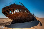
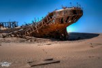
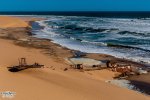
It's called the "Skeleton Coast" because of the hulks of wrecked ships buried in the sand -- see https://en.wikipedia.org/wiki/Skeleton_Coast :


4957601_orig.jpg 3427300_orig.jpg 9214375_orig.jpg


It also seems as if some tour-operaters have taken 4x4s from Luderitz to Walvis Bay through the center of Namib-Naukluft National Park, avoiding the impassible part of the "Lange Wand" in the south, catching the coast about half way up through the park, and then proceeding onwards through Conception Bay and Sandwich Harbor to Walvis Bay:


3463625_orig.jpg


[video=youtube;lTgaIFq8e44]https://www.youtube.com/watch?v=lTgaIFq8e44 [/video] [video=youtube;MCwK8-DxdOw]https://www.youtube.com/watch?v=MCwK8-DxdOw [/video]
[video=youtube;JQF8InUbzQc]https://www.youtube.com/watch?v=JQF8InUbzQc [/video] [video=youtube;9ObZ8VEAaG4]https://www.youtube.com/watch?v=9ObZ8VEAaG4 [/video]
[video=youtube;ZRlJ1gqurFY]https://www.youtube.com/watch?v=ZRlJ1gqurFY [/video] [video=youtube;n3Qgat509kI]https://www.youtube.com/watch?v=n3Qgat509kI [/video]


For some videos of what appear to be day-excursions from Walvis Bay down to Sandwich Harbor and then back, see https://www.youtube.com/watch?v=AsSTSownvrc , https://www.youtube.com/watch?v=OuIS2cncDt0 , https://www.youtube.com/watch?v=ExbCGDbIP2g , https://www.youtube.com/watch?v=uwh1otDck2k , https://www.youtube.com/watch?v=DeUUHVPbSxE , https://www.youtube.com/watch?v=2_6WLb4TSBA , https://www.youtube.com/watch?v=OQFG1tjXRg0 , and https://www.youtube.com/watch?v=G-yIi4HFYh0 .

And for what appears to be a longer, 5-day excursion that took in the north end of Namib-Naukluft park, beginning in Solitaire and driving over to the coast at Conception Bay, then up through Sandwich Harbor and Walvis Bay, see https://www.youtube.com/watch?v=aFYgQtHsLjA , https://www.youtube.com/watch?v=eTyivLqxXxU , https://www.youtube.com/watch?v=ddgeGNOwea8 , https://www.youtube.com/watch?v=t5RetS4ywB4 , and https://www.youtube.com/watch?v=A60rbLOiAbU . This video-series is well-shot, with professional production values, and worth watching for that reason alone.

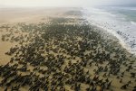
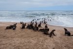
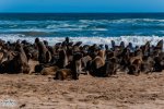
At Cape Cross just a bit north up the coast from Swakopmund and Walvis Bay, there's a huge seal reserve teaming with life -- see https://en.wikipedia.org/wiki/Cape_Cross , https://sites.google.com/site/thesealsofnam/home , and http://www.namibiahc.org.uk/resources/content/park_brochures/Cape Cross Brochure.pdf :


1360873.jpg 6302342_orig.jpg 8861373_orig-1.jpg


[video=youtube;LQ923EKEVpw]https://www.youtube.com/watch?v=LQ923EKEVpw [/video] [video=youtube;7jRfr-yQiaA]https://www.youtube.com/watch?v=7jRfr-yQiaA [/video]


And for some particularly beautiful videos that focus on Nambian landscapes and wildlife, see https://www.youtube.com/watch?v=tYxuKMhv1dI , https://www.youtube.com/watch?v=bOczyukSoec , https://www.youtube.com/watch?v=EM5lM5WEY3Q , https://www.youtube.com/watch?v=6KfNu1HEcO4 , https://www.youtube.com/watch?v=hv-JMEOYl8M , and https://www.youtube.com/watch?v=j82u8q8aDLY .


****************************************

CONTINUED IN NEXT POST
..
 
Last edited:

biotect

Designer
.
CONTINUED FROM PREVIOUS POST

****************************************


According to an article in National Geographic, the level of humidity directly on the coast of Namibia stays at 100 % for 19 hours a day during the summer months, and 11 hours a day during the winter months -- see http://voices.nationalgeographic.com/2014/08/18/geography-in-the-news-the-strangest-desert/ . But the Dryland Climatology book suggests that the fog maximum in many places in the Namib occurs in the dry spring months, from September to November. And other data suggest that the best time to visit the coast specifically, would be the winter months, because those are the foggiest months, if not the most humid.

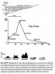
Here is Nambia's climate at a more minute level of detail. First, if we only pay attention to Fog precipitation, there is no question that in most places there is more fog precipitation during the winter months of June/July, than the summer months of December/January:


Untitled-1.jpg


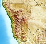
Furthermore, as per the coast of South America, the fog density increases with altitude, with the maximum between 300 to 600 m above sea level (the coastline in Namibia is immediately backed by huge dunes, the highest dunes in the world). So a slightly inland station like Swartbank actually receives more Fog precipitation, than a coastal station like Swakopmund:


Namibia_relief_location_map.jpg..Untitled-6.jpg


But if instead we pay attention to Fog frequency (as opposed to density), on the coast more than 200 days a year have fog. Whereas as one goes inland, the frequency of fog quickly decreases:


Untitled-5.jpg


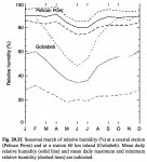
Furthermore, if we focus on humidity instead of fog, there is no question that although humidity on the coast can reach close to 100 % during the summer months, it drops to around 75 % during the height of winter, when most of southern Africa is in fact very dry, i.e. June/July:


Untitled-2.jpg


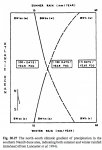
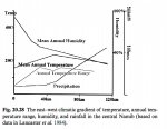
Again, note that while humidity and fog in Nambia increase as one approaches the coast, precipitation (i.e. rainfall) decreases:


Untitled-7.jpg


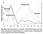
Even so, a coastal station like Swakopmund does get a a few millimeters of rainfall in March, i.e. the autumn, just before winter:


Untitled-3.jpg


But clearly, the Fog-water precipitation that Swakopmund receives in June/July/August, during winter, is much more significant.

So on this basis, it seems safe to say that the TerraLiner could visit the coast of Namibia any time of the year, and because of the TerraLiner's AWG's, it would be able to produce water -- if the temperature were warm enough. The issue here will be temperature, not available humidity. Even in the least humid months of winter, relative humidity would still be very high, around 75 %. Surfing would be best in the winter, and at Swakopmund there would be an abundance of Fog-water precipitation. Furthermore, Swakopumund is far enough north that even during the wintertime, its daily temperature does not seem to fall below 15 degrees Celsius:


Untitled-4.jpg


So it really would be possible to glamp the Skeleton Coast for 3 or 4 months, and with two AWGs on board, one would never have to worry about water.


****************************************

CONTINUED IN NEXT POST
..
 
Last edited:

biotect

Designer
.
CONTINUED FROM PREVIOUS POST

****************************************


22. Why Glamp the Skeleton Coast for 3 months? Surf Namibia!


****************************************


A while back egn asked something to the effect, "Why would anyone want to glamp for 3 months straight, in the middle of nowhere, in a desert without lakes, rivers, or rainfall?"

For me the answer is simple: Surf Nambia!!!


[video=youtube;F7JuK1d5Zvg]https://www.youtube.com/watch?v=F7JuK1d5Zvg [/video] [video=youtube;T3dxhwd0vS8]https://www.youtube.com/watch?v=T3dxhwd0vS8 [/video]


****************************************

CONTINUED IN NEXT POST
..
 
Last edited:

biotect

Designer
.
CONTINUED FROM PREVIOUS POST

****************************************


[video=youtube;_r8iVe2n7wc]https://www.youtube.com/watch?v=_r8iVe2n7wc [/video] [video=youtube;kugOZSpVsOg]https://www.youtube.com/watch?v=kugOZSpVsOg [/video]
[video=youtube;s8Rzfa27qGo]https://www.youtube.com/watch?v=s8Rzfa27qGo [/video] [video=youtube;pXERsqhmA-8]https://www.youtube.com/watch?v=pXERsqhmA-8 [/video] [video=youtube;HpoJAtoCGc4]https://www.youtube.com/watch?v=HpoJAtoCGc4 [/video]


Notice in the last video that he's not only surfing a ridiculously long barrel through salt-water, he's surfing through fog.....:wings:

Namibia has some of the very best waves on the planet, and for the most part they are completely uncrowded, if not exactly "undiscovered" -- see http://www.wannasurf.com/spot/Africa/Namibia/index.html , http://www.wannasurf.com/spot/Africa/Namibia/Skeleton_Bay/index.html , http://www.wannasurf.com/spot/Africa/Namibia/Donkey_Bay/ , and http://www.wannasurf.com/spot/Africa/Namibia/Luderitz_Wedge/index.html . Only problem is that some (although not all) of the terrific waves are on private, diamond-mining property -- for instance, see http://www.wannasurf.com/spot/Africa/Namibia/elizabeth_bay/index.html , http://www.wannasurf.com/spot/Africa/Namibia/angras_juntas_left/index.html , http://www.wannasurf.com/spot/Africa/Namibia/spencer_bay/index.html , http://www.wannasurf.com/spot/Africa/Namibia/delarey_point/index.html , and http://www.wannasurf.com/spot/Africa/Namibia/hottentot_bay/index.html . But apparently there's a fantastic, little-known wave just north of Mowe Bay -- see http://www.wannasurf.com/spot/Africa/Namibia/ovahimba_point/index.html .


****************************************


24. Why Glamp Namibia's Skeleton Coast for 3 months? Wildlife, and Clean Fog Water


****************************************


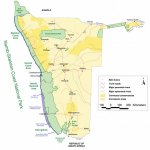
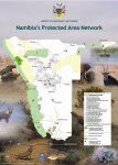
In addition, the interior of Namibia is just as spectacular as the coast, and filled with wildlife in the areas where desert gives way to open savannah. Namibia is an eco-success story where the wildlife is flourishing, a country where the native population has managed to combine development with conservation. Namibia has set aside a huge amount of its territory as National Parkland and "communal conservancies":


parks-map.jpg PA Map latest.jpg


It's all the more remarkable that they've done this in a country that is so arid.

There's one more good reason to glamp Nambia's coast: WATER. Knowing what we now know about Namibia's fog desert, the TerraLiner would want to glamp Namibia's coast precisely in order to replenish water during southern-Africa's dry season. As we saw earlier, in posts xxx to xxx, in the wintertime southern Africa is dry, not wet:


320px-MeanMonthlyP.gif


Indeed, southern Africa in general is quite dry, at least in comparison to equatorial Africa. And some of the most desirable countries in southern Africa to visit from a game-watching Safari point of view -- Botswana, Namibia, southern Angola, and southern Zambia -- are the driest:


Sub-Saharan-Africa-dominates-new-business-for-World-Bank-political-risk-insurance.jpg AIS-AFRICA-MAP.jpg
South_Africa.jpg south-africa copy.jpg
sapanlrg.jpg Untitled-1.jpg


But equipped with one or two AWGs, the TerraLiner could not only meet its daily water needs during the winter, it could completely replenish its freshwater tanks. Either the TerraLiner system as a whole, or just the TOAD, could then make "safari runs" into all the areas in eastern Namibia and neighboring countries that would be bone dry during the winter. In Africa it is said that the best time to see wildlife is precisely the dry season, because that's when wildlife has no choice but to concentrate where there is still water, and where it will be easily visible clustered around watering holes, the remnants of seasonal lakes and rivers, etc. Given the TerraLiner's unique water-autonomous capabilities, however, it would be able to visit the wildlife concentrated in such locations without having to draw groundwater likewise.

When water runs low, the TerraLiner could then return to the coast where coastal fog and high humidity would allow it to replenish freshwater tanks yet again, and catch a few more waves..... Or, alternatively, just the TOAD could do the exploring, in short one-to-two week "safari runs", loading up with water again every time it returns to "base camp", where the TerraLiner would be parked somewhere along the Namibian coast.


****************************************

CONTINUED IN NEXT POST
..
 
Last edited:

biotect

Designer
.
CONTINUED FROM PREVIOUS POST

****************************************


25. Walvis Bay as Watering Hole, and exploring Southern Africa by TOAD


****************************************


In greater detail, making coastal Namibia the TerraLiner's "base camp" could be imagined something along the following lines.

Most of the videos above were shot at "Skeleton Bay" (aka "Donkey Bay"), one of the longest barrels on the planet that rolls around a point on a remote sandbar, located just off Namibia's main port city of Walvis Bay -- see http://encyclopediaofsurfing.com/entries/skeleton-bay , http://www.wannasurf.com/spot/Africa/Namibia/Skeleton_Bay/index.html , http://www.wannasurf.com/spot/Africa/Namibia/Donkey_Bay/ , http://www.seabreeze.com.au/forums/Surfing/Shortboards/Skeleton-Bay-Namibia/ , https://prezi.com/ri2gzaoydn5q/skeleton-bay/ , and https://en.wikipedia.org/wiki/Walvis_Bay :


Untitled-1.jpg


Surfers access Skeleton Bay on day-trips from Walvis Bay via 4x4 SUVs, about a 30 km drive. The best article available online describing the wave, complete with audio and a slideshow of images, can be found at http://www.surfline.com/surf-news/spot-check-skeleton-bay-namibia_69446/ and http://www.surfline.com/surf-news/s...best,-longest-sand-bottomed-left-tube-1_69446 . As the article makes clear, Namibia probably has at least 2 or 3 other "Skeleton Bays" and many more "World Class" waves still waiting to be discovered. So an actual TerraLiner might want to make a currently undiscovered Namibian wave its base instead. But Skeleton Bay should prove useful as a proposed "based camp" for this hypothetical logistical sketch, because a good road running across Nambia begins at Walvis Bay.

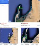
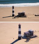
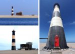
Furthermore, there's also a spot on the sandbar where one might hypothetically leave the TerraLiner for a few weeks at a stretch, while exploring elsewhere with the TOAD, confident that the TerraLiner will be safe. Unlike the coastlines of Spain or Chile described earlier in this posting series, Nambia probably does not have that many "ranches" or "farms" located directly on the coast. Instead, it seems that much of the coastal property in Namibia is owned by diamond-mining companies. But as luck would have it, further up the sandbar from Skeleton/Donkey Bay there is an improbably remote hotel called the "Pelican Point Lodge", in what appears to be a recently renovated building directly adjacent the Pelican Point lighthouse; a lodge that can be accessed only by 4x4 SUV across the sand bar -- see http://www.pelicanpointlodge.com and https://www.google.co.uk/maps/dir/P...025c5e1d245!2m2!1d14.432044!2d-22.9284764!3e0 :


Untitled-1.jpg Untitled-1.jpg Untitled-1.jpg


This is all hypothetical, but conceivably the TerraLiner could try to make prior arrangements with the lodge to glamp beside it for a monthly fee.

The Pelican Point Lodge is a very posh, upscale, and expensive sort of hotel: surf the website, taking note of the quality of the interior design of the various "suites", especially the "Captain's Cove", and soon the descriptor "Lodge" seems a bit modest. A hotel of this quality might then balk at the idea of becoming part-campground. But the TerraLiner's owners could explain in advance the uniquely autonomous nature of their vehicle, how it will have no need for standard RV hookups, will incinerate its own waste, etc. They might also explain how the TerraLiner's massive solar, advanced serial hybrid power-train, "leave no trace" logistical autonomy, and overall design ethos would be in complete harmony with the eco-ethos of hotel like the Pelican Point Lodge. Indeed, one can imagine the TerraLiner's owners using this argument often, around the world, to convince eco-lodges to allow the TerraLiner to glamp on their properties, when suitable farmland to glamp is in short supply. At the very least, if the TerraLiner were well-designed, beautiful, hyper-eco, and über-futuristic, its presence might redound to the credit of hotel like the Pelican Point Lodge, and may present some excellent photo-ops that could be loaded onto Google Panoramio.

At the very least, as the photos above suggest, there's more than enough space on the sandbar to accommodate the TerraLiner.....:sombrero: Assuming this were feasible, the TerraLiner would then be "covered" by the security umbrella of the lodge. The TerraLiner's owners could explore up and down the Namibian coast with their TOAD, as well as further afield, throughout Namibia and perhaps as distant as Botswana and Zambia, always secure in the knowledge that the TerraLiner would be safe on the Lodge's property.

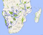
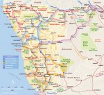
The following map shows most of the routes that the TOAD might want to explore to/from Walvis Bay, with a view to seeing as many of the parks and reserves within reasonable driving distance as possible. It also includes sights further afield, as well as a possible route through Zambia to Mozambique, and then up to Tanzania:


Untitled-1 copy.jpg


Those familiar with southern Africa will note how I have fairly systematically avoided South Africa and Zimbabwe. The explanation will follow shortly below.

For instance, Walvis Bay to Sossusvlei is 5 1/2 hours; to Lüderitz, 11 hours; to Orangemund, 13 hours; to Mowe Bay, 6 1/2 hours; to Estosha National Park, 7 1/2 hours; to the Parque Nacional de Mupa in Angola, 13 hours; to the Reserva de Namibe in Angola, 21 hours; to the Caprivi Game Park, 14 1/2 hours; to the Chobe Game Park in Botswana, and/or Livingstone in Zambia 20 - 21 hours; to the Central Kalahari Game Reserve in Botswana, 17 hours; to the Khaudum Game Reserve in Nambia, 12 hours.

Obviously one would want to combine a number of these destinations in logical "circuits" that would last 7 to 10 days, as per the following excellent map of 5 possible safari-circuits mostly within Namibia:


namibia_routemap.jpg


From an overview in Google maps of southern Africa, it seems evident that the greatest "density" of National Parkland in southern Africa plays out along a triangle that takes in almost all of Namibia and Botswana, the southern parts of Angola and Zambia, and the easternmost portion of Zimbabwe:


Untitled copy.jpg


****************************************

CONTINUED IN NEXT POST
..
 
Last edited:

biotect

Designer
.
CONTINUED FROM PREVIOUS POST

****************************************


Looking at individual country maps of National Park systems, this might not be so readily apparent:


1 map condensed 6 park systems


But the potential ecological and touristic "synergy" of park-linkage in this boundary area between Namibia/Angola/Botswana/Zambia/Zimbabwe has been recognized for over a decade, and was formalized with the recent establishment in 2012 of the "Kavango-Zambezi Trans-Frontier Conservation Area" or KAZA-TFCA for short -- see http://advocacy.britannica.com/blog...go-zambezi-transfrontier-conservation-area-2/ , http://www.peaceparks.org/news.php?pid=19&mid=1008&lid=1008 , http://peaceparks.com/search.php?dds=1&q=Kavango-Zambezi TFCA Park Development , https://en.wikipedia.org/wiki/Kavango–Zambezi_Transfrontier_Conservation_Area , http://www.africanconservation.org/...ezi-transfrontier-conservation-area-kaza-tfca , https://www.giz.de/en/downloads/giz2015-en-tfca-kaza.pdf , and https://www.cbd.int/doc/meetings/pa/ewsipals-01/other/ewsipals-01-presentation-27-en.pdf :


1 map
https://www.youtube.com/watch?v=FZs6z0BTJrk


Southern Africa's "Peace Parks" are trans-border agglomerations that deliberately try to integrated ecological zones across national borders, promoting both political peace between nations, as well as wildlife migration across ancestral habitats that knew nothing of the artificial construct called the modern nation-state -- see http://www.peaceparks.org/story.php?pid=100&mid=19 , https://en.wikipedia.org/wiki/Transboundary_protected_area , and http://www.botswana.co.za/Botswana_Regional_Info-travel/transfrontier-parks.html :


1 map


The KAZA-TFCA is by far the largest of these efforts, and its total area is roughly the size of France. It is home to roughly 50 % of Africa's elephants, the largest remaining population of wild elephants in the world. Through KAZA-TFCA it is hoped that the elephants in Botswana's Chobe National Park, where they are flourishing and are perhaps now too dense, will migrate to the Luiana National Park in Angola, and the Hwange National Park in Zimbabwe. In the latter two countries elephants have become depleted due to civil war, poor wildlife conservation efforts, and poaching. So by promoting local community "buy-in" to help re-establish ancient wildlife migration corridors, it is hoped that National Parks in immediately adjacent countries will benefit from the exemplary stewardship of Botswana and Namibia, wildlife will recover, and communities in adjacent countries will also begin to see economic improvement from an influx of tourist dollars.

It's a bold plan, and the shear size of the conservation area depicted in the maps above is quite startling. So from the point of view of TerraLiner travel, it might seem a bit silly to try to see this huge area with Walvis Bay in Nambia as a base. Walvis Bay could still serve as a base to see Nambia, but perhaps one or two months before the beginning of the summer wet season, the TerraLiner would want to decamp to another "base" location situated somewhere within the confines of KAZA-TFCA. Most probably somewhere in Botswana, because that would be the safest. From that location the TerraLiner's owners could then explore the whole conservation area by TOAD, even extending their sojourn to 3 or 4 months, because once the summer rains kick in rooftop rainwater collection would begin to work. After taking in the 30-odd National Parks and all the scenic beauty of KAZA-TFCA, the TerraLiner could then either move back to coastal Namibia, or once the rainy season is over, head further north to Tanzania, and/or south to Mozambique by way of Zambia.


****************************************


26. The Safety Issues raised by TerraLiner Travel through Southern Africa


****************************************


Now the southern-African countries just listed don't have HDIs (human development indices) as high as Latin American countries or China.

But Namibia, Botswana, and Zambia especially rate as well as France, Spain, and Britain in terms of a metric known as the "Peace Index" -- see https://en.wikipedia.org/wiki/Global_Peace_Index and https://en.wikipedia.org/wiki/List_of_countries_by_Human_Development_Index:


Global_Peace_Index.svg.jpg GPI Map 2014.jpg
800px-GPI-world-map-2008.jpg l_1529_a5cd38ef2d4f683aeeda509a59b00038.jpg


There are slight discrepancies in these maps of the Peace Index, in part because they map different years. But for the southern African countries that currently concern us, the pattern is stable across the maps.

Notice how South Africa and Angola rate as well as the United States and central South American countries in the first map; as well as the United States in the second map; and South Africa rates only a bit worse than the United States in the third map (bottom right-hand-corner). Also notice how Namibia, Botswana, Zambia, Tanzania, and Mozambique actually rate better than the United States in the first two maps, and as the same in the third, except for Botswana, which still rates better. Which perhaps should not be too surprising, because in comparison to all other developed countries, the United States is a rather unsafe, violent, and hyper-militarized sort of place. Finally, notice how in all maps Botswana, Zambia, and Mozambique have Peace Indices as high or higher than France. And in some of the maps, Namibia and Tanzania do as well.

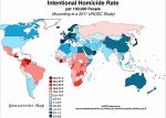
However, before we conclude too much from these maps, it must be noted that the “Peace Index” takes into account multiple factors including a country's foreign policy and degree of militarism. Which are two reasons (but not the only ones) why the United States does not rank that well. In other words, the Peace Index is is not merely a "safety index" or a "criminality index". Yes, the Peace Index does include levels of homicide, violent crime, terrorist activity, internal political unrest, etc. But it also includes ease of access to small firearms and light weapons, and military expenditure as a percentage of GDP. On both counts a highly weaponized and militarized society like the United States does poorly, and so it rates the same as South Africa, even though the United States has a much lower homicide rate than South Africa:


World-Murder-Rate-Geocurrents-Map-1024x726 copy.jpg


Here is another map of the Peace Index, this one from The Economist Intelligence Unit, which is a bit different from the ones posted above. Although the United States still does not rate any better than Brazil, South Africa and Zimbabwe do rate much worse than Namibia, Botswana, Zambia, Mozambique, and Tanzania, which seems more consistent with the high rate of homicide in South Africa shown in the map above:


Untitled-1.jpg peace_map.jpg


The Guardian newspaper also publishes its own Peace Index map, but on first glance the coloring of its map seems much less clear, and not very “legible” – see http://www.theguardian.com/news/datablog/2012/jun/12/global-peace-index-2012 , http://www.theguardian.com/news/datablog/2014/jun/18/global-peace-index-2014-every-country-ranked , and https://docs.google.com/spreadsheets/d/14Fl6gcIqOLE5HNZQgwOWOgt-Ag-wCRpeaid04B80JvA/edit#gid=0 . However, the very detailed data table provided in the Guardian article just referenced might be a useful source of "disaggregated" information.

Much more genuinely indicative would be something called a “Safety Index Map” or a “Crime Index Map”: a world map that captures the level of safety – or lack thereof – that an ordinary, middle-class person or traveller might experience. As luck would have it, maps of both the “safety level” and “crime level” worldwide are available on-line at http://www.numbeo.com/crime/gmaps_rankings_country.jsp?indexToShow=safety&title=2015-mid and http://www.numbeo.com/crime/gmaps_rankings_country.jsp?indexToShow=main&title=2015-mid :


Untitled 15.jpg Untitled 16.jpg


These maps look absolutely identical, so there is no point labeling one "Crime" and the other one "Safety". It's also not clear what information these maps are based upon, and how much they might weight homicide and rape versus say robbery. But they seem to provide at least an intuitively more "plausible" picture of overall safety for the average person, than a Peace Index map that rates South Africa as no more worrisome than the United States. These maps lack data for most countries in central Africa, but it's notable that Nambia ranks as much safer and more crime-free than South Africa. Namibia is also safer than most Latin American countries, and about as safe as the United States and France. I expect that Botswana, Zambia, and Mozambique would rank similar to Nambia, if data were available, because in the previous “Peace Index” maps these three countries were ranked as being as peaceful as Namibia. And on some maps, as even more peaceful.

On the other hand, one reason why I am inclined to take the "Peace Index" map semi-seriously, is because it seems to correlate with the “Travel Warning” advice produced by the governments of Canada and Australia. Maps based on those warnings look very similar to Peace Index maps – see https://www.targetmap.com/viewer.aspx?reportId=40773 , http://www.cbc.ca/news2/interactives/travel-warnings/ , http://travel.gc.ca/travelling/advisories , http://sharetraveler.com/safe-travel-really/ , http://www.theatlantic.com/internat...gerous-countries-for-tourists-in-maps/274593/ , http://skift.com/2013/04/03/a-map-of-countries-that-north-america-doesnt-think-you-should-visit/ :


atlantic-travel-safety.jpg


This map lumps southern African countries into the same ballpark as the safer and more politically stable South American countries; as relatively safe Central American countries like Costa Rica and Nicaragua; and China.

The basic problem is that, as near as I can tell, nobody has yet produced a transparent, clear world map backed up by a reputable data-set, which condenses the kinds of "safety statistics" that matter most to the average person, or the average middle-clas traveller. It's all fine and good to roll together metrics of military spending and foreign intervention with metrics like homicide or robbery, producing a "Peace Index" of the kind that only a smug, self-satisfied, pacifist Euro-Leftist would love. Norway or Germany are bound to come out smelling like roses when everything gets rolled into one, because they are not engaged in the dirty military work of maintaining the global capitalist system that has made them rich. So what's needed instead is a more "politically neutral" world map that merely condenses the kinds of statistics that would matter most to the average traveller, i.e. murders, rapes, assaults, robberies, carjackings, etc.; a world map that leaves out the politically loaded "Peacenik" metrics like military spending. And I say this as someone who actually is a pacifist and Euro-Leftist!!

There is always value in more "positivistic" information-gathering and mapping exercises that at least try to be politically neutral, even though all social scientific analysis is necessarily politically loaded to some extent. At the end of the day, what someone traveling through Namibia versus South Africa wants to know, is how safe they and their car will be. They really could not care less whether South Africa or Namibia have more military spending per-capita -- or less -- than the United States. A Left-polititicized Peace-Index loaded with too much extraneous information ceases to have concrete value for the average traveller. Yes, the Peace Index maps posted above are better than nothing, and they do seem to jibe with "Travel Warning" maps produced by Canada and Australia. But if anyone reading this knows of a world map of comparative crime and/or safety that is more focused, narrow, and politically neutral regarding the statistics that it condenses, please post!!! I've been trying to find one for at least a year, and so far have come up short.

In any case, synthesizing the results of these various maps, it seems reasonable to assert that the TerraLiner should be comparatively safe when traveling Nambia, Botswana, Zambia, Mozambique, and even Tanzania and Angola. Although South Africa is by far the most economically developed southern African country, South Africa along with Zimbabwe is also comparatively speaking much more dangerous than the others. The "Travel Warning" map immediately above suggests that South Africa is just as safe to travel as other southern African countries, but somehow I doubt it. This observation deserves a bit more discussion.


****************************************


27. Crime in South Africa specifically


****************************************


Crime is a very big problem in South Africa, which is why I was so skeptical about its ranking on some "Peace Index" maps -- see https://en.wikipedia.org/wiki/Crime_in_South_Africa , http://www.economist.com/node/2131478 , http://www.economist.com/blogs/baobab/2013/09/crime-south-africa , http://businesstech.co.za/news/gove...st-violent-and-unsafe-countries-in-the-world/ , http://businesstech.co.za/news/general/93294/the-worst-crime-hot-spots-in-south-africa/ , and https://www.gov.uk/foreign-travel-advice/south-africa/safety-and-security . The following is an excellent BBC documentary film that provides a snapshot of the problem -- see https://en.wikipedia.org/wiki/Law_and_Disorder_in_Johannesburg :


[video=dailymotion;xycnjl]http://www.dailymotion.com/video/xycnjl_law-and-disorder-in-johannesburg_lifestyle [/video]


This video makes it clear that, as per the United States, the worst forms of South African crime -- e.g. murder and rape -- are primarily black-on-black, and occur in the townships, relatively distant from the places that most tourists visit. The homicide rate in South Africa is truly astronomical, however, roughly 6 times that of the United States, and nearly 20 times the homicide rate in Britain -- see http://www.economist.com/node/14564621 .

On the other hand, in South Africa car-hijacking or "Carjacking" is widespread, and shows no particular racial preference -- see http://www.southafricaholiday.org.uk/travel_tips/driving_hijacking.html , http://businesstech.co.za/news/general/93504/the-worst-hijacking-spots-in-south-africa/ , http://www.dailymail.co.uk/news/art...g-caught-seat-belt-shouted-Mommy-help-me.html , and http://www.thesouthafrican.com/sas-top-7-hijacking-videos/:


[video=youtube;F8GcUQO4-jY]https://www.youtube.com/watch?v=F8GcUQO4-jY [/video]
[video=youtube;kVPU0rfB9qY]https://www.youtube.com/watch?v=kVPU0rfB9qY [/video]


Vehicle theft in South Africa then needs to be put into perspective. More vehicles are stolen per annum per person in the United States, than in South Africa -- see https://africacheck.org/reports/is-...ears-ago-the-facts-behind-that-facebook-post/ . South Africa has a population of 53 million, and in 2011/2012 60,000 vehicles were stolen, or one for every 883 people. Whereas about 700,000 vehicles were stolen in the United States in 2013, or one for every 456 people -- see https://africacheck.org/reports/is-...ears-ago-the-facts-behind-that-facebook-post/ . In short, if South Africa's rate of vehicle-theft alone were cited as a good reason not to tour South Africa by TerraLiner, then the TerraLiner should also avoid traveling the United States, because from a vehicle-theft point of view, the United States is even more dangerous than South Africa. And yet the United States has a huge motorhome industry and motorhome service infrastructure, and it would be silly to not tour the United States with the TerraLiner.

Germans, Scandinavians, Canadians, and Australians who want to travel the world by motorhome simply have to accept the fact that most of the planet is not as safe, peaceful, and crime-free as the societies in which they grew up. If they need that level of safety and security, or if they feel they have a right to it, then they should simply stay at home, and not travel abroad. And this includes travel not just to Second and Third-World countries like South Africa, but also travel to First-World countries like the United States that have much higher levels of crime.

Here it's worth noting that the vehicles most prone to carjacking in South Africa are not the ones one might think. It's the older and smaller, more common car brands that seem preferred, because 50 % of the cars stolen in South Africa will be resold internally -- see http://www.aa.co.za/about/press-roo...-your-car-on-the-hijackers-wanted-list-j.html . In effect, the stolen car market in South Africa seems to function as a form of white-to-black income redistribution. Black South Africans still earn much less than white South Africans, and a large percentage of black South Africans are unemployed. So whites with better incomes can afford to buy their cars new, whereas probably most black South Africans cannot. The latter are probably not even paid enough to be able to afford to buy a used car that enters the second-hand market legally.

In sum, to some extent like the United States, South Africa is a crime-ridden country of gated communities and vast private armies of "rent-a-cops", with a ridiculous proportion of GDP going to the security industry -- see http://www.economist.com/node/14564621 , https://en.wikipedia.org/wiki/Private_security_industry_in_South_Africa , http://edition.cnn.com/2013/02/08/business/south-africa-private-security , and http://www.defenceweb.co.za/index.php?option=com_content&task=view&id=28306&Itemid=116 :


More fortress-like gated communities are being built, guarded around the clock by armed men. Most of the white and black middle class barricade themselves behind increasing layers of security: bright lights; high perimeter-walls topped with electric fencing or razor wire; guard dogs; panic buttons and an alarm system linked to one of the many armed rapid-response security firms that promise to arrive within three minutes of a call. Since 1996 the government has quadrupled its anti-crime spending. But private spending has risen far more, by a factor of 400. Private security in South Africa is now worth 14 billion rand ($1.9 billion) a year, with 300,000 registered guards.


But of particular concern for the TerraLiner will be the high level of attacks on South African farms, and the murder of farmers -- see https://en.wikipedia.org/wiki/South_African_farm_attacks . Recall that a central feature of TerraLiner travel will be "glamping farmland", motivated by the assumption that farmland will prove comparatively safe. And indeed, farms will prove safe places to glamp in most countries. But in South Africa remote farms have been viewed as "soft targets", and thousands of farmers have been killed since the end of Apartheid.

So there is an open question as to how precisely the TerraLiner might glamp South Africa, or whether it even should glamp South Africa. Namibia, Botswana, Zambia, Mozambique, and even Tanzania and Angola all seem much safer, and would no doubt also prove cheaper in some respects. And perhaps they would have landscapes much more genuinely "wild" to boot?


****************************************

CONTINUED IN NEXT POST
..
 
Last edited:

biotect

Designer
.
CONTINUED FROM PREVIOUS POST

****************************************


28. The Ethical Issues raised by TerraLiner Travel through Southern Africa


****************************************


With all that nuance now in place, the overall picture should also be clear. The countries that lie below west equatorial Africa are not the Congo, and once again, it is simply foolish to imagine the Third World as one unitary, "undifferentiated" bloc.

When countries are ranked instead using a more sophisticated 4-level hierarchy in which "First" through "Fourth World" denotes economic status, and not communist versus capitalist political orientation, Botswana, South Africa, and Nambia all now rank as "Upper Middle Income" countries, and Angola ranks as "Lower Middle Income":


18.jpg


For extended discussions earlier in the thread of how outmoded it is to think of the planet in terms of a binary "First World versus Third World" opposition, see posts #226 and #227 on page 23, at http://www.expeditionportal.com/for...pedition-RV-w-Rigid-Torsion-Free-Frame/page23 , http://www.expeditionportal.com/for...igid-Torsion-Free-Frame?p=1586461#post1586461 , and http://www.expeditionportal.com/for...igid-Torsion-Free-Frame?p=1586462#post1586462 , as well as posts #711 and #712 on page 72, at http://www.expeditionportal.com/for...pedition-RV-w-Rigid-Torsion-Free-Frame/page72 , http://www.expeditionportal.com/for...pedition-RV-w-Rigid-Torsion-Free-Frame/page72 , and http://www.expeditionportal.com/for...igid-Torsion-Free-Frame?p=1671356#post1671356 .

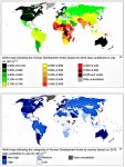
As suggested in those posts, personally I prefer to categorize countries in a more nuanced way, using a four-tier hierarchy based on the HDI (the Human Development Index), with colors signifying as follows:


HDI dark Green -- the FIRST WORLD

HDI medium, light green,. and light yellow .[and light yellow]..--.the SECOND.WORLD .[WORLD]

HDI medium yellow and dark yellow -- the THIRD.WORLD

HDI orange
, bright red, dark red, and black -- the FOURTH WORLD


Untitled-1.jpg Untitled2.jpg


The first is a global map of countries classified in terms of HDI for 2009, the second is a map for 2014, and the third and fourth are maps for 2013, with the colors in the first three maps meaning the same thing. Notice how the HDI improved in some African countries between 2009 and 2014 (e.g. Ethiopia, Mali, Niger, Zambia, South Africa), whereas in much of Latin America the HDI actually got worse over the same time period (Mexico, Colombia, Peru, Ecuador, Brazil....)

I prefer to use the HDI, because simply being classified as "Upper-Middle-Income" is not enough to count as "progressively developing", if most of a country's wealth is still concentrated in the hands of tiny elite, there is virtually no middle class, and most of the population is poor -- see http://www.economist.com/news/middl...ly-rich-or-poor-not-middle-class-should-worry . It is widely known by statisticians that extreme wealth-outliers can radically skew upwards a country's average or "arithmetic mean" GDP-per-capita figure, thereby providing a very inaccurate picture of the incomes of most people. See https://en.wikipedia.org/wiki/Average , https://en.wikipedia.org/wiki/Mode_(statistics) , and https://en.wikipedia.org/wiki/Median . So "median household income" tends to be a more accurate measure of the wealth or poverty of a typical household, than "GDP per capita" -- see https://en.wikipedia.org/wiki/Median_household_income .

Southern Africa, Namibia, Botswana, and Angola are all countries with extreme income inequality, with GINI coefficients much worse than the United States, which is really saying something, because the United States is itself a very economically unequal sort of society, comparatively speaking -- see http://www.theatlantic.com/internat...anks-near-bottom-on-income-inequality/245315/ , http://www.theatlantic.com/business...-much-higher-in-the-us-than-in-france/278660/ , http://www.theatlantic.com/business...y-its-worse-today-than-it-was-in-1774/262537/ , http://www.theatlantic.com/business...arned-about-income-inequality-in-2014/383917/ , http://www.theatlantic.com/business/archive/2015/06/what-matters-inequality-or-opportuniy/393272/ , http://www.huffingtonpost.com/2013/08/15/income-inequality-wall-street_n_3762422.html , and http://time.com/3855971/us-economic-inequality/ :


Untitled-1.jpg


Notice in the second map how the United States is more economically unequal than most of Eurasia, including a relative poor country like India. The United States is also more unequal than most of French West Africa, and the United States is much more unequal than developed Anglosphere countries like Canada, Australia, Britain, Ireland, and New Zealand. Notice how Australia is comparatively very egalitarian, only just one level below the very high income equality enjoyed by Germany, Austria, and the Scandinavian democracies. Only much of Latin America (although not all) is more economically unequal than the United States, and southern African countries could be described as "hyper-unequal".

This is not merely a matter of economic justice, but also a matter of economic development: a large middle class in the center is precisely what sustains a high level of overall demand for goods and services in advanced economies. Just one rich person with a gargantuan appetite still cannot produce the same economic demand as 10,000 middle-class shoppers with much more moderate needs. Even a super-excessive rich person can only wear one pair of jeans at a time, and can eat only three expensive meals a day. So African countries will only truly begin to "take off" economically once they become economically more equal as well, and develop sizable middle classes whose aggregate demand provides the internal motor driving the production of goods and services for local consumption.

As former Labor secretary Robert Reich and the Nobel-prize-winning economist Joseph Stiglitz have pointed out, this basic truism applies equally well to an advanced economy like the United States. In the United States flat or even slightly declining middle-class incomes over the last 4 decades -- despite increasing productivity and overall growing GDP -- have become not just an ethical issue or a matter of economic justice, but also an economic problem. Stagnant American middle-class incomes mean stagnant American middle-class demand, which in turns means less economic production, fewer jobs, lower growth, and less prosperity. Even if upper-class greed-motiviated entrepreneurialism is the energy that drives innovation in the American economy, those innovations won't be purchased by very many people unless there also exists a large, growing middle class whose rising incomes enable them to buy the innovations.


****************************************


Still, with those cautionary remarks in place, countries like South Africa, Nambia, Botswana, and Zambia do classify somewhere between Second and Third World, and not as Fourth World, as per the Congo, Mali, Niger, the Central African Republic, Burkina Fasso, Guinea, Sierra Leone, etc. Furthermore, as shown in the previous post, the hyper-inequality in Namibia, Botswana, or Zambia has not (yet) translated into a high crime rate, although perhaps hyper-inegalitarianism and the legacy of Apartheid is one of the causes of South Africa's stratospheric level of criminality. Zambia is an ambiguous case, because although Fourth-World in terms of income, Zambia's HDI is still much better than the Congo's. Mozambique and Tanzania are also interesting cases, because although they have Fourth-World HDIs and per-capita incomes, they are also more egalitarian than the others, and seem relatively safe to travel. Which is why I tentatively suggested "extensions" of the TerraLiner's hypothetical itinerary through southern Africa, passing via Zambia over to Mozambique, and up to Tanzania.

Ergo, most or even all of these Southern African countries -- with the exceptions of South Africa and Zimbabwe -- seem well worth traveling by TerraLiner, and might also be considered "ethical" places for the TerraLiner to travel. The locals in Namibia or Botswana won't be so desperately dirt poor that they will experience the TerraLiner driving through as a slap in the face, as an obscene affront. As far as South Africa and Zimbabwe are concerned, I would need to do a bit more research before coming to a definitive conclusion. For instance, do upper-middle-class South Africans who have First-World incomes and considerable savings, travel the country in Class-A motorhomes, as per those who are wealthier in Australia? Is there an extensive system of RV parks in South Africa, comparable to systems in Australia, the United States, Canada, and Europe? Would it be possible to travel South Africa in a large Class-A motorhome and not have to worry that much about crime, as long as one travels using the RV park system, assuming that one exists?

Glamping farmland is basically my proposed solution to the security problem of traveling with a large, Class-A size motorhome in Second World and Third World countries that lack extensive RV park systems. But South Africa seems an ambiguous case, because part of the population enjoys a First-World level of prosperity, while a much larger proportion of the population is living at a Third-World level.

In any case, if it were feasible for the TerraLiner to glamp South Africa in relative safety (as safe, for instance, as traveling with a Class-A motorhome through the United States), then clearly the network of blue lines for the TerraLiner's hypothetical southern-African itinerary would extend down to Capetown and Port Elizabeth at a minimum. And the TerraLiner's itinerary would most definitely include a sojourn in or near the "Great Limpopo Transfrontier Park" now in the process of formation, a mega-park that like KAZA-TFCA straddles national borders, and includes Kruger National Park in South Africa -- see https://en.wikipedia.org/wiki/Great_Limpopo_Transfrontier_Park , http://www.peaceparks.org/story.php?pid=1005&mid=1048 , http://www.peaceparks.org/tfca.php?pid=19&mid=1005 , http://www.peaceparks.org , http://www.greatlimpopo.org , http://www.greatlimpopo.org/about-gltp/, http://www.greatlimpopo.org/maps/project-maps/ , http://www.sanparks.org/conservation/transfrontier/great_limpopo.php , http://www.sanparks.org , http://www.southafrica.net/za/en/ar...hafrica.net-great-limpopo-transfrontier-park1 , http://www.britannica.com/place/Great-Limpopo-Transfrontier-Park , http://www.golimpopo.com/parks/transfrontier-parks/great-limpopo-transfrontier-park , http://www.dolimpopo.com , http://www.sanparks.org/parks/kruger/ , and http://www.krugerpark.co.zareat-limpopo-transfrontier-park-south-africa.html :


https://www.youtube.com/watch?v=3mwFMUd1pLU


In many ways, the "ideal" TerraLiner southern Africa itinerary would be a very large circle. Beginning in Walvis Bay or Capetown, where the it would arrive by ship, the TerraLiner would follow a clockwise itinerary that runs Nambia -> Botswana -> Zambia -> Tanzania -> Malawi -> Mozambique -> South-Africa -> Nambia. These are all countries deemed safe to travel, although I still have lingering doubts about South Africa, because its levels of all types of crime are so high.....

If anyone reading this has extensive experience traveling through southern Africa, and would care to comment on the relative safety of Namibia and Botswana versus South Africa, or Botswana versus Zambia, Tanzania, and Mozambique, please post!! I tend to get my news from The Economist, which in my experience does a fairly good job reporting the socio-economic and political "facts" in a relatively unbiased way. The Economist is absolutely honest about the levels of violence and economic inequality in the United States, for instance. So it was in The Economist that I first learned that Botswana and Namibia have become models of southern-African good government and far-sighted economic policies, albeit diamond-mining funded....:) -- see
http://www.economist.com/news/middl...inent-governance-and-rule-law-again-law-first , http://www.economist.com/node/14699869 , http://www.economist.com/news/middl...swana-faces-worrying-times-losing-its-sparkle , http://www.economist.com/node/18806159 , http://www.economist.com/node/18340509 , http://www.economist.com/topics/botswana , and http://www.economist.com/topics/namibia .

As for Zimbabwe, I've been simply assuming that the country is a complete economic and political wreck, thanks to decades of mis-rule by Mugabe -- see http://www.economist.com/news/leade...imbabwe-without-robert-mugabe-act-tyrant-dies , http://www.economist.com/news/middl...d-weak-rand-may-do-more-decade-sanctions-spur , http://www.economist.com/news/middl...ment-free-its-coalition-partner-risks-driving , http://country.eiu.com/zimbabwe , http://www.economist.com/topics/zimbabwe , and http://www.economist.com/topics/robert-mugabe . And that until Mugabe dies, Zimbabwe does not have much hope. Once he does die, Zimbabwe will probably go through a period of even greater chaos, after which with any luck it may finally find its way towards a better future.

There's only the remaining problem of ground-water contamination to consider.....


****************************************


29. The Sanitation Issue raised by TerraLiner Travel through Southern Africa


****************************************


The levels of open defecation in these southern African countries -- when understood in terms of people per square mile -- are not even remotely as bad as India's:


20140712_gdc954.jpg


However, the population pyramids in these countries are still very much classical pyramids, and today's parents who defecate in the open will be raising 5 or 6 children to do the same. With this in mind, Namibia's current rate of open defecation when expressed as a percentage of the population, is significant cause for alarm, especially in rural areas:


Open-Defecation-in-the-World-national-2012.jpg open-defecation-in-the-world-rural-2012.jpg


Southern Africa Population Pyramids.jpg


Even though the overall level of open defecation per square km in Namibia is still low, because the country is so thinly populated, if over 45 % of the general population defecates in the open, and over 60 % of the rural population does as well, then as Nambia's population pyramid works its way upward, and the country sees a dramatic increase in population over the coming decades, the number of people defecating per square km will also increase dramatically. Unless a serious public health initiative intervenes, the rate of open defecation per square km in Namibia is set to skyrocket.

But from the TerraLiner's point of view, given the continuously high level of relative humidity along Nambia's coast, if the TerraLiner were equipped with two AWGs it would have abundant water when glamped there, and not once would it have to draw water from the ground. Stocked up with water obtained from the fog in coastal western Nambia, the TerraLiner's TOAD could then make "forays" into eastern dry Nambia. And the complete TerraLiner could then depart the Namibian coast completely stocked up with freshwater, as it drives to a "base camp" location somewhere in northern Botswana , from where the TOAD would in turn explore southern Angola, Zambia, and (if safe enough) a bit of Zimbabwe. Even if these countries were suffering from epidemics of water-borne diseases caused by rapidly increasing populations and an unfortunate "tradition" of open defecation, the TerraLiner's water-supply could remain clean and fresh.

In short, paradoxically the ultra-dry coast desert of Nambia -- dry from the point of view of rainfall -- might serve as the TerraLiner's watering hole for much of its sojourn in southern Africa.

So I figure that Nambia deserves at least another 15 or 20 posts, at some point over the next few months.....:ylsmoke:...When I finally get around to finishing the series of posts on “Average Annual Relative Humidity Worldwide”, begun on page 146 and following, at http://www.expeditionportal.com/for...edition-RV-w-Rigid-Torsion-Free-Frame/page146 , I will be writing about Namibia at even greater length!!


****************************************


30. Why Glamp Southern Angola for 3 months? More Surf, Wildlife, and Clean Fog Water


****************************************


Here it's also worth noting that Angola, like Namibia, has great surf, but it's even more "uncharted" territory. The following excellent video was made just a year ago:


[video=vimeo;78853553]https://vimeo.com/78853553 [/video]


As per many videos in this genre, the narrator tries to dramatically "exoticize" a journey through what is actually one of Africa's more recently prosperous and successfully developing countries. He and his mate catch a nice modern bus, after all, and they drive along paved roads to their coastal destination.

Sure, Angola had a very long civil war that finally ended only in 2002. But since then Angola has had one of the fastest-growing economies in the world, mainly due to an oil and diamond-mining boom -- see https://en.wikipedia.org/wiki/Angola . Yes, like many African nations, Angola is a massively corrupt and unequal kleptocracy, and Isabel dos Santos, the daughter of Angola's President, has used her political clout to extort stakes in companies that want to invest in Angola, thereby becoming Africa's first female billionaire -- see https://en.wikipedia.org/wiki/Isabel_dos_Santos , http://www.forbes.com/sites/kerryad...-short-route-to-become-africas-richest-woman/ , and http://www.forbes.com/sites/kerryad...president-is-africas-first-woman-billionaire/.

But Anglola is not the Congo, Luanda looks prosperous and is booming, some of the prosperity is trickling down from the elite level, and China at least has been nudging Angola in a more "economically democratic" direction, massively subsidizing infrastructure and housing construction. The big challenge for Angola will be distributing the oil and diamond-mining wealth more widely, removing all the land mines, and re-establishing Angola's status as southern Africa's breadbasket. But at least the potential is there, and neighboring countries like Botswana and Nambia have demonstrated just how prosperous a southern African country can become, given reasonably good government:


[video=youtube;4QSmRYQBfN4]https://www.youtube.com/watch?v=4QSmRYQBfN4 [/video]


Those still-unsurfed, unknown waves in Angola's desert south look awfully attractive, and it's only too easy to mentally substitute the TerraLiner for the 4x4 SUV in the video, glamped directly on the beaches that these intrepid guys were surfing (about 6 minutes into the video, and following.....:)).

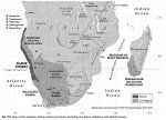
I would have to research things further, but the relative humidity and fog along Angola's southern coast is probably very similar to Nambia's Skeleton Coast. A few posts back the last map depicting Southern Africa's comparative aridity provided a detailed outline of the full extent and length of the Namib desert:


Untitled-1.jpg


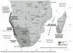
According to this map, the Namib desert extends well into Angola, about halfway up the coast between the border with Namibia and the capital city of Luanda. So if relative humidity along the coast of this northernmost stretch of the Namib were more or less the same as relative humidity along the central coastal in Namibia, then southern Angola should also prove ideal country where a TerraLiner equipped with a few AWGs could sojourn at leisure, for many months, never once having to worry about water. Even though rain would be scarce-to-non-existent, the climate would be desert, and the nearest oasis, lake, or stream would be hundreds of kilometers distant, the TerraLiner's owners would not have to water-ration even once......:)


****************************************

CONTINUED IN NEXT POST
..
 
Last edited:

biotect

Designer
.
CONTINUED FROM PREVIOUS POST

****************************************


30. Why Coastal Fog Deserts are ideal for TerraLiner Surf-Glamping


****************************************


The series of posts about “Average Annual Relative Humidity Worldwide” in which I discovered the existence of Coastal Fog Deserts, and began working out the reasoning of the last two pages (pages 161 and 162, standard ExPo pagination), was one of the the more “complicated” things that I've had to write on this blog. That posting series is still not quite complete, and again, I hope to finish it throw it up in this thread over the next few months.

As research progressed, one "aha!" moment followed another, and soon I felt overwhelmed by the shear volume of interesting stuff that was emerging. So overwhelmed, that it felt necessary to abandon the research for a few months, and concentrate instead on solar, which seemed more "tractable". And so too, I decided to concentrate a bit on actual AWG equipment and technology. However, after I created posts about various AWG models and technologies, I then decided it might help the reader after all to understand why AWGs have become so important to me. For the next few pages I will be going into AWGs in greater depth. But before doing so, I just wanted to make it very clear that I have some very specific geography in mind, geography where I think AWGs will work like gangbusters namely, Costal Fog Deserts. And I wanted to emphasize that I have a very clear and focused operational objective in mind, in terms of which carrying one or two AWGs will add tremendous value to the TerraLiner, namely, surf-glamping.

Agreed, in many geographic contexts one or two AWGs will seem merely "supplementary" or perhaps even superfluous, just adding a bit of extra water-collection capability in a climate where high relative humidity correlates with rainfall in any case. So if rooftop rainwater collection is working, and uses much less energy, why the need for one or two AWGs?

However, in the case of Coastal Fog Deserts in particular, the AWGs become paramount, the main producers of water. Coastal Fog Deserts also typically have excellent DNI levels, once the fog has dissipated by late-morning. So a typical cycle when glamped in a Coastal Fog Desert might see the TerraLiner charging up its batteries using the solar array from 11 am to 6 pm, and then running one or two AWGs off battery power at night and in the early morning, say, from 3 am to 8 pm, when the fog is the densest, and relative humidity the highest. Repeating the same cycle, day after day, the TerraLiner's owners could probably take full baths every second day, and would never have to worry about water-rationing. They'd be glamping for months in northern Namibia or southern Angola, in landscapes that many describe as some of the most desolate and inhospitable terrain on earth. But neither water nor power would ever be an issue for them. And, if suitably stocked up with food, they wouldn't have to worry about groceries either.

So I decided to provide the pages above as a kind of "condensation" of my research so far into Coast Fog Deserts, because such deserts powerfully suggest why equipping a TerraLiner with one or two AWGs will add significant value, given the TerraLiner's explicitly stated role as "Surf Glamper". If the TerraLiner were not a Surf Glamper, perhaps AWGs would not matter as much. Or if a reader is not much interested in surfing, then my obsession with designing for water-autonomy in the Namib desert may hold little interest. But once extensive "Surf Glamping" is explicitly specified as a central TerraLiner operational requirement, the value of one or two AWGs escalates dramatically.

Now although the coverage above may seem detailed, regarding Namibia especially, there is still lots more to be said about driving the southern coast of the Mediterranean, for instance, Morocco to Israel, drinking AWG-produced fog-water alone.... So too, there's much more to be said about the Atacama and the Sechura (or "Nazca") deserts in northern Chile and Peru, and how the TerraLiner's "fog-catching" will work in concert with solar-power collection. And even more to say about the Coastal Fog Desert in Baja California, and what also appears to be a coastal-fog semi-arid region in the far north-western corner of Australia. So far I haven't discussed either of these last two areas at all, and yet both have great surf.

The tremendous design opportunity presented by locations that have remote desert climates, abundant fog water, and great surf, is something that might only occur to a dedicated surfer like myself. The "payoff" from a design point of view is that this constellation of environmental challenges and opportunities provides tangible, concrete motivation to create a truly unique vehicle: a water-autonomous surf-glamper that perhaps some globe-trotting surfers have vaguely felt they needed, but have not yet even conceived at an imaginative level, let alone at the more practical level of technological implementation. Thinking through the TerraLiner in relation to Coastal Fog Deserts has proven, at least for me, by far the most exciting "conceptual design challenge" that this thread has generated thus far. The reader should then expect that I will be returning to this topic at great length in future. I already have tons of pages written, images downloaded, and videos researched; just a matter of finding time to finally post it all!!

Until then, thought I would close this section on "Coast Fog Deserts" with a gallery of South American satellite images and surfing videos that should drive home the point even more forcefully: that these are deserts that we surfers would love to surf.

Northern Chile and Peru have some incredible, truly world-class waves -- see http://www.wannasurf.com/spot/South_America/Chile/index.html , http://www.wannasurf.com/spot/South_America/Chile/Tarapaca/index.html , http://www.wannasurf.com/spot/South_America/Chile/Antofagasta/index.html , http://www.wannasurf.com/spot/South_America/Chile/Coquimbo/index.html , http://www.wannasurf.com/spot/South_America/Peru/index.html , http://www.wannasurf.com/spot/South_America/Peru/North/index.html , http://www.wannasurf.com/spot/South_America/Peru/Central/index.html , http://www.wannasurf.com/spot/South_America/Peru/Lima/index.html , and http://www.wannasurf.com/spot/South_America/Peru/South/index.html .

And as per Namibia, some of the best surf spots locate right in the middle of semi-arid, arid, or hyper-arid desert wasteland -- see for instance http://www.wannasurf.com/spot/South_America/Peru/North/punta_sal/index.html , http://www.wannasurf.com/spot/South_America/Peru/North/organos/index.html , http://www.wannasurf.com/spot/South_America/Peru/North/Varadero_El_Nuro/index.html , http://www.wannasurf.com/spot/South_America/Peru/North/Varadero_El_Nuro/index.html , http://www.wannasurf.com/spot/South_America/Peru/North/panic_point/index.html , http://www.wannasurf.com/spot/South_America/Peru/North/baterias/index.html , http://www.wannasurf.com/spot/South_America/Peru/North/balconies/index.html , http://www.wannasurf.com/spot/South_America/Peru/North/pacasmayo/index.html , http://www.wannasurf.com/spot/South_America/Peru/Central/centinela/index.html , http://www.wannasurf.com/spot/South_America/Peru/Central/playa_grande/index.html , http://www.wannasurf.com/spot/South_America/Peru/Central/Puerto_Morin/index.html , http://www.wannasurf.com/spot/South_America/Peru/Lima/pico_alto/index.html , http://www.wannasurf.com/spot/South_America/Peru/South/el_olon_de_ilo/index.html , http://www.wannasurf.com/spot/South_America/Peru/South/El_Hornito/index.html , http://www.wannasurf.com/spot/South_America/Chile/Tarapaca/El_Loa/index.html , http://www.wannasurf.com/spot/South_America/Chile/Tarapaca/barrancon/index.html , and http://www.wannasurf.com/spot/South_America/Chile/Coquimbo/teniente/index.html :


Untitled-1b.jpg Untitled-1.jpg Untitled-1.jpg
Untitled-1.jpg Untitled-2.jpg Untitled-1.jpg


10 images from maps


All of the spots shown above merit either 4 or 5 star "quality" ratings from Wannasurf, and most are described as "World Class" waves. And yet almost all are described as "empty" both on weekends and during the week. The few that are not, will have only "a few surfers" on the weekends. Some are located a bit further north or south of places that are ultra-crowded on weekends, like Capo Blancos and Lobitos -- see http://www.wannasurf.com/spot/South_America/Peru/North/cabo_blanco/index.html and http://www.wannasurf.com/spot/South_America/Peru/North/lobitos/index.html . But most of the spots shown above are literally in the middle of nowhere. Such spots are "empty" of other surfers for the simple reason that nobody lives there, and so there's no support infrastructure, no water, no toilets, nowhere to buy food, nowhere to rent a room. Literally, nothing. Indeed, perhaps some of these spots are so hyper-arid that nothing lives there.

So if a vehicle could be designed that could collect water from the Atacama or Sechura fog when it rolls in, and energy from the super-high solar irradiation once the fog dissipates, then such pristine, remote, desolate and spectacular desert beaches with great waves would open up for long-term glamping. At least for those who have a TerraLiner......:sombrero:


****************************************


31. Three Ridiculously Long Barrels located in Coastal Fog Deserts


****************************************


When I say "World Class" waves, I am not exaggerating.

In fact, there almost seems to be something of a loose correlation between hyper-arid climates and ultra-long barrels that can give rides running 1 km or more. In Surferuropemag's list of the 7 longest waves in the world, 3 out of 7 are located in Coastal Fog Deserts -- see http://surfeuropemag.com/features/the-worlds-7-longest-surf-rides.html#igtCZE1UsMbyFEQL.97 , http://www.surfertoday.com/surfing/8354-the-longest-waves-for-surfing-in-the-world , and http://indosurflife.com/2014/06/the-worlds-7-longest-surf-rides/ .

Number one is Skeleton Bay (Donkey's Bay), Namibia, which we've already seen.

Then there' s La Chicama, in northern Peru -- see http://encyclopediaofsurfing.com/entries/chicama , http://www.surfline.com/travel/tripwire/tripwire.cfm?id=1311 , http://www.theinertia.com/surf/chicama-peru-home-of-the-worlds-longest-left/ , http://www.wannasurf.com/spot/South_America/Peru/North/chicama/index.html , http://magicseaweed.com/Chicama-Surf-Report/416/ , http://magicseaweed.com/Chicama-Surf-Guide/416/ , http://www.globalsurfers.com/spot.cfm?travel=Chicama&surfing=144&land=Peru , https://en.wikipedia.org/wiki/Puerto_Chicama , https://en.wikivoyage.org/wiki/Chicama ,https://es.wikipedia.org/wiki/Puerto_Chicama , http://web.archive.org/web/20120414...com.br/blog/2010/08/chicama-puerto-malabrigo/ , http://thesurfersview.com/chicama-peru-the-longest-wave-in-the-world-part-i , http://www.nbcnews.com/news/latino/peru-surfing-worlds-longest-wave-chicama-n293611 , http://www.chicamasurf.com , http://www.chicamasurf.com/en/sections/the-wave#.Vi_TRnkhn6k , http://www.chicamasurf.com/en/sections/surfing-around#.Vi_U4Xkhn6k , http://wikimapia.org/#lang=it&lat=-7.697298&lon=-79.442310&z=13&m=b , and https://www.google.co.uk/maps/place...0x0000000000000000:0x673e1996b0ff22d9!6m1!1e1. The following gallery of Chicama videos is more eloquent than my words ever could be:


****************************************

CONTINUED IN NEXT POST
..
 
Last edited:

biotect

Designer
.
CONTINUED FROM PREVIOUS POST

****************************************


[video=vimeo;103198149]https://vimeo.com/103198149[/video] [video=vimeo;137792509]https://vimeo.com/137792509[/video]


In addition, see https://www.youtube.com/watch?v=HEefCrxpm-A , https://www.youtube.com/watch?v=CLhlEDVZLOI , https://www.youtube.com/watch?v=jo0mLOdSRT4 , https://www.youtube.com/watch?v=3uKYVLJlRrg , https://www.youtube.com/watch?v=zKI7cCF-7m8 , https://www.youtube.com/watch?v=va0p7GdIdmc , https://www.youtube.com/watch?v=TZgGK15g4H0 , https://www.youtube.com/watch?v=gRvxXybbFt0 , https://www.youtube.com/watch?v=PqorHoJTBvo , https://www.youtube.com/watch?v=jkVXc6BEhRA , https://www.youtube.com/watch?v=F4Z8nRcT-yE , https://www.youtube.com/watch?v=RwMBOBkgt5g , https://www.youtube.com/watch?v=fpVoJzADEcc , https://www.youtube.com/watch?v=HRDXYKTJBhw , https://www.youtube.com/watch?v=PHH3SRCDzKk , https://www.youtube.com/watch?v=-hT-oQvVnxI , https://vimeo. com/124110311 , http://vimeo. com/69497812 , https://www.youtube.com/watch?v=4jyI_MxRwCY , https://www.youtube.com/watch?v=MmH5zptblB4 , https://www.youtube.com/watch?v=tBC6JReOC4M , https://www.youtube.com/watch?v=aPcndzbPU1U , https://www.youtube.com/watch?v=wsAmHWkIlTw , https://www.youtube.com/watch?v=JyeUej_bPxw , https://www.youtube.com/watch?v=4vfZj8Oxbqw , https://www.youtube.com/watch?v=ym5nZtV8y8I , and https://www.youtube.com/watch?v=WU1uDV9Y1p0 .

And see the six-part series about an attempt to set a wave-sailing world record, a series that's also packed with tons of information about Chicama and the surrounding area, titled "Endless Ride", at https://www.youtube.com/watch?v=YC_JXSUGj2I , https://www.youtube.com/watch?v=6-9pk3DnQAA , https://www.youtube.com/watch?v=qTf9cNTMfFI , https://www.youtube.com/watch?v=zHVX2g72Wrc , https://www.youtube.com/watch?v=yyJK4CQErtc , https://www.youtube.com/watch?v=vjfmZToUoMo , and https://www.youtube.com/watch?v=jk8RvjhE0UI .


****************************************


Now remember, the locations in the previous post imaged as satellite photos -- great surf spots set in remote, barren desert along the Chilean and Peruvian coasts -- would probably prove every bit as good as Chicama. In fact, even better, precisely because they are so remote and relatively unfrequented. Such remote and very desirable surf-spots will not yet feature yet on YouTube, precisely because they have no facilities, few surfers, and hence, few surfers taking videos and posting them on the Internet.... But that's exactly what makes them so great.

Indeed, as the last four videos directly above suggest, just one hour north of Chicama there is excellent surf spot that is in some ways is even better than Chicima, called Pacasmayo:


1 image


It's a bigger and even more powerful left barrel than Chicama, and the wave is almost as long as Chicama. But it's much less known, except amongst wave-sailors and kite-surfers. Wannasurf describes Chicima as "crowded" on both weekends and weekdays, whereas it describes Pacasmayo just an hour up the coast as "empty" -- see http://www.chicamasurf.com/en/sections/surfing-around#.Vi_oGXkhn6k , http://www.wannasurf.com/spot/South_America/Peru/North/pacasmayo/index.html , http://magicseaweed.com/Pacasmayo-Surf-Report/3289/ , http://magicseaweed.com/Pacasmayo-Surf-Guide/3289/ , https://www.google.co.uk/maps/dir/C...f0b73165764d4d!2m2!1d-79.5887535!2d-7.4137239 , https://www.youtube.com/watch?v=BuNEB_Gg7ec , https://www.youtube.com/watch?v=CGO3Fphcxd0 , https://www.youtube.com/watch?v=R7ZKFRt5TW0 , http://vimeo. com/47640725 , http://vimeo. com/72620879 , https://www.youtube.com/watch?v=RiJbkreb4Kw , https://www.youtube.com/watch?v=TWe_hFcRnHU , https://www.youtube.com/watch?v=HJdFfQEOdiM , https://www.youtube.com/watch?v=2C9rC9QiZss , https://www.youtube.com/watch?v=eKdlSS-5DqY , https://www.youtube.com/watch?v=NTCTz9fZfbQ , https://www.youtube.com/watch?v=9efhM52afBM , https://www.youtube.com/watch?v=svVvMxWNI0s , https://www.youtube.com/watch?v=tp-YyDnQlMs , and https://www.youtube.com/watch?v=7Jrbg07Bzpw .


****************************************


Finally, I'll finish off this "condensation" with a few videos of Baja California.

The third very long desert wave is at Scopion Bay, La Juanica, Baja California -- see www.scorpionbaybaja.com , https://www.google.co.uk/maps/place...2!3m1!1s0x86b52e2d8850174f:0x3fc192561c91dfd0 .


Glamping and surfing Coastal Fog Desert


Water-rationing in Scorpion Bay? Not for the TerraLiner, with its AWGs....

There's also Red Bluff in northwestern Australia, which has terrific surf in the middle of a very arid, remote location, but I'll be addressing Red Bluff a bit further along in this current posting series.


****************************************


32. Places with No Humidity and No Rainfall


****************************************


Sure, as I have already amply demonstrated, I also know full well that in certain seasons in certain places, AWGs will simply not work. For instance, in the middle of the Australian desert during the winter, or throughout most of India in March. But in other places that are great for surfing, like the coasts of Peru, Chile, and Namibia, one or two AWGs will prove a godsend, pretty much year-round, because these Coastal Fog Deserts have high relative humidity as well as warm enough temperatures year-round.

This is all very exciting stuff, if you think about it. If the Terraliner has a water system that combines rainwater collection on the roof, as per the Bliss Mobil, + an AWG or two, + a Watermaker that recycles greywater, then there are only a few places on earth where the TerraLine will have to lay down a hose to obtain water from a source on the ground, no matter what the season. Only in the centers of the world's most extreme deserts would the TerraLiner's autonomous water-creation systems prove insufficient no matter what the month. Again, these places would be:


(a) the Tibetan Plateau
(b) the Altiplano in Peru/Bolivia (except for Lake Titicaca)
(c) the Central Sahara
(d) the center of the Arabian Penninsula
(e) the center of the Australian desert, especially during the winter


Almost everywhere else, the TerraLiner might enjoy a very high degree of “water autonomy”, if it chose to travel through a given region during a "water optimal" season.

Furthermore, it even turns out that the Gobi, the Thar desert, the Patagonian desert and much of the Australian desert are relatively humid, at least when compared to the Tibetan plateau. Like the American Southwest, much of the Gobi Desert seems to have an Average Annual Relative Humidity that falls in the 30 – 50 % range, i.e. the range where an AWG would still work, if the temperature were also warm enough:


View attachment 311809


The humidity map above is clearly not as precise as one would like, and there is the added problem that like rainfall, humidity is very seasonal, and sometimes inversely correlates with rainfall, and other times directly correlates. Direct correlation is not that valuable, because if there is already high rainfall in any case, why use an AWG? Rooftop rainwater collection would be much simpler and would not consume fuel or electricity. For instance, as we saw earlier, some parts of the American Southwest that have two rainy seasons will be humid in the winter rainy season, and humid again during the second, summer rainy season. But they will be bone dry in May in terms of both rainfall and relative humidity. So an AWG won't add much value, over and above rooftop rainwater collection. So too inverse correlation in a climate where winter is the dry season, but winter nonetheless has higher humidity, may also prove pointless if it's too cold to run an AWG in any case, precisely because it's winter.

Even still, the global map above of yearly average relative humidity is still good enough to allow me to make an important point, a point that at first seems counter-intuitive: that many deserts are positively dripping with humidity.


****************************************


33. A Realistic Goal: "Enhanced" or "Significantly Augmented" Water Autonomy. Even if not 100 % perfect Water Freedom.....


****************************************


A while back I was more than happy to admit that in many parts to the world, during certain seasons in particular, neither an AWG nor rooftop rainwater collection will work. Even combined, these systems do have "operational limits".

But here I would like to add that just because an AWG + rooftop rainwater collection will not prove a 100 %-perfect panacea, even though they will not be a 100 % "cure all", and will not provide 100 % "water autonomy" always, in all situations and places...... does not mean that they are completely worthless. Or that they will make no difference to the operational capabilities of the TerraLiner. The opposite, pessimistic point of view is also quite false.

Given the existence of places like "Coastal Fog Deserts", and given the fact that the TerraLiner is mobile, and can choose its itineraries, it does seem possible that with bit of foresight and planning, the TerraLiner probably could experience genuine water autonomy at least 90 % of the time, or more. In other words, more than 90 % of the time the TerraLiner could travel for many months without needing to pump water from an outside source. And throughout those months it could use water liberally, without any need for shower-rationing, for instance.

For instance, when visiting the southern portion of Africa, the TerraLiner could first arrive in Western Cape Province during the wet, winter rainy season -- the season, by the way, which is also be best season for surfing....:wings:...As things get warmer, towards the spring and the summer the TerraLiner could move into the central highland areas of South Africa, and then Botswana, Zambia, perhaps up to Tanzania and Kenya, then back down to Zambia, and then Angola -- all places where where rainfall arrives during the summer as afternoon thunderstorms. And finally the TerraLiner could end up on the coast of Namibia during the following winter, where it could glamp for months drinking up coastal fog, and where the surfing is also terrific, especially in the winter.....:wings:...

Or consider Bolivia and Chile. There the TerraLiner could begin its travels in and around Lake Titicaca during the middle of the Altiplano's summer rainy season, staying on a bit afterwards when the skies clear, the air is still warm, and the landscape surrounding lake Titicaca is still green. Then around March or April it would travel west to the coast, where the fog along the Atacama desert is very dense, and the AWGs could be producing most of the water. Traveling down the Chilean coast, autumn would gradually turn into winter, and by that point the TerraLiner would be glamping near Punta de Lobos, Chile's "surfing capital". There the TerraLiner would obtain water from its roof-top collection system during central Chile's wet, rainy, "mediterranean" winter. Here too, winter would be the best time to surf....:wings:...

Winter would give way to spring, and the TerraLiner could then begin driving further south still, to Chile's islands accessible by road in the bay south of Puerto Montt. And then even further south, via various roads down to Tierra Del Fuego. Even though it would be summer, on the Chilean side of Patgonia there would still be significant rainfall and humidity available, because the area is climatologically classified as "coastal rainforest". On the Argentinian side of the Andes, of course, things would be much drier:


3 maps


Southern Chile is very much fjord-land boating country, with only the most limited road access. But roads do arrive at the inland terminuses of the fjords:


Road Map


And this is an area packed with national parks and endless, dense forests:


3 images


So again, assuming that the TerraLiner could rent a bit of land from a local farmer or rancher, it could spend a wonderful summer exploring some of the last truly untouched wilderness on earth, using the TerraLiner Rigid Inflatable Boat, or RIB.

In short, one needs to think of rooftop rainwater collection, watermarking, and one or two AWGs as "autonomy enhancers" or "operational freedom augmenters". They will not be the final, complete, and prefect solutions to the challenge of achieving maximal water autonomy. But they most certainly will drastically increase the operational flexibility of the TerraLiner, especially given the existence of "weird" climatological anomalies like Coastal Fog deserts.


****************************************

CONTINUED IN NEXT POST
..
 
Last edited:

Forum statistics

Threads
188,283
Messages
2,904,831
Members
229,961
Latest member
bdpkauai

Members online

Top