TerraLiner:12 m Globally Mobile Beach House/Class-A Crossover w 6x6 Hybrid Drivetrain

campo

Adventurer
Hi Biotect and the others
Thank you for your amazingly detailed remarks.
I did not think that you where that far in your concept evolution.
.
You're right and even if it is not a linear process I would keep in mind following and adapted maybe theoretical development structure:
.
Design planning:
1. Ethical, environmental and budgetary study
2. Overall idea and definition of main parameters (length, # persons, destinations)
3. Choice for today's most innovative techniques or futuristic and only designer solutions
4. Weight repartition and axle position
5. Hybrid propulsion and drive line components position
6. Monocoque design or traditional chassis and suspension choice
7. Garage or storage position for bikes, spare wheels and doors
8. Position of tanks, batteries and techniques
9. Interior layout
10. Exterior design
11. Building timeframe

Regards Campo
 

biotect

Designer
2. Overall idea and definition of main parameters (length, # persons, destinations)


Hi campo,

Thanks for the updated list. Yes, the parameter of "intended destinations" seems fundamental, and I've spent quite a bit of time in this thread trying to think this through. I still haven't posted a long series that I wrote a few months ago, about the emerging "Asian Highway Network", and what it means for overlanding.

To put the matter very bluntly, most of Asia has become or is becoming Second-World, and China's economic development is powering the emergence of vast Asian rail and highway networks to facilitate trade.

This seems a very important, fundamental point that needs systematic articulation. Why? Well, because I am not designing the "TerraLiner" for the world as it is now, circa 2014. And I am not designing the TerraLiner for the world as it will be just 3 or 4 years from now, in 2017 or 2018. Rather, I am designing the TerraLiner for what the planet's highway capacity will be also in 2025, or 2030. Because ideally, a vehicle this big and this expensive should be usable by its owners for 15 years. Here it is worth noting that the MAN SX-45 chassis, on which the vehicle might be built, has a projected service life of more than 30 years -- see http://www.scribd.com/doc/17296072/The-Mobility-Elite .

So what follows below is somewhat "abridged" version of my thoughts on the subject of the emerging Asian Highway Network. I eliminated all the material about the Qinghai-Tibet railway, which is an engineering marvel unto itself; as well as the material about the economic and geopolitical relations between India and China. But the bottom line is that the Chinese are extending the Tibet-Qinghai railway to the Nepalese and Indian borders (in Sikkim). And within in our lifetimes, it is perfectly conceivable that we will be able to take a train direct from Delhi to Beijing, via Kathmandu and Lhasa. A Delhi-to-Beijing 4-lane expressway is a bit further off, but this too is conceivable. Especially given that China has been patiently constructing a 4-lange expressway from Beijing to Lhasa.......

In any case, the following posts can be summarized in a few propositions:


1. Eurasia is becoming a uniformly First-World + Second World continent, with only a few countries remaining Third World. The most important still-Third-World country in Asia is of course India. But over the last decade India's economy has been booming as well, and some predict that India's near-term economic future (the next 25 years), might be even brighter than China's, because India's demographic age-pyramid is much better.

2. Because of such widespread Eurasian economic development, Eurasia is fast developing a first-class road infrastructure, one that spans the entire super-continent.

3. Any truly capable RTW (round the world) expedition motorhome needs to be designed so as to be able to take full advantage of this emerging trans-Eurasian highway infrastructure.

4. This means, in particular, that any truly capable RTW expedition motorhome needs to be able to cross the Tibetan plateau with ease.

5. There are continuing, valid questions about the ethics of motorhome travel in African Third-World countries, specifically. But these questions increasingly no longer apply to Asian countries, now that so many Eurasian countries are economically booming.

6. So although a large expedition motorhome can and should be designed for Eurasian conditions, it is probably both a technical and an ethical mistake to design such a motorhome for central African conditions.

7. Put simply: when designing a truly capable RTW expedition motorhome, Tibetan altitude should matter. Congolese mud-tracks should not.


Anyway, that's the gist of the argument. The details follow, for anyone who has the stomach to read all of this.....:sombrero:


****************************************


1. Emerging Asian Transportation Networks, and the Implications for Overlanding


****************************************


As suggested in the previous series of posts about Tibetan Altitude in this thread, highway conditions in central Asia are changing rapidly, and the economic engine that's driving this change is China – see pages 35 to 38 in this thread, posts #348 to #380, at http://www.expeditionportal.com/for...pedition-RV-w-Rigid-Torsion-Free-Frame/page35 to http://www.expeditionportal.com/for...pedition-RV-w-Rigid-Torsion-Free-Frame/page38 , standard ExPo pagination.

In a few years China's web of motorways will surpass America's interstate system in total mileage, and the Chinese now buy more cars annually than Americans – see http://www.economist.com/news/china...ross-tibetan-plateau-some-reaching-lhasa-road . China is a middle-income country, with roads to match, and the demands of Chinese industry are fueling the growth of similar road networks in surrounding countries.

This much is common knowledge.


****************************************


2. The Asian Highway Network and the New Silk Road


****************************************


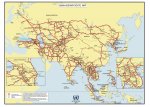
Perhaps less well-known is that Asian countries have banded together to create an “Asian Highway Network”, a continent-wide infrastructure of good roads that will boost regional trade.

The desirability of developing an “Asian Highway Network” was recognized over 50 years ago, and the “AH project” as it is known was first initiated by the United Nations in 1959. But for political and economic reasons, progress in the first few decades was slow. Things only began speeding up quite recently, after 2004, when 23 countries signed on to the IGA treaty (the “Intergovermental Agreement on the Asian Highway Network”), during the 60[SUP]th[/SUP] session of the ESCAP commission in Shanghai, China (ESCAP stands for the “United Nations Economic and Social Commission for Asia and the Pacific”). As of 2014, 29 countries have ratified the agreement – see http://en.wikipedia.org/wiki/Asian_Highway_Network , http://www.unescap.org/our-work/transport/asian-highway/about , http://www.unescap.org/resources/intergovernmental-agreement-asian-highway-network , http://www.unescap.org/resources/asian-highway-route-map , http://www.unescap.org/sites/default/files/pub_2173_ah_ch1.pdf , http://www.unescap.org/about , https://sites.google.com/site/indianoceancommunity1/trans-asian-highway , http://www.lib.muohio.edu/multifacet/record/mu3ugb3314250 , http://www.unescap.org/sites/default/files/Full version.pdf , http://www.adb.org/sites/default/files/pub/2009/WP37-Roads-Asian-Integration.pdf , and http://unohrlls.org/UserFiles/File/LLDC Documents/MTR/Toward integrated highway.pdf :


Asian_Highways2.jpg


One immediate consequence of this agreement is that major routes identified as critical to the network are now designated as “AH” highways on signage, with “AH” followed by one, two, or three digits.

To get a sense of how recent this is, the first crossing of the full extent of the Asian Highway Network by a car, east to west, took place just a few years ago, in 2007, by two Britons driving an Aston Martin Vanguard. They followed the AH1 and AH5 from Tokyo to Istanbul, driving a total of 12,089 km (7,512 miles), before joining the European road network, and driving another 3,259 km (2024 miles) to London – see http://www.nzherald.co.nz/motoring/news/article.cfm?c_id=9&objectid=10457885 , http://www.autoracing.com/blog/aston-martin-on-the-asia-pacific-highway/ , and http://www.driventogether.co.uk :


trackedroute.jpg


Although recent, the Asian Highway Network is having a big impact on Asian regional economies, even if all of this is a bit “under the radar”, and not directly evident to the public – see for instance http://www.atimes.com/atimes/Asian_Economy/HF14Dk01.html and http://www.roadtraffic-technology.com/projects/asian-highway-network/ . The first, shorter video on the left below describes the Asian Highway Network, while the second, longer video discusses potential benefits for India, which hopes the Network will strengthen ties to Southeast Asia :


[video=youtube;Bx29AS3-WXA]https://www.youtube.com/watch?v=Bx29AS3-WXA [/video]


For a comprehensive YouTube playlist about the Asian Highway Network, see https://www.youtube.com/playlist?list=PL1XGvyUz5UfHjVN7OgktD_qCZiY5Kkrvc


****************************************

CONTINUED IN NEXT POST
.
 
Last edited:

biotect

Designer
.
CONTINUED FROM PREVIOUS POST

****************************************


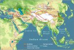
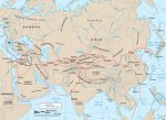
Put more poetically, the ambition is to create a “New Silk Road”, a series of transportation corridors that will integrate the economy of Eurasia – see http://news.bbc.co.uk/2/hi/asia-pacific/3660467.stm and http://aheadoftheherd.com/Newsletter/2011/The-New-Steel-Silk-Road.htm .

The previous Silk Road flourished most when either China, Europe, or both, were most politically stable. For instance under the Roman and Han empires, and much later, under a “Pax Mogolica” that encompassed China – see http://en.wikipedia.org/wiki/Silk_Road , http://www.penn.museum/documents/publications/expedition/PDFs/52-3/waugh.pdf , http://www.travelthesilkroad.org/images/resources/detailed_history.pdf , http://www.travelthesilkroad.org/content/view/14/28/ , http://www.travelthesilkroad.org/content/view/16/30/ , http://home.comcast.net/~mruland/resources/silkroad.htm , http://www.ecai.org/silkroad/ , http://www.ecai.org/silkroad/empires/ , http://www.drben.net/ChinaReport/Sources/History/Silk_Road/Chronology_Silk-Road.html , http://worldhistoryconnected.press.illinois.edu/6.1/anderson.html , http://www.silkroadfoundation.org/toc/index.html , http://www.silk-road.com/toc/newsletter.html , http://en.wikipedia.org/wiki/Pax_Mongolica , and http://www.silk-road.com/artl/paxmongolica.shtml :


1024px-SeidenstrasseGMT.jpg Silk-Road-Map1.jpg SilkRoad2.jpg
silkroad.jpg silk_road_map.jpg silk road map1.jpg


But the Asian Highway Network is much more comprehensive than the ancient Silk Road, because the transportation links it strengthens run east/west along multiple latitudes, from northern Russia to central India, as well as criss-crossing north/south, all the way down to Jakarta. The longest continuous strip of highway, designated the AH-1, runs along the perimeter of southeast Asia, on a route that has little to do with the ancient Silk Road's land route, although it does somewhat resemble the ancient sea route – see http://en.wikipedia.org/wiki/AH1 :


AH1_Route_Map.svg.jpg


So at best “New Silk Road” is a metaphor, for a transportation revolution that is now encompassing the entire continent of Eurasia.


****************************************

CONTINUED IN NEXT POST
.
 
Last edited:

biotect

Designer
.
CONTINUED FROM PREVIOUS POST

****************************************


3. TAR: The Trans-Asian Railway


****************************************


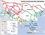
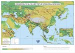
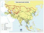
The second major component of the Eurasian transportation revolution is railway integration. The IGA agreement on an Asian Highway Network is just one element of the more encompassing “ALTID” project, “Asian Land Transport Infrastructure Development”, which includes rail – see http://www.adbi.org/files/s3_1_karandawala.pdf , http://www.unescap.org/our-work/transport/trans-asian-railway , http://www.unescap.org/resources/mo...ernational-railway-transport-asia-and-pacific , http://www.unescap.org/sites/default/files/pub_2681_fulltext.pdf , http://www.unescap.org/resources/trans-asian-railway-network-map , and http://www.unescap.org/resources/integrated-map-ah-tar-dry-ports-international-importance , and http://globalbhasin.blogspot.com/2012/08/asia-europe-railway.html :


478-2.jpg AH-TAR-DryPorts-Map.jpg TAR-mapA3_Jan2014.jpg


Here the ambition is to create a trans-continental railway system called “TAR”, or “Trans-Asian Railway”. This is often advertised as a “New Eurasian Land Bridge” or “Iron Silk Road” – see http://en.wikipedia.org/wiki/Trans-Asian_Railway , http://en.wikipedia.org/wiki/Eurasian_Land_Bridge , http://en.wikipedia.org/wiki/New_Eurasian_Land_Bridge , http://www.people.hofstra.edu/geotrans/eng/ch5en/conc5en/NEW_Corridor_Freight.html , and http://says.com/my/tech/is-china-really-planning-to-build-an-underwater-super-train-to-the-usa .

To be sure, a major obstacle is rail gauge incompatibility. But even still an agreement was signed in 2006, and major improvement of routes has been taking place since, with huge implications not just for Asian economies but also for Europe's – see http://www.railwaygazette.com/news/single-view/view/trans-asian-railway-network-nears-agreement.html , http://www.rmtbristol.org.uk/2006/10/iron_silk_road_un_treaty.html , http://en.ria.ru/world/20061111/55546632.html , http://web.archive.org/web/20070928...cn/displayarticle.asp?aid=18616&slug=RAILROAD , http://www.railwaygazette.com/news/...e-standard-gauge-transcontinental-artery.html , http://www.railwaygazette.com/news/...ilway-network-agreement-comes-into-force.html , http://www.railwaygazette.com/news/single-view/view/connecting-china-and-europe.html , http://www.railwaygazette.com/news/infrastructure/single-view/view/caspian-corridor-agreement.html , http://www.nationmultimedia.com/opi...w-to-link-Europe-with-East-Asia-30204791.html , and http://www.aapacgroup.com/china-germany-freight-rail-link.html , and http://edition.cnn.com/2013/06/27/business/silk-railroad-trading-network/ .

See the following videos, for instance, for what the “Trans-Asian” railway might mean for Germany:


[video=youtube;5Z0kT8P6XDE]https://www.youtube.com/watch?v=5Z0kT8P6XDE [/video]


Or consider: as part of TAR, China wants to build a trans-Himalayan railway linking Kashgar to Pakistan's deep-sea port of Gwadar – see http://www.daijiworld.com/news/news_disp.asp?n_id=245358 .


****************************************

CONTINUED IN NEXT POST
.
 
Last edited:

biotect

Designer
.
CONTINUED FROM PREVIOUS POST

****************************************


4. London to Beijing in 2 days, by Train


****************************************


China's ultimate ambition? A high-speed Eurasian rail connection that links China to Europe, making London to Beijing possible in just 2 days by bullet train, a veritable “Orient Super-Express” – see http://www.telegraph.co.uk/news/wor...-two-days-on-new-high-speed-rail-network.html , http://www.industrytap.com/reviving-the-silk-road-connecting-chinas-high-speed-rail-to-europe/1278 , http://www.dailymail.co.uk/news/article-1256536/200mph-train-link-London-Beijing-just-days.html , http://www.thetransportpolitic.com/...continental-ambitions-with-massive-rail-plan/ , http://nextbigfuture.com/2014/05/china-rolling-out-global-high-speed.html , http://grist.org/news/could-a-bullet-train-take-you-from-the-u-s-to-china-to-europe/ , http://www.sbs.com.au/news/article/...inas-high-speed-rail-dream-begins-take-flight , http://www.zukunft-mobilitaet.net/2...uropa-hochgeschwingigkeitszug-trasse-planung/ , and http://news.sky.com/story/1194709/china-high-speed-rail-network-to-be-doubled :


article-1256536-08A6E10F000005DC-314_634x327_popup.jpg china-europa-hochgeschwindigkeitszug-strecke-transeuropa.jpg
eisenbahnstrecke-china-tuerkei-bulgarien.jpg eurasia2.jpg


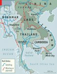
As well as another high-speed railway that links Kunming directly to Singapore, by way of Laos – see http://www.economist.com/node/17965601 , http://www.economist.com/blogs/banyan/2013/09/infrastructure-laos , http://www.economist.com/blogs/banyan/2013/10/infrastructure-spending-thailand , http://www.telegraph.co.uk/news/wor...3/Chinas-120mph-railway-arriving-in-Laos.html , http://www.aspistrategist.org.au/changing-asia-chinas-high-speed-railway-diplomacy/ , http://english.caixin.com/2014-06-26/100696032.html , http://www.theworldofchinese.com/2014/01/train-imperialism-and-the-trans-asian-railway/ , http://eandt.theiet.org/news/2011/may/Kunming-Singapore.cfm , http://www.wantchinatimes.com/news-subclass-cnt.aspx?id=20110425000064&cid=1102 , http://shanghaiist.com/2014/01/15/china_to_build_high-speed_rail_to_s.php , http://www.skyscrapercity.com/showthread.php?t=1327387 , http://www.skyscrapercity.com/showthread.php?t=460975&page=8 , http://www.skyscrapercity.com/showthread.php?t=443798&page=4 , http://nextbigfuture.com/2013/10/china-may-work-with-malaysia-and.html , http://investvine.com/high-speed-train-on-track-for-2015/ , http://voltimes.com/news.php?id=249 , http://www.globaltimes.cn/content/859360.shtml , http://chinahighspeedrail.com/news/...inas-influence-in-the-mekong-river-basin.html , http://www.fastcompany.com/1718727/china-dominates-asean-talks-links-singapore-high-speed-rail , http://www.rfa.org/english/news/laos/railway-01032014153336.html , http://www.nationmultimedia.com/bus...ail-link-now-a-priority-project-30215555.html , http://news.bbc.co.uk/2/hi/asia-pacific/1637032.stm , http://news.google.com/newspapers?i...4,27057345&dq=kunming+singapore+railway&hl=en , http://www.theguardian.com/business/2004/nov/29/china.internationalnews , and http://en.wikipedia.org/wiki/Kunming–Singapore_Railway :


Railway-map.jpg


[video=youtube;jinvPzwaFsU]https://www.youtube.com/watch?v=jinvPzwaFsU [/video] [video=youtube;bR-lVtyCtGE]https://www.youtube.com/watch?v=bR-lVtyCtGE [/video]


Yes, all of this will be built with European technology that (perhaps foolishly) was voluntarily transferred to China over the last 20 years, when companies like Alstom and Siemens built the first high-speed railways in the Middle Kingdom – see http://www.chinaeconomicreview.com/high-speed-rail-worlds-loss-chinas-gain . But it has to be admitted that China has the economic depth and political will necessary to pull off Eurasian high-speed railway integration in a way that Europe never could. Europe can't even manage EU-level high-speed railway integration, because political barriers and intra-EU squabbling constantly delay further development.


****************************************


5.The Shear Speed of Chinese Railway Construction


****************************************


Sure, there is no question that Europe pioneered high-speed rail and has an impressive network. But the European network is still not well-integrated, with many different technology platforms. Liberalization of European railways in 2010 may eventually usher in direct service from London to Frankfurt, or Berlin to Madrid. But as of 2014 the long-hoped-for direct connection of Britain to Germany, via Deutsche-Bahn “ICE” trains, has yet to materialize, it seems, primarily due to Siemens' delay in delivering the necessary trains. Earlier on there were also delays because Eurostar and Alstom, the French companies which respectively run the chunnel service and build the trains, had enjoyed monopolies, and clearly resented their monopoly positions undermined by Deutsche Bahn and Siemens.

The London-Frankfurt high-speed rail service was supposed to begin in 2013, then 2015, but has now been pushed back to 2016 at the earliest – see http://www.thisismoney.co.uk/money/article-1237867/Eurostar-chaos-opens-door-rivals.html , http://www.spiegel.de/international...-lock-horns-over-channel-tunnel-a-725503.html , http://www.bahn.com/i/view/GBR/en/about/overview/ice-in-london.shtml , http://www.economist.com/node/16889039?zid=303&ah=27090cf03414b8c5065d64ed0dad813d , http://www.economist.com/blogs/gulliver/2010/10/eurostars_new_trains , http://www.theguardian.com/world/2010/sep/19/london-frankfurt-train-high-speed , http://www.theguardian.com/business/2011/jan/23/channel-tunnel-row-threatens-london-frankfurt-link , http://www.theguardian.com/business/2011/mar/20/europe-rail-transport
http://www.bloomberg.com/news/2011-...te-delayed-to-2015-as-trains-arrive-late.html , http://www.businesstraveller.com/news/dba-s-ice-london-service-postponed-yet-again , http://www.telegraph.co.uk/finance/...llow-Deutsche-Bahn-to-use-Channel-Tunnel.html , http://www.ausbt.com.au/london-frankfurt-direct-high-speed-train-service-still-on-track , http://www.dailymail.co.uk/news/art...-Berlin-London-service-given-green-light.html , http://www.railnews.co.uk/news/2014/02/19-db-puts-london-plans-on.html ,
http://www.trainmountain.co.uk/2014/02/19/frankfurt-london-high-speed-rail-link-put-hold/ , http://www.totalrail.org/2014/02/19...speed-rail-project-hold/#sthash.h58VDA7z.dpbs , and http://uk.reuters.com/article/2014/02/18/uk-germany-rail-idUKBREA1H1IX20140218 .

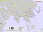
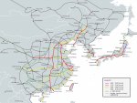
China's network is now larger and properly integrated, even though the first route opened only in 2003 – see http://en.wikipedia.org/wiki/High-speed_rail , http://en.wikipedia.org/wiki/High-speed_rail_in_Europe , http://en.wikipedia.org/wiki/Trans-European_high-speed_rail_network , http://www.thetransportpolitic.com/...ss-the-continent-with-five-new-line-segments/ , http://www.eurail.com/trains-europe/high-speed-trains , http://en.wikipedia.org/wiki/China_Railway_High-speed , http://www.thetransportpolitic.com/2009/01/12/high-speed-rail-in-china/ , http://www.economist.com/news/china...will-soon-stretch-considerably-farther-faster , http://buyingbusinesstravel.com/new...lays-high-speed-london-frankfurt-rail-project , and http://factsanddetails.com/china/cat13/sub86/item1724.html :


Europe-HSR6.jpg High_Speed_Railroad_Map_of_Europe_2013.svg.jpg
Eastern_Asia_HSR2013.svg.jpg China-HSR-Update-16-Dec-2012.jpg


As one article suggests:


China is not the first to embrace high-speed rail. But what Europe and Japan accomplished over 40 years, China has effectively quadrupled in little more than a decade.


[video=youtube;43yWhj2th_E]https://www.youtube.com/watch?v=43yWhj2th_E [/video] [video=youtube;ix7Av9PEa-8]https://www.youtube.com/watch?v=ix7Av9PEa-8 [/video]
[video=youtube;ZobskktXYac]https://www.youtube.com/watch?v=ZobskktXYac [/video] [video=youtube;2gSMFgOK7bs]https://www.youtube.com/watch?v=2gSMFgOK7bs [/video]


****************************************

CONTINUED IN NEXT POST
.
 
Last edited:

biotect

Designer
.
CONTINUED FROM PREVIOUS POST

****************************************


[video=youtube;GJXW5gtR7Iw]https://www.youtube.com/watch?v=GJXW5gtR7Iw [/video]


As with rail, so with everything else: the frantic pace of Chinese and more broadly Asian economic development beggars belief. The following map goes some ways towards capturing the extent of China's ambitions regarding railway integration in Eurasia:


iron_silk_road.jpg


This map communicates graphically what a thousand words could not: Eurasia becoming economically integrated via the transportation tentacles of a gigantic octopus, called China.

I focused in the last few posts mainly on railway development instead of highway development, because there tend to be many more articles and videos available on the web about China's rapidly expanding rail system. Railways are big and expensive, and high-speed railways are even more big and expensive. Their speed also symbolizes "modernity", and the idea of China not only catching up with America and Europe, but indeed surpassing them. Furthermore, connecting railways across national borders is much more difficult and "politically loaded", than connecting highways across borders. And so the Chinese effort to run a high-speed rail line through Laos down to Singapore, for instance, will receive much more press coverage than equivalent highway projects.

China's pan-Eurasian railway ambitions then provide a very dramatic and accessible way to tell the story of China's commitment to developing not just Chinese infrastructure, but pan-Eurasian infrastructure as well. A map like the one just above, or videos of China's high-speed bullet trains, serve my "rhetorical purposes" perfectly. They suggest just how wrong-headed it is to imagine most countries in contemporary Asia as still desperately poverty-stricken and Third-World, with bad roads to match.


****************************************

CONTINUED IN NEXT POST
.
 
Last edited:

biotect

Designer
.
CONTINUED FROM PREVIOUS POST

****************************************


6. China Spends Even More on Highways than on Railways


****************************************


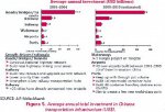
Now to correct any possible false impressions: railways are not China's biggest infrastructure expenditure. Rather, roads and highways are.

China has been investing more than three times as much per annum on new highway construction, as it is investing in new railway construction -- see http://international.fhwa.dot.gov/pubs/pl08020/fmic_08_03.cfm :


figure_5a.jpg


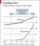
And the total combined length of China's express highway network has probably by now surpassed the length of its railway network, even though the latter continues to increase as well:


CFB753.jpg


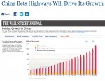
China is investing so much in roads, that it's annual rate of road investment has surpassed the United States in absolute terms, i.e. billions of dollars per annum -- see http://www.economist.com/node/16909167 and http://online.wsj.com/articles/SB122635482375915243 :


P1-AN580A_HIGHW_NS_20081110184833.jpg


Even though the rate of growth of Chinese road construction is logarithmic, the growth curve for Chinese car ownership is steeper still -- see http://www.china-mike.com/facts-about-china/facts-infrastructure-roads/ :


economist-china-vehicles-highways.jpg


For three excellent (albeit somewhat dated) articles that appeared in the BCC News Service, The Economist and the WSJ respectively (2005, 2007, and 2008), articles that detail the the full range of Chinese transport infrastructure development, see http://news.bbc.co.uk/2/hi/business/4633241.stm, http://online.wsj.com/articles/SB122635482375915243 , http://online.wsj.com/news/interactive/HIGHWAYS08?ref=SB122635482375915243 , and http://www.economist.com/node/10697210 :


Untitled.jpg Untitled2.jpg

Untitled4.jpg Untitled5.jpg


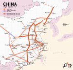
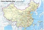
And here is a relatively recent (2010) map of China's current network of express highways:


highway.jpg


****************************************

CONTINUED IN NEXT POST
.
 
Last edited:

biotect

Designer
.
CONTINUED FROM PREVIOUS POST

****************************************


7. The Eurasian Century: Not just China


****************************************


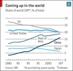
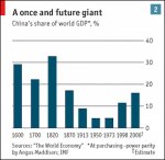
The larger geopolitical development here is what analysts are calling the rise of "The Eurasian century”: an era in which global economic and political power decisively shifts back to Eurasia, after a brief period when it concentrated in the Americas, i.e. in the hands of the United States.

As The Economist is always fond of pointing out, there was a time not so long ago (the early 19th century) when China's share of world GDP was still by far the largest of any nation -- see -- http://www.economist.com/node/8880918. And that time will come again:


CSU012.jpg CSU011 copy.jpg


From a geopolitical standpoint, an economic colossus like China needs to ensure that its huge economic engine never fails to be fed by raw materials. And China also needs uninteruptible access to export markets, particularly in Eurasia. Russia, in turn, wants infrastructure in place that will always enable it to export its raw materials to China. Both China and Russia then see an initiative like TAR (the Trans Asian Railway) as an excellent way to circumvent possible trade boycotts imposed by the United States or Europe:


[video=youtube;ABsojbvC18g]https://www.youtube.com/watch?v=ABsojbvC18g [/video] [video=youtube;xFo9Oq2QEX4]https://www.youtube.com/watch?v=xFo9Oq2QEX4 [/video]


Americans may not like it, but that doesn't mean it ain't gonna happen…..

In other words, it would be a mistake to think of all of these Eurasian infrastructure developments as merely expressions of a kind of Chinese transport Imperialism. Russia and other Eurasian countries have motivations every bit as strong as China's to contribute to the development of well-integrated highway and rail networks spanning the entire continent.


****************************************


8. The Sole Remaining Physical Obstacle: Tibetan Altitude


****************************************


All of this new Eurasian transportation infrastructure has implications for tourism, and more specifically, for travel by motorhome. It may soon be possible to travel to almost any country in Asia by major routes from Europe in very ordinary, mainstream, “non-expedition” motorhomes, i.e. motorhomes that do not have special suspension or wheels. To put the point another way, as Asian highway infrastructure massively improves, Asia will become “mainstream” motorhoming territory, as opposed to “expedition” motorhoming territory. As most of Eurasia becomes either economically First-World or Second-World, and as infrastructure dramatically improves everywhere, "expedition grade" motorhomes with their attendant worries about weight, multiple drive capability, suspension travel, etc., may become overkill.

But only for continent-wide travel in Eurasia specifically; and only for travel on Eurasia's expanding network of good, paved roads. Travel on other continents, like South America, and especially the poorer parts of Africa, may still require expedition-grade kit.

Of course, when one leaves major AH highways and travels secondary roads in Eurasia, or roads that are only partially paved like the G219 in Tibet, having a motorhome that can handle “bad roads” will continue to be important – see page 37 in this thread, posts #366 - #368, at http://www.expeditionportal.com/for...pedition-RV-w-Rigid-Torsion-Free-Frame/page37 , standard ExPo pagination. But it will eventually become an open question whether Eurasian travel specifically will require a reasonably light, 4x4, truly “off-road” motorhome, of the kind nimble enough to drive along dirt tracks or through mud. Although 6x6 expedition motorhomes are bigger and heavier, 6x6 expedition motorhomes should find it easy enough to travel in Eurasia almost anywhere that a big dump truck can. Which, increasingly, means just about anywhere.

So as suggested in the last post of the previous series about Tibetan Altitude (post # 380), the primary physical barrier that will make travel between India and China difficult will not be the condition of the roads, but rather, the altitude encountered when crossing the Tibetan plateau:


When I first began this thread, I had not thought much about altitude as a design consideration. As the thread developed, it soon transpired that the length, weight, and height of an overlanding motorhome would have big implications for where it could and could not go. So one important design constraint is the ”size versus geographic reach” trade-off, which also means a “comfort versus geographic reach” trade-off. Here it would be good to know just where exactly a large, 6x6 expedition motorhome might and might not be able to go. So far in this thread contributors have posted personal experiences and impressions, but what's really wanted is a database of global road quality.

In the course of participating in the “High Altitude Heating” thread, however, it began to dawn on me that in our post-cold-war era, an era in which Beijing is now readily accessible by road from Europe, the Tibetan plateau is likely to become a major transportation fulcrum. It must be re-emphasized that China has not only become politically accessible to foreign-registration vehicles, but also practically accessible, because Chinese transport infrastructure is now so good. Furthermore, Chinese economic growth functions as a massive engine driving regional development across Asia, and one direct consequence of that development is the rapid improvement of an emerging “Asian Highway Network” – see for instance http://en.wikipedia.org/wiki/Asian_Highway_Network , http://news.bbc.co.uk/2/hi/asia-pacific/3660467.stm , http://www.lib.muohio.edu/multifacet/record/mu3ugb3314250 , http://www.unescap.org/sites/default/files/Full version.pdf , http://www.adb.org/sites/default/files/pub/2009/WP37-Roads-Asian-Integration.pdf , and http://unohrlls.org/UserFiles/File/LLDC Documents/MTR/Toward integrated highway.pdf .

I will discuss the Asian Highway Network in a later series of posts, but suffice it to say that travelling throughout Asia even by ordinary motorhome will become much easier over the next decade or two, because of this network. *The primary physical barrier that will make travel between India and China difficult, then, will not be the condition of the roads, but rather, the altitude encountered when crossing the Tibetan plateau. So extreme-altitude capability for the TerraLiner now strikes me as worth just as much careful consideration as overall size and weight. If a TerraLiner cannot cross Tibet easily, then it will be unable to take full advantage of an emerging excellent road network that will soon encompass the entire Eurasian continent.


****************************************


9. The Sole Remaining Geo-political Obstacle: Sino-Indian Relations


****************************************


Now I think it's undeniable that overlanders will want to take advantage of China's growing network of good paved roads to travel, explore, or simply cross the Tibetan Plateau, to get to China from India and vice versa. If you look at the map of the Asian Highway Network again, not crossing Tibet means instead trying to get to China by first going down through Myanmar (Burma):


AH-MapA3-Jan2014.jpg


But looking at this map, what's also very noticeable is that the "Asian Highway Network" seems to bypass Tibet. The road across the plateau is only indicated as a dotted line, as a "potential" AH route. Furthermore, looking back at maps of TAR, or the "Trans-Asian Railway", no railway line seems to cross Tibet.

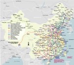
This is most curious indeed, because the Qinghai-Tibet railway was completed at great expense in 2006, and it now does link Lhasa to Beijing -- see posts #412 - #425 in this thread, at http://www.expeditionportal.com/for...pedition-RV-w-Rigid-Torsion-Free-Frame/page42 and http://www.expeditionportal.com/for...pedition-RV-w-Rigid-Torsion-Free-Frame/page43 :


chinarail.jpg chintra6.jpg
6a00d8349889d469e2017c31d943d3970b.jpg qztl.jpg %e9%9d%92%e8%97%8f%e9%93%81%e8%b7%af 35.jpg

20140621_CNM921.jpg


As the last map very clearly indicates, China also has every intention of extending the Qinghai-Tibet railway east and west from Lhasa, connecting to Khotan in one direction, and Chengdu and Kunming in the other -- see http://www.economist.com/news/china...s-tibets-integration-rest-country-taming-west .

Furthermore, it is the stated intention of both the Nepalese and Chinese governments that the Qinghai-Tibet railway should extend down to Kathmandu. The map indicates this as well, and railway lines are now under construction extending down from Shigatse to Nyalam on the border with Nepal, and Dromo on the border with Sikkim.


****************************************

CONTINUED IN NEXT POST
.
 
Last edited:

biotect

Designer
.
CONTINUED FROM PREVIOUS POST

****************************************


Moreover, as already indicated, it is perfectly possible to drive on good paved roads from Kathmandu to Lhasa, and from there on to Beijing as well -- see http://www.economist.com/news/china...ross-tibetan-plateau-some-reaching-lhasa-road , http://en.wikipedia.org/wiki/China_National_Highway_109 , and http://en.wikipedia.org/wiki/G6_Beijing–Lhasa_Expressway , and see posts #349 to #359 in this thread, at http://www.expeditionportal.com/for...pedition-RV-w-Rigid-Torsion-Free-Frame/page35 and http://www.expeditionportal.com/for...pedition-RV-w-Rigid-Torsion-Free-Frame/page36 :


20121222_CNM957.jpg


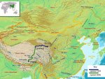
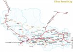
The Chinese really are building a 4-lane Beijing-to-Lhasa expressway, and Tibet's total highway milage now exceeds 70,000 km – see http://eng.tibet.cn/2012sy/xw/201402/t20140219_1973884.html :


Tibet-Location-and-Topography.jpg A-tibet3.jpg A_TibetWhole.jpg
tibet-road-map.jpg A-ScXzQhYn1.jpg roadsTOlhasa(All).jpg


The Chinese seem likely to double that figure of 70,000 km in the next 10 years, and they are also massively improving road links with Nepal – see http://en.wikipedia.org/wiki/Friendship_Highway_(China-Nepal) ,
http://www.theguardian.com/world/2013/apr/23/nepal-china-tibet-india-araniko-highway , and http://news.bbc.co.uk/2/hi/south_asia/8480637.stm .

So why is the G109 paved highway that runs right across the Tibetan Plateau not explicitly on the map of the AH network? And why is the Qinghai-Tibet Railway not indicated as a possible trade route between China and India on maps of the TAR network? My strong suspicion is that the answer is very simple: politics.

First, because China is not quite ready for the plateau to become a major transportation hub for trans-Asian commerce, as long as Tibet remains an “autonomous region” prone to unrest (the Chinese perspective), or an occupied country (the perspective of most other countries, and most people who are not Chinese).

And second, because of India. The Qinghai-Tibet Railway was not built because China want to improve diplomatic relations or economic ties with India. In fact, it was built in spite of Indian diplomatic and security concerns.


****************************************


10. A Not-So-Short Primer on Sino-Indian Relations on the Himalayan Frontier


****************************************


If one is not familiar with Asian geopolitics, one might imagine that a direct railway link between India and China across Tibet should be “win-win” infrastructure development, welcomed by both sides. Unfortunately, much of the border between China and India is disputed, with India claiming Aksai Chin in the West, currently administered by China, with China's G219 highway running right through it; or China claiming much of Arunacahal Pradesh in the east – see http://en.wikipedia.org/wiki/Aksai_Chin and http://en.wikipedia.org/wiki/Arunachal_Pradesh .

The Economist deftly summarizes India's perspective as follows:

The government in Delhi has been nervously watching China's build-up of infrastructure in Tibet. The extension to Shigatse, besides facilitating military movements near China's border with India, is likely to boost trade with Nepal, where the two giants are vying for influence in a power struggle that is still going on. China has long-term plans for more extensions of the line, to Nyalam on the border with Nepal and to Dromo near Bhutan and the Indian state of Sikkim. Nepal wants the railway extended to Kathmandu, which India fears would give China more clout in a country India sees as part of its sphere of influence. Another proposed line, from Lhasa east to Nyingchi, would bring the network close to the Indian state of Arunachal Pradesh, most of which China claims.

Tibetans might have mixed feelings too. The rail link to Lhasa brought disproportionate benefits to ethnic Han Chinese whose language and culture enabled them to take quicker advantage of the Han tourist influx. Tibet Business News said the majority of traders in Shigatse were migrants from beyond Tibet.

See http://www.economist.com/news/china...s-tibets-integration-rest-country-taming-west . The following map also summarizes Indian sentiment:


07_03_14-metro20.jpg


Here is another telling analysis, from an Indian perspective:

While Chinese officials say the infrastructure investment is directed at boosting development, the plans have been seen by many strategic experts in India and by some officials as aimed at expanding China's military mobilisation capabilities in the sparsely-populated remote border areas. The projects, they say, will widen infrastructure asymmetry across the border.

See http://www.thehindu.com/news/intern...ail-link-ahead-of-schedule/article3939249.ece

So instead of viewing the Tibetan railway as an economic opportunity, India tends to view it as a geopolitical threat, as a bid by China to create railway infrastructure to support possible future military annexation of Indian territory by force. India's worry is that railways built ostensibly for purposes of Tibetan economic development and tourism also have strategic implications – see http://www.atimes.com/atimes/China/LJ16Ad01.html . These railways reflect China's combined civilian-military dual-use development policy, i.e. Chairman Mao's theory of the “the synthesis between the requirements of peacetime and war”, or the “unity of soldiers and civilians”. Tibetan roads and railways built to carry tourists can just as easily move troops and military equipment to the Indian border at short notice – see http://timesofindia.indiatimes.com/...n-Tibet-nears-Sikkim/articleshow/31549078.cms , http://idsa.in/jds/2_2_2008_TheTraintoLhasa_SArya , http://www.niticentral.com/2014/03/...ail-network-in-tibet-nears-sikkim-196925.html , http://www.niticentral.com/2014/01/...e-bridge-on-yarlung-tsangpo-river-180898.html , http://timesofindia.indiatimes.com/...-nears-Indian-border/articleshow/31568453.cms , http://news.oneindia.in/2013/03/08/...-line-close-to-indian-bordersoon-1167232.html , http://timesofindia.indiatimes.com/...line-closer-to-India/articleshow/18886910.cms , http://www.jagranjosh.com/current-a...ion-of-qinghaitibet-railway-line-1394184190-1 , http://www.hindustantimes.com/world...network-close-to-sikkim/article1-1191926.aspx , http://www.sundayobserver.lk/2014/03/09/wld07.asp , http://claudearpi.blogspot.it/2012/11/the-train-arrives.html , http://claudearpi.blogspot.it/2012/12/new-railway-lines-in-india-and-in-china.html , http://claudearpi.blogspot.it/2014/01/indias-nightmares-over-chinese-bridge.html , and http://claudearpi.blogspot.it/2014/01/a-chinese-train-to-indian-border.html .

For instance, when the railway to Shigatse extends further down to the border of Sikkim, it's worth remembering that Sikkim is territory that China once claimed – see http://www.atimes.com/atimes/China/LJ16Ad01.html and http://orfonline.org/cms/sites/orfo...s/AnalysisDetail.html?cmaid=2157&mmacmaid=102 .

However, it seems doubtful that China would risk another military confrontation as per the 1962 Sino-Indian war, given that both China and India are now nuclear powers – see http://en.wikipedia.org/wiki/Sino-Indian_War . As such, Indian ambivalence about the development of transportation infrastructure across the Himalayas is perhaps more driven by economic concerns than military ones. Chinese productivity is now so high, that even though Chinese wages are so much better than Indian wages, Chinese goods are flooding the Indian market, and the two countries have a significant trade imbalance in China's favor. Although India is a participant in the Trans-Asian Railway or “TAR” project, its enthusiasm has been mostly luke-warm. India's enthusiasm picked up recently, but even still India sees TAR primarily as a means to improve its rail-links with countries in Southeast Asia, and Myanmar in particular, but not China – see http://www.atimes.com/atimes/South_Asia/IC21Df01.html , http://timesofindia.indiatimes.com/...sian-Railway-Network/articleshow/12488320.cms , and http://www.business-standard.com/ar...ans-asian-railway-network-113091600475_1.html .

Indian and Chinese delegations have met to discuss co-operation on railway issues, and China has made it clear that it would like to extend its high-speed rail network into India. But most recently India seems inclined to opt for Japanese Bullet-train technology instead, ostensibly for funding reasons, but no doubt also geopolitical and economic ones – see http://www.worldcrunch.com/world-af...-technology-li-keqiang/c1s16312/#.U7KhonlnD6l , http://translate.google.co.uk/trans...n/12764/2008/03/18/2945@1982449.htm&sandbox=1 , and http://www.thehindu.com/news/intern...ighspeed-rail-link-to-india/article244282.ece .

The following two passages nicely sum up Indian ambivalence and fear:

Underlying India's poor transport infrastructure in its border regions is a perception that roads and railways there are not in India's interest, as they would enhance China's access to India. Such transport links are not seen as providing Indian access to China.

Fear, rather than ambition, thus dictated India's strategy to the Himalayan region.

But with China flattening the Himalayan barrier to South Asia with its ambitious road and railway building in the region, India has been forced to respond.

Slowly it is acting to build roads and railways in its states bordering China. It has plans to build rail infrastructure into Nepal as well. Five rail links between the two countries are being planned. Most are just a few kilometers long, and do not run through the kind of rugged terrain that the Chinese in the Himalayas have to contend with. However, Indian engineers are likely to run into a far more formidable barrier in executing the projects - official lethargy and negative mindsets.

Unless India looks at its Himalayan infrastructure building as an opportunity rather than with trepidation, it will not be able to gain benefits of its own from China's leveling of the Himalayas.

See http://www.atimes.com/atimes/China/LJ16Ad01.html .

Economists have said the Indian government has been shortsighted in assessing the benefits and feasibility of [Himalayan railway] projects……

Compare that with the benefits to China of a Nathu La link, which will open access to the Indian port of Kolkata and to markets in the Indian plains, Myanmar and Southeast Asia.

Parts of the Indian establishment also fear that building an extensive road/rail network along the country's northern borders will help Chinese good to flood Indian markets - overlooking the opportunities for India in the opposite direction.

See http://www.atimes.com/atimes/South_Asia/JE15Df01.html .

There is of course also a Nepalese perspective in all this. Many in Nepal look forward to Kathmandu connecting to Lhasa by Tibetan railway, because once in place, this connection would rob India of its ability to use unilateral economic blockade against Nepal as a political weapon – see http://www.telegraphnepal.com/headl...red-nepal-china-rail-link-soon-a-reality.html and http://idsa.in/strategicanalysis/RailwaytoLhasaAnAssessment_rnarayanan_1008 . India has in fact done so in the recent past. So articles written in Indian newspapers complaining that Nepal is becoming a “Chinese colony” should be read with a grain of salt, and seem to be instances of the pot calling the kettle black – see http://www.newindianexpress.com/col...Indo-Nepal-Axis/2014/02/18/article2062304.ece , http://www.firstpost.com/india/why-nepal-cant-ignore-india-despite-cozying-up-to-china-942983.html , http://www.niticentral.com/2013/04/20/nepal-is-the-new-chinese-colony-68542.html , http://claudearpi.blogspot.it/2013/09/bridge-over-river-tsangpo.html , and http://claudearpi.blogspot.it/2014/01/new-roads-to-tibet-for-2014.html . The following quote provides a nice summary of Indian worries about growing Chinese influence in Nepal:


For India, the southward advance of China's rail system is fraught with implications for its security and influence. Nepal has played a traditional role as buffer between India and China. New Delhi has wielded considerable influence in Nepal for decades, half of Nepal's trade is with India and its currency is linked to the Indian rupee.

India's influence has been on the decline in recent years, especially with Nepali Maoists entering Nepal's political mainstream. Indian officials believe that during their brief stint in power, the Maoists built strong ties with the Chinese government. Anti-India sentiment in Nepal is high, with many people and politicians blaming "Delhi's meddling" for an ongoing political impasse.

Indian officials fear that the arrival of trains bearing Chinese people and goods will further undermine their country's already weakening hold in Nepal.

See http://www.atimes.com/atimes/China/LJ16Ad01.html

Nepal would no doubt prefer to be neither a colony of India nor a colony of China, so it has to play a balancing act between the two giants. It should then be emphasized that Nepal very much wants China to extend the Shigaste line to the Nepalese border, and China has repeatedly promised Nepal that it will do so – see http://www.thehindu.com/news/intern...ork-to-touch-indias-border/article2811629.ece , http://www.voatibetanenglish.com/co...tches-rapidly-towards-south-asia/1685892.html , http://defence.pk/threads/china-wil...l-after-shigatse-is-linked-to-beijing.276385/ , http://www.tibetanreview.net/news.php?id=12618 , http://web.archive.org/web/20110524204059/http://www.zeenews.com/news438911.html , and http://www.thehindu.com/news/intern...-to-town-near-nepal-border/article5757520.ece .

In sum, it seems safe to say that China will soon connect its railroad to Kathmandu. This first means building another extension westwards from Shigatse to Nyalam, a distance of 400 km, or 120 km more than the distance from Lhasa to Shigatse. And then from Nyalam down to Kathmandu. But whether the Indians will in turn help Nepal build a further connection to India is a different question. At present Nepal has almost no railways, and there is no rail connection between Kathmandu and India – see http://en.wikipedia.org/wiki/Railways_in_Nepal . This may change:

India does plan to expand its rail links with Nepal, proposing to extend across the Nepal border to Kathmandu the rail line at present connecting Raxaul in Bihar state with Birganj. Trucks carrying Indian goods from Birganj to Kathmandu have to travel 220 kilometers. A train from Birganj to Kathmandu that cuts through mountains will be a mere 80 kilometers, cutting travel time and costs.

See http://www.atimes.com/atimes/South_Asia/JE15Df01.html

But given Indian ambivalence and dithering, change may be slow in coming.

Note that a rail connection between China and India might better run through Sikkim, because this would provide a more direct route to Kolkata, where goods could be transferred from trains to ships. Although there is currently no railway up to Gangtok, there is a railway as far as the New Jalpaiguri station station in Siliguri, just 115 km from Gangtok – see http://www.mapsofindia.com/gangtok/gangtok-travel.html and https://maps.google.co.uk/maps/plac...lpaiguri,&fb=1&gl=uk&hq=New+Jalpaiguri,&cid=0 . So if the Chinese ran a line down from Shigaste to Yadong, and then crossed the Nathu La pass to Gangtok, perhaps only another 130 km of track would be necessary to connect to the Indian system – see http://translate.google.co.uk/trans...n/12764/2008/03/18/2945@1982449.htm&sandbox=1 :


3.jpg


Mainly because of friendly Chinese overtures, the Nathu La pass between China and Sikkim was opened again in 2006, after a gap of 44 years – see http://www.atimes.com/atimes/South_Asia/JE15Df01.html . And because of Chinese developments across the border, the Indian government now has plans to finally upgrade infrastructure in Sikkim:

In Sikkim, the Gangtok - Nathu La road is being widened and the government has sanctioned another linking Sikkim with the rest of India to be built……

See http://www.atimes.com/atimes/South_Asia/JE15Df01.html .

But again, don't hold your breath waiting for infrastructure development on the Indian side:

This array of road and rail-building projects looks positive on paper but completion targets may prove fickle, if the experience of the strife-torn states of Jammu and Kashmir and Manipur is any guide. Trains were supposed to be running in the Kashmir Valley by last August, but that now looks unlikely to happen for another five years at least.

In comparison, road and rail projects in China are completed quickly and often ahead of time. The Golmud-Lhasa line was ready a year ahead of schedule. "China begins implementation of projects quickly," a Sikkim government official said. A month after the inauguration of the Golmud-Lhasa railway, China promised the Nepal government that it would extend this line up to the Sino-Nepal border. "Less than two years after that promise was made, work has begun," the official said. "And it will be completed in five years."

See http://www.atimes.com/atimes/South_Asia/JE15Df01.html .

…… India's infrastructure development in the Himalayan region has been lethargic. Its road and rail network near its boundary with China is abysmal. For instance, there is just one single-lane road connecting Sikkim's capital Gangtok to Nathu La and one landslide-prone road linking Sikkim to the rest of India. Sikkim's road density is 28.45 kilometers per 100 square kilometers against the national average of 84 kilometers. Arunachal Pradesh is even worse off, with a road density of just 18.65 kilometers per 100 square kilometers. India might have the world's largest rail network but there are no trains running into Sikkim or Arunachal.

This means that when trainloads of Chinese goods begin arriving at Nathu La around a decade from now, mere truckloads of Indian goods will be trickling in.

See http://www.atimes.com/atimes/China/LJ16Ad01.html and – see http://www.outlookindia.com/printarticle.aspx?232323 .


****************************************


11. A Short Summary of Sino-Indian Relations on the Himalayan Frontier


****************************************


That was no doubt a great deal of central Asian geopolitics to absorb in one go. But the upshot is basically this. China will continue its massive buildup of infrastructure in Tibet, both railways and highways, and China will deepen its transporation links with Nepal. China will continue to "flatten" the Himalayas, and eventually, probably grudgingly, India will be forced to create links on its side as well. The primary Chinese motivation here, however, has never been and never will be strengthening trade ties with India via the Himalayas. Rather, the primary Chinese motivation is internal, namely, the economic and political integration of Tibet (one perspective), or the deepening subjugation of Tibet's people and the exploitation of Tibet's resources (another perspective).

Improving transportation links with Nepal should then probably be seen as a bid to “bribe” Nepalese diplomatic acquiescence vis-a-vis China's occupation of Tibet. Because better transporation links with China will undoubtedly improve Nepal's economy.

Now a likely accidental "spin-off" of all of these geopolitical motivations will be that in less than 20 years India and China will be directly connected by a railway that crosses the Himalayas, and Tibet will indeed be turned into major transportation fulcrum. Again, this is not China's stated intent. But railways built for political and military purposes have a nice way of "morphing" into corridors that promote trade.


****************************************

CONTINUED IN NEXT POST
.
 
Last edited:

biotect

Designer
.
CONTINUED FROM PREVIOUS POST

****************************************


12. Designing a TerraLiner to Cross Tibet


****************************************


Even before the new railway extension from Lhasa to Sigaste (a town nearer the Nepalese border), trade between Tibet and Nepal – and by proxy, between China and India via Tibet – has increased dramatically in recent years. This is only one of the reasons why Tibet now has a “boom” economy, an economy that has been growing at 12 % per annum right through to 2014. Massive Chinese subsidies for infrastructure development, tourism growth, China's military presence, and more recently, a mining boom, are also part of the picture. There is no denying that economic growth in Tibet over the last few decades has been incredible, even by Chinese standards, and that Tibetan highway and railway development is bound to have long-term economic implications for Tibet's role in Eurasian transport.

It is easy to imagine a future in which diplomatic relations between India and China continue to slowly improve, both sides agree to respect current borders, and the Tibetan plateau becomes thoroughly integrated with both Trans-Asian Rail network and the Asian Highway Network, becoming a veritable land-transport “fulcrum” or “hub”, akin to Switzerland in Europe, or Colorado in the United States. And where Tibet's railways first went, four-lane expressways may eventually follow.

A Wired article about the “Quinghai-Tibet” railway, written in 2006, closes with the words:

“In the coming years, two new lines linking Lhasa with other, more remote parts of Tibet are expected to open. And government planners have already asked Wu what it would take to construct a superhighway to Lhasa.”

See http://archive.wired.com/wired/archive/14.07/chinarail.html?pg=3&topic=chinarail&topic_set= .

But even if Tibet does not become the Colorado of Asia, the series of posts earlier in this thread about “Why Tibetan Altitude Matters” have amply demonstrated that the two-lane highway which already crosses Tibet – the G109 – is paved the whole way, and that it is now possible to drive from Kathmandu to Lhasa to Beijing without an expedition vehicle. See http://en.wikipedia.org/wiki/China_National_Highway_109 , and see pages 35 to 38 in this thread, posts #348 to #380, at http://www.expeditionportal.com/for...pedition-RV-w-Rigid-Torsion-Free-Frame/page35 to http://www.expeditionportal.com/for...pedition-RV-w-Rigid-Torsion-Free-Frame/page38 . And see the "High Altitude Heating" thread, posts #21 at http://www.expeditionportal.com/for...BEST-High-Altitude-Solution-for-Heating/page3 , and posts #43 - #48, at http://www.expeditionportal.com/for...BEST-High-Altitude-Solution-for-Heating/page5 .

So even if Tibet does not become a major transportation fulcrum in the Asian Highway Network and TAR, and a major conduit for trade between China and India, crossing the plateau will still come to be seen as an attractive “shortcut” for motorhomes wanting to get from India to China, or vica-versa.

As such, extreme-altitude capability for the TerraLiner strikes me as worth just as much careful consideration as overall size and weight. If a TerraLiner cannot cross Tibet easily, then it will be unable to take full advantage of the emerging excellent road network that will soon encompass the entire Eurasian continent.


****************************************

CONTINUED IN NEXT POST
.
 
Last edited:

biotect

Designer
.
CONTINUED FROM PREVIOUS POST

****************************************


13. The Asian Highway Network and Residual Colonial Prejudice


****************************************


Now talk of an emerging excellent road network in Eurasia is perhaps unwelcome for a certain kind of overlander. When reading some overlanding blogs and magazines, or watching some overlanding videos, one detects a kind of residually colonial nostalgia for the days of yore, when overlanding across Asia was truly difficult, and the quaint locals encountered along the way were barefoot and pregnant.

For instance, in a recent video about the Silk Road north of the Taklamakan desert, the presenter seems to express some regret that much of it is now modern Chinese expressway:


[video=youtube;zkgGK99VsqE]http://www.youtube.com/watch?v=zkgGK99VsqE [/video]


Similarly, in the video that explicitly compares and contrasts the “One Millionth Discovery” expedition and its precursor, the “Oxford and Cambridge Far Eastern Expedition 1955 – 1956”, the presenter implausibly states:


“Now we're following in the spirit if not exactly the footsteps of an incredible expedition that happened in the mid-1950s, in a vehicle just like this one [i.e. a Landrover]. The guys, like us, went all the way from England, and they were headed, too, for Beijing. But political problems meant that they had to head down to Singapore instead. They were the first to do that huge overland trip, and following them is something pretty awesome. Now to tell you the truth, we've had our challenges as well. As I talk to you now the border between here and China is blocked by snow. So even in 2012, a good half a century after the original guys went down to Singapore, we too might have to look at our destination. Can we make it to China? The jeopardy is very real, and the adventure is very real.”


[video=youtube;77487qPkey0]https://www.youtube.com/watch?v=77487qPkey0&index=14&list=PLE8E7C8E376FE8B E7[/video]


This is, without a doubt, one of the more absurd bits of video I've yet encountered about overlanding. Otherwise the series documenting the “One Millionth Discovery” expedition is pretty good – see the YouTube playlist at https://www.youtube.com/playlist?list=PLE8E7C8E376FE8BE7 .

First off, the original Oxbridge expedition participants knew long before they left England that crossing China would be impossible for political reasons, because it was still the height of the cold war. This is not something they “discovered” en-route. Second, the Oxbridge expedition did face genuine physical challenges, because they had no idea whether the Ledo road across Burma, built by General Stillwell a decade earlier in the Second World War, was still passsable. Whereas the only major “obstacle” that the “One Millionth Discovery” expedition seems to have encountered is a bit of snow. If a bit of snow now counts as “challenge” and high adventure, then every time an American or a Canadian drives through blizzards and snow 3 or 4 feet deep to get to work in the morning, they're Marco Polo.

To put the matter bluntly, crossing China is now no more physically demanding and no more adventurous than crossing the United States, because the roads are now so good. This seems to be unwelcome news for a certain kind of overlander, and perhaps that reaction needs more examination?


****************************************

CONTINUED IN NEXT POST
.
 
Last edited:

biotect

Designer
.
CONTINUED FROM PREVIOUS POST

****************************************


14. The Ethics of Expedition Motorhome Design


****************************************


One of the main reasons why I find myself wanting to describe the TerraLiner as an “all-road” or “bad-road” vehicle, instead of an “off-road” vehicle, is ethical.

I figure that if the TerraLiner were merely the kind of large 6x6 motorhome that can handle the corrugation of gravel tracks in Australia, or the corrugation of some sections of the G219 highway in Tibet, then that should be enough. A vehicle this large should only go where highway infrastructure is good enough to support it, and this means middle-income “Second-World” countries like China, and some of the more prosperous and stable Third-World countries that have improving road networks. These will then be countries where the wealth that such a large motorhome represents is less likely to be experienced by locals as an affront and an insult. Put graphically, there would be nothing unethical about driving through China or Botswana with such a large motorhome, because one would not be driving past poor people who are starving.

Whereas to design even a medium-sized vehicle that can handle mud-tracks in the poorest parts of Africa, i.e. countries in the center like the Republic of Congo, is to invite ethical controversy. The days of colonialism are long gone, and to design vehicles motivated by Imperial nostalgia is politically and geographically anachronistic, to say the least. Central Africa is not a “dark continent” whose remotest corners are still waiting to be discovered by white men travelling in luxurious 4x4 Unimog-based motorhomes. Rather, central Africa is a desperately poor region plagued by war, disease, famine, corrupt governments and weak nation-states, whose borders do not correspond to natural, ethnic, or linguistic boundaries, because they were imposed by Europeans and did not emerge organically.

So while a 6x6 “bad-road” TerraLiner designed to traverse the emerging Asian Highway Network, as well as Second-world developing countries more generally, seems morally defensible, a more extreme sort of “off-road capable” vehicle deliberately designed to transport one to the worst parts of Africa seems awfully problematic. Yes, I am just as bitten by the bug of wanderlust and just as sympathetic to the spirit of adventure as the next guy. But the bottom-line geo-political fact is that we no longer live in a world that contains lots of “undiscovered” peoples and cultures.

Sure, it's a world that still contains wilderness, and millions of undiscovered species, most of them bacteria and insects. But the world's various ethnicities and cultures should no longer be imagined as objects of neo-Imperial or anthropological “discovery”, but rather, as peoples whose countries we visit as tourists, even if they are poor. Just like us they want to develop and modernize. They do not want to remain quaint primitives whose barefoot children or bare-breasted wives and daughters serve as exotic props for our photographs.

This is deflationary argument, to be sure, and deliberately so. For further discussion, see the thread titled “Ethics of Third World Travel by Motorhome” at http://www.expeditionportal.com/for...orhome?highlight=third+world+travel+motorhome , and see the article written by Barry and Margaret Williamson that inspired that thread, at http://www.magbaztravels.com/content/view/1440/324/ .

The Williamson's article is inspiring and thought-provoking, and seems a "must read" for anyone seriously interested in the economic, political, and ethical issues raised by expedition motorhome design. Sure, one could just ignore the article, and design as if it had never been written. But on my own view that would be hubristic and short-sighted. The Williamson's article is the fruit of vast personal experience and ethical rumination, it is well-written and well-argued, and so it must be taken very seriously.

Furthermore, although most participants on ExPo seem to have technical backgrounds, or backgrounds in science and engineering, and seem to prefer technical discussions to the exclusion of aesthetic or ethical ones, modern transportation design studies is not like this at all. This may be hard for some ExPo participants to hear, or accept. But it's a simple fact. A consideration of economic, political, and ethical questions is now absolutely central to transportation design studies, especially at the MFA level. The following is the description of the MFA program at the Art Center College of Design in Pasadena, California, universally acknowledged as the foremost institution for Transportation Design studies in the United States:


Transportation Systems and Design

Our Transportation Systems and Design students are developing compelling, sustainable and viable transportation and mobility solutions for an inspired future.

For people passionate about the automotive industry and the expansive field of transportation and personal mobility, our Master of Science program encourages creativity and strategic thinking beyond the sketchpad to impact the vehicle manufacturing industry, and to create better, compelling transportation solutions at a systems level, rather than a product level.

Because design brings value well beyond the areas of product and service development, our curriculum encompasses a combination of design methodology, strategic innovation, systems thinking, customer-driven research, political insight plus entrepreneurial and communication skills. The program's community of students—with prior degrees in subjects such as design, architecture, urban planning, business, engineering, anthropology and economics—brings diverse perspectives and stimulates the transdisciplinary culture that is essential to advance transportation design throughout the coming decades. Degree candidates participate in international conferences and conduct rigorous research; in collaborative teams they explore how to create the ideal user journey while preserving precious environmental resources. The College's strong ties to government and industry provide direct access to organizations pushing the emerging fields of new mobility and alternative energies.

This course of study encourages graduates to become agents of change prepared to reinvigorate industry across a broad landscape, from design studios and manufacturers to organizations responsible for transportation systems solutions at the national, state and local levels.


See http://www.artcenter.edu/accd/programs/graduate/transportation_design.jsp .


So even if the typical ExPo participant is uninterested in such questions, that does not mean that they are not worth asking, or that they should not be central to this thread. This thread, after all, is a "transportation design thread".


****************************************


15. The Simplistic Geopolitics of “Third World Travel by Motorhome?”, by Barry and Margaret Williamson


****************************************


With that said, after considerable reflection, the Williamson's article now strikes me as a bit outdated. In a nutshell, the Williamsons draw a very strong, dualistic contrast between travelling by motorhome in the First World (morally acceptable), versus travelling the world by motorhome almost everywhere else (morally unacceptable). This contrast seems motivated by a rather anachronistic and geopolitically naive categorization of most countries as either “First World” or “Third World”, consigning only a handful of former Soviet-communist countries to the "Second World" category:


By 'third world country' we mean the majority of the world's 200 or so countries. The 'first world' are the few developed countries to fully benefit from advanced capitalism. The 'second world' includes Russia itself, the countries in central and eastern Europe it occupied between 1945 and 1990 and its former empire in central Asia. Some third world countries are slowly developing towards a higher status, but are still unsuitable for motorhome travel (South Korea, Taiwan, China, India, Brazil).


Again, see http://www.magbaztravels.com/content/view/1440/324/ .

My considered view is that this division is too simplistic, because it no longer makes sense to talk about a non-communist “Third World”, simpliciter.

As already discussed at length in this thread, much of the planet is now better described as economically “Second World”: middle-income developing countries that are no longer abjectly poor – see posts #225, #226, and #227 on page 23 of this thread, at http://www.expeditionportal.com/for...pedition-RV-w-Rigid-Torsion-Free-Frame/page23 (standard Expo pagination). The term "Second World" began as a political term, used mainly to describe the Soviet Union and its eastern-european satellite states. But as suggested earlier in the the thread, it is best to now understand "Second World" as an economic category, instead of a political one. And when used as an economic category, huge swathes of the planet are now better classified as "Second World" as opposed to "Third World".

The various maps shown in post #226 vary widely in their interpretation of what countries should count as "First World", "Second World", and "Third World." Two maps even classify Brazil and Mexico as First World, India as Second-World, and only central African states as Third World:


UN_Human_Development_Report_2007.jpg First_Second_and_Third_world_map_2007.jpg


These maps strikes me as far too optimistic. But on the other hand, some maps will go in the opposite direction, and like the Williamsons, they will classify all countries outside North America, Europe, and Russia as "Third World":


world44.jpg


This map also strikes me as wrong-headed, because it so dated.

So for me, by far the best maps are those that depict the more nuanced gradations captured by the UN's HDI (human development index):


UN_Human_Development_Report_2009.jpg


On my own view, this much more detailed and nuanced HDI map should be used to categorize the countries of the world along the following lines:


HDI dark Green: the First World

HDI medium and light green: Second World

HDI bright yellow and dark yellow: Third World

HDI orange
, bright red, and black: Fourth World


In terms of transportation design, it then seems ethically acceptable to travel by expedition motorhome in countries colored dark green, medium and light green, bright yellow, and perhaps even dark yellow, for instance, South Africa and Botswana. But it is much more ethically problematic, for the reasons given by the Williamsons, to travel by motorhome in countries colored orange, bright red, and black. Put another way, it is most definitely ethically problematic to travel by expedition motorhome in central African countries that are Fourth World:


Least_Developed_Countries_map_-_2006 copy.jpg


Now notice how in none of these maps does contemporary China ever classify as Third World. Not even in the most pessimistic map. One of the optimistic maps even classifies China as First World! To be sure, this seems wrong; but it seems equally wrong for the Williamsons to classify China as Third World. And even more wrong for them to describe China as "slowly developing towards a higher status".

"Slowly developing"
is not a description that most people would ever apply to the pace of economic change in China over the last 2 decades.


****************************************

CONTINUED IN NEXT POST
.
 
Last edited:

biotect

Designer
.
CONTINUED FROM PREVIOUS POST

****************************************


16. Tibet is not Third-World


****************************************


In the videos included in this series of posts I focused on China's High-Speed Rail system, because these images speak volumes about the actual state of much of contemporary Asia, as opposed to the bare-foot-and-pregnant poverty conjured up by Western post-colonial imagination and liberal guilt.

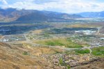
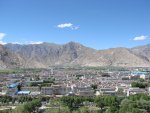
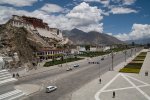
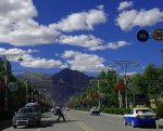
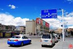
As for Tibet in particular, which has been a major focus of this series of posts, the housing and roads in Lhasa are probably now better than much of the infrastructure in the British midlands. Tibet's 12 % rate of economic growth per annum adds up very fast – see http://en.wikipedia.org/wiki/Lhasa . A picture is worth a thousand words, and a gallery of pictures is worth millions. So what follows in the next few posts are some photographs that show just how much Tibet has modernized, Lhasa in particular.

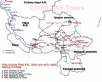
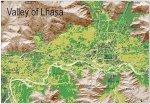
First, here are some maps and panoramic views, to get a sense of the lay of the land:


Lhasa,_Tibet.jpg satellite-panoramic-map-of-29n40-91e00.jpg LhasaY.jpg
lhasa_map.jpg lhasa.whole.jpg map-lhasa-b.jpg
173440755201303130039312420494685330_011.jpg 173440755201303130039312420494685330_013.jpg Lhasa_Valley_in_Tibet.jpg
Lhasa_scene.jpg


****************************************

CONTINUED IN NEXT POST
.

 
Last edited:

biotect

Designer
.
CONTINUED FROM PREVIOUS POST

****************************************


Lhasa's Potala Palace is recognizable enough, and a symbol of Tibet the world over:


Lhasa_from_the_Pabonka_Monastery.jpg 4079kathmandu-&-lhasa-tour.jpg 20070702_enigmatic_lhasa004.jpg
117.jpg 173440755201303130100412977024203645_002.jpg 173440755201303130100412977024203645_003.jpg


But what seems less commonly known, is how clean, modern, and well-kept the surrounding city has become.

I honestly don't know where the photographs that follow below originally came from; I found them posted on "Skycraper City", in a thread titled "Lhasa Infrastructure" -- see http://www.skyscrapercity.com/showthread.php?t=1600517 . They could be partially "staged" photographs deliberately taken to promote the Chinese line that their occupation and economic development of Tibet has been positive and beneficial. But even if these photographs are partly Chinese propaganda, there is only so much that can be "staged", and the prosperity evident in these photographs is only too evident. These are not pictures of a Third-World country:


173440755201303130039312420494685330_005.jpg 173440755201303130039312420494685330_006.jpg 201112521580595.jpg
173440755201303130100412977024203645_001.jpg


****************************************

CONTINUED IN NEXT POST
.
 
Last edited:

biotect

Designer
.
CONTINUED FROM PREVIOUS POST

****************************************


Lhasa_from_Potala_place.jpg 173440755201303130059221303235356060_002.jpg 173440755201303130039312420494685330_003.jpg
173440755201303130039312420494685330_000.jpg 173440755201303130039312420494685330_015.jpg 173440755201303130039312420494685330_014.jpg


And here are some images of pedestrian zones in the historic quarter, and some Lhasa parks:


173440755201303130045052476207288288_017.jpg Jokhang_Square,_the_first_destination_or_drop-off_for_most_tourists.jpg 201112521592651.jpg
Lhasa-Jokhang-Temple-city-view-Bernt-Rostad.jpg


****************************************

CONTINUED IN NEXT POST
.
 
Last edited:

Forum statistics

Threads
188,494
Messages
2,905,691
Members
230,502
Latest member
Sophia Lopez
Top