The Map is Not the Territory: A Northern Maine Adventure

epicxcrider

Observer
surprised you guys didn't go into mckay station. farther down the gorge, is the power station. water roars out of the man-built tunnel there. and actually, there is where the water level is controlled.

I've been there rafting before, so wanted to explore upriver a bit. Didn't know that's where the water was controlled, thanks! I bet it was gorgeous (ha ha) before the dam was installed.


Might this be the (former?) Prey’s (Pray’s)? cottages? We were in this area a few times back in the late 80’s and early 90’s…used to be small compound with rental cottages and a “general store”.

Man I have been drooling reading this thread…

Bill

I think you're right about that - in fact I found the old website!
http://www.campstorent.com/prays.htm

and Thanks!
 

epicxcrider

Observer
Blasting Down the Golden Road at a good clip I noticed the terrain beginning to turn mountainous. The road started to curve more, and we couldn’t see as far ahead on the straightaways because of the undulating terrain. We came to a tall steep climb in the road, looking up I noticed quite a bit of mud in the road. Drop to 3rd, lock the center diff, punch it. The engine wound up and we held speed up the hill, our line tracking slowly to the shoulder in the soft road grade. A little input and I kept it in the lane until the top of the hill. Looking for Josh in the rearview I slowed when he didn’t appear right behind me. A short time later I saw his headlights pop up over the hill - he had taken the more moderate way up the hill :)

Shortly after this we made our first turn East heading towards Second Roach Pond. We would look for a route through, around the East side of White Cap Mountain and just West of Saddleback Mountain. It was all on the map...

I slowed the pace down here on the secondary roads, which were rutted and potholed most of the time - still about 30 mph. With Nick as my navigator we picked our way through the multitude of unmarked turns using only the terrain to navigate - the GPS was useless here again. Many times we felt we must be going the wrong way only to find a land feature minutes later. After a good while all signs of hunting camps dwindled, and the grass growing up in the road showed a lack of regular use.

Checking the map at an intersection, I spotted a reasonable shortcut and decided we would go further East. 5 minutes up the road, a large (locked) gate blocked our path with very clear No Trespassing signs on nearby trees. Paper company land. Backtracking West we turned South at the intersection, back on the planed route. We wound our way up and down hills, around and in between swamps and ponds. Simply beautiful landscape.

Card%2525203%252520%252528103%252529.JPG


300060_939848479061_11014177_43716567_1296574739_n.jpg


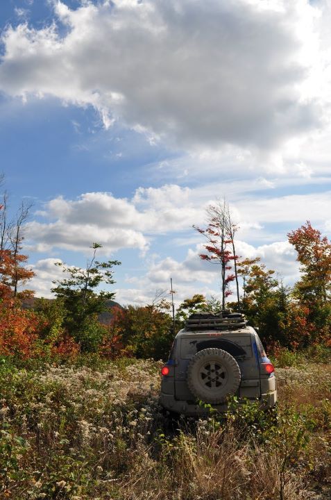
South of Crawford Pond we started descending a series of switchbacks. Coming around the second bend there was a magnificent view of White Cap and Big Shanty mountains which we enjoyed the rest of the way down the hill. The sun was bright in the sky, the road was good, and I was looking forward to the view of the ridge as the road wound around the East side of the mountain. Until I saw this...

IMG_7617.JPG
 

epicxcrider

Observer
Just got a few additional (unedited) photos from Nick B - our photographer. www.nickbrandreth.com

_MG_1385.jpg

Trio Ponds (Day two)

_MG_1409.jpg

Negotiating Trio Ponds Road (Day two)

_MG_1479.jpg

Swamp on Trio Ponds Rd (Day two)

_MG_1508.jpg

Looking over the valley (Day two)

_MG_1582.jpg

Negotiating the washout (Day three)


BillTex

Adventurer
I think you're right about that - in fact I found the old website!
http://www.campstorent.com/prays.htm

and Thanks!

Whoa!
Flashback...
Thanx for finding that website...seems like 100 yrs ago when we were last there.
We camped out not too far from there (did not stay in the cabins) but I remember stopping in the "store" and chatting with the (then) elderly couple running the place...
That was a good twenty years ago!

Keep on rockin' you Guys are motivating me to get back up to that area...probably when things thaw out next spring...after mud season...

Bill
 

epicxcrider

Observer
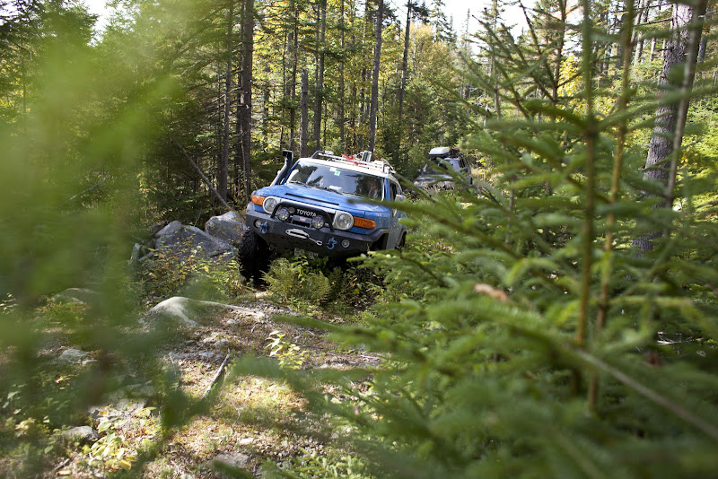
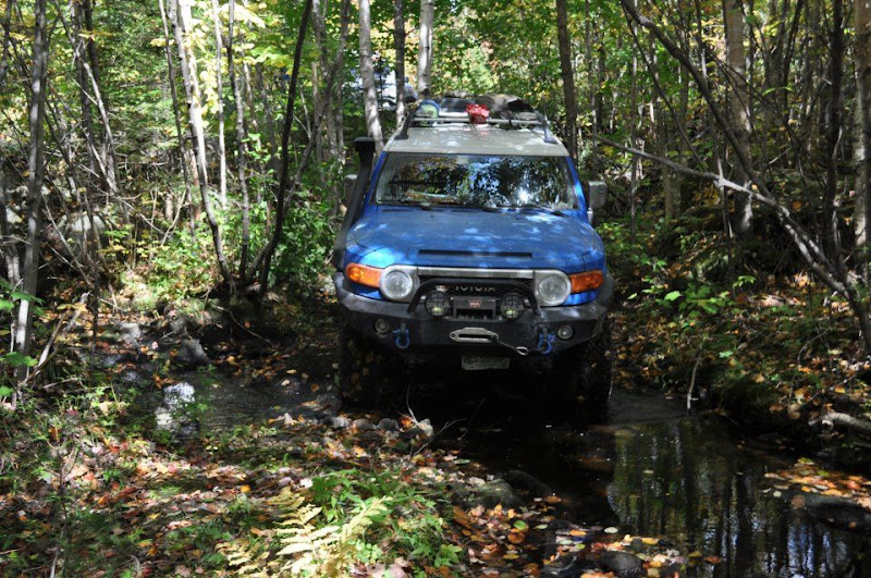
At one time this road would have been well traveled. It had the remains of a firm gravel base and only saplings began to grow close to the road. We had to move slowly here where the road had washed away, the ruts were deep and filled with water from the past few days of rain. Moving East we enjoyed the foliage and solitude as we passed several lakes, the sun peeking in between the leaves of the hardwood canopy - occasionally there would be a view of the mountains surrounding us.

IMAG0595.jpg


298012_939848783451_11014177_43716574_1800687119_n.jpg


The old road continued East and got better for a while and we came to a fork. Northeast looked like a better road, but Southeast was shorter on the map. We set off Southeast. We cruised for a few miles on nice gravel until the signs of logging had disappeared. Grass grew up in the road which now became windy and hilly. There were also a good number of roads branching off the main path, luckily there had been enough traffic to show which road should go through.

IMG_7628.JPG

As we started to head South, the trail became less and less traveled. The map showed a number of stream crossings, and I wondered what the condition of any bridges or culverts would be. I got my answer shortly.

IMG_7622.JPG

The roadbed stopped abruptly and dropped down into the stream. It was a steep descent and climb on the other side, but not a big deal. Everyone hopped out to get a good look while Nick and I scouted a bit ahead. The road was so overgrown now I was beginning to get nervous about whether or not it would bring us to our destination. Adding to the stress level we had used all of our reserve fuel - all we had was what was left in the main tanks.

IMG_7621.JPG

Nick and I walked a few hundred yards down the trail which was overgrown but still clear enough to pass. Deciding to press onward we negotiated the stream crossing and continued South. I was excited, figuring this was the "impassable" section the atlas referenced though I wondered what the next three stream crossings would be like...


305757_939849072871_11014177_43716580_1294913180_n.jpg


IMG_7624.JPG


IMG_7626.JPG


Last edited:

cshontz

Supporting Sponsor
The nice thing is, it's already apparent that you didn't meet a fateful end by running out of gas and becoming stranded in the Maine wilderness.

EDIT: ...unless you ate the others.
 
Last edited:

epicxcrider

Observer
Card%2525203%252520%2525281388%252529.JPG

After the stream crossing things smoothed out and widened up a bit. Grass and brush grew about a foot high in the road, but the bed was packed gravel allowing us to do around 20. It was becoming harder to distinguish the road from side shoots here because again, the map was incorrect. We were off any sort of track on the GPS and only navigating by counting stream crossings and looking at the peaks. I made a few wrong turns bringing us to dead ends, usually an old logging area. Each time we would have to backtrack, sometimes a mile or two to the main road.


Card%2525203%252520%2525281378%252529.JPG


Each time the track we were supposed to take became more and more overgrown. We were still making decent time and the fuel was holding out well, but our overall pace had slowed considerably to a few miles per hour. As we approached the next stream crossing a quick check of the map showed it was still about 3 miles as the crow flies to the next known good road...

299150_939852810381_11014177_43716630_2102005582_n.jpg

We approached the second major stream crossing which was obscured by the branches now reaching into the road. I hopped out to take a look and began to get nervous when I saw the remains of a wooden gate in the road... We had not gone through the “impassable” section yet. We were at it now. Ahead of us lay the remains of a wooden bridge over a river, the footings of which were 8 feet tall and now collapsing. There was no possible way to pass over what was left of the bridge. Even sand ladders couldn’t help us here ;) We would have to find a way around, or turn back altogether. I was not about to turn around now only a few miles from our goal.

293471_939850305401_11014177_43716611_1098374397_n.jpg

Josh, Nick, and I started looking for a way around the bridge. Jason was somewhere, Erek and Kevin were still fighting a hangover from the night before. I looked West of the bridge - too dense. We’d have to cut a path the width of the FJ to get through, and that wasn’t something I was interested in doing. Leave no trace. East of the bridge there was a small path through the trees. It was extremely narrow, diving down into the woods below the bridge, across the river and through some muck on the other side. There was a spot to rejoin the main trail about 200 feet later, up a very steep embankment. It was extremely technical, but we would make it work. I jumped in the FJ, put it in 4-low and inched my way off the trail into the woods....

IMAG0602.jpg


epicxcrider

Observer
Creeping through the narrow opening in the trees I realized there was nobody to spot me through here - where the heck was everyone? I should have waited for a spotter but I kept going an inch at a time.

Mistake one.

Moving forward inch by inch, I brought the nose of the truck around the tree with the front left tire flexed up on a moss covered rock.
I should mention I wasn’t aired down.

Mistake two.

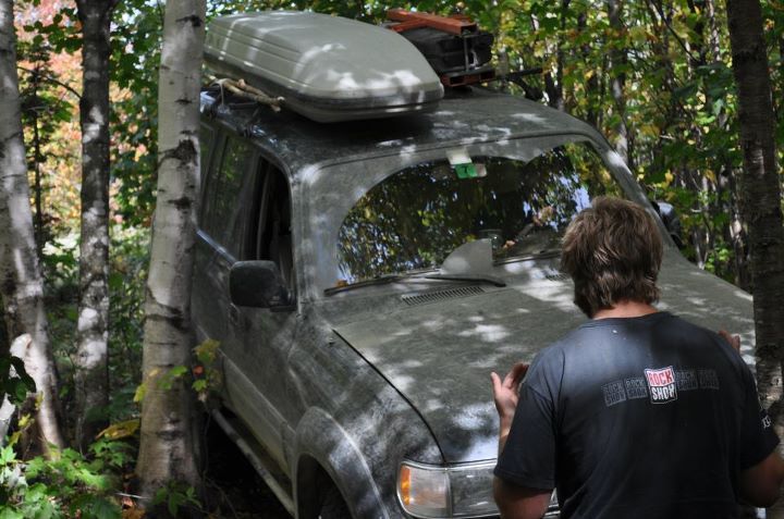
As I cut hard right to avoid a tree in front of me I slipped off the rock and hit a tree with the passenger mirror. Luckily it just folded the mirror in with no damage. Reverse - I’ll back out. Spinning wheels. Every movement put me harder and harder into the tree, until I was completely resting on my passenger mirror and unable to drive forward without ripping it off. By this time everyone had appeared and I told Josh he was going to need to pull me backwards. The stress level was rising - we needed the winch and the back of the FJ was barely off the main road.

Josh got the LX in position to pull me backwards and readied his winch while I gave orders to everyone else to clear the path ahead of the downed trees and branches. I’m sure everyone could sense the stress at this point, but I’ll stop and add up everything on my mind right now...
  • FJ stuck against a tree, almost surely resulting in body damage
  • Running low on fuel
  • Still need to get FJ and LX-450 through tight & muddy bridge bypass
  • Several miles of unknown trail and obstacles ahead
  • Now 1:00 PM
  • Possibility of having to turn around and come back through

I stopped to ask Josh if he was comfortable driving through - he was. We pulled the FJ back away from the tree and I prepared for a second attempt with Josh as my spotter. Negotiating the tight trees, big rocks, and roots was not easy - even with a second set of eyes. But I made it through - just barely - by pushing a tree aside with the steel front bumper. That investment has more than paid for itself. The FJ was through the tightest section and we all took a break for a minute to make a plan for the mud...

294227_939849337341_11014177_43716586_1066412694_n.jpg

There wasn’t much of a plan since there wasn’t much we could do. There was extremely soft mud on both sides of a large rock protruding at a perfect height to catch the rear diff. My only hope was to try and ride up on the rock with the front and hope the rear followed.

4-Low. Locker. Snorkel engaged. :p

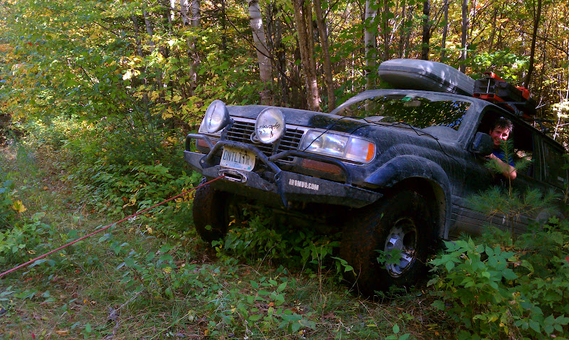
Pulling forward in second gear - in case I needed some wheelspin - the front wheels climbed rock, then immediately slipped off into the muck and I just kept going as it wasn’t going to get any better. This worked for another 5 feet until the pumpkin hit the rock and I was stuck with all four (three) wheels spinning. At this point I had no choice but to winch the diff over the rock. I didn’t want to risk getting Josh’s vehicle stuck behind me and I couldn’t back up. I pulled line and Erek hooked up the cable. I slowly scraped over the rock with the front wheels digging in until the truck rested on the skidplates.


307248_939849676661_11014177_43716594_1946424220_n.jpg


IMAG0603.jpg

I gained some ground here but the trail turned 90 degrees here and the winch was now pulling against me. Erek un-hooked the cable and I tried to move under my own power - nothing. Hooking to another tree I was able to pull around the corner and up a small ledge, ready for the final ascent up the 7 foot high bank to the road.


_MG_1792.jpg


316077_939849886241_11014177_43716599_667184015_n.jpg

Erek ran up to the roadbed with the cable as I crept the front wheels up. As the back started to climb the inclinometer was well past 30 degrees - and I started sliding. Quickly standing on the brakes as hard as I could I locked the rear end again and thought about hooking to the trees. I decided to give it another try.

mistake three.

As I let off the brakes I couldn’t let the clutch out fast enough and the FJ rolled back quickly. I stood on the brakes again but it was too late - *CRACK* my passenger mirror hit a tree.
Luckily, only the plastic broke and the mirror was intact. I was now stuck up against a tree on the driver’s side, and would have to winch out. Erek wrapped the tree strap around a large stand of alders he hoped would hold, and I loaded the winch. The angle was so extreme the rope bent around the curve of the banking as I started to pull myself up. Winch whining, creeping slowly up the banking the FJ finally crested and was on the road.

Everyone was relieved until I reminded them we would have to get Josh’s considerably larger LX through the same spot.
 

epicxcrider

Observer
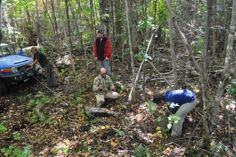
I decided to scout ahead a bit - I say I a lot, these were group decisions - and make sure there wasn’t another “impassable” obstacle just ahead of us. Nick and I hopped in the FJ with Chirp and took off. I left the rest of the guys with instructions to try and make a road through the muck with some bigger rocks in hopes that Josh would have an easier time getting through. We explored probably ¼ mile of trail. The trail got very narrow but remained drivable so I decided to press on and we returned to the washout.

309130_939850105801_11014177_43716606_1052025005_n.jpg

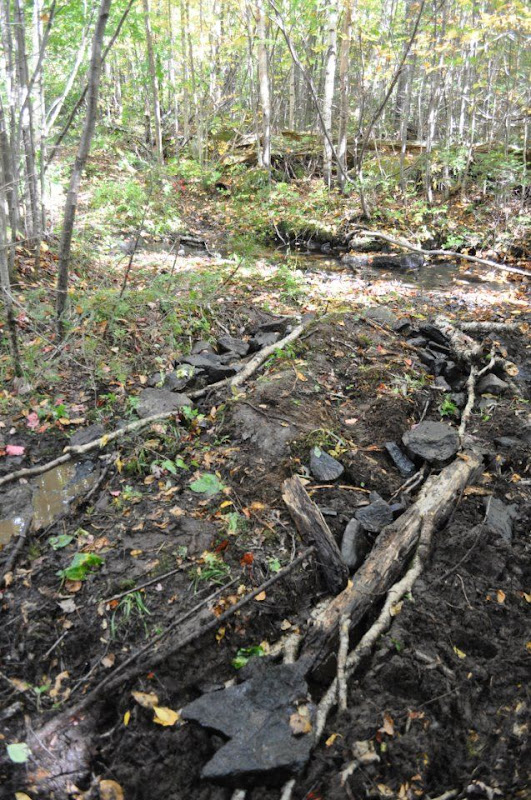
The guys had built up the mucky area well enough by filling in the tire tracks so Josh got back in the LX and I got in position to spot him through the tight trees.

299453_939850505001_11014177_43716613_1707896605_n.jpg

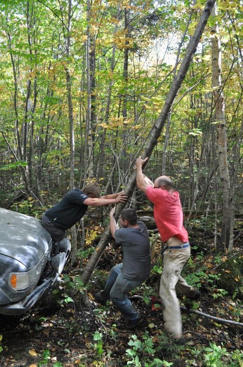
Slowly the big SUV crept through the trees and up onto the rock I had fallen off before. Things looked good until Josh started cutting right - he wasn’t going to fit. I looked up and said “two options, the bumper or the roof”. He tried to squeeze between the trees a few more times but the truck was just too large. Reluctantly I got out the hatchet - we would have to take down one of the smaller trees to get him through.

310310_939850709591_11014177_43716614_1695490632_n.jpg


298354_939850894221_11014177_43716615_1793662558_n.jpg


Card%2525203%252520%2525281313%252529.JPG

With Erek and I taking turns we got most of the way through the trunk in a few minutes, and toppled it over by hand. Erek and Jason cleared the brush while I spotted Josh through - he just fit and was now in the riverbed.

Card%2525203%252520%2525281323%252529.JPG


Card%2525203%252520%2525281330%252529.JPG

Josh tried the same line over the rock I did with the same result. Inch up up up then SPLORCH into the muck. Luckily this time the rocks were in place, preventing him from sinking as deep.
Josh locked both axles and I warned he was probably going to need some wheelspin - everyone backed away. With surprisingly little drama the diff ground over the rock, and his front tires climbed the next ledge. Again with some gusto the rear tires were up! He was on firm ground now, ready for the climb up the embankment.

Card%2525203%252520%2525281349%252529.JPG


Card%2525203%252520%2525281353%252529.JPG


IMAG0611.jpg

The front wheels crept up until the trailer hitch dragged through the dirt. He wasn’t going any further without risking body damage. We pulled line, hitched to the same tree and the hydraulic winch quickly and quietly pulled the heavy LX up onto the road. I was relieved to be through, still nervous about the miles of unknown trail that lay ahead of us.
 

epicxcrider

Observer
Card%2525203%252520%2525281354%252529.JPG

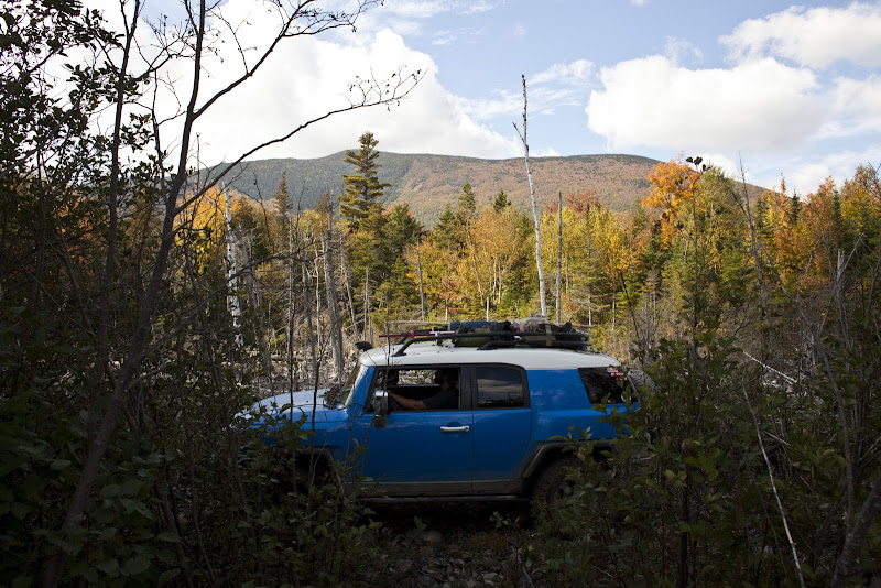
We packed away the recovery gear and headed south again, excited to have made it through. The tree growth here was very young allowing us an excellent view of the mountains all around. The area had clearly been logged, I would guess about 15 or 20 years ago. Just as quickly as the trees opened up, they closed back in. A LOT.

Card%2525203%252520%2525281357%252529.JPG

It got so dense we couldn't even see where we were driving as the alders folded the mirrors in with a bang! The trees would open up just a little - still scraping the side of the trucks - and then close back in so tight I couldn't see the end. It went on like this for a quarter mile.

Card%2525203%252520%2525281356%252529.JPG

Now I understand why Rovers have branch raisers.

Card%2525203%252520%2525281359%252529.JPG

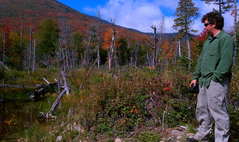
We abruptly emerged from the tree-tunnel into a small clearing by a swamp. We got our first nice view in a while, but I had no idea where the road went.

Card%2525203%252520%2525281358%252529.JPG

See the road? It's right there on the left. How could you miss it?

There were a few logs in the road and since we had to move them I thought it would be a good idea to scout ahead a little bit. A small stream crossing, narrow "road", nothing bad. Until the downed tree.

Card%2525203%252520%2525281360%252529.JPG


Card%2525203%252520%2525281362%252529.JPG

We needed to make better time so I skipped the hatchet and got the chainsaw, making quick work of the obstacle. Back in the trucks we navigated the small stream and were moving South again. After another couple hundred yards the road even started to open up again!

Card%2525203%252520%2525281363%252529.JPG


_MG_1832.jpg


Card%2525203%252520%2525281364%252529.JPG


Card%2525203%252520%2525281368%252529.JPG


Card%2525203%252520%2525281372%252529.JPG
 

epicxcrider

Observer
Now we were really moving South at a good pace! The road stayed open, the challenge now was finding our way through the maze of turns and dead ends. We backtracked here and there but navigating was becoming easier as landmarks became more visible.

Card%2525203%252520%2525281376%252529.JPG


Card%2525203%252520%2525281391%252529.JPG


Card%2525203%252520%2525281396%252529.JPG

Up ahead I spotted a narrow section with a log across it. It would be tricky to navigate. After determining a good line through I decided to scout ahead a little on foot. Rounding the bend the road disappeared through some alders then-

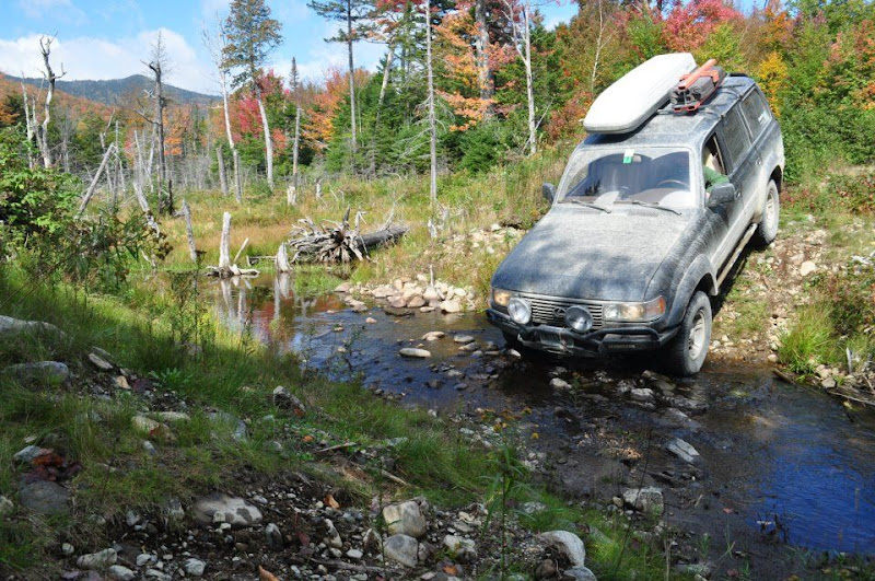
Oh yeah. The third river.

Card%2525203%252520%2525281397%252529.JPG
 

Forum statistics

Threads
187,898
Messages
2,899,647
Members
229,072
Latest member
fireofficer001
Top