You are using an out of date browser. It may not display this or other websites correctly.
You should upgrade or use an alternative browser.
You should upgrade or use an alternative browser.
Traversing the US (and back)
- Thread starter jessejman
- Start date
Yes, now that would do it! Foy, you could spend weeks in there.
The sweet spot within a wide range of variables, and with a 20% reserve, is about a 400 mile range on the built-in diesel fuel tank.
Foy
Day 27: Jarbridge to the middle of nowhere (west of Owyhee)
I dumped 10 gallons in my truck to start the day off. The jeep was drinking a little less gas but not much. Missing the gas station in Rogerson added some stress to this section. And we were still pressed for time.
Another huge thing that added to stress was the fact that I had no maps for Nevada other than a large US atlas. We were navigating completely off of direction using a map that I had sketched in my head. I knew the main roads and a quadrant we were working in yet I had no detail on the ground. This was super frustrating. We had a smartphone but no maps loaded on it either. It was a little better than the GPS at this game, but not much.
We woke up refreshed having gone to bed pretty early. It was awesome to have help from my parents in doing the daily chores - cooking, cleaning, packing up.

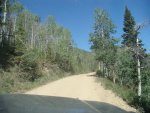

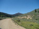

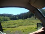
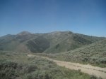
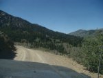
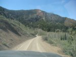
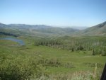
Is this what you think of when you think of Nevada?
Near where the last photo was taken we met an older couple for California. Our going plan was to stop and ask anyone we say directions west. This couple had a NV gazetteer and let us spend some time figuring out the best way to proceed. This helped a ton but we soon realized how useful the GPS was.
I dumped 10 gallons in my truck to start the day off. The jeep was drinking a little less gas but not much. Missing the gas station in Rogerson added some stress to this section. And we were still pressed for time.
Another huge thing that added to stress was the fact that I had no maps for Nevada other than a large US atlas. We were navigating completely off of direction using a map that I had sketched in my head. I knew the main roads and a quadrant we were working in yet I had no detail on the ground. This was super frustrating. We had a smartphone but no maps loaded on it either. It was a little better than the GPS at this game, but not much.
We woke up refreshed having gone to bed pretty early. It was awesome to have help from my parents in doing the daily chores - cooking, cleaning, packing up.


Is this what you think of when you think of Nevada?
Near where the last photo was taken we met an older couple for California. Our going plan was to stop and ask anyone we say directions west. This couple had a NV gazetteer and let us spend some time figuring out the best way to proceed. This helped a ton but we soon realized how useful the GPS was.
Day 27: Jarbridge to the middle of nowhere (west of Owyhee)
Maps for day 27: Jarbridge to West of Owyhee and East of Starvalley Ranch. Camped right on the border of Idaho and Nevada literally.
Overview:


Part 1: Jarbridge to Owyhee

Part 2: Owyhee to Starvalley Ranch

You can tell we didn't have good maps because of the crazy looking route. That said, we covered some amazing paths.
Maps for day 27: Jarbridge to West of Owyhee and East of Starvalley Ranch. Camped right on the border of Idaho and Nevada literally.
Overview:


Part 1: Jarbridge to Owyhee

Part 2: Owyhee to Starvalley Ranch

You can tell we didn't have good maps because of the crazy looking route. That said, we covered some amazing paths.
Last edited:
Day 27: Jarbridge to the middle of nowhere (west of Owyhee)
Descending south out of the mountains we were looking for Charleston Reservoir on our left and a good gravel road on the right. We passed what we assumed was Charleston Res. and the old settlement and took the next road to the right.
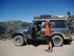
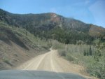
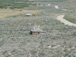
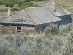
Here is where we turned onto what we though and may have been, not sure, was road 7xx. Some dilapidated houses and barns that looked like they had been built right but neglected.
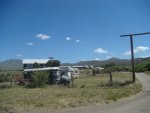
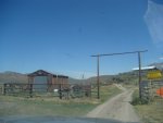
Continuing on we quickly came up to this ranch: completely off the grid and large with lots of equipment and barns/sheds. It was a really nice place and far far away from any grocery store or gas station. You can make out some of the large solar array they have for power.
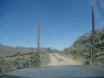
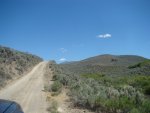
We passed through this gate that looked very private. Had to get out and open it right below the house. I kept thinking someone would come out and ask us what we were doing there but no one came. I wish they had - guaranteed they knew more about the area than we did.
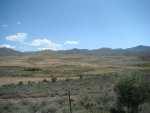
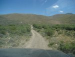
After closing the gate and passing into the questionable area behind the house the nice gravel road diminished and turned into a narrow track. Tension was high as we were expecting a nice road but the scenery was awesome and we decided it wouldn't be horrible if we had to turn around within a few miles. But gas was running low(ish) too.
Descending south out of the mountains we were looking for Charleston Reservoir on our left and a good gravel road on the right. We passed what we assumed was Charleston Res. and the old settlement and took the next road to the right.


Here is where we turned onto what we though and may have been, not sure, was road 7xx. Some dilapidated houses and barns that looked like they had been built right but neglected.


Continuing on we quickly came up to this ranch: completely off the grid and large with lots of equipment and barns/sheds. It was a really nice place and far far away from any grocery store or gas station. You can make out some of the large solar array they have for power.


We passed through this gate that looked very private. Had to get out and open it right below the house. I kept thinking someone would come out and ask us what we were doing there but no one came. I wish they had - guaranteed they knew more about the area than we did.


After closing the gate and passing into the questionable area behind the house the nice gravel road diminished and turned into a narrow track. Tension was high as we were expecting a nice road but the scenery was awesome and we decided it wouldn't be horrible if we had to turn around within a few miles. But gas was running low(ish) too.
Day 27: Jarbridge to the middle of nowhere (west of Owyhee)
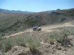
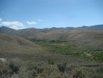
Climbed out of one valley and eventually dropped down into another.
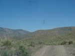
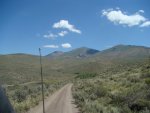
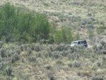
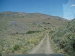
No troubles through, just beautiful narrow rough track. We were worried about the new stripes we were putting on this 4,000 mile-old Jeep.
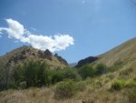
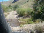
Yep, that's where we were headed. Down into another canyon.
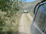
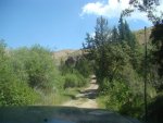


Climbed out of one valley and eventually dropped down into another.


No troubles through, just beautiful narrow rough track. We were worried about the new stripes we were putting on this 4,000 mile-old Jeep.


Yep, that's where we were headed. Down into another canyon.


Day 27: Jarbridge to the middle of nowhere (west of Owyhee)
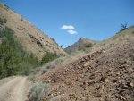
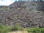
First real obstacle other than tight atv trail was around this bend. There had been a slide and the rocks covered the trail. Others had been over it but it was slow going and loose. No pictures for some reason.
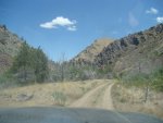
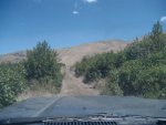

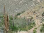
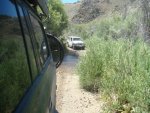
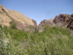
This trail kept going and going. We were very worried at this point that it wouldn't go through. That we would hit an obstacle that we couldn't get through. We were at no turn-around point with our gas levels. We had to make Owyhee this way.
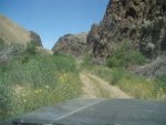
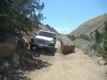
Second and third obstacles happened successively. The second was another slide on a narrow section of trail with a large drop off to one side and cliff wall to the other. A section of cliff had crumbled away. There was no go -around but the only danger was the camber that threatened to throw my truck off the cliff. Again, it wasn't horrible and the wheels did't get 'light' but it raised blood pressure for sure. The third obstacle was a large stone in the trail. It definitely limits the size truck that could pass through the trail. Relatively easy to negotiate in our trucks but a longer or wider one might have difficulty.


First real obstacle other than tight atv trail was around this bend. There had been a slide and the rocks covered the trail. Others had been over it but it was slow going and loose. No pictures for some reason.


This trail kept going and going. We were very worried at this point that it wouldn't go through. That we would hit an obstacle that we couldn't get through. We were at no turn-around point with our gas levels. We had to make Owyhee this way.


Second and third obstacles happened successively. The second was another slide on a narrow section of trail with a large drop off to one side and cliff wall to the other. A section of cliff had crumbled away. There was no go -around but the only danger was the camber that threatened to throw my truck off the cliff. Again, it wasn't horrible and the wheels did't get 'light' but it raised blood pressure for sure. The third obstacle was a large stone in the trail. It definitely limits the size truck that could pass through the trail. Relatively easy to negotiate in our trucks but a longer or wider one might have difficulty.
Day 27: Jarbridge to the middle of nowhere (west of Owyhee)
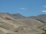
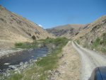
At one point we had to do a mandatory short reroute where the road had washed out. We backtracked and went up and over a finger of hill and dropped back to the river which we had decided must be a fork of the Bruneau.
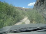
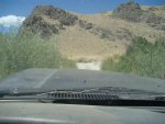
The track continued to constrict.
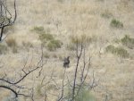
We got to watch this guy fly around the valley for a bit. He came close to us once or twice - very graceful.
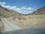
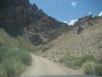
Wahoo! signs of civilization, however faint, were very encouraging. And the narrow track finally ended into the Bruneau River Loop road as we hoped it would. We had completed the first stage through the mountains but we weren't on pavement (or back on our maps) yet.
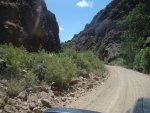
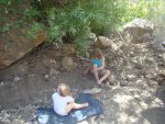
Stopped for lunch and a break.


At one point we had to do a mandatory short reroute where the road had washed out. We backtracked and went up and over a finger of hill and dropped back to the river which we had decided must be a fork of the Bruneau.


The track continued to constrict.


We got to watch this guy fly around the valley for a bit. He came close to us once or twice - very graceful.


Wahoo! signs of civilization, however faint, were very encouraging. And the narrow track finally ended into the Bruneau River Loop road as we hoped it would. We had completed the first stage through the mountains but we weren't on pavement (or back on our maps) yet.


Stopped for lunch and a break.
Day 27: Jarbridge to the middle of nowhere (west of Owyhee)
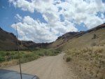
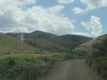
Tennessee Gulch didn't really remind us much of home but it was pretty all the same.
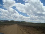
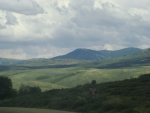
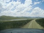

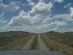
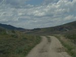

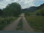
We crossed the Whitehorse high desert area on some fast gravel road that narrowed but the line of sight was long and we were able to keep our speed up. Beautiful fun area.


Tennessee Gulch didn't really remind us much of home but it was pretty all the same.


We crossed the Whitehorse high desert area on some fast gravel road that narrowed but the line of sight was long and we were able to keep our speed up. Beautiful fun area.
Day 27: Jarbridge to the middle of nowhere (west of Owyhee)
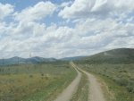
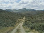
We made it out of the forest and down into Owyhee. Had to ask for gas in Owyhee as the only gas was three miles north of town. We drove all through the town (didn't take long) and I started to ******t myself because there was no gas to found, just an old closed down station. Panic didn't last long luckily and from there we headed west through the desert to cross the Owyhee River. The locals didn't think it would be a problem but also hadn't been out there in years/ever. But we had fuel and food now so we felt confident in tackling the rural track to McDermit, our next gas.
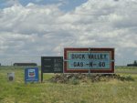
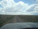
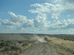
On this flat and fast section of gravel we saw our first rain of the entire trip. Only a few drops made it from the dark clouds to the windshield.
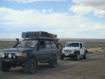
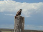
Pretty soon we had to go around a small farm/homestead that wasn't quite abandoned. This hawk, a lone sentinel, watched over the property as we passed through it's backyard and got onto a pipeline road.
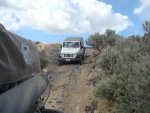
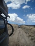
Descending a small shelf into the river plain.
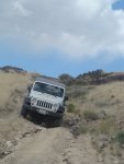
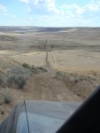
Long vistas. We hoped we could make it through.


We made it out of the forest and down into Owyhee. Had to ask for gas in Owyhee as the only gas was three miles north of town. We drove all through the town (didn't take long) and I started to ******t myself because there was no gas to found, just an old closed down station. Panic didn't last long luckily and from there we headed west through the desert to cross the Owyhee River. The locals didn't think it would be a problem but also hadn't been out there in years/ever. But we had fuel and food now so we felt confident in tackling the rural track to McDermit, our next gas.


On this flat and fast section of gravel we saw our first rain of the entire trip. Only a few drops made it from the dark clouds to the windshield.


Pretty soon we had to go around a small farm/homestead that wasn't quite abandoned. This hawk, a lone sentinel, watched over the property as we passed through it's backyard and got onto a pipeline road.


Descending a small shelf into the river plain.


Long vistas. We hoped we could make it through.
Few options
Jesse,
Leaving Jarbidge to the south you had no real options as to route if the Owyhee townsite was your next fuel. You passed over the Bear Creek pass then the Coon Creek pass just a few miles farther south. Dunno what lake you saw before Charleston, but unlikely it was Charleston Reservoir, as it's a good 6-7 miles south of the "community" and your turn-off back to the north/northwest. Had you continued to the Charleston Reservoir, you could have turned west on 746, which runs around 21 miles to pavement (NV 225 south of Wildhorse Reservoir). By jogging back north/northwest, you passed the Prunty Ranch and continued down the Bruneau River (not a fork--but the main branch). You lunched at Mink Ranch where your north/northwest road down the river crossed the river. You then continued up Meadow Creek Road on a southerly heading, leaving Tennessee Mountain on your left, to Sunflower Reservoir on your left, there turning west across Sunflower Flat to NV 225 a little south of Mountain City, NV. Mountain City is on the Owyhee River, which drains Wildhorse Reservoir, flowing northwest through MC to Owyhee and on into Idaho. You left the main branch of the Owyhee and headed west to the pipeline road, crossing the South Fork of the Owyhee. The South Fork crossing is close to Bull Camp, where self-styled "mountain man" Claude Dallas gunned down two Idaho wildlife law enforcement officers in 1981.
I'm looking forward to seeing how and where you crossed the Little Owyhee and reached US 95 at McDermit. Thanks for all the detail and the considerable effort to post it all. Epic journey, no doubt.
Foy
Day 27: Jarbridge to the middle of nowhere (west of Owyhee)
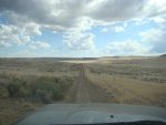
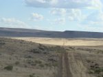
We knew the Owyhee was somewhere in this valley. The GPS didn't point to its exact location for some reason and after we descended some steep troughs I became really confident. There was only a slight bit of mud in the bottom of one of the beds and I was excited that the river was indeed dry due to the low rainfall.
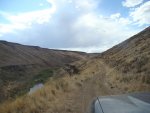
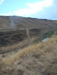
After expressing my excitement to anyone who would listen to me - well, in our limited group, imagine the raw pit that opened in my stomach, when, directly in front of us a huge rent in the earth reared its deep jaws. I was surprised, caught off guard but not hopeless by any means. I had studied this crossing by satellite thanks to google and I was mostly confident it would go even though no maps show it connecting.
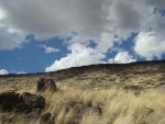
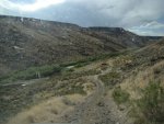
We dropped over the edge, opened a barbwire fence and scouted down the descent. It looked decent. The water didn't look fast moving or extremely deep but the exit ramp out of the canyon was straight up, steep and a bit gnarly. We have a video of the jeep ascending somewhere but I can't seem to find it. Will post later. But I'm getting ahead of myself.
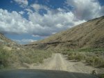
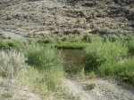
We crawled down with no problem, scouted the crossing, worried about the stock intake on the jeep, had a lesson on bow waves and speed when crossing (or lack of speed but steady throttle) and I made all the kids take a quick bath.
Crossing was not too bad. Video is somewhere yet to be found but I will post a link later. My Dad hit the water with a great rush of speed despite all the warnings and assurances that this crossing wasn't bad at all. He sent water flying over the hood and in open windows. It was great - bent his California rental tag straight up.
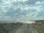
Going up the other side was challenging, rocky and loose. Both vehicles made it fine but the climb continued to deliver until we were all the way on the mesa. And then we were met with the challenge of vanishing roads.


We knew the Owyhee was somewhere in this valley. The GPS didn't point to its exact location for some reason and after we descended some steep troughs I became really confident. There was only a slight bit of mud in the bottom of one of the beds and I was excited that the river was indeed dry due to the low rainfall.


After expressing my excitement to anyone who would listen to me - well, in our limited group, imagine the raw pit that opened in my stomach, when, directly in front of us a huge rent in the earth reared its deep jaws. I was surprised, caught off guard but not hopeless by any means. I had studied this crossing by satellite thanks to google and I was mostly confident it would go even though no maps show it connecting.


We dropped over the edge, opened a barbwire fence and scouted down the descent. It looked decent. The water didn't look fast moving or extremely deep but the exit ramp out of the canyon was straight up, steep and a bit gnarly. We have a video of the jeep ascending somewhere but I can't seem to find it. Will post later. But I'm getting ahead of myself.


We crawled down with no problem, scouted the crossing, worried about the stock intake on the jeep, had a lesson on bow waves and speed when crossing (or lack of speed but steady throttle) and I made all the kids take a quick bath.
Crossing was not too bad. Video is somewhere yet to be found but I will post a link later. My Dad hit the water with a great rush of speed despite all the warnings and assurances that this crossing wasn't bad at all. He sent water flying over the hood and in open windows. It was great - bent his California rental tag straight up.


Going up the other side was challenging, rocky and loose. Both vehicles made it fine but the climb continued to deliver until we were all the way on the mesa. And then we were met with the challenge of vanishing roads.
Similar threads
- Replies
- 3
- Views
- 743
- Replies
- 4
- Views
- 2K
- Replies
- 0
- Views
- 426
Forum statistics
Members online
- Obsessed2findARuggedHybid
- TallerMike
- Eric93k
- Scandia
- TheHoof
- Vampergt4
- OVRLND
- Greg03XLT
- valcon1
- MiKoo2010
- mistermustard
- spfrom1973
- MatttheHatt
- freedomproject
- Datsun Man2
- fatmab
- simple
- mthntnful
- blacklbzbeauty
- matttahoe53
- WU7X
- JMV
- DorB
- superjosh
- Hegear
- NomadQ
- Dan Grec
- Jurfie
- tacoma22
- renottse
- karlfunk
- marcantoine77
- elbowtidwell
- enve77
- mark5280
Total: 2,800 (members: 38, guests: 2,762)

