Traversing the US (and back)

jessejman

Adventurer
Jesse,

Leaving Jarbidge to the south you had no real options as to route if the Owyhee townsite was your next fuel. You passed over the Bear Creek pass then the Coon Creek pass just a few miles farther south. Dunno what lake you saw before Charleston, but unlikely it was Charleston Reservoir, as it's a good 6-7 miles south of the "community" and your turn-off back to the north/northwest. Had you continued to the Charleston Reservoir...
Foy

Foy, I went back and looked at the maps and sure enough, I found Charleston Reservoir. Whatever we turned at was much smaller in comparison, probably just a water hole for cattle. Thanks for the info and I'm glad to have finally seen if only on maps. In the end I'm glad we missed 746 and took whatever little road we did along the Bruneau. Thanks again -J
 

jessejman

Adventurer
Day 27: Jarbridge to the middle of nowhere (west of Owyhee)

Coming off of a morning of not having any idea of where we were and the first moment of the trip where I felt foolishly unprepared, I was quite surprised to play the fool again.

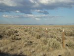
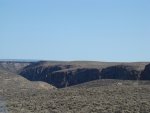
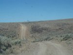
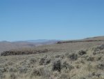
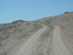
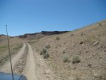
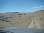
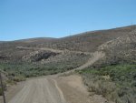
Lost above the canyon crossing we traversed one two mile section of road three times searching for the road we were supposed to take northwest towards Star Valley Ranch. It was late in the day and we were far under the miles we hoped to do. We traveled slowly, I got on top of the cruiser to try to spot the faint two-track through the sage. But I still didn't find anything. We ended up taking the nearest route that would get us to the same place. We hoped.
893.jpg 897.jpg

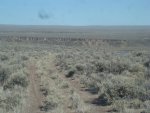
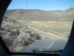
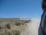
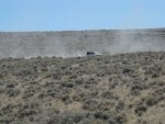
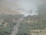
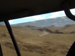
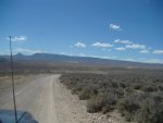
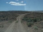
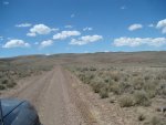
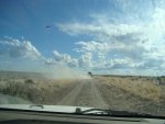
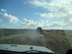
It was extremely rough, no faster than idle due to the huge rocks hidden in drifts of dust - dust that the tires picked up and threw in a large plume into the car, behind the car, on top of the car. Everywhere. And we were only moving 5 mile per hour. We put lots of space between the cars and idled on north, not on the road we were supposed to be on with the end of the day approaching.

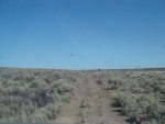
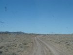
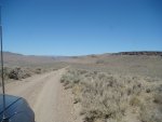
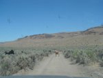
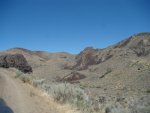
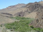
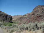
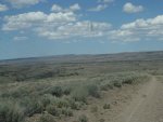
I left the camera with my parents and they took the above pictures of the good road as we restraced our steps twice, spooked some beautiful wild horses, but they didn't get any photos of the slow, idle-speed roads.
898.jpg 899.jpg
901.jpg 902.jpg

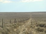
On this faint two-track path for two miles, we finally came to a long straight and well made fence. It was close to where the GPS had the borders of Idaho and Nevada and I'm assuming that it was a boundary fence even though it was 300 meters or so from where it should have been according to the GPS. It was also where we were supposed to make a turn to the west.

After three miles on the state line, looking back and forward. We had 4 more miles of this and then we didn't know what.
904.jpg 916.jpg
917.jpg

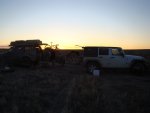
Camp on the border of Idaho and Nevada was beautiful solitary and windy. This road hadn't been driven in years. We were all very happy.
 
Last edited:

Foy

Explorer
ID-NV border oddity

On this faint two-track path for two miles, we finally came to a long straight and well made fence. It was close to where the GPS had the borders of Idaho and Nevada and I'm assuming that it was a boundary fence even though it was 300 meters or so from where it should have been according to the GPS. It was also where we were supposed to make a turn to the west.

My trusty Benchmarks show the NV-ID border and the NV-OR border as well as principal lines of latitude. Looks as though the border of both NV and OR + ID was intended to be the 42 degree line, and the map shows the NV-OR line superimposed on the 42 degree line from the "triple point" on westward. At the triple point, however, the ID-NV border dips ever so slightly south of due east then back to due east, and parallels the 42 degree line immediately to the south of it all the way to NV 225 at Owyhee, and perhaps beyond--I didn't look. Dunno why there'd be a fence along the border unless it marks some sort of land ownership partition, such as between BLM land and private land, or Duck River Reservation land vs BLM, etc. Perhaps the fence line is an accurately surveyed ownership division intended to follow the border as expressed by the 42 degree line, but prior surveying errors plotted the border slightly to the south and modern maps depict the older plotting.

Been looking closely at what's ahead to your west and eager to see how you got to McDermit. Your overnight wasn't at the end of the Earth, but I suspect you could see it from there!

Foy
 

jessejman

Adventurer
Day 28: Star Valley, NV to Alvord Desert, Utah

SV to Mcdermitt.jpg
Part 1: Star Valley to McDermitt

Mcd to Fields.jpg
Part 2: Mcdermitt to Alvord Desert (Fields), Utah

934.jpg 935.jpg

We woke up and continued along this fence line. It was marked as a road in the GPS and on the Benchmark but in reality it was just a faint service road used when the fence was put in. I also had to load a new section of map. I opened up my case and plugged in the adapter only to have it split in two as I treed to plug it in. I was able to salvage it with some careful taping and jiggling to make it work and we loaded our last route before we started heading east. While I was doing this my wife drove for the first time of the entire trip.
942.jpg 943.jpg

What? Can't see the road? Yeah, we couldn't tell what we were on either. We did leave the reroute along the fence and hook back up with our intended route. I was amped that the trail we were supposed to be on was actually there this time.
946.jpg 947.jpg

We followed it over a few rises and through some washouts and finally came to the big depression that makes Star Valley. Star Valley is a semi-abandoned ranch/farm. It may still some use but there wasn't much evidence of this when we were there.
952.jpg 955.jpg

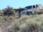
Descending into the canyon was loose with some small ledges and very narrow. The jeep wasn't liking what we were doing to it. The dash was lit up with all kinds of warning lights - none looked good but everything seemed to be working still - at least, engine, four wheel drive and low range. I mean, they could even run their A/C which was more than we could claim in the Cruiser.
 

jessejman

Adventurer
Day 28: cont.

At the bottom of the narrow trail into Star Valley was an unlocked gate but it had three signs on it saying no trespassing. With no other option and a bit nervous as we had seen what looked to be a ranch in the valley we continued on down the road. There was no way around the ranch; we would be going straight to it. At some point down here we ran out of camera batteries. For the first time of the trip we had forgotten to put the second battery on to charge. We did take some camera/phone photos but I haven't found them yet. I will do my best to explain the next miles using words rather than photos.

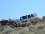
The road at the bottom of the incline was narrow and rough. It was deeply rutted and our undercarriages drug in the dirt a bit here. After a few hundred meters we came to a deep wash and the ruins of an old wooden bridge that crossed the wash in front of the ranch. At this point it was clear to us that ranch was not in use and probably no one was around to witness our 'trespassing.' The bridge consisted of two 2x8 laying flat and spanning a ten foot gap. Maybe they would be good for hikers? I can't imagine anyone using them but they were spaced out at an ATV width. There was a clear go around down a steep dirt bank, over large stones and up another steep bank. I made it through with minimal work in the cruiser but the jeep's length and lack of clearance kept it from pulling up the far bank. We hooked up a strap and I drug it up the embankment. I distinctly remember taking a photo of this ranch and a very old flatbed truck that was parked next to a corral but I cannot find the pics. With the jeep up the bank we carried on moving northwest down the canyon for a short distance where there was a confluence with a creek with running water and another bridge that we dared not cross. But the go around was easy and forward progress continued, though slowly due to the rocky conditions of the road.

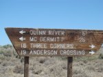
If you look at the map you can tell that we dropped down into Star Valley only to climb back out of it via a different route. There wasn't much way around this as the only westerly roads go into and then out of the valley. The climb out on the west side of the ranch was nothing. It was slow and twisty but never steep or difficult. Upon climbing out it wasn't long before we hit the three corners area of Nevada, Idaho and Oregon. It was here that we would cross into Oregon only to leave it for Nevada and the Quinn River area.

As we neared the three corners area we stopped at a small road that lead south to the actual corner. Getting out to stretch and relieve myself it didn't take me long to notice a burning smell in the air. And this wasn't the smell of burning rubber, oil or plastic; it was the smell of campfire. But there was no campfire or anybody anywhere around. As we all were discussing the smell and what it smelled like it finally dawned on me and I looked under the jeep to see a thin but steady whisp of smoke coming from around the catalytic converter. Tons of chaff (seed husks I guess), light feathery cottonwood seed-like husks were crammed up under the jeep in every little cranny. Worse still, the transmission skid acted like a shovel and scooped them up and against the exhaust system where they were steadily and quietly burning. I quickly grabbed a dead branch of sage and began cleaning the around the exhaust. My wife was getting water and my Dad was grabbing the fire extinguisher. After a couple minutes of cleaning it appeared that I had the majority out and there was a burning clump of fuel under the jeep. We moved the jeep forward, put the smoldering out with water and spent another fifteen minutes giving the undercarriage another scrape clean with sticks. After the urgency wore off, I still could not shake the images of a burning white rental jeep in the middle of the desert. We'll save that for another trip. Somewhere I have a photo of two bodies halfway under the jeep in with water bottles right next to us at the ready. When I find it I will post it.

From the three corners area we continued west, southwest on State/County Line Rd. It was a long and straight but very rocky and deeply rutted in sections and there were lots of gates to pass through. This road would eventually take us into Mcdermitt along the Quinn River. I will pick up here later with photos.
 

jessejman

Adventurer
Day 28: cont.

954.jpg 956.jpg
958.jpg

Dropping down into Star Valley Ranch

002.jpg 006.jpg
010.jpg 012.jpg
014.jpg 015.jpg

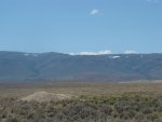
The plains leading to Quinn River. Some of the roads were fast, some slow. It was still very dusty.

001.jpg
 

sseaman

Adventurer
As a fellow Tennessean I am looking forward to my trip west next summer, it will be no where near the adventure you guys had. I am impressed your kids made sitting that close together for so long, my 2 would have killed each other.
 

jessejman

Adventurer
As a fellow Tennessean I am looking forward to my trip west next summer, it will be no where near the adventure you guys had. I am impressed your kids made sitting that close together for so long, my 2 would have killed each other.

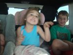
Well, they made it but it wasn't always pretty. To that end, we actually left one third-row jumpseat in and sat one of the older ones back there. Having my 6 year-old son and 4 year-old sleep next to each other every night was sometimes awful. I kept telling them there was an imaginary wall between them but I am tempted to actually build one before another long trip. Will you post a report of your trip? If so I'll be looking for it. -Jesse
 

Ozarker

Well-known member
WOW!

This is one of the greatest rides I've been on, I have spent this afternoon reading through this and really enjoying your travels. I am really impressed with you and your young family, it'sjust fantastic that you would take this one with three little ones. Bet you have no idea what it will mean to the two older kids years from now. For you too!

I think I'll head down to Arkansas and pick up your trail. There seems to be so many spots that you could just stay there, beautiful and so remote. I'm surprised you didn't have more land owner meetings. And your escapefrom the Okie Ranger gate was pretty funny. You've been livin right! :)
 

jessejman

Adventurer
WOW!

This is one of the greatest rides I've been on, I have spent this afternoon reading through this and really enjoying your travels. I am really impressed with you and your young family, it'sjust fantastic that you would take this one with three little ones. Bet you have no idea what it will mean to the two older kids years from now. For you too!

I think I'll head down to Arkansas and pick up your trail. There seems to be so many spots that you could just stay there, beautiful and so remote. I'm surprised you didn't have more land owner meetings. And your escapefrom the Okie Ranger gate was pretty funny. You've been livin right! :)

Thanks for the compliments. You should definitely run the Ozark traverse. It was one of our favorite parts of the trip and I was talking with some folks today about going back and riding motos through the forest. As I said, I had lots of great help/advice from Mr. Leary here on ExPo. He's also at centraloverland.com if you're familiar with that place.

Take pictures when you go...
 

jessejman

Adventurer
Day 28: Star Valley, NV to Alvord Desert, Utah

021.jpg 023.jpg

Out of the desert and down into the Quinn River valley not far from McDermitt.

025.jpg 029.jpg

the trail was narrow and sandy with deep ruts so that we had to try to run with the wheels on the sides of the ruts without falling in. The thing was that if you got too high on the sides you'd be running through tall bushes. It was a delicate balance that went on for a few miles. We still managed to make pretty good time and only scraped the bottom of the truck a couple times. I was pretty sure that skid plate on the jeep that had collected burnable material was now acting as a sand shovel. I hoped my Dad had enough sense to drive on the sides and I meant to ask him but I never did.

035.jpg 041.jpg

The canyon tightened and got taller...

046.jpg 051.jpg

and we stopped for lunch and a cold swim/bath after
a water crossing.

052.jpg 054.jpg
 

jessejman

Adventurer
Day 28: Star Valley, NV to Alvord Desert, Utah

059.jpg 060.jpg

We followed the Quinn for a while with some fun crossings but it constricted and the road left the river for the hills above the river. It wasn't long before we were down in McDermitt.
068.jpg 083.jpg

There wasn't much in McDermitt but there was a gas and grocery market so we fueled up and bought some home ground chorizo and headed out for the Trout Creek loop.

098.jpg 100.jpg

We're headed up and over this mountain range and then down into the Alvord Desert and to the Steen Range for camp.

103.jpg 108.jpg
110.jpg 116.jpg

Disaster Peak Road was nice and fast but after a number of miles we turned east onto Trout Creek which was a bit rougher and steep. We had to stop twice to let the engine cool down. At one stop we met some rock-hounders and they explained what they were doing and looking for. They had some connection to Tennessee that I can't remember now - a family member near us I think. They gave the kids some petrified wood which actually made it home. We took an unnamed road (at least I can't remember the name) over Mahogany ridge. The views were awesome but it was extremely rough - sharp rocks everywhere - and taxing to drive. The sun was baking me so I set the sun shade up in my window for a while - it works well, let's air in and reflects heat out. I recommend it!
 

Forum statistics

Threads
188,468
Messages
2,905,442
Members
230,428
Latest member
jacob_lashell
Top