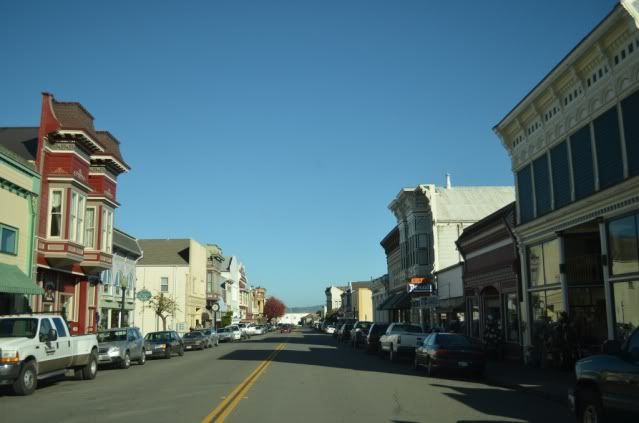
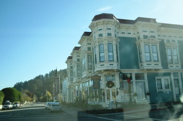
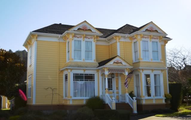
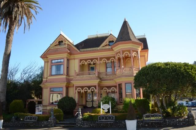
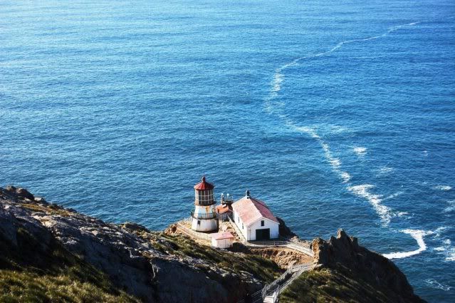
Wandering in CA

suntinez

Explorer
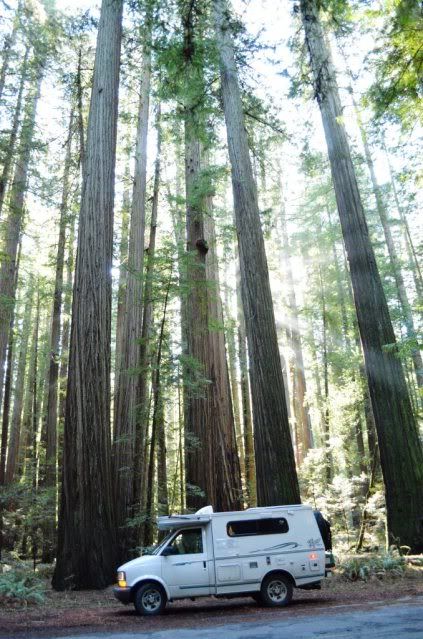
Humboldt Redwoods forest, west of 101

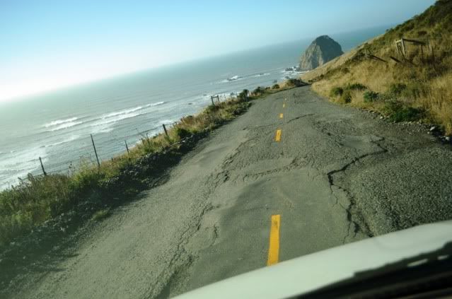
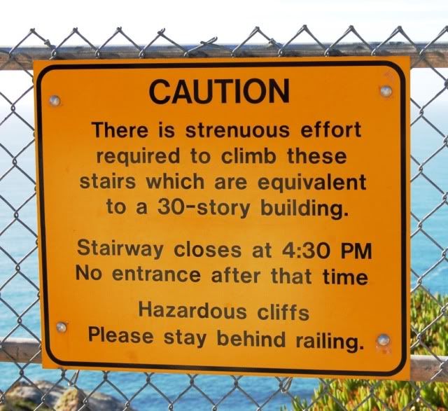
You must have nerves of steel! I've often passed bicycles on this route, wondering how they do it. And beautiful pic - threads are for sharing, you can't steal them ;)

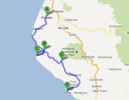
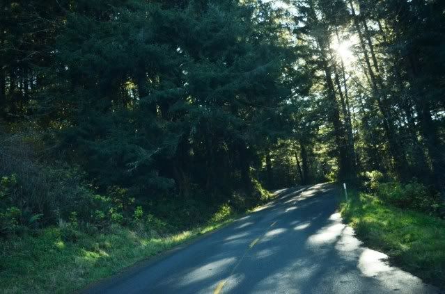
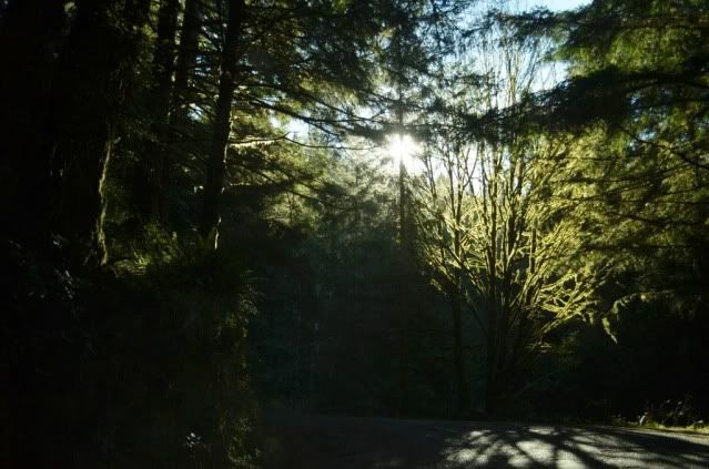
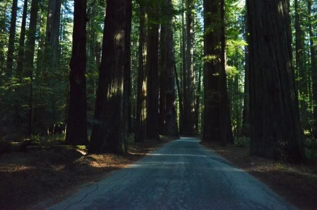
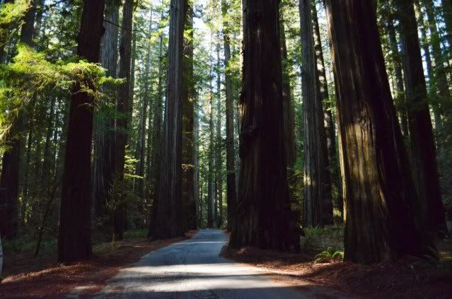
Heading west into the redwoods along Bull Creek Flats Rd, past Rockefeller Redwood Forest and the Cuneo and Albee campgrounds, the road gets very narrow and daylight recedes beneath the canopy.

5-redwoodsroad-1.jpg


5b-redwoodsroad.jpg


5a-redwoodsroad.jpg


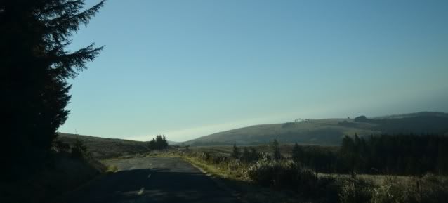
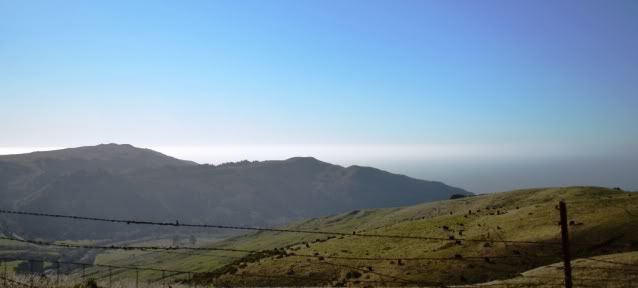
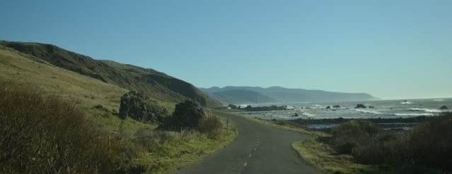
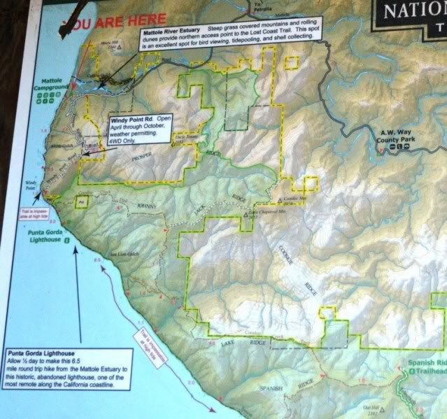
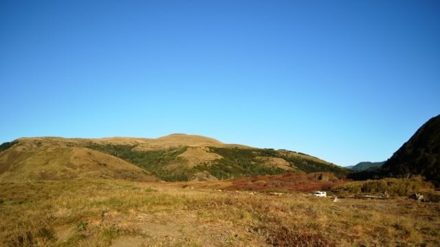
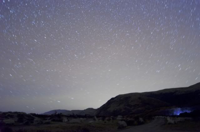
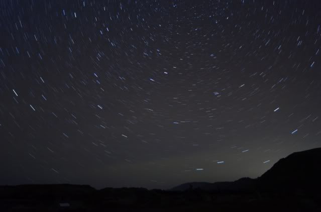
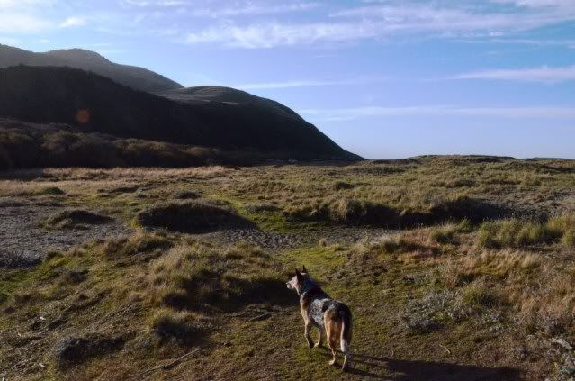
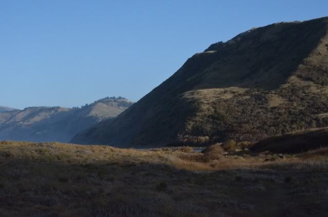
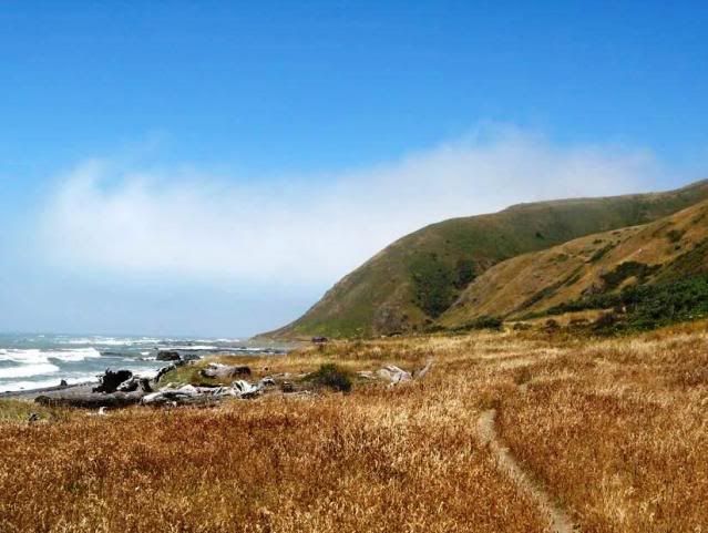
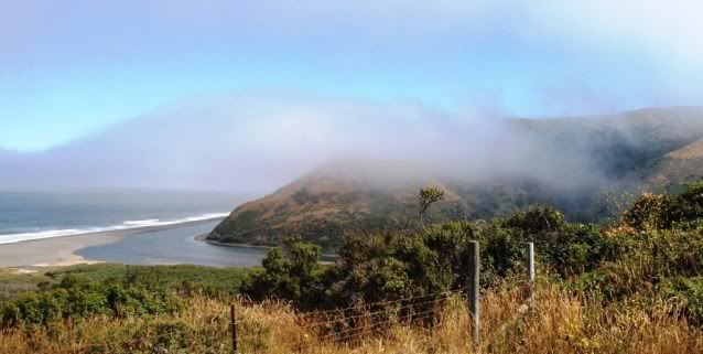
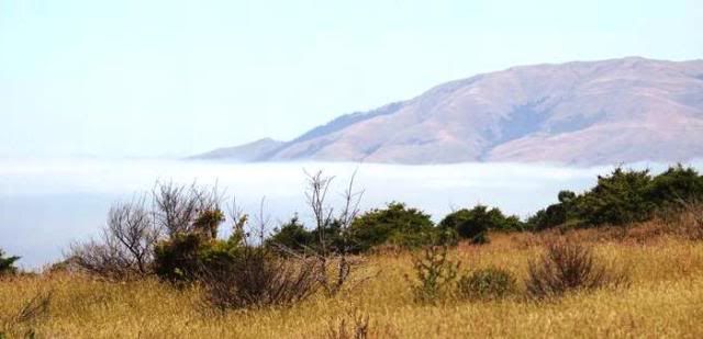
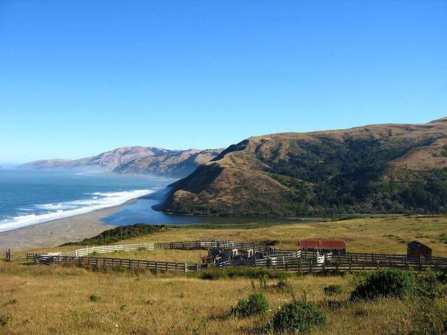
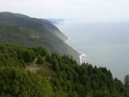
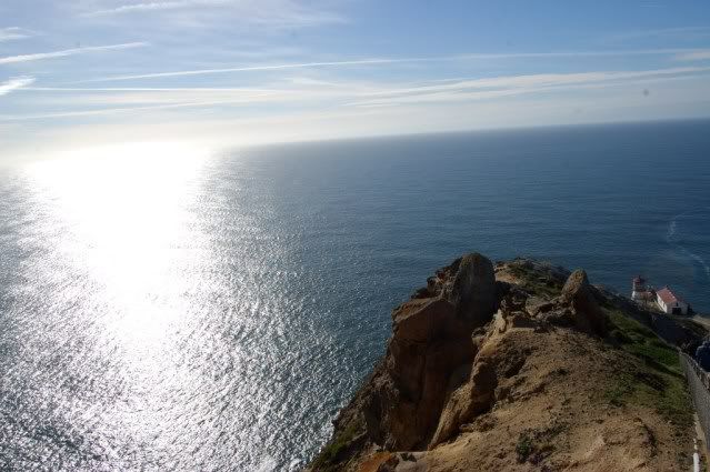
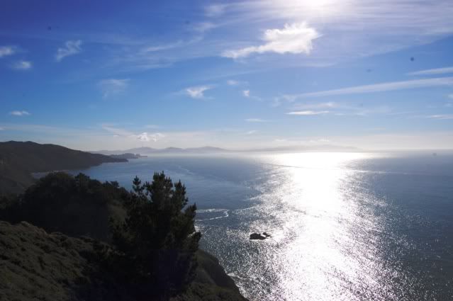
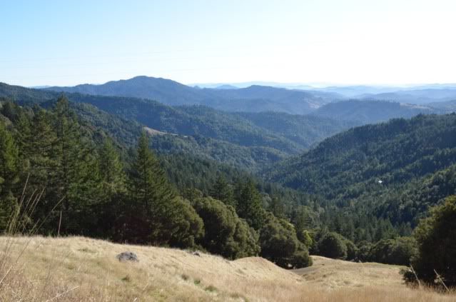
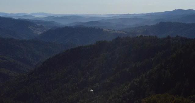
Miles of curves and you ascend the hill to Mattole Rd to come to this commanding view of the King Range:

5c-kingsrange2.jpg


5c-kingsrange.jpg


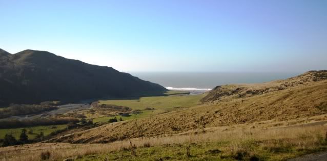
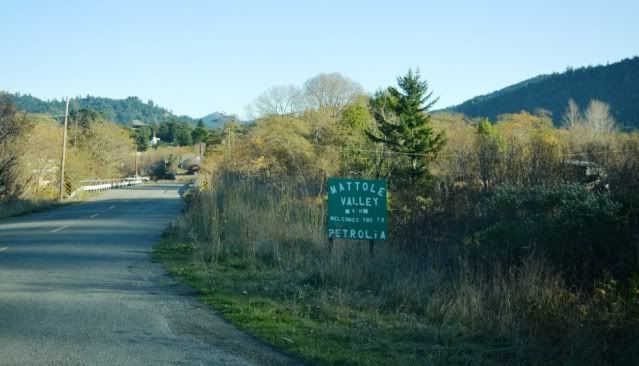
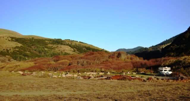
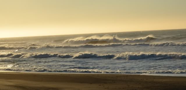
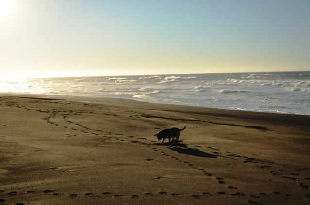
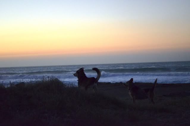
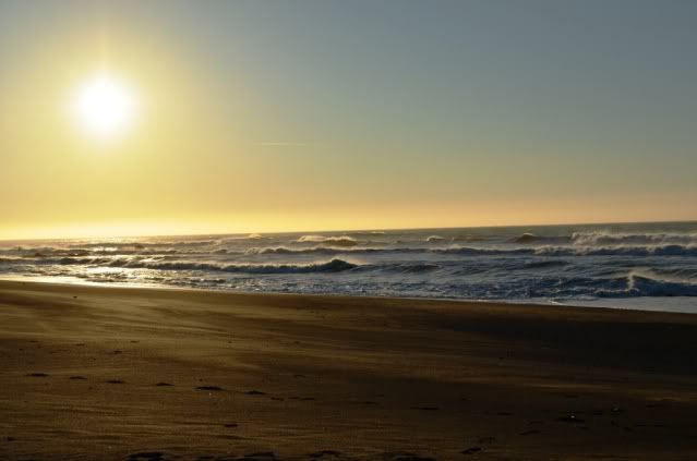
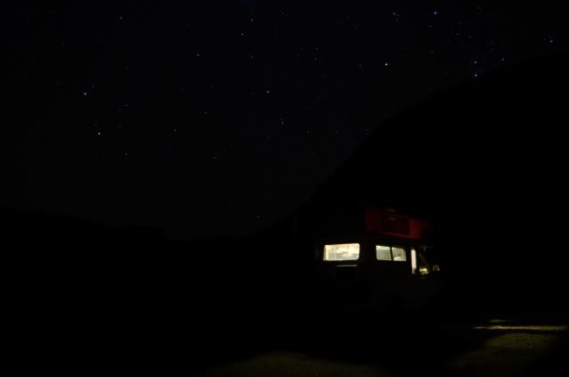
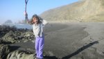
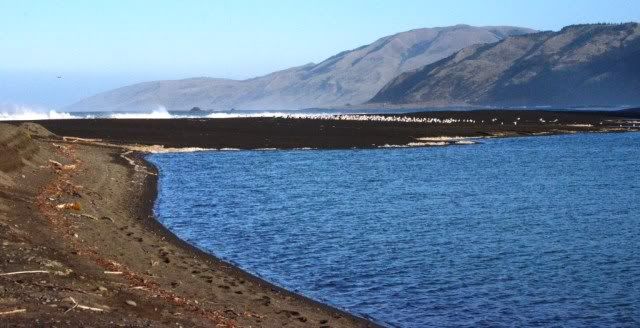
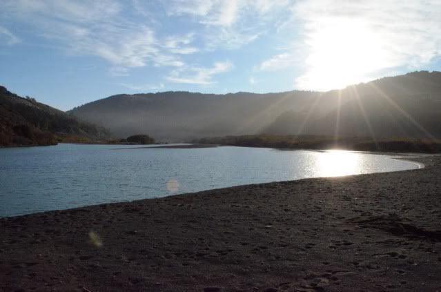
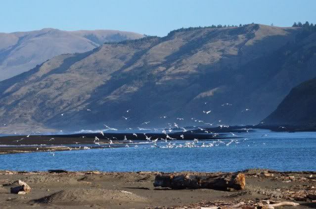
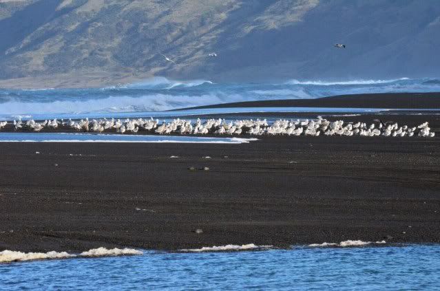
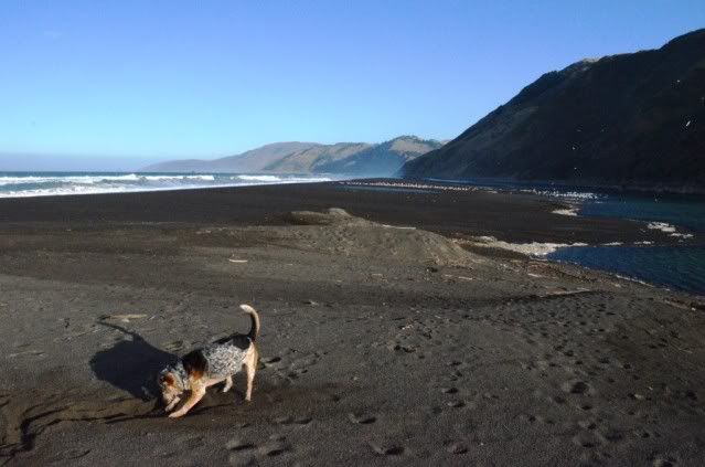
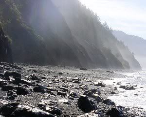
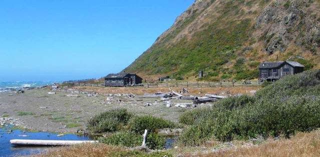
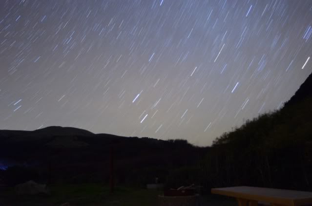
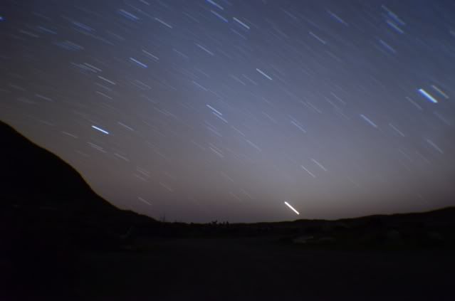
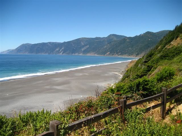
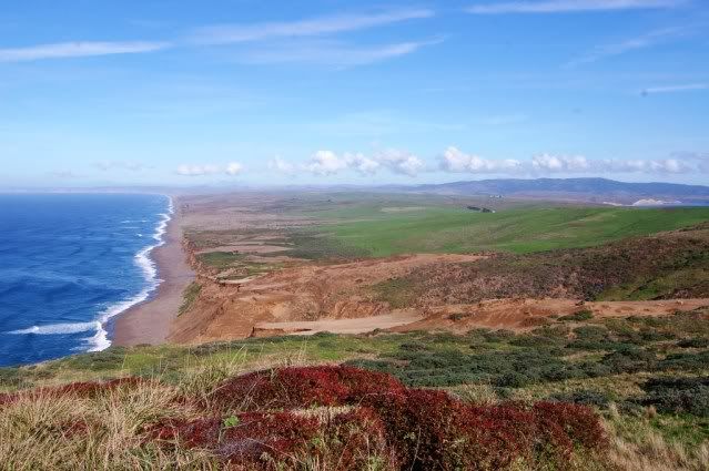
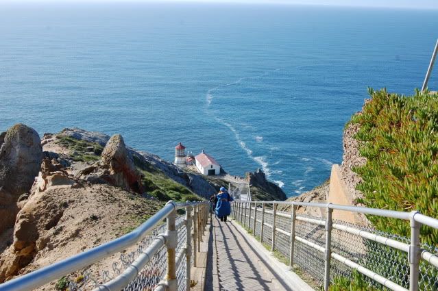
Every time I’ve gone to the Lost Coast I’ve headed down these hills into Honeydew, so I thought I’d try a different way this time. After savoring the silence and gawking at trees the day was getting late, so I headed back to my campsite.
 

dustboy

Explorer
Great thread, gave me the wanderlust. That little Tiger GT is a cool rig, it's a wonder you don't see more of them.

I too have lived in CA for 30 years and feel like I've barely scratched the surface.
 

Errant

Explorer
Thanks for sharing! I made the trip up the coast and into Portland with my family as a kid. It was an amazing summer and something I'll never forget. You're report is bring back some great memories :)
 

suntinez

Explorer
Scotia to Ferndale

In the morning, we left for Ferndale and made a stop through Scotia. Scotia is a logging town and one of the last remaining American “company-owned” towns.

Scotia.jpg


Scotialogging.jpg


Crossing Eagle Prairie bridge into Dell Rio for gas and supplies.

Scotia-DellRio.jpg


Then on to Ferndale, a little town known for its Victorian houses.

I looped around the outside of town coming in and found cheap but unappealing camping at the Humboldt County Fairgrounds:

Ferndalefarigrounds.jpg


Still good to know, didn’t want to have a repeat of hunting for campgrounds in the dark. Seems like I'm always noting where campgrounds are.

So into Ferndale for the sights … and some classic historical “general store” type shops. Downtown:

Ferndale-downtown.jpg


the Victorian Inn

Ferndale-VictorianInn.jpg


Ferndalehouse.jpg


And the Gingerbread Mansion, a B&B with a piece of history. A sign of the times, it's in foreclosure and for sale … for a mere $1.7mil, it could be yours. Probably negotiable.

Ferndale-thegingerbreadmansion.jpg


A quaint little place, but now it’s time to get lost ….
 

suntinez

Explorer
LOST COAST - the most undeveloped portion of the California coast

The terrain here is too rugged for highway building, so Rt 1 and U.S. 101 are forced inland. This remote region is known as California's Lost Coast, and is only accessible from a few back roads. This 64-mile section of the California Coastal Trail is a mecca for hikers, and requires careful planning, close attention to tide charts and respect for the journey.

The next few days were spent driving roughly this route:
lostcoastmap2.jpg


Much of the land in the north end of the Lost Coast is now owned by the federal government. In 1970 over 60,000 acres were designated as the King Range National Conservation Area. In the south end, CA started protecting the Sinkyone Wilderness State Park and progress has been made to preserve this area.

Georgia-Pacific had other plans, and their lands include massive tracts of virgin redwoods, fir and spruce trees. Due to the remoteness of the area, the forests had survived although sawmills had been used within ~5 miles of the stands at USAL (1900s) and Wheeler (1950s). In the 1980s, Georgia-Pacific started logging the area again, and a standoff ensued.

The area is ripe with controversy among the different factions, see the BLM and GORP websites for more details, and this map:

m_lost.gif


The Lost Coast is one of those places that can magically transport you to a different time. A place where nothing is taken for granted, people are few and far between, there is an awesome beauty here. You can spend hours in the forest and not see another soul, and get to know some trees that have been on the earth for a long time. Climbing the hills of the King Range through steep-walled canyons, you get an occasional view of cliffs dropping into the ocean, watch a fog bank speed in and roll over the mountains, or get blown over by the wind. It’s easy to imagine early settlers and the trials they endured which we can barely wrap our minds around these days. There’s an overwhelming feeling of earth’s power and emptiness.

Months later, I sit here trying to recapture the feeling and its tough. But it’s there. This place leaves an indelible impression on you.

For me, one of the best things about traveling is that you take your memories with you when you leave. Then you can pull them out when you need a little escape. Life's been a bit crazy lately, and it's been nice to take a little mind-trip to the Lost Coast.
 

suntinez

Explorer
Ferndale to Petrolia

Coming out of Ferndale, you hop on Wildcat Rd/Mattole Rd and are immediately engulfed by forest.

DSC_0064.jpg


DSC_0068.jpg


Google maps indifferently tells you it is 29 miles from Ferndale to Petrolia, a little over an hour drive. What Google doesn't tell you is that this is possibly one of the worst paved roads ever. I wasn't prepared for the sudden drop-offs, literally infinite axle-eating potholes, skinny blind curves on steep grades, and missing pieces of the road – left, right and middle. Only one car encountered going the other way, with the expected near collision.

This road could well define off-camber. I don't think there was one car-length where all 4 tires were in the same direction. In all fairness, I don't think the road is always in this kind of condition. But seriously, some roads are better left unpaved!

Tiger did great on all this, but I was a wreck. By the time I reached the top, I was in one of those surreal post-adrenaline states of exhaustion, and pulled over as soon as I found a spot. The wind almost knocked me over, I had to hang on to the Tiger to get around and let my pup out.

DSC_0073.jpg


Then the road got better, and the views were unfolding. I was feeling the emptiness of the Lost Coast.
DSC_0080.jpg


Ah! The ocean …
DSC_0084.jpg


Then you crest a hill, and this breathtaking view of Cape Mendocino comes into sight. Just offshore is Sugarloaf Island, which is made up almost entirely of 323 foot tall Cape Rock. The lighthouse which used to be here has been relocated to the town of Shelter Cove, a bit south.

DSC_0105.jpg


This place is a facility for all the cows on these hills, pretty surprising to see it out here.
DSC_0095.jpg


Driving south along the coast … all private property here, and nowhere to stop. But there's no one on the road, and long views on the approach, so I stopped in the road.

DSC_0124.jpg


And finally, Petrolia. It took me almost 3 hours to get here from Ferndale, wasn't expecting that!
DSC_0128.jpg


Petrolia's sole claim to fame is that it's the first place in California where someone decided to drill an oil well. There's a historic marker in the middle of town.

There's a small general store with a nice deli in Petrolia, gas pump here appears to not be working for quite a while. I picked up a couple things and headed down Lighthouse Rd to Mattole Beach, driving next to the Mattole River. This is an easy dirt road, and after a long day I was happy to see the sign:
DSC_0132.jpg
 

suntinez

Explorer
Mattole Beach

Great trip report as alway's,Thanks for sharing.
Thanks Bob - hope the road is treating you well!


I was even happier to see the deserted campground. This is unheard of in CA – beach camping for $8??

DSC_0136.jpg


DSC_0144.jpg


As you enter the CG there is a parking area for folks hiking the Coastal Trail, and a couple of pit toilets. On the other side is the camping area. We arrived mid- afternoon and it was super windy but not too cold. Fortunately there were a couple large spots that had brush nearby for a wind break so I set up there. I think they were actually equestrian sites.

for8bucks.jpg


DSC_0194.jpg


It’s a short walk over the dunes to the beach. Pepper was a happy girl – rocks on the beach! I don’t really know all the rules to the rock game, but it involves picking them up and bringing them to me. Sticks and balls are less interesting than rocks. Sometimes you have to dig for the rocks to get >just< the right angle to pick them up.

DSC_0215.jpg


rock3.jpg


1a-rock.jpg


I spotted a road up the hill, maybe tomorrow we’ll go check it out.

DSC_0182.jpg


This is the most wild and rugged beach I’ve ever been to.

The wind whips around swirling in all directions, the fog is sucked in and out, and the waves are bent over from the force of the wind. When the fog rolls in, you can't see 10 feet in front of you. This meeting of earth, wind and water is a full sensory experience - earth is powerful here. While the sun goes down and the fog is out, the angles are just right and there are fast little rainbows behind every wave – pretty cool.

DSC_0207.jpg


DSC_0204.jpg


DSC_0177.jpg


Just at dusk, another pup surprised us and showed up on the beach – this is Walter. His parents had hiked north for the last 3 days from Shelter Cove and were getting picked up by a shuttle which provides this service. Seems the preferred direction for hiking is north to south due to the winds, but this was their 2nd trek so they did it the other way.

1b-walter.jpg


DSC_0231.jpg


The shuttle van arrived after dark and brought someone else who was doing the N-S route solo with her dog. They camped over by the mouth of the Mattole river and were gone in the morning by the time we got up. I got the tripod out and weighted it down against the wind, messing around with some night shots and startrails.

DSC_0058-Copy.jpg


DSC_0052.jpg


DSC_0054.jpg


I stayed up way too late playing with the camera and got chilled to the bone. Pep was pooped so we called it a night. Fell asleep with the Tiger rocking from the wind, and listening to the waves crash onto the shore. Nice.

DSC_0080.jpg
 

shortbus4x4

Expedition Leader
Ever since I can remember the Wildcat has been a pretty rough road and I have been driving it off and on for a few years. Sometimes it gets snow on it too. When I lived in Fortuna my family would usually make the HoneyDew-Petrolia-Ferndale Loop at least once a year, it was an all day affair. You see more people in summer, winter its pretty lonely, not too many people camping out there that time of year.

Here are some pictures of our last trip a year ago, had a week of really nice weather in Feb or March. This is right after you get to the ocean coming from Ferndale, lots of little tide pools and critters to find. We would usually spend a few hours here. Thanks again for the writeup.
 

Attachments

  • 336.jpg
    336.jpg
    537.9 KB · Views: 2
  • 354.jpg
    354.jpg
    573.7 KB · Views: 1
  • 345.jpg
    345.jpg
    561.6 KB · Views: 2
  • 352.jpg
    352.jpg
    565.3 KB · Views: 1

suntinez

Explorer
around Mattole Beach

We started the day out walking over to the estuary at the mouth of the Mattole River. Along the way, there was a goat wandering near the beach &#8211; Pepper took care of him and he went skittering off to home, wherever that is.

DSC_0164.jpg


approaching the estuary:
DSC_0083.jpg


DSC_0104.jpg


Mattole River:
DSC_0145.jpg


We saw hundreds of seagulls at the sandbar which forms at the mouth of the river. Due to low waterfall during the year, the river is very low and the sandbar is much larger than usual. Walking across the black sand the birds would take off and swoop around us, then move to another spot.

DSC_0089.jpg


DSC_0110.jpg


More playing on the beach.
DSC_0140.jpg


DSC_0020.jpg


After talking to the hikers, I thought I would try walking a few miles south to the Punta Gorda lighthouse, so I packed some things in a backpack and set out. The first obstacle is called Windy Point, and it's impassable at high tide. After you get off the dirt-path, you're on sand. Tilted sand sloping down to the beach &#8211; one leg definitely does more work than the other. This is not hardpack sand. It is put one foot down, sink 8 inches and have to pull it out kind of sand. Walking closer to the hill is easier, but plenty of pebbles and grapefruit sized rocks. Lots of variation in terrain here.

trail.jpg


hike1-Copy.jpg


I saw these abandoned buildings by the trail, this is called the &#8220;Lost Ranch&#8221;.
lostranch.jpg


There were lots of little streams to cross, snakes on the beach, sea otters and seals in the ocean, and &#8230; very fresh bear scat on the trail. And the wind &#8211; always the wind. Operating solo without a plan didn't seem like best idea anymore. I wasn't sure how far the lighthouse was, so we turned around.

From the map posted at the campground that there is a 4WD accessible rd open from Apr thru Oct called Windy Pt Rd that gets you close to the lighthouse. Maybe I'll come back and try that one day, or set out from Mattole Beach a little better prepared.

After some lunch, I decided to drive up that road I'd seen on the hill. I think it's called Prosper Ridge Rd. And the fog starting rolling in:

prosperridgerd.jpg


All the way in:
prosperridgerd2.jpg


We kept driving and in maybe 15 minutes, it rolled out:
mattoleriver.jpg


We headed back to camp, and the day was done. After dinner and a few more night shots I called it a day.

DSC_0047.jpg


DSC_0038.jpg
 
Last edited:

suntinez

Explorer
Ever since I can remember the Wildcat has been a pretty rough road and I have been driving it off and on for a few years. Sometimes it gets snow on it too. When I lived in Fortuna my family would usually make the HoneyDew-Petrolia-Ferndale Loop at least once a year, it was an all day affair. You see more people in summer, winter its pretty lonely, not too many people camping out there that time of year.

Here are some pictures of our last trip a year ago, had a week of really nice weather in Feb or March. This is right after you get to the ocean coming from Ferndale, lots of little tide pools and critters to find. We would usually spend a few hours here. Thanks again for the writeup.

Lucky you - I try and do this area whenever I have the time. I'll definitely go check out the tidepools at the bottom next go around. Thanks for the great pics, good looking heeler you have there :)
 

suntinez

Explorer
Honeydew & Shelter Cove

It was getting time to get back to the city, but I wanted at least one more night out here. Packed up and headed to Honeydw, a tiny little town with a general store and post office, but not much else. On the way we stopped by A.W. Way county park right next to the Mattole River to check it out.

AWWay.jpg


Chatted with some locals in Honeydew, seems there are a couple older folks in town who have never been “out” of the valley, never seen anything east of Rt 101. That’s hard for me to imagine, but I guess this is how it was in generations past. Pondering this, we continued … a view on the way:

views.jpg


We drove down plunging twisty roads to Shelter Cove to get a look at the black sand beaches and the relocated lighthouse from Cape Mendocino, and also get gas. Unfortunately I left the memory card for my camera here, so only a couple pics from the little camera on this leg. Shelter Cove is the only inhabited town on the ocean on the Lost Coast, home to perhaps 300 hardy souls who prefer the castaway lifestyle.

shletercovepkglot.jpg


0-sheltercovelighthouse-Copy.jpg


Camped at Wailaki campground for another $8 and did an easy hike up Chemise Mountain trail.

For a list of campgrounds in the King Range check the BLM website. There’s a good guide to county, state and national campgrounds of Humboldt county here.


South of Shelter Cove is the Sinkyone Wilderness State Park, I think I’ll explore down there next time.
 

suntinez

Explorer
Point Reyes National Seashore

On the way back to the city, a long detour over to Point Reyes National Seashore in Marin county. The drive in is through beautiful rolling green hills with lakes and the ocean views are spectacular.

DSC_0191.jpg


DSC_0204.jpg


a picture worthy private house on the way in:
DSC_0184.jpg


On the way we saw lots of deer and happy CA cows – and one bold coyote. Keep your cattle dog handy and they won’t bother you a bit.

5-coyote.jpg


It’s a bit of a hike from the parking area up to the lighthouse overlook and the wind is so blustery up here the trees are permanently bent over.

5a-PtReyestrees.jpg


Sandy matrix in the conglomerate shows the work of water here:
DSC_0216.jpg


The long trek down to the lighthouse,
DSC_0224.jpg


DSC_0221.jpg


5aa.jpg


I went about halfway, with the mile+ trek uphill before the descent my calves were screaming.

5b-PtReyeslighthouse.jpg
 

suntinez

Explorer
Muir Beach overlook

Taking the slow route back into the city, and one more stop at the Muir Beach Overlook in Golden Gate National Recreation area.

4aa-Muirbeachoverlook.jpg


During World War II, the defense of San Francisco Bay was augmented by soldiers who manned these “gopher holes”. In those fearful times, the US was reeling from the attack on Pearl Harbor. These stations were manned by 2 soldiers whose main job was to scan the ocean with a powerful spotting scope and relay sighting information to a plotting crew who would then triangulate firing instructions for gun batteries in the Marin Headlands. Pretty tight quarters for two people!

4ab-gopherholes.jpg


Looking south to the city:
4-MuirBeachoverlook.jpg


A beautiful spot, not far from San Francisco. This section of Rt 1 is particularly picturesque, but beware of deer leaping into the road in front of you.
 

shortbus4x4

Expedition Leader
Are there new bathrooms up at AW Way campground? Last time we were out there they had torn the old ones down and it looked like they going to build new ones.
 

Forum statistics

Threads
186,602
Messages
2,887,913
Members
226,715
Latest member
TurboStagecoach
Top