A Week in the Heart of the Appalachian Mountains: West Virginia & Pennsylvania

mortonm

Expedition Leader
The next morning we got up early and started our cannonball run to Gettysburg. We head north up through the Shenandoah Valley, a quick run through Maryland and into Pennsylvania.

We approached Gettysburg down the Chambersburg Road, those of you familiar with Civil War History will know this as the main road of advance for the Confederate Army towards Gettysburg.

It was lunchtime before we reached Gettysburg, and we spent the afternoon in the Museum and viewing the cyclorama. What an amazing experience, the museum is huge! We don't have any pictures because I feel that it takes away from the enjoyment trying to get pictures of every little display. If you are in the area I would highly suggest start your visit there!

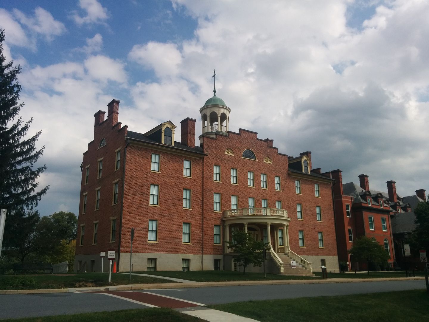
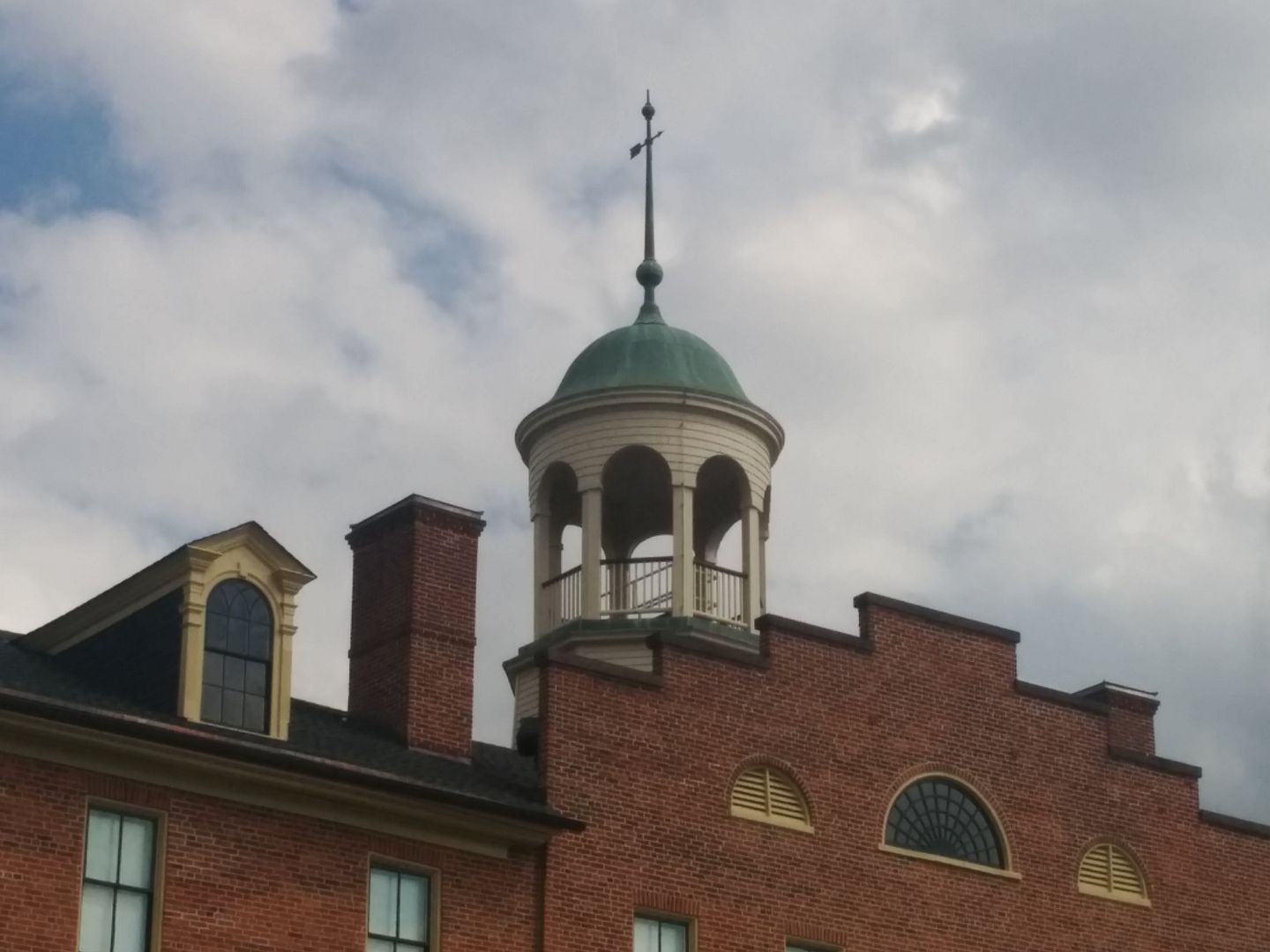
They offer a guided vehicle tour (guide drives your vehicle for you) but we had removed the back seats to better stow the gear so that option was out. We decided to purchase the self guided tour CD but more on that tomorrow. We took a quick little tour through town and came across the Lutheran Seminary. The cupola in the pictures is where Gen. Buford was standing to get a better view of the advancing Confederate troops.


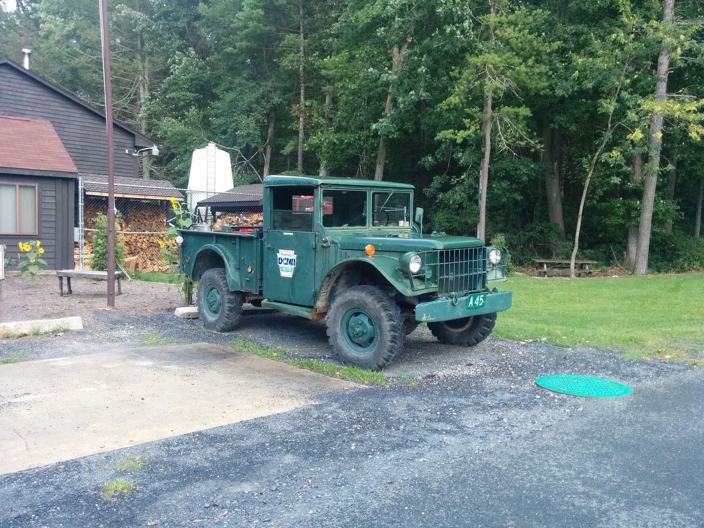
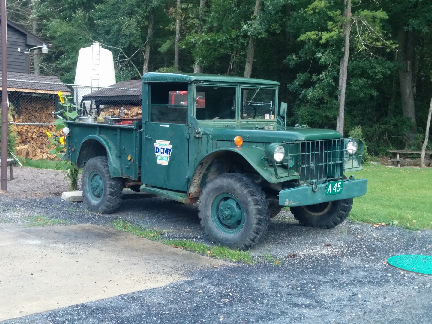
It was nearly four in the afternoon, so we decided to grab a campsite for the night, and start the tour fresh in the morning as we were pretty tired. We decided to stay in Caledonia state park, as it was close. It was your typical state park type camping, not the worst nor the best. It started pouring as we pulled in so we had to delay setup for awhile. We did explore around a bit and found this old forestry truck, this thing looks like a beast!


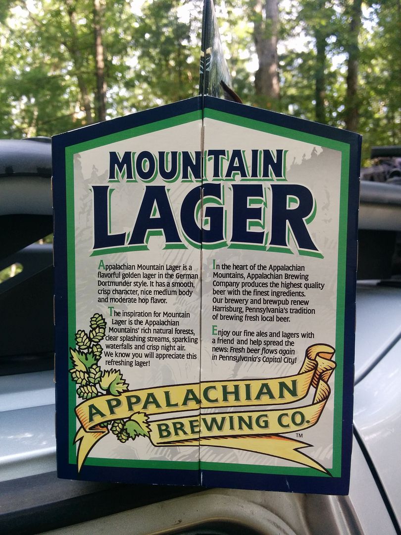
We had bought some beer in Gettysburg, cooked some dinner and had a fire and went to bed.


mortonm

Expedition Leader
The next morning we were up early, broke camp and had started our self guided tour by 8am. The plan was to spend the morning in Gettysburg and then push on to Rothrock State Park later in the day.

I will spare you all the intimate details of the battle, it was a long and bloody fight as I am sure you all know. If you want to know more I would suggest visiting, besides I'm you Americans (yanks and rebs) don't want to hear about the U.S Civil War from a couple of Canadians. I did take quite a few pictures and I will post the most interesting here.

Looking down the Chambersburg Road (towards Chambersburg)


There are hundreds of Cannons on site (literally). The tour starts out on seminary ridge (Confederate Positions)


mortonm

Expedition Leader
Virginia Soldiers Memorial (Gen. Lee on top)


Little and Big Round Top from the Confederate Positions


Staring across the fields from where Pickets start would have commenced (Little and Big Round Top to the right)


Cannon Position on Little Round Top. It was cleared at the time of the battle such as the picture shows, that is the reason it was held as the end of the Union Line. Big Round top had tree cover and wasnt suitable for artillery placement


View from Little Round Top. The spot where Chamberlain and the 20th Maine made their famous stand (and charge) was further down the line in the trees


Pennsylvania Soldiers Memorial. The largest and most extravagant on the battlefield


View from Culps Hill down onto the town of Gettysburg.


mortonm

Expedition Leader
Heart of the Union Line. Hard to see in the panorama but in person you can see the treeline where the Confederates massed their troops. Across this mile of open field they had to march into the teeth of the Union Guns.


Site of the death of Gen. Lo' Armistead


High Water Mark of the Civil War, known as the "Copse of Trees" This spot marks the further point of advance by the Confederates at Gettysburg and also the height of the C.S.A. After this the war would turn against them and would eventually lead to Lee's surrender at Appomattox Courthouse two years later.


mortonm

Expedition Leader
After the tour and lunch, we set our sites for Rothrock State Forest. We ahdnt been before, so thought it would be a great place to check out. There isn't anything to speak up for offroading but lots of good hiking and views and a few cool spots to explore.

Thanks to the Purple Lizard Map of Rothrock that my brother picked up at the Mid-Atlantic Overland Festival we found a hawk watch platform, and did the short hike in to check it out. It was worth the time!


270 degree view, Its almost an unobstructed 360 degree view from up top.


That night we stayed at Greenwood Furnace State Park, with plans in the morning to check out the furnace and move on into Bald Eagle State Forest.


We learned our lesson with the sausages and sketchy grills...found this at a dollar general for a couple bucks


mortonm

Expedition Leader
The next moring we did a bit of exploring at Greenwood Furnace State Park.

Civilian Conservation Corps (CCC) built dam.


Even the Pennsylvania DCNR likes the Purple Lizard Maps!


Remnants of one of the Stacks that made up the Greenwood Furnace, used for producing steel


There was still some metal slag remnants from when the stack was last fired 110 years ago!


Straight up the stack!


mortonm

Expedition Leader
After the furnance we headed over into Bald Eagle State Forest, we took a few driveable trails we hadnt done before, but nothing of note, as they were in pretty good shape.


A couple of nice views though...


That night we decided to get a hotel Room in Lockhaven, time to dust off and clean up a little bit. The town of Woolrich is very closet to Lockhaven, we decided to head up to the factory outlet store, as we both had a few items from Woolrich already.

Nice Land Rover in Lockhaven!


They had a ton of stuff inside, I ended up getting a wool blanket and my brother a plaid shirt (Canadians need plaid to maintain citizenship.)


Buffalo Check Plaid Woolrich Subaru


That night we stayed in the hotel, made some dinner outside on the picnic table and watched the NFL season opener. In the morning we were going to head to Kammerdiner Trail, one that I had been wanting to try for quite some time but had yet to do.
 

mortonm

Expedition Leader
The next morning was grey and foggy, and looked like it might rain. The weather forecast was for bad weather that night all over Pennsylvania/New York and up into Canada. We werent sure if we were going to camp or end up heading home late that night.

It was a little dreary but made for some good early morning pictures.


It is a pretty quick jaunt to get to the start of Kammerdiner Road. The map shows the trail continuing for a few miles and then dead ending, this isn't entirely the case, it in fact goes all the way to Lockhaven. My brother had ridden he trail at the Mid-Atlantic Overland Festival back in July, and made it all the way through only to be blocked by a gate. We didn't know if we would make it that far in my Xterra or what the status of the gate would be.

Kammerdiner Trail - Dead End (ish)


We had some leftover wood, as we would likely be heading home late that night we decided to leave it at the trail head for someone else to use. Even if we decided to camp we don't like dragging wood too far to prevent the spread of invasive species.


The Start of Kammerdiner is pretty tam for the first mile or so. The Purple Lizard Map shows a point of interest off the trail to the north, but no path leading up to it. There is a rocky path up there, its not easy but I had no issues in my Xterra. It does get a little tight in a few places but should be passable for most vehicles.


Worth the side trip? You tell me...


One of my favorite pictures of the whole trip of my Xterra


Coming back down to Kammerdiner


My brother said that he heard that the spot was using for launching gliders off of, I cant confirm if thats true but it looks like it would be a great place to do so, and the brush as been cleared down the hill quite a ways.
 

mortonm

Expedition Leader
There were a few wet sections (and stream crossings) but as in the high parts of most of the Appalachians it was stone bottom, no issues with traction


Lots of Rocks on this trail, none too big but 4LO would be recommended for most of the trip....more on that later...


Near as we can figure this little descent is where the trail ends on the map.


A couple of downed trees, we didnt have a chain saw or any large hand saws so we had no real way of removing the trees short of hacking them out with the axe, so we drove over top in the interest of time.


It had rained overnight but they were pretty slick

BFG AT conforming to the terrain well


There were a few small creek crossings, nothing to worry about, not sure if they would an issue in the spring.


Another creek crossing


Pretty good off camber and flex at the same time over this hump


This doesn't look bad but its a pretty steep little slope after coming out of the creek, it was here that I realized I had done the entire first half in 2HI! I guess that shows how much traction you can get from airing down your tires. After the side detour came back into Kammerdiner I shifted back into 2HI and got a little excited and forgot to switch into 4LO when we got to the tough stuff (including the wet logs). It was a pretty good lesson for us actually, it showed me how far you can go with good tires, aired down properly, and careful modulation of the pedal.


Some sections had some slick rocks and roots


Nice little creek


When we got to the end of the trail, it spills out into a local park which has a gate across the entrance. We were lucky and there was someone in there doing work with a truck and the gate was left open, so we just drove on out into the middle of Lockhaven. From there we headed home, west along 81 and north up 219.

It was a great trip exploring some new areas as well as some that we had been to before. We are eagerly awaiting our trips for next summer and I plan to attend the Mid-Atlantic Overland Festival next year as well
 

Duramax3388

New member
Nice trip. My dad is from around Blackwater falls area and I was just there the last week of Sept. Love that area can never get enough time to go see everything we want to.
 

nater

Adventurer
Your thread inspired me to take the wife next weekend to the cass railroad. Any chance you would be willing to share your gps tracks? Would love to hit a few of them, and finding information seems hard part the caanan loop and that area (which I have run before, look for an older post I made... But I would love to find some more tracks)
 
Last edited:

mortonm

Expedition Leader
Your thread inspired me to take the wife next weekend to the cass railroad. Any chance you would be willing to share your gps tracks? Would love to hit a few of them, and finding information seems hard part the caanan loop and that area (which I have run before, look for an older post I made... But I would love to find some more tracks)

Thanks man! Check out the Mountain State Overland Webpage, they have the GPS tracks for purchase on their site, that is where we got ours!
 

Forum statistics

Threads
187,611
Messages
2,895,870
Members
228,596
Latest member
donaldsonmp3
Top