You are using an out of date browser. It may not display this or other websites correctly.
You should upgrade or use an alternative browser.
You should upgrade or use an alternative browser.
A Week in the Pennsylvania Wilds - Allegheny NF - Bald Eagle SF - Pine Creek Gorge
- Thread starter mortonm
- Start date
Haggis
Appalachian Ridgerunner
You guys started your trip in our extended backyard. The ANF has become the "Land of the Gated Roads" over the last few years but if your willling to get out of your ride and lace up some hiking boots you can immerse yourself in some great scenery. There are also some damn fine trout streams winding through those hollers.
mortonm
Expedition Leader
MONDAY
The next morning we awoke to wet tents, wet ground but dry equipment. We hung up our flys and tents as best we could and made a quick breakfast. The rain had stop and we were both excited to get on the road and head towards Bald Eagle State Forest. There were several options on our route, but we decided to take the slow, steady and scenic route south-east.
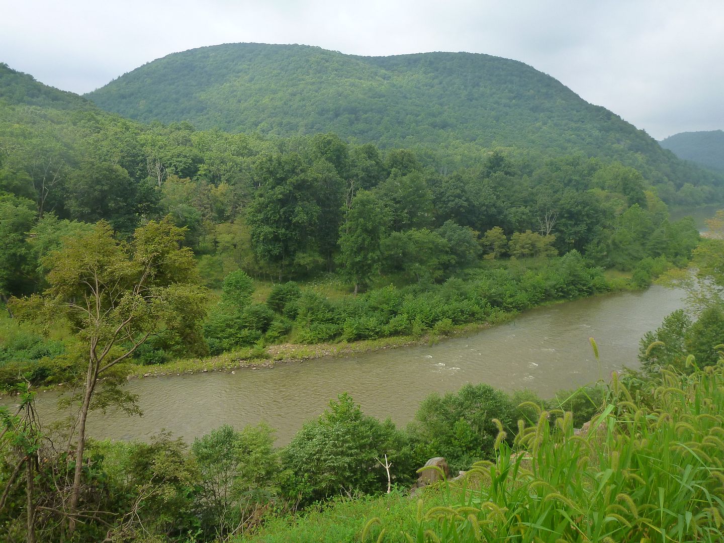
We headed down the 219 and went west on the PA 120, which is one of their listed scenic byways. These routes are slower than the freeways and interstates, but provided great views as we snaked along the West Branch Susquehanna river, which eventually drains into the Chesapeake Bay. This is called the Buck-tail scenic byway, and is so named after a group of volunteers (Bucktail Regiment)who travelled along the old Indian tracks and the river to join up with the Union army during the American Civil War.
We took a couple of back roads (their name escapes me) to cut across country from the 219 to the 120, we had considered taking the slighter quicker route, but our sense of adventure pushed us off the main course for a few miles. Very lucky we did, not long after we got off the 219 we had a young black bear (~200 lbs) run across the road in front of us, he looked back as he loped into the forest on the other side of the road. This would be our only bear encounter for the week.
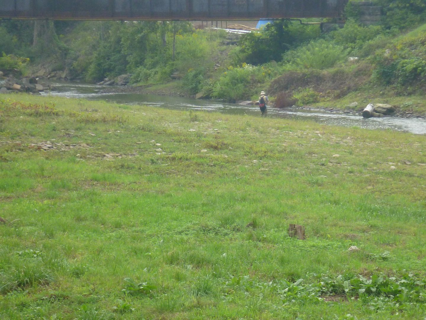
Here is a picture of a nice steel bridge in Emporium, PA, including a man who is fly fishing literally a stones throw from a gas station. We don't see that back home!
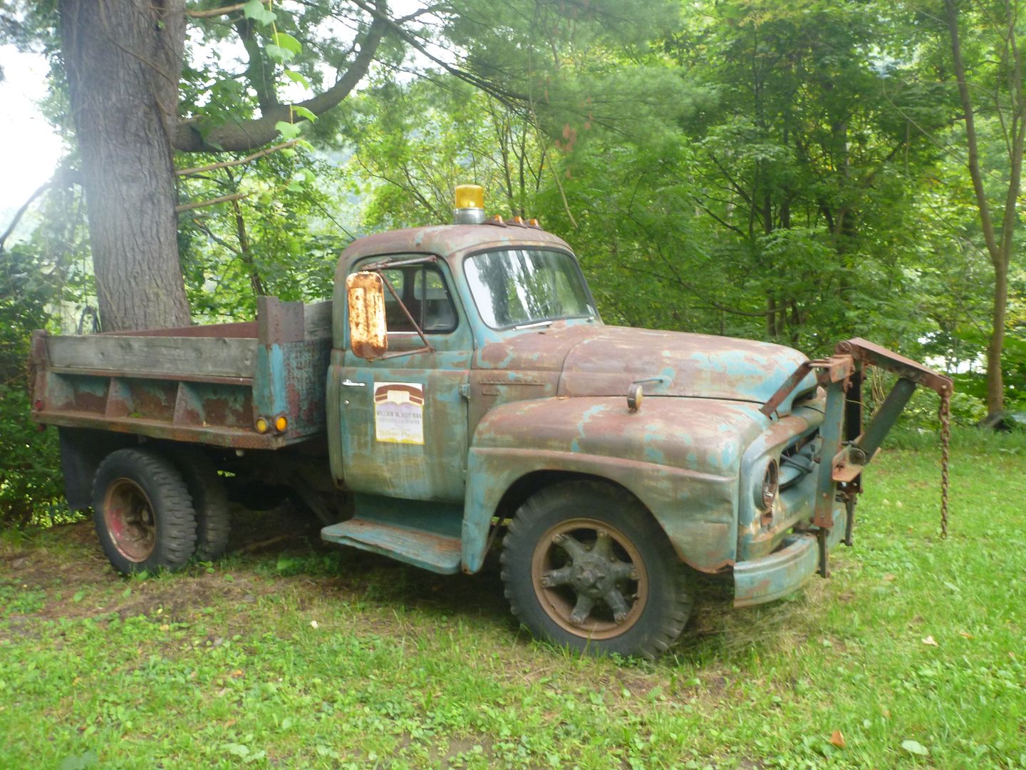
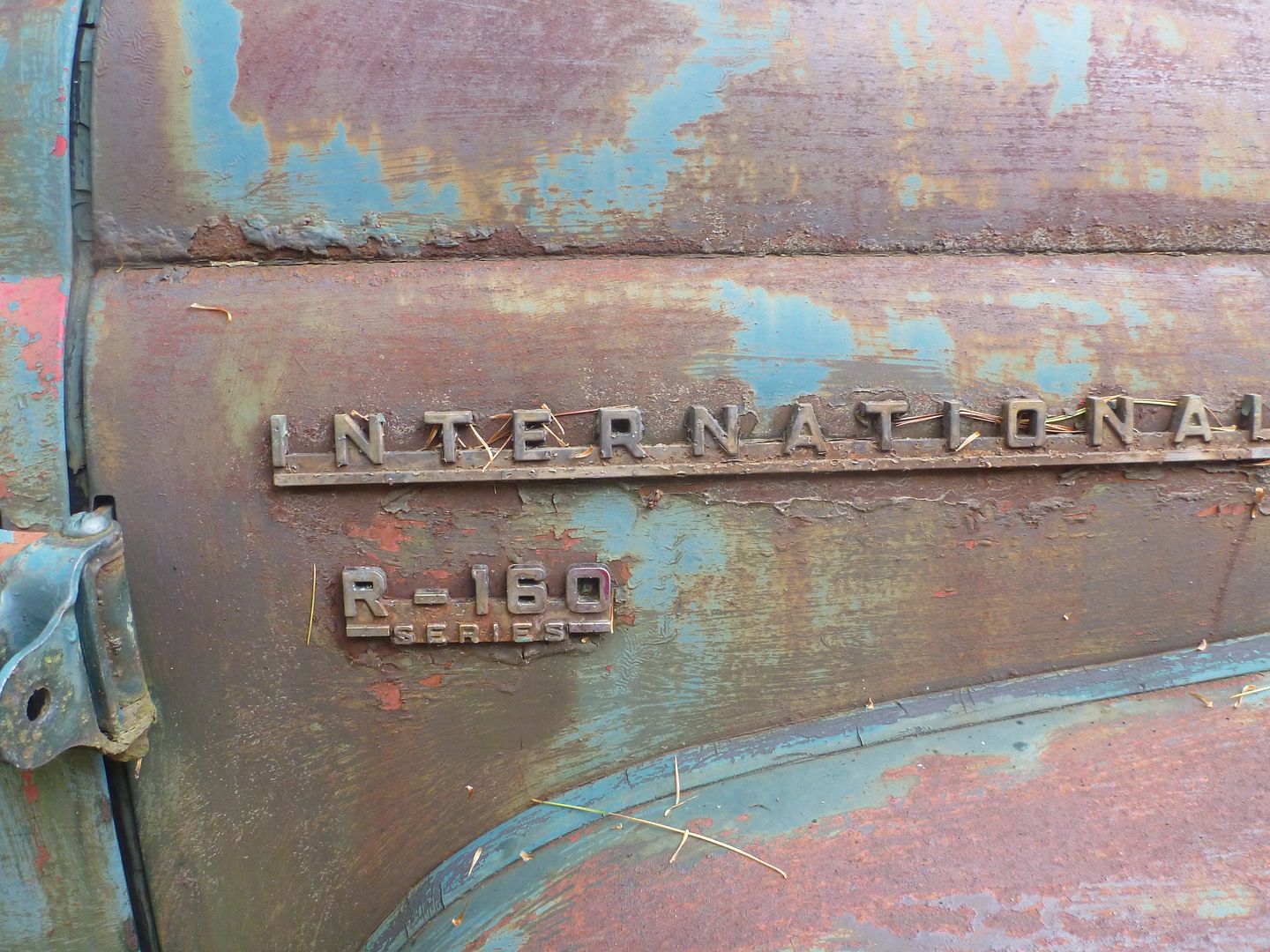
Later down the road we came upon this old International work horse, it was an R-160, we stopped to take a quick look and let buddy have a bathroom break.
Just around this time the sun came out, and we pushed further east along the PA 120, what a great and scenic drive; winding hills, winding river, lush green trees everywhere. One of our only regrets is not making this trip 3 weeks later; the leaves in full colour turn would have been breathtaking.
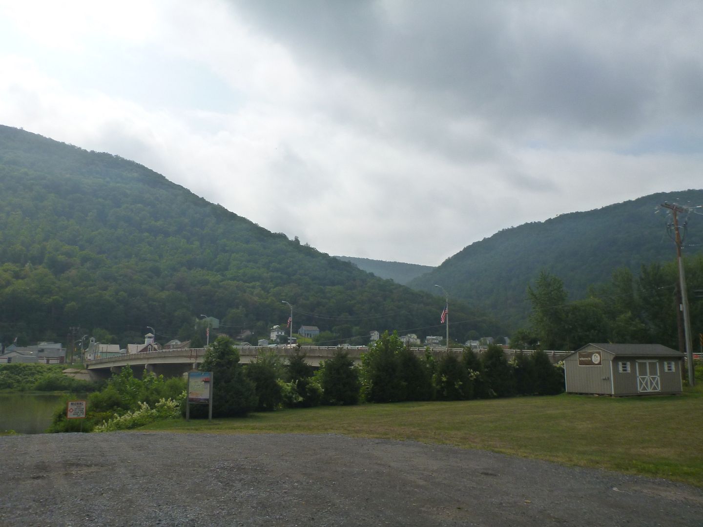
After awhile we reached the town of Renovo, here we had two options, to conitue on the 120 or push further South down another scenic byway, The High Plateau byway. We decided to head south.
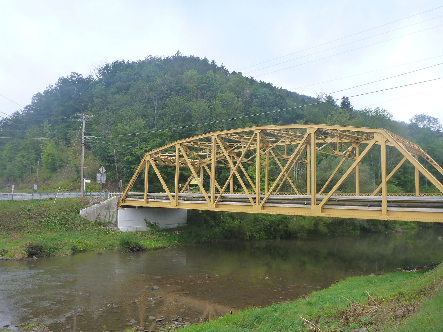
Here is the bridge in Renovo, PA across the West Branch Susquehanna
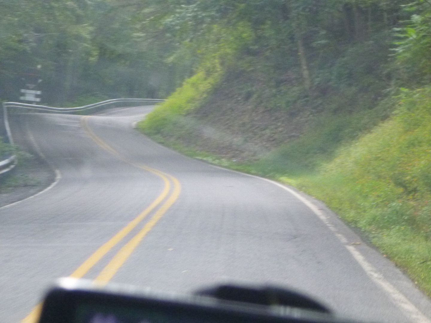
What a great road, this is one of the few times in the last two years I have regretted selling my Volkswagen, it would have loved to carve up these roads
Great view looking West on the 144, we are literally parked beside the highway
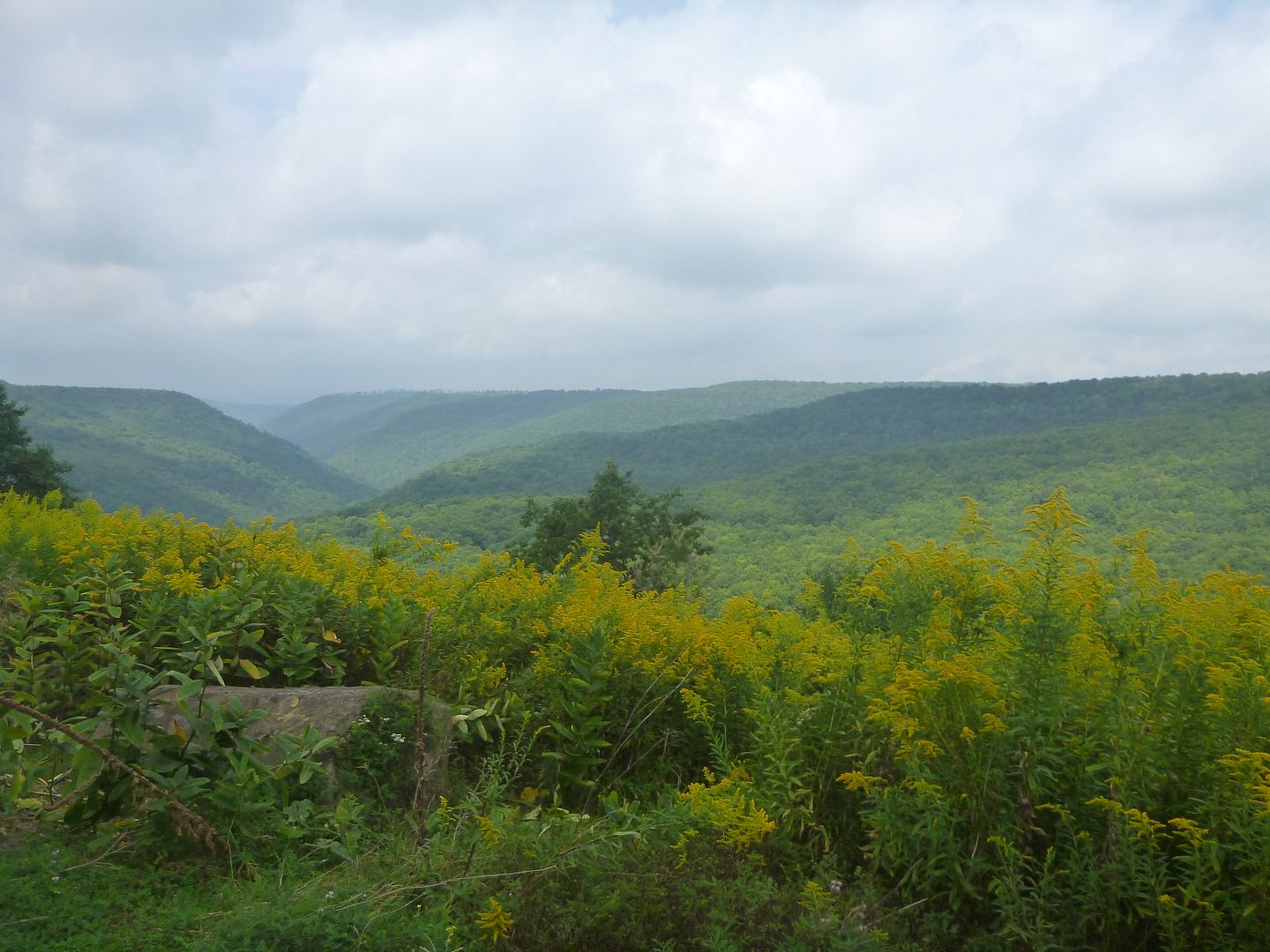
More beautiful curves
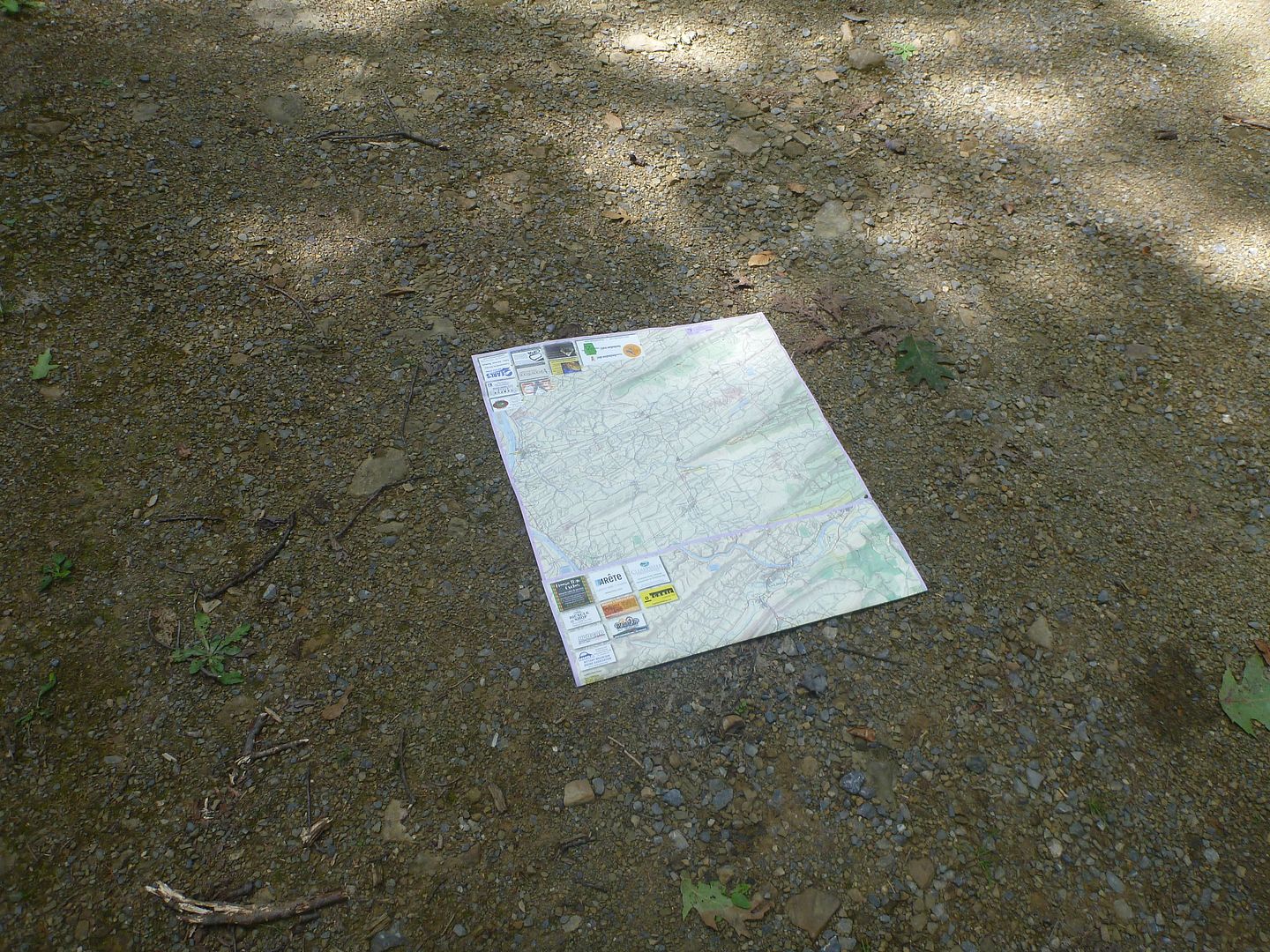
We rolled into State College Pennsylvania early afternoon to refresh our grocery supply and pick up a copy of Purple Lizards map of Bald Eagle State Forest. I can't recommend his maps enough, and he is a member on here. We only had occasion to use the BESF map, but without it our trip would have not been the same. All the fire roads, park roads, driveable trails were well listed, as well as interesting features, vistas and important places to get food, groceries and gear in nearby towns.
Home of the NIttany Lions
We found a quick campsite just on the South end of Bald Eagle State Forest (BESF) and had a quick dinner and then grabbed some sleep. Tomorrow morning we would start exploring the area, and we had three full days to take a look around, and what a great view we had…….
The next morning we awoke to wet tents, wet ground but dry equipment. We hung up our flys and tents as best we could and made a quick breakfast. The rain had stop and we were both excited to get on the road and head towards Bald Eagle State Forest. There were several options on our route, but we decided to take the slow, steady and scenic route south-east.
We headed down the 219 and went west on the PA 120, which is one of their listed scenic byways. These routes are slower than the freeways and interstates, but provided great views as we snaked along the West Branch Susquehanna river, which eventually drains into the Chesapeake Bay. This is called the Buck-tail scenic byway, and is so named after a group of volunteers (Bucktail Regiment)who travelled along the old Indian tracks and the river to join up with the Union army during the American Civil War.
We took a couple of back roads (their name escapes me) to cut across country from the 219 to the 120, we had considered taking the slighter quicker route, but our sense of adventure pushed us off the main course for a few miles. Very lucky we did, not long after we got off the 219 we had a young black bear (~200 lbs) run across the road in front of us, he looked back as he loped into the forest on the other side of the road. This would be our only bear encounter for the week.
Here is a picture of a nice steel bridge in Emporium, PA, including a man who is fly fishing literally a stones throw from a gas station. We don't see that back home!


Later down the road we came upon this old International work horse, it was an R-160, we stopped to take a quick look and let buddy have a bathroom break.


Just around this time the sun came out, and we pushed further east along the PA 120, what a great and scenic drive; winding hills, winding river, lush green trees everywhere. One of our only regrets is not making this trip 3 weeks later; the leaves in full colour turn would have been breathtaking.


After awhile we reached the town of Renovo, here we had two options, to conitue on the 120 or push further South down another scenic byway, The High Plateau byway. We decided to head south.
Here is the bridge in Renovo, PA across the West Branch Susquehanna

What a great road, this is one of the few times in the last two years I have regretted selling my Volkswagen, it would have loved to carve up these roads

Great view looking West on the 144, we are literally parked beside the highway

More beautiful curves

We rolled into State College Pennsylvania early afternoon to refresh our grocery supply and pick up a copy of Purple Lizards map of Bald Eagle State Forest. I can't recommend his maps enough, and he is a member on here. We only had occasion to use the BESF map, but without it our trip would have not been the same. All the fire roads, park roads, driveable trails were well listed, as well as interesting features, vistas and important places to get food, groceries and gear in nearby towns.
Home of the NIttany Lions

We found a quick campsite just on the South end of Bald Eagle State Forest (BESF) and had a quick dinner and then grabbed some sleep. Tomorrow morning we would start exploring the area, and we had three full days to take a look around, and what a great view we had…….
Last edited:
mortonm
Expedition Leader
You guys started your trip in our extended backyard. The ANF has become the "Land of the Gated Roads" over the last few years but if your willling to get out of your ride and lace up some hiking boots you can immerse yourself in some great scenery. There are also some damn fine trout streams winding through those hollers.
We did find a lot of gated roads, even in the one day we spent exploring. We wished we had more time to Hike, it looked like there were endless miles of great trails.
WagoneerSX4
Adventurer
I'm from London, been through PA many times but I have to admit, almost every time it was booking down the interstate. I've always wanted to stop and explore though. When you're on the highway, you can almost always see a trail following the highway with some rickity bridges over tons of little streams or ponds. Girlfriend never let me get off the highway to see if I could find an entrance to them 
Great write-up!
Great write-up!
mortonm
Expedition Leader
TUESDAY
We awoke that morning to a beautiful sunrise, and a crisp clear day. The temperature had dropped a little, and would be cooler for the coming few days, but there would be no rain, perfect for exploring. I was a little nervous of what we would encounter, I knew that there were not any extremely difficult trails, and I knew that my truck would be able to handle them, I was a little more worried about how I would handle them. I am still getting used to the idea of the off camber feeling, and this trip made me feel much better about it.
I actually installed a Lev-O-Gage before we set out on this trip. I did some reading beforehand and saw a lot of mixed reviews. Most of them said it was a distraction and not really worth the time or effort to install. I found it to be quite useful for me. This rig will never see high off camber situations, but it will quite often see 15-20 degrees, which isn’t that uncommon. I do realize that for more experienced people this isn’t a lot, but my but-o-meter didn’t feel great with that before. I know this truck can handle a lot more than 15-20 degrees, but having a lev-o-gage telling me my but-o-meter is off was nice, and made me MUCH more comfortable. Money well spent for me. Eventually I won’t need it, but for now I am very happy with it.
There are a few trip reports out there for Bald Eagle State Forest, most of them on here. They had al taken place in the spring, however, and there was a lot of mud and water. We were hoping this time of year it would be dryer and easier to traverse. It didn’t take very long until we were into the State Forest
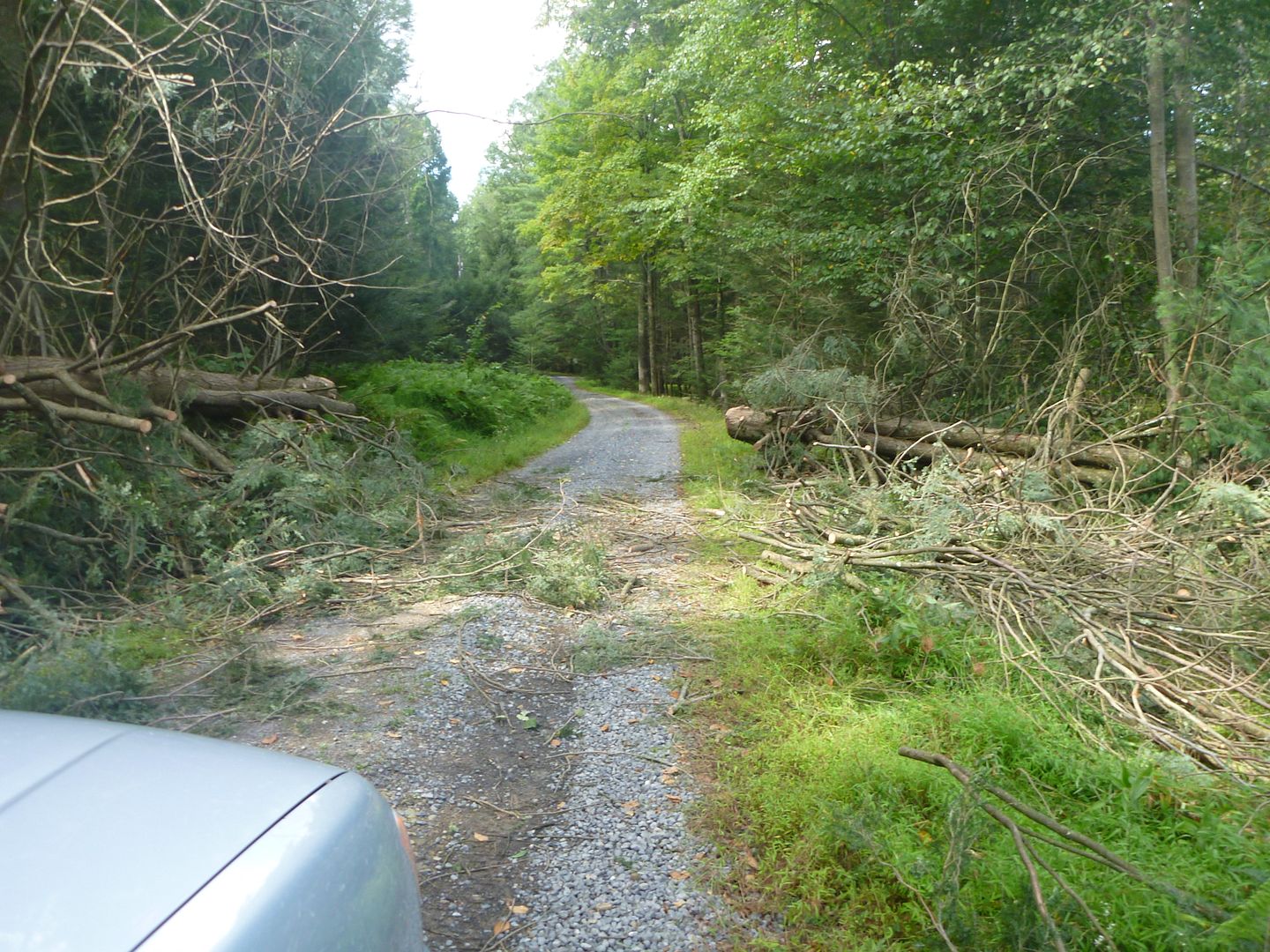
We head into the Forest from the south-west end of Old Lancaster Valley road, it didn’t take much traveling along to realize that this road had been blocked off at some point, not sure why exactly. There was a gate listed on the Purple Lizard map, which we didn’t see, but we assumed this is what was meant. This is the second time in the week we had to turn around, but it would be the last, come hell or high-water (literally)
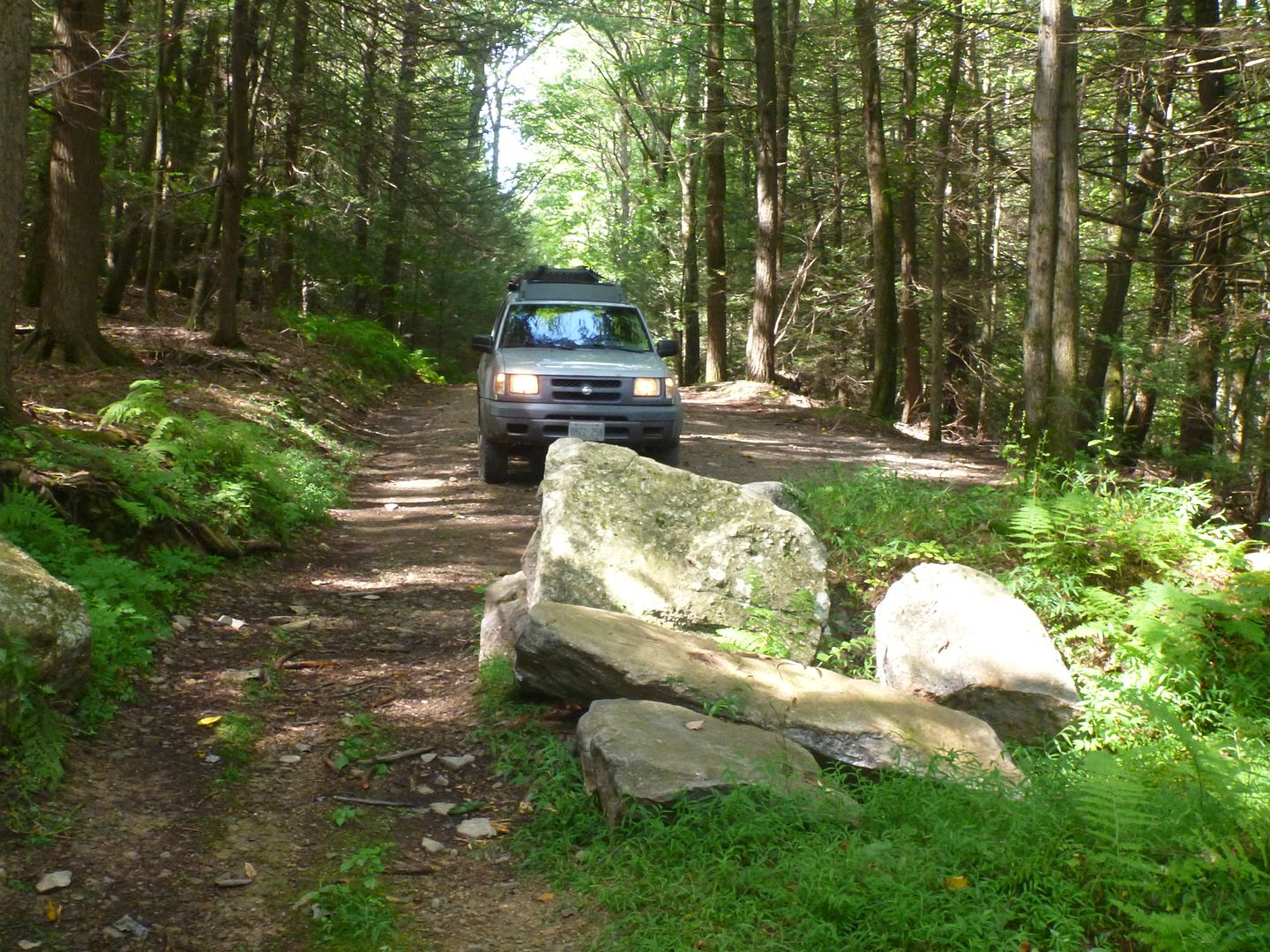
This had fallen and someone had taken the time to cut it up with a chainsaw, but had left a bunch of sharp sticks on the road, so we took 5 minutes and tossed them all off to the side
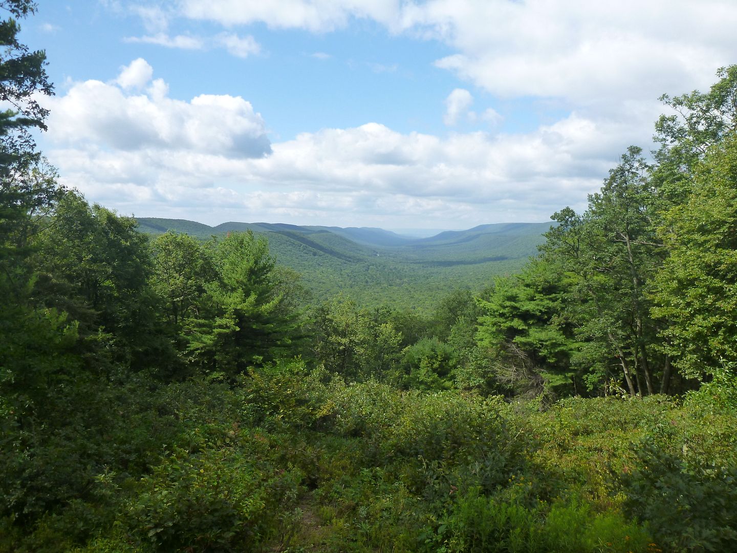
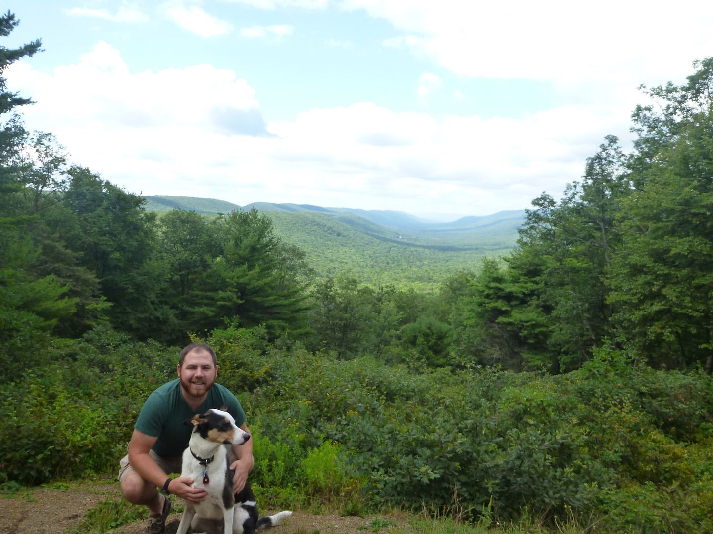
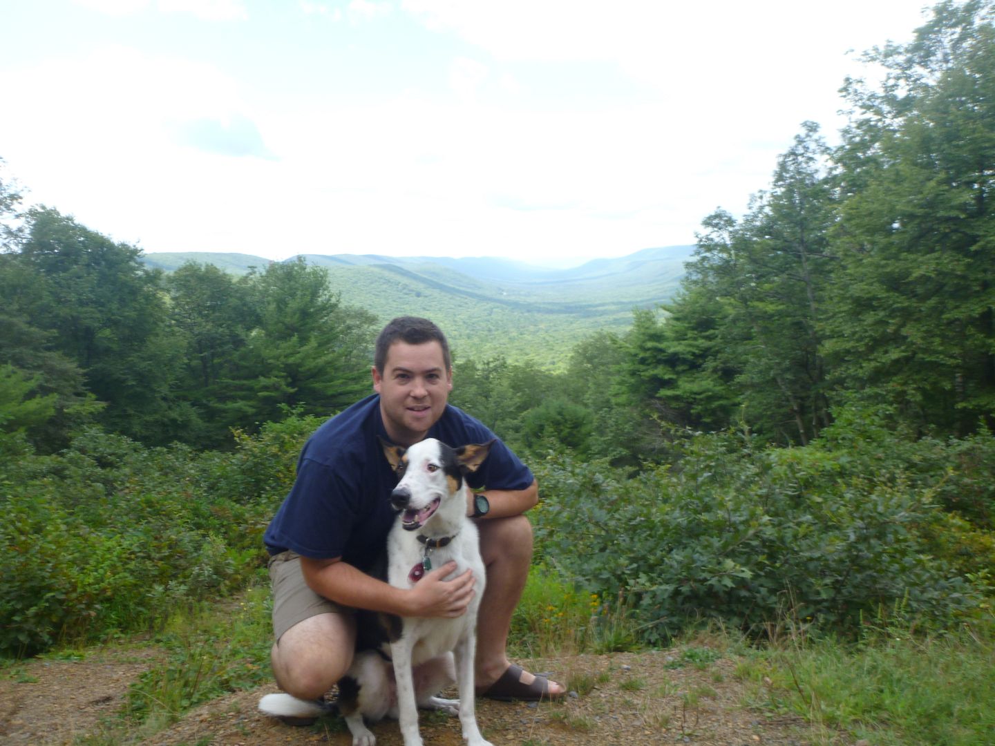
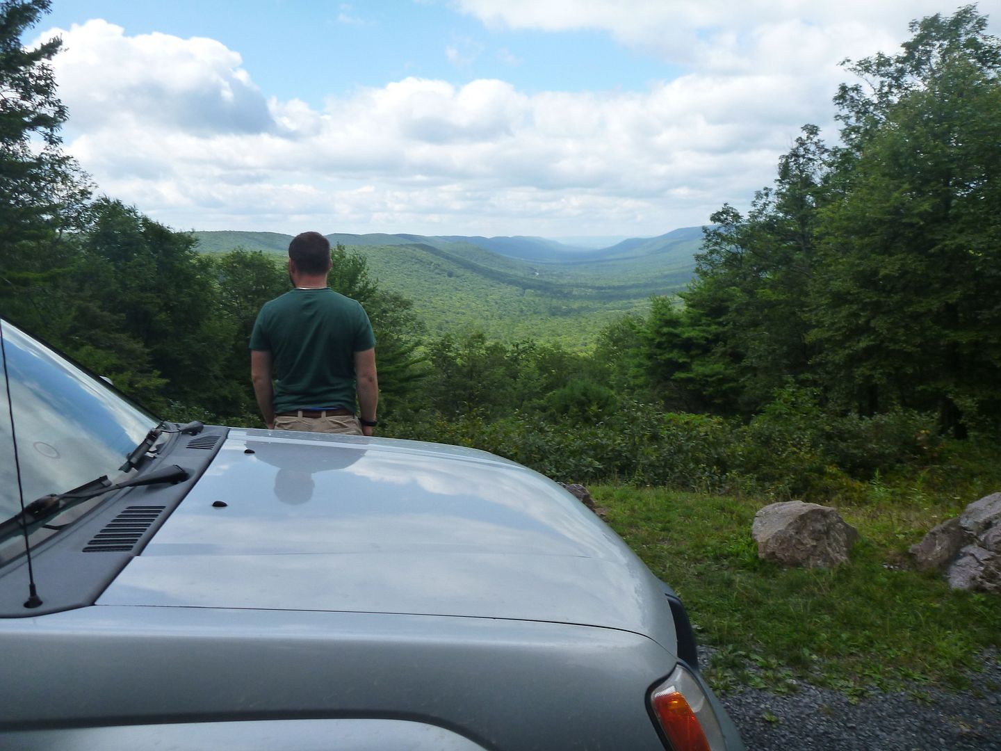
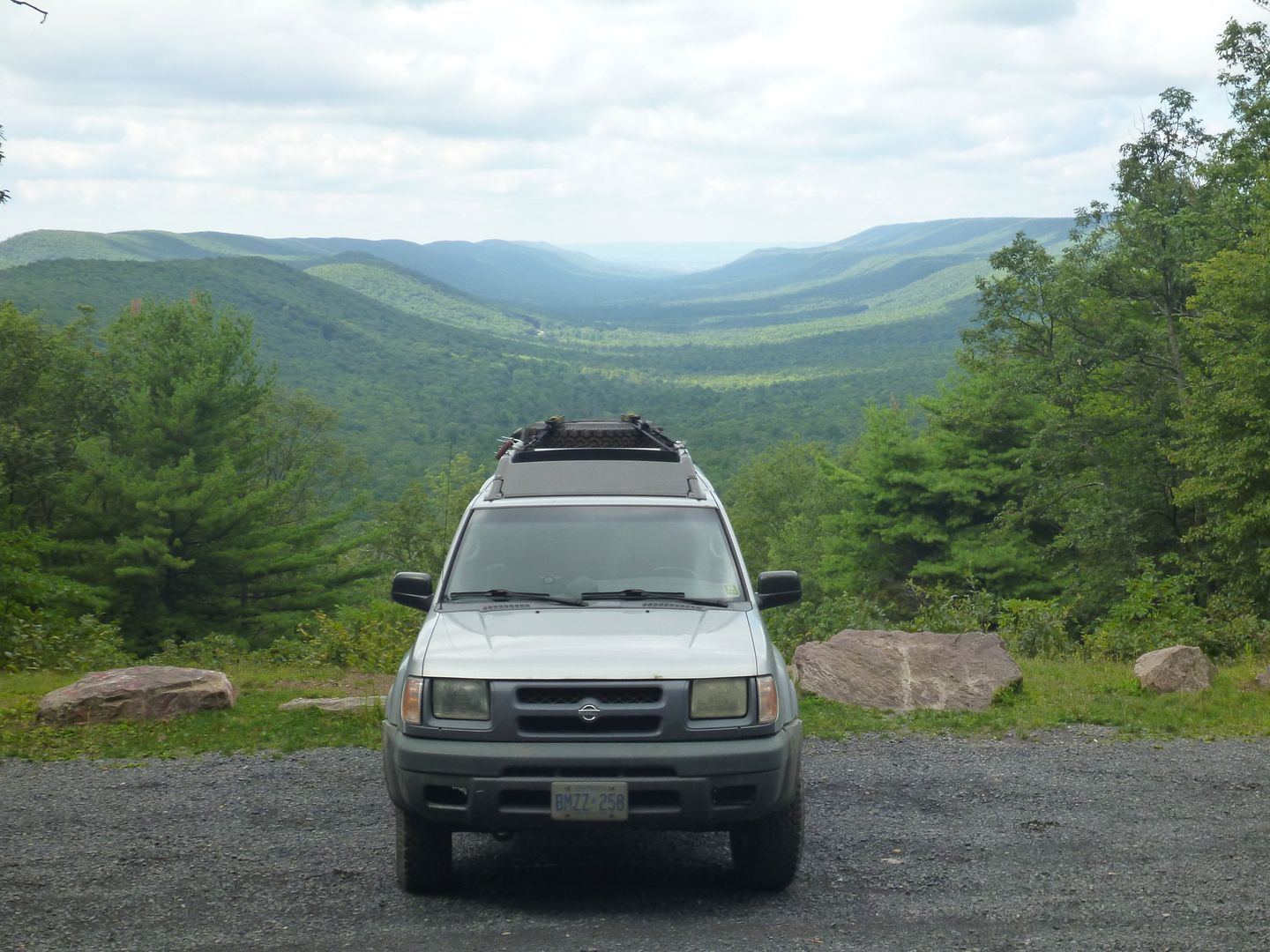
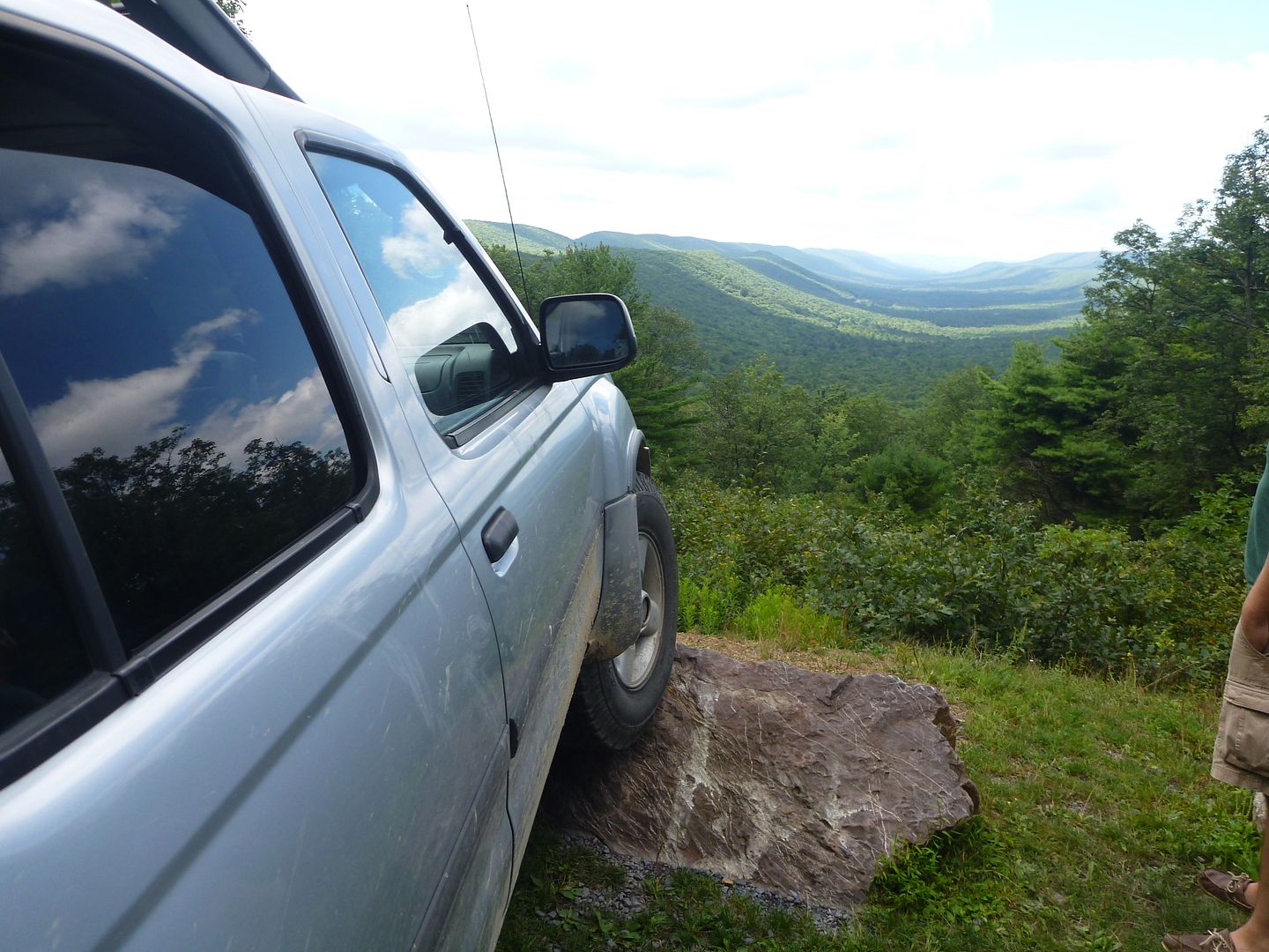
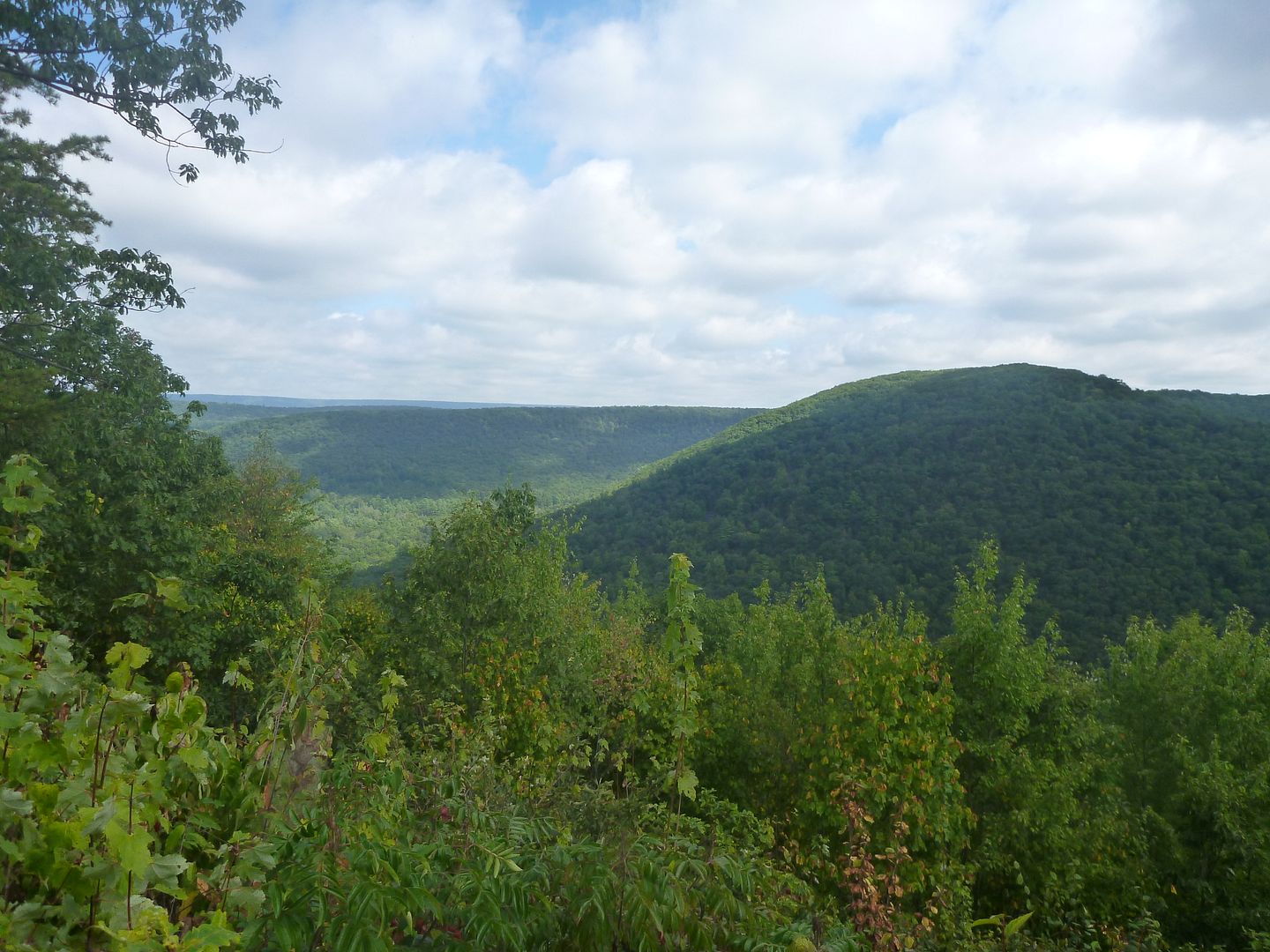
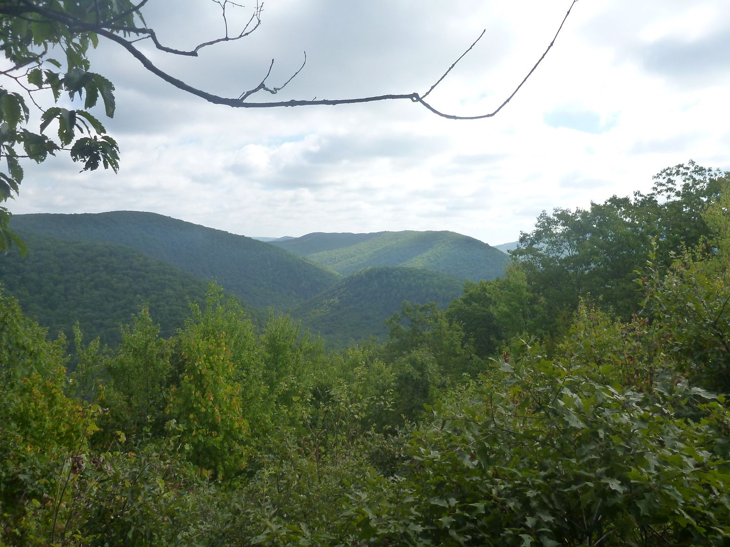
From there, we headed back and got onto Locust Ridge Road, and came across this super nice view of Lancaster Valley. Stopped for a little break, took some pictures and took a look at the map to plan out the rest of our day.
Here are the GPS coordinates (off google maps) in case anyone is interested
N 40°44'24.84"N
W 77°26'3.79"W
From here we headed onto Knob Ridge Road
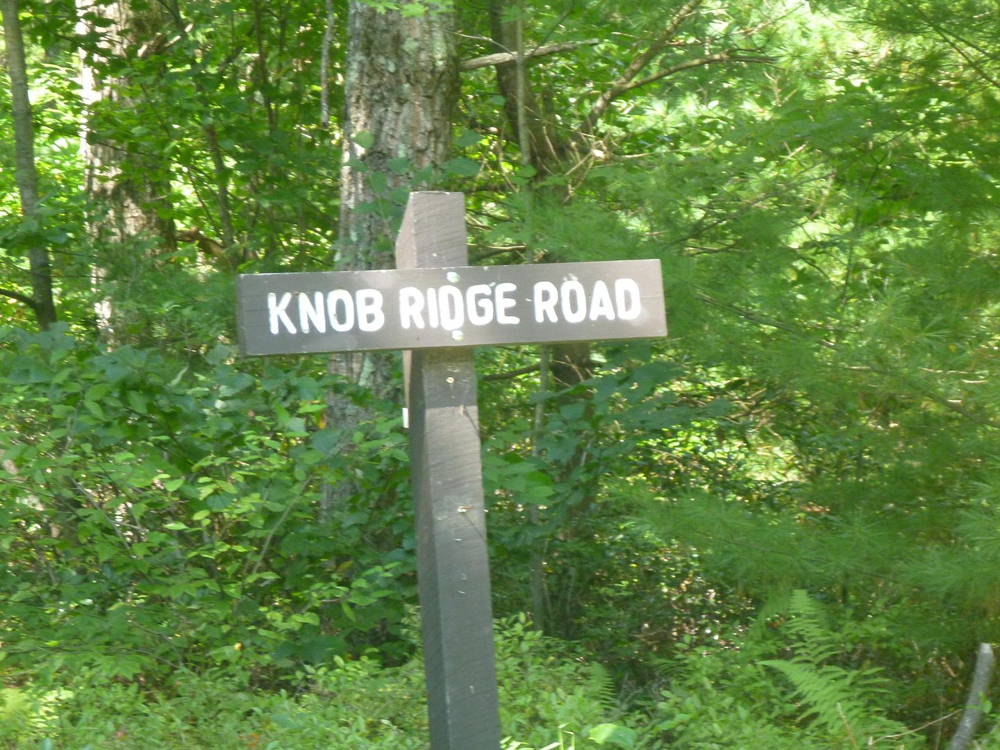
This was designated as a Driveable Trail, 4WD Recommended
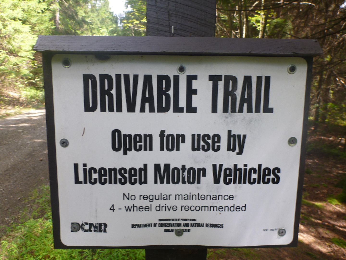
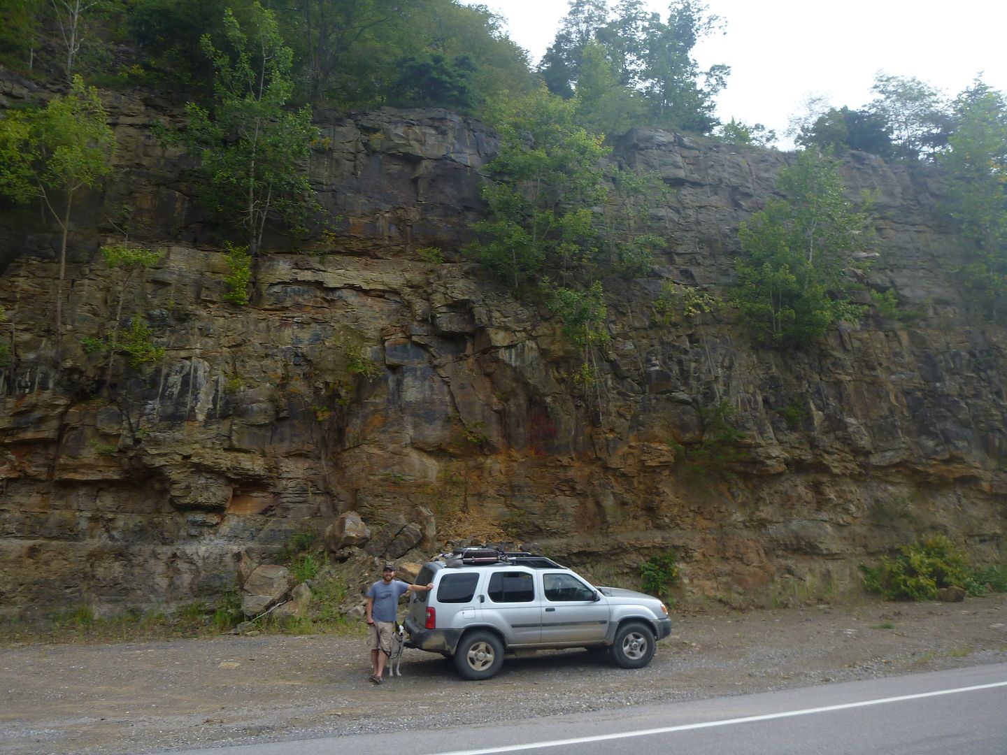
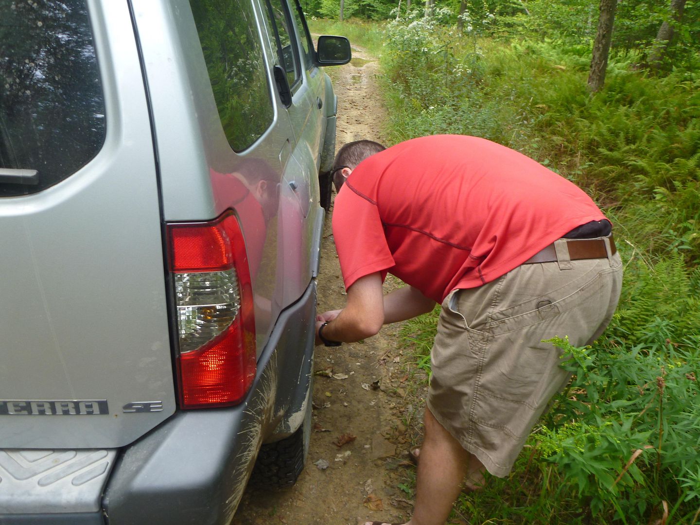
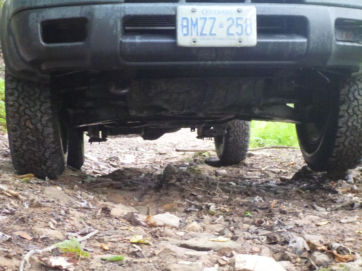
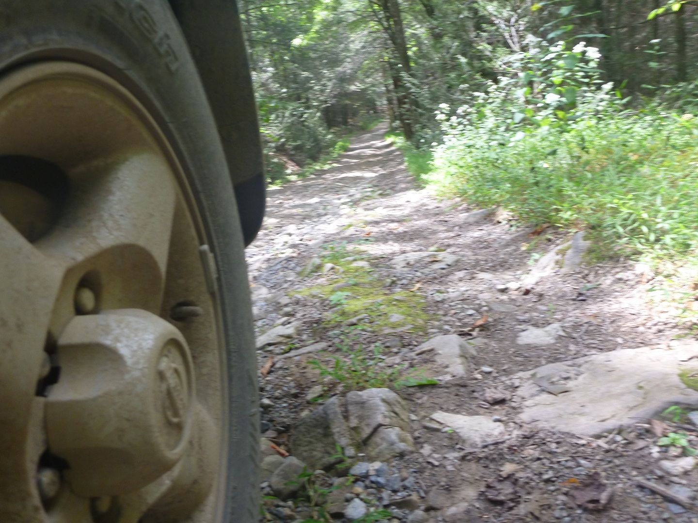
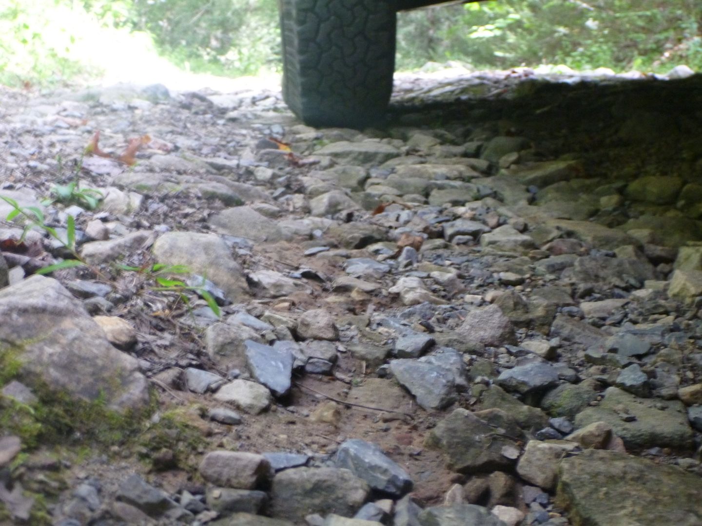
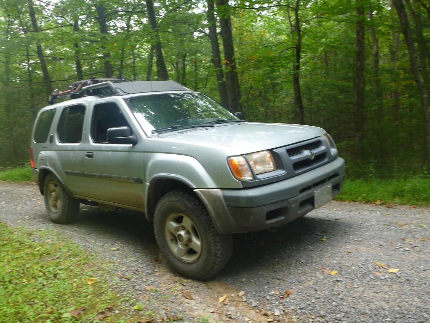
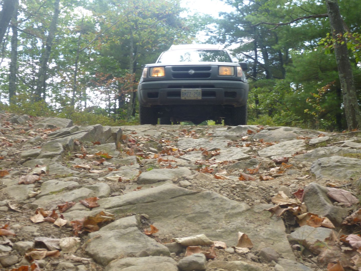
I will state right now, that any trail or road that we took during this trip could have been accomplished by any stock 4WD truck or SUV currently for sale in North America. The one modification I would say is necessary is a good sturdy LT tire, there were lots of rocks, sharp rocks and all the access and fire roads are crushed stone. I could see a set of P rated tries getting shredded pretty quickly up there if you aren’t careful. I only suggest suing 4WD for the use of low range. On the driveable trails we were in 4lo almost exclusively, this allowed a smoother throttle response and allowed us to just slowly crawl over and through obstacles without wheel spin. In trails like these the tread lightly principle is very important for preservation. I could see these trails have the potential for damage if you went in there all four tires spinning.
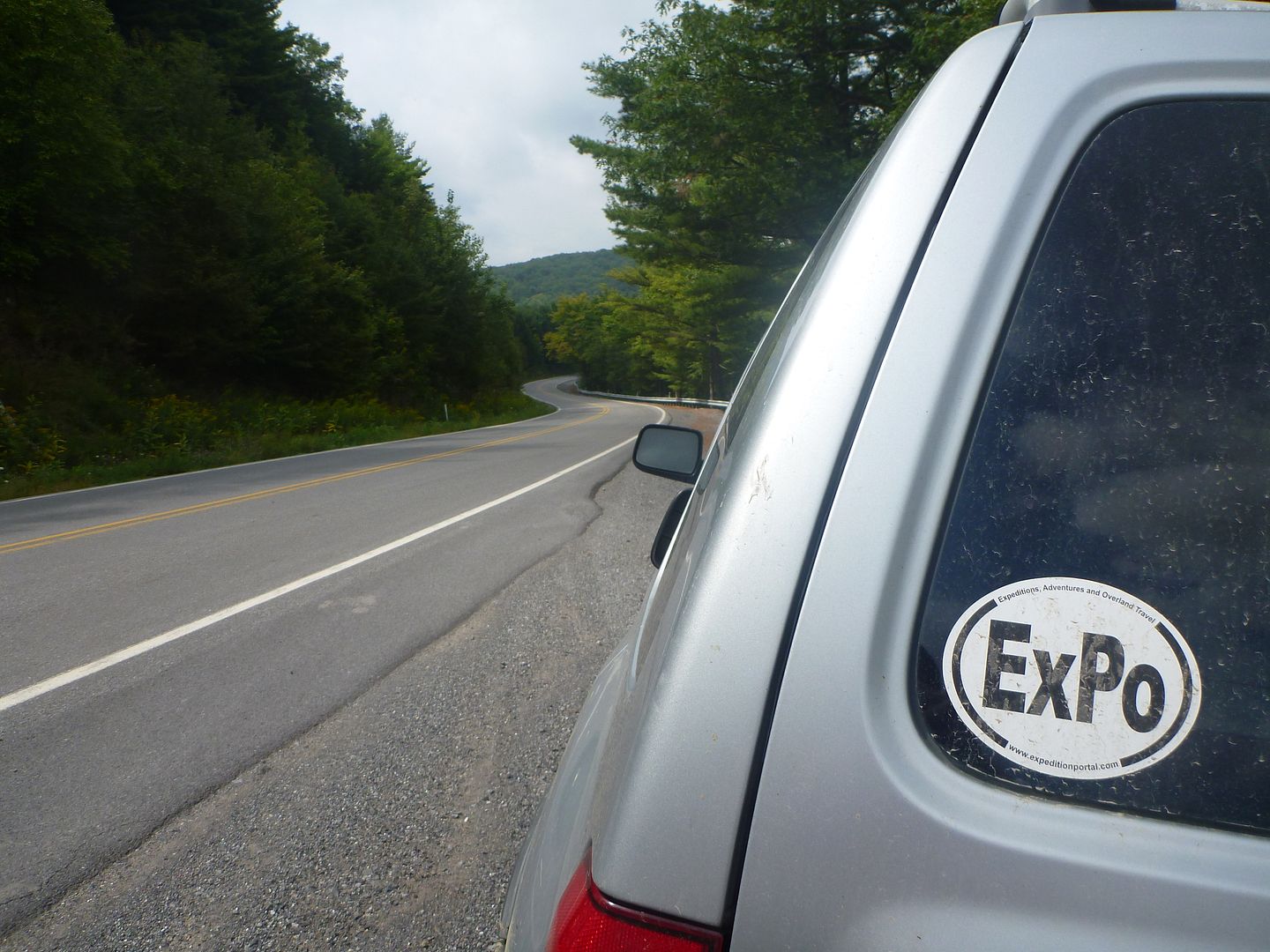
We aired down to about 25 psi, and ran this all week. We only saw a few miles of pavement, all of it around 40 mph, so I wasn’t worried about airing up and down all the time.
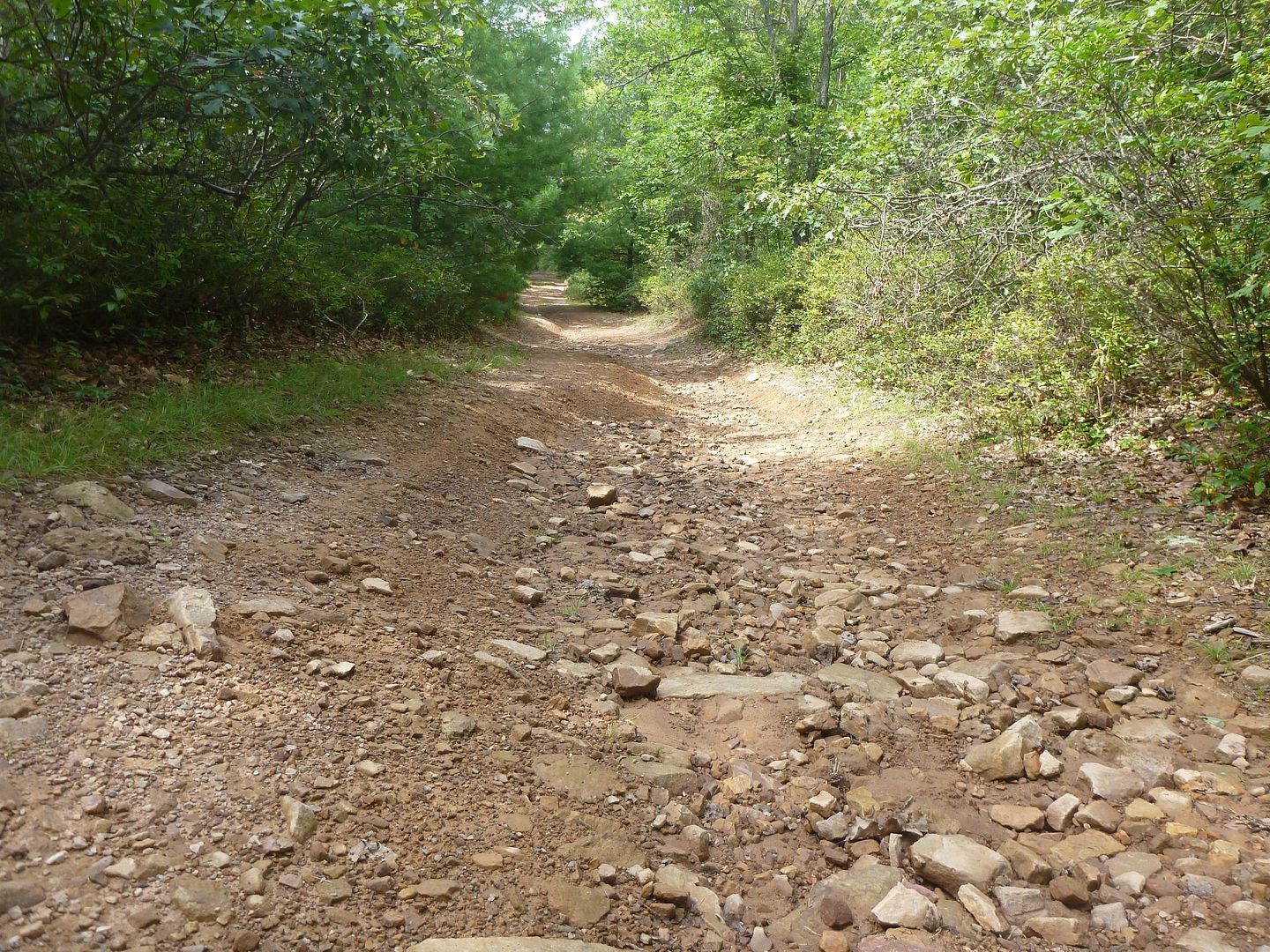
Very typical of the driveable trails, lots of rocks.
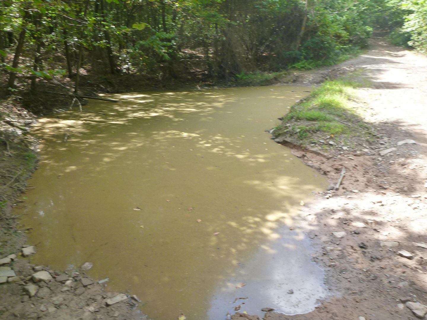
Still some standing water from rain the night before
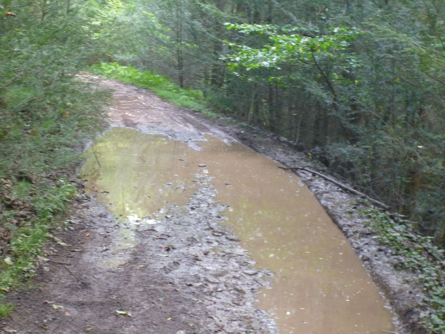
There is a bypass for this water hole, it looked pretty deep, but we didn’t even bother checking the depth. It looked like you would need an ATV to get out of the other end, pretty off camber, steep and narrow.
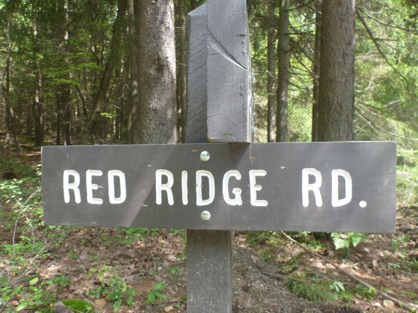
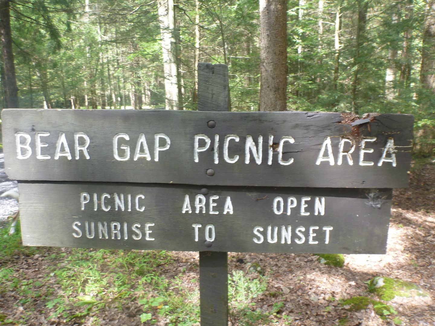
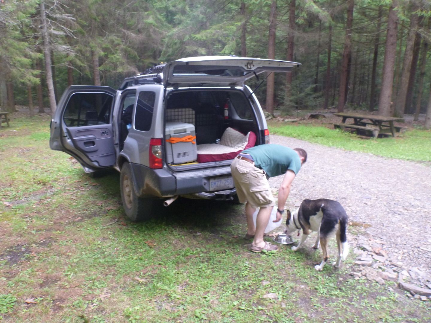
It took us about an hour to complete knob ridge road, with a few stops to let the dog out and stretch his legs. We then continued onto red ridge road, to treaster valley road and then to strong mountain road. There is a place called Bears Gap Picnic area on strong mountain rd. We stopped there to have some lunch and a beer.
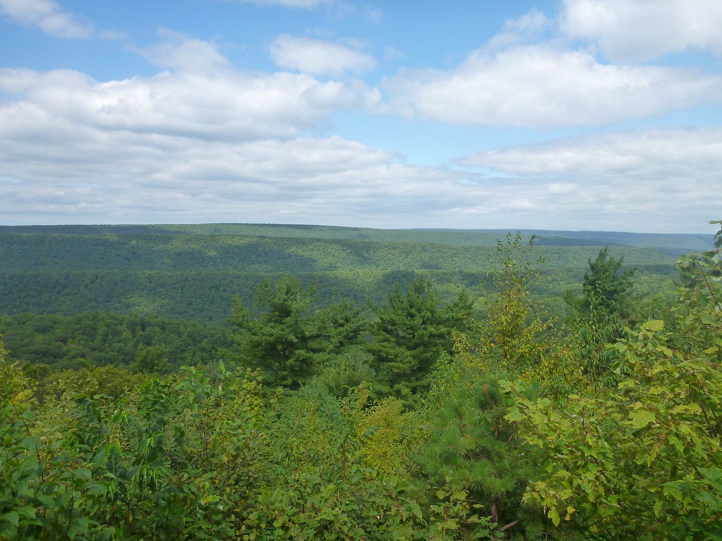
Some nice Views along Red Ridge Rd
Saw some type of military plane while we were stopped
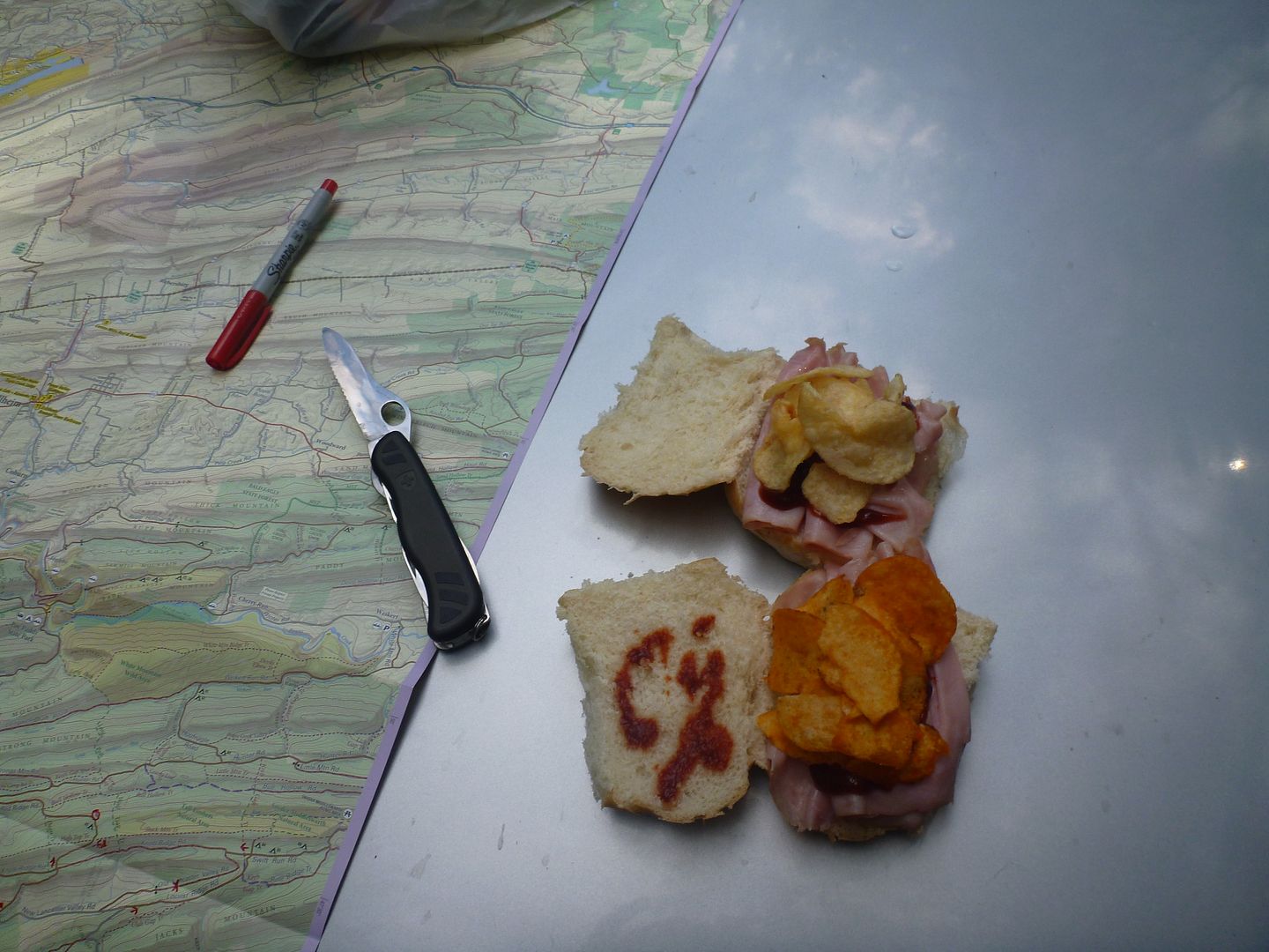
Ham and Cheese sandwich for lunch, but we ran out of cheese so we used chips, and bbq sauce.
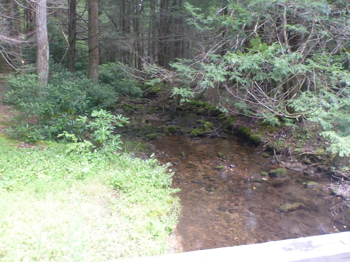
Just down the road a little we came across a nice little bridge and took a few pictures
We awoke that morning to a beautiful sunrise, and a crisp clear day. The temperature had dropped a little, and would be cooler for the coming few days, but there would be no rain, perfect for exploring. I was a little nervous of what we would encounter, I knew that there were not any extremely difficult trails, and I knew that my truck would be able to handle them, I was a little more worried about how I would handle them. I am still getting used to the idea of the off camber feeling, and this trip made me feel much better about it.
I actually installed a Lev-O-Gage before we set out on this trip. I did some reading beforehand and saw a lot of mixed reviews. Most of them said it was a distraction and not really worth the time or effort to install. I found it to be quite useful for me. This rig will never see high off camber situations, but it will quite often see 15-20 degrees, which isn’t that uncommon. I do realize that for more experienced people this isn’t a lot, but my but-o-meter didn’t feel great with that before. I know this truck can handle a lot more than 15-20 degrees, but having a lev-o-gage telling me my but-o-meter is off was nice, and made me MUCH more comfortable. Money well spent for me. Eventually I won’t need it, but for now I am very happy with it.
There are a few trip reports out there for Bald Eagle State Forest, most of them on here. They had al taken place in the spring, however, and there was a lot of mud and water. We were hoping this time of year it would be dryer and easier to traverse. It didn’t take very long until we were into the State Forest
We head into the Forest from the south-west end of Old Lancaster Valley road, it didn’t take much traveling along to realize that this road had been blocked off at some point, not sure why exactly. There was a gate listed on the Purple Lizard map, which we didn’t see, but we assumed this is what was meant. This is the second time in the week we had to turn around, but it would be the last, come hell or high-water (literally)

This had fallen and someone had taken the time to cut it up with a chainsaw, but had left a bunch of sharp sticks on the road, so we took 5 minutes and tossed them all off to the side

From there, we headed back and got onto Locust Ridge Road, and came across this super nice view of Lancaster Valley. Stopped for a little break, took some pictures and took a look at the map to plan out the rest of our day.
Here are the GPS coordinates (off google maps) in case anyone is interested
N 40°44'24.84"N
W 77°26'3.79"W


From here we headed onto Knob Ridge Road

This was designated as a Driveable Trail, 4WD Recommended

I will state right now, that any trail or road that we took during this trip could have been accomplished by any stock 4WD truck or SUV currently for sale in North America. The one modification I would say is necessary is a good sturdy LT tire, there were lots of rocks, sharp rocks and all the access and fire roads are crushed stone. I could see a set of P rated tries getting shredded pretty quickly up there if you aren’t careful. I only suggest suing 4WD for the use of low range. On the driveable trails we were in 4lo almost exclusively, this allowed a smoother throttle response and allowed us to just slowly crawl over and through obstacles without wheel spin. In trails like these the tread lightly principle is very important for preservation. I could see these trails have the potential for damage if you went in there all four tires spinning.
We aired down to about 25 psi, and ran this all week. We only saw a few miles of pavement, all of it around 40 mph, so I wasn’t worried about airing up and down all the time.

Very typical of the driveable trails, lots of rocks.

Still some standing water from rain the night before


There is a bypass for this water hole, it looked pretty deep, but we didn’t even bother checking the depth. It looked like you would need an ATV to get out of the other end, pretty off camber, steep and narrow.

It took us about an hour to complete knob ridge road, with a few stops to let the dog out and stretch his legs. We then continued onto red ridge road, to treaster valley road and then to strong mountain road. There is a place called Bears Gap Picnic area on strong mountain rd. We stopped there to have some lunch and a beer.
Some nice Views along Red Ridge Rd


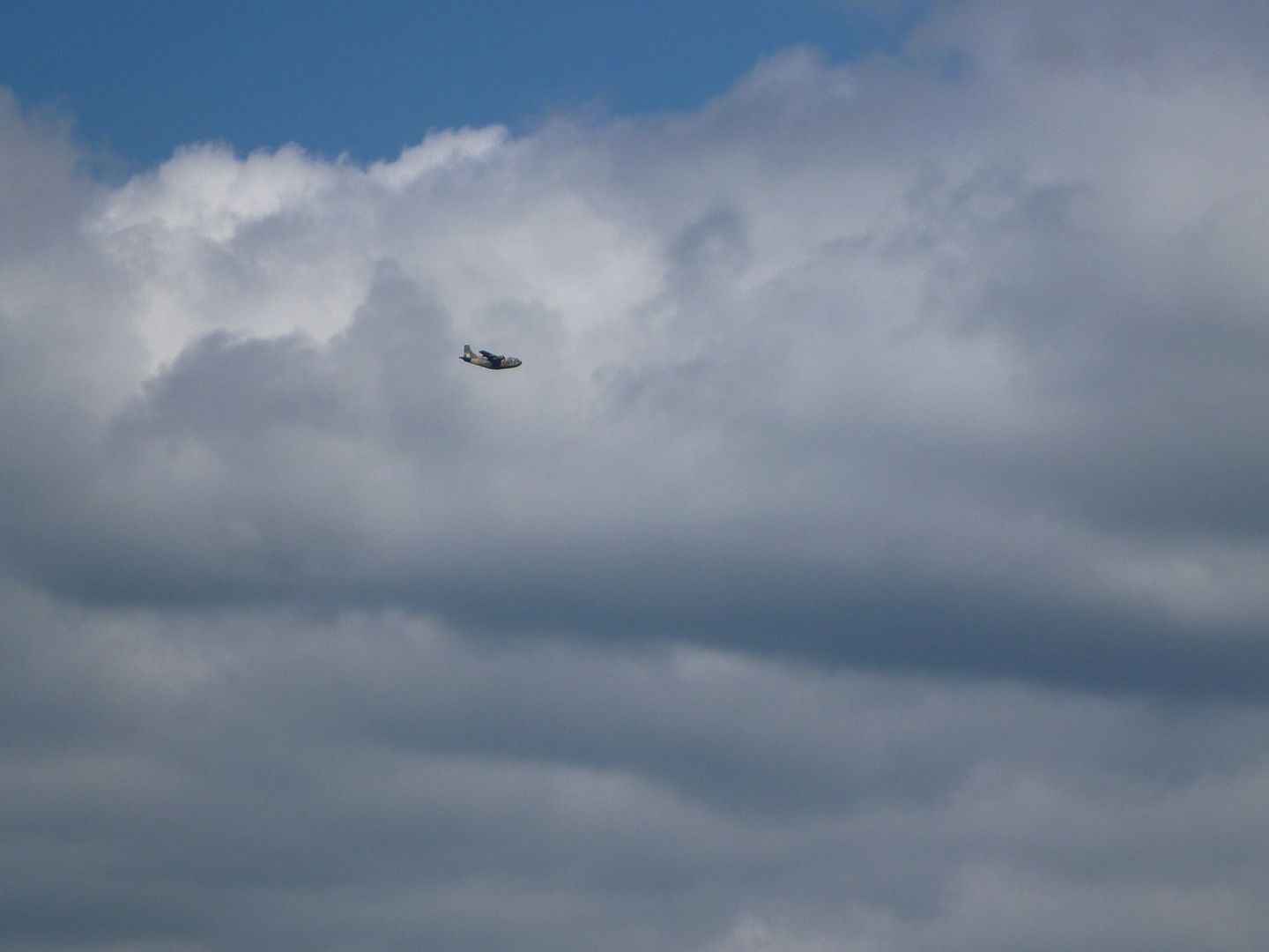
Saw some type of military plane while we were stopped


Ham and Cheese sandwich for lunch, but we ran out of cheese so we used chips, and bbq sauce.


Just down the road a little we came across a nice little bridge and took a few pictures


Last edited:
mortonm
Expedition Leader
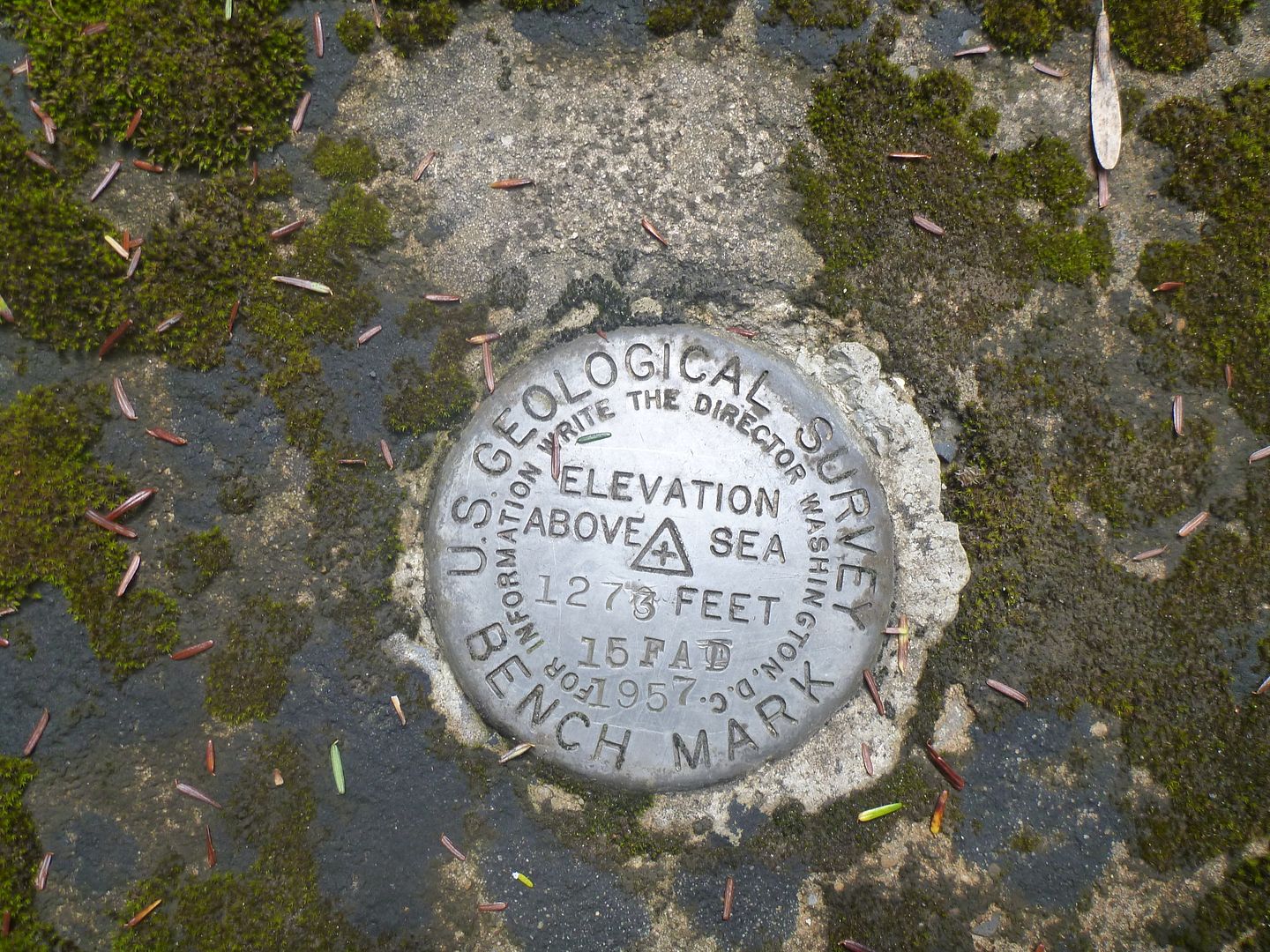
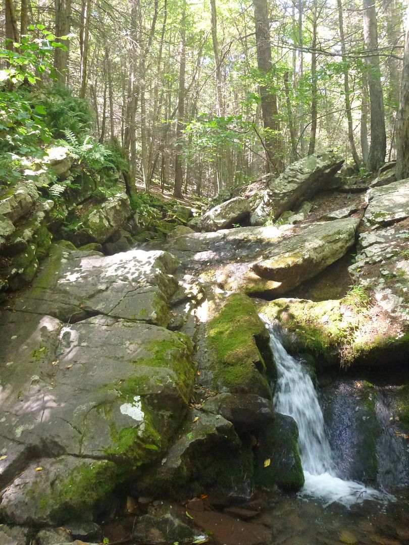
There was a USGS Survey Marker from 1957 there, this place is in the middle of nowhere now, it must have been really remote 55 years ago!
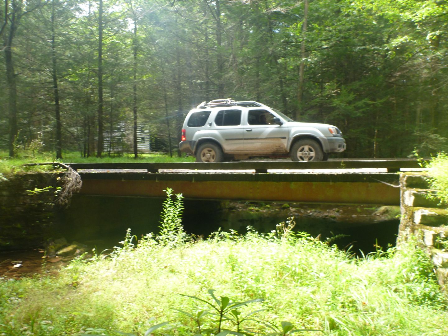
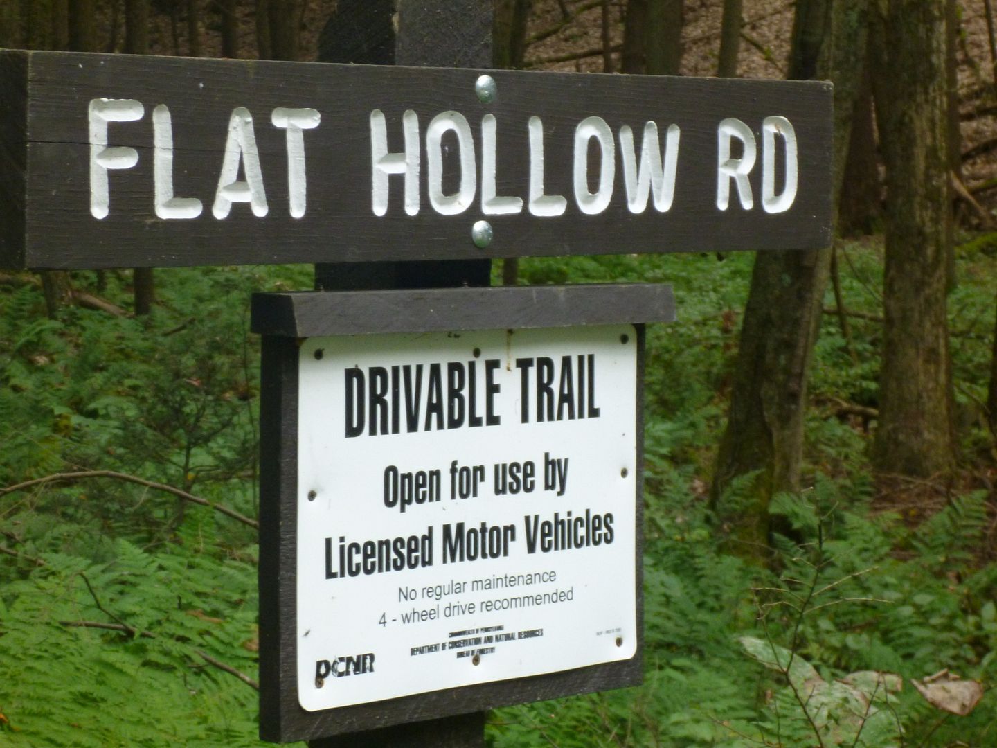
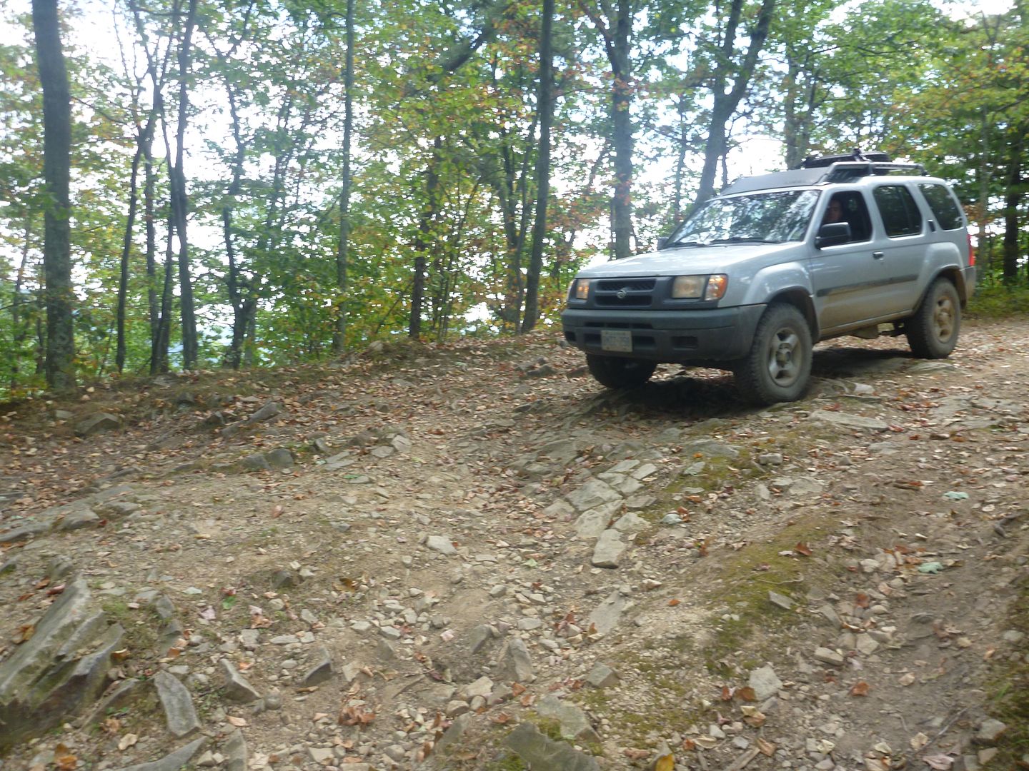
We then took Flat Hollow Road, which was listed as a driveable trail, but was significantly easier going than knob ridge road.
Little bit of flex
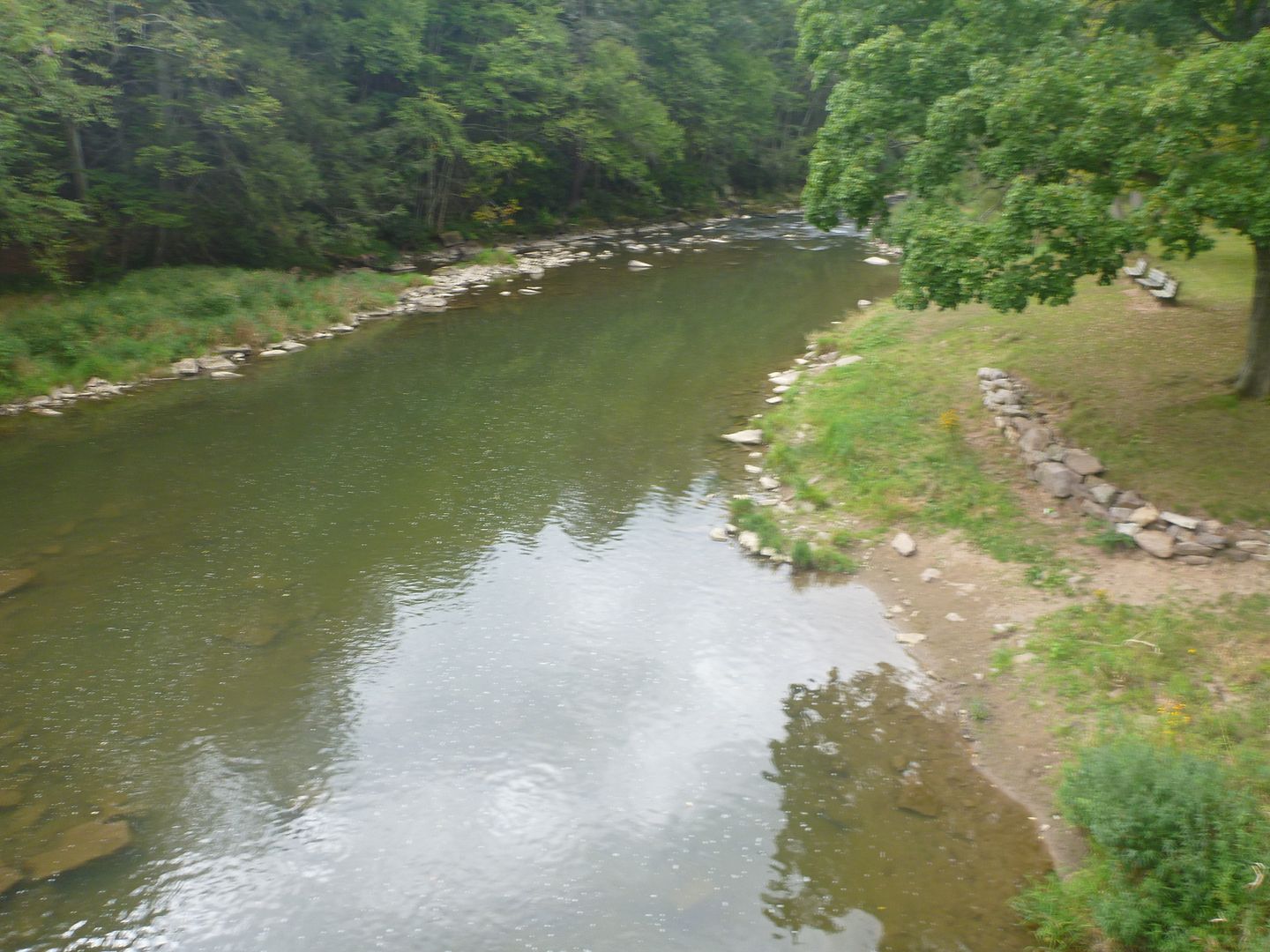
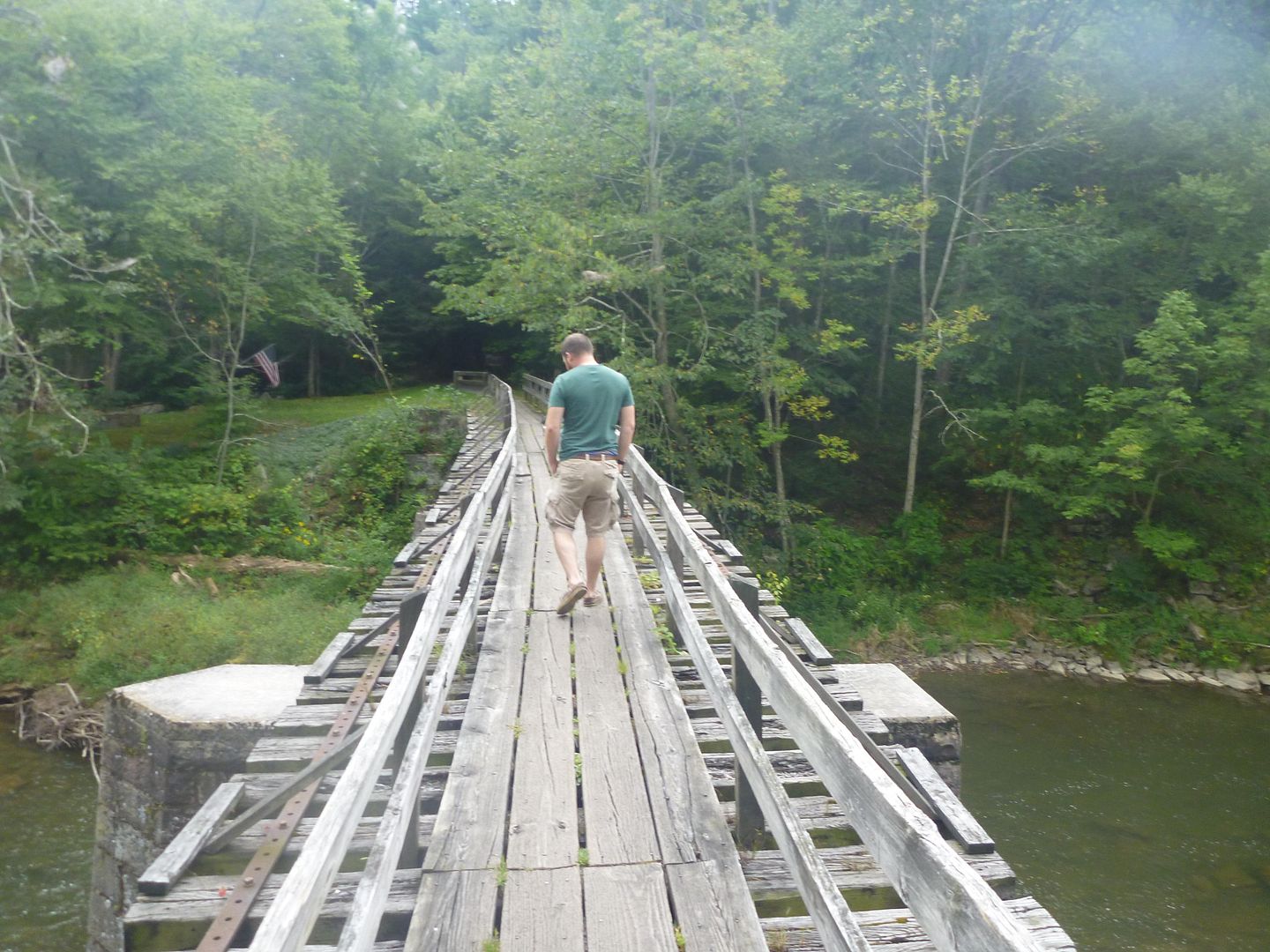
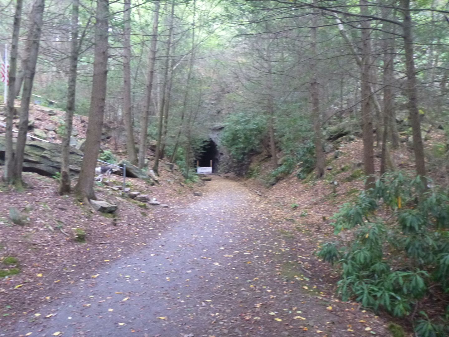
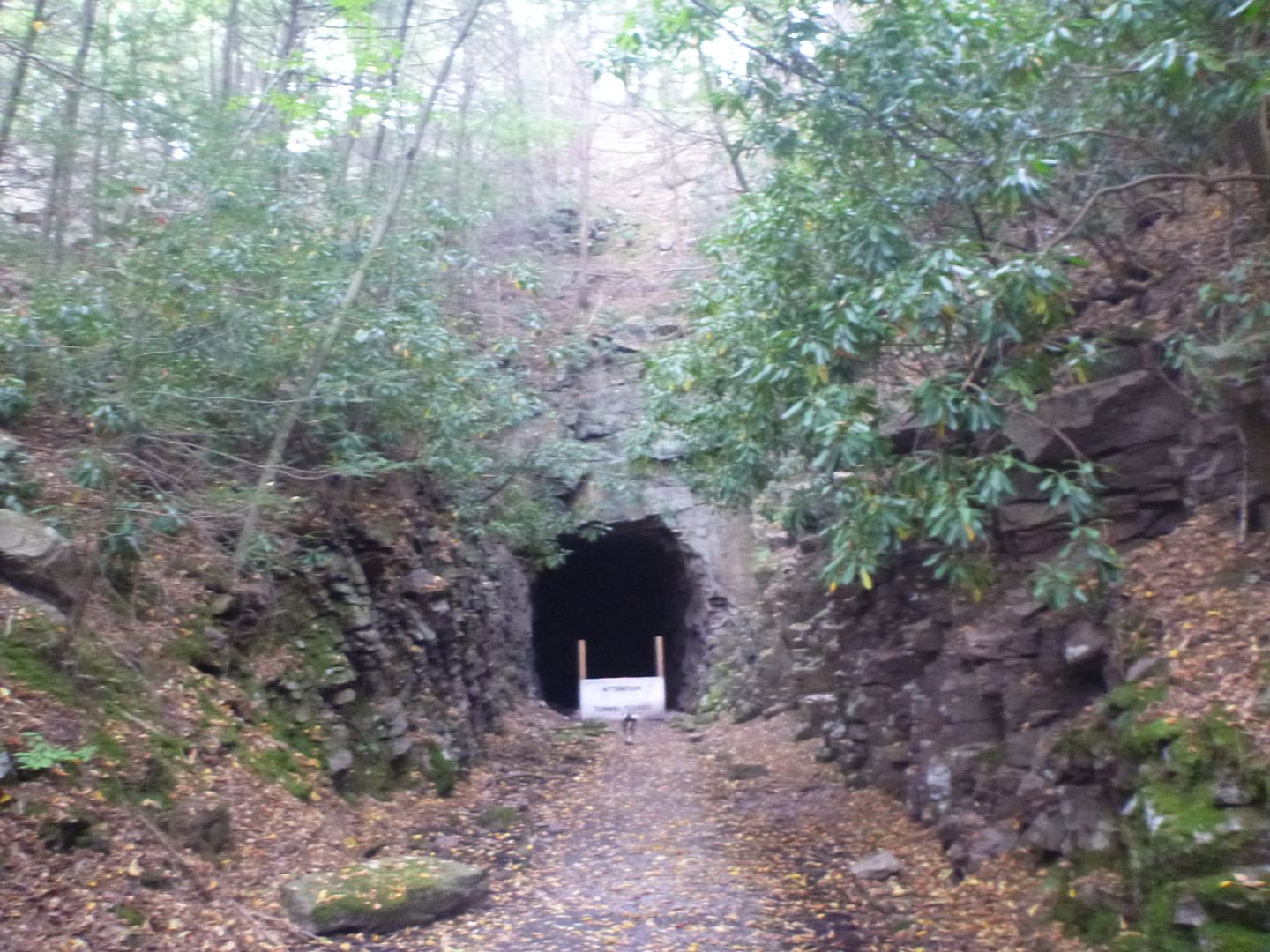
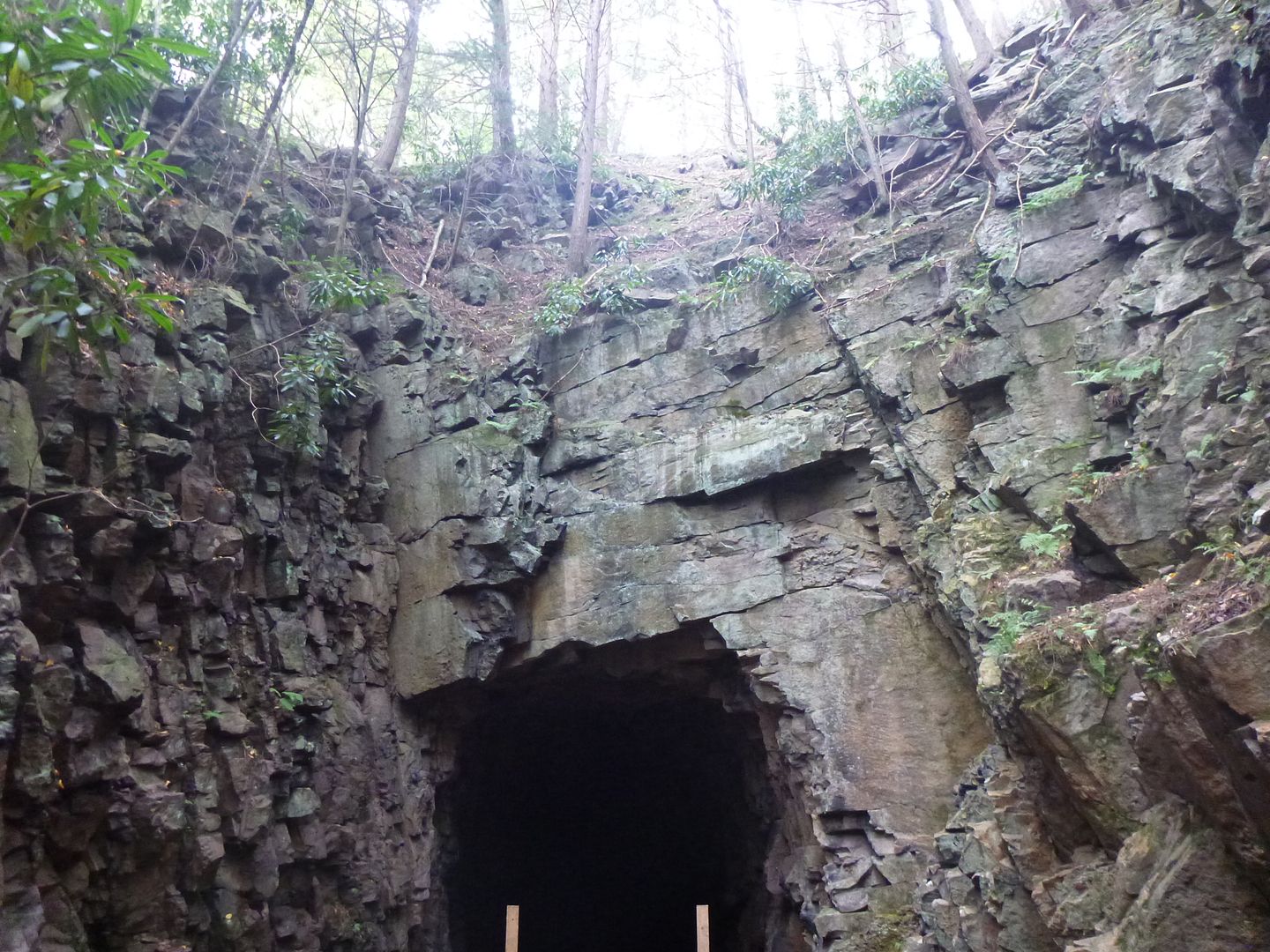
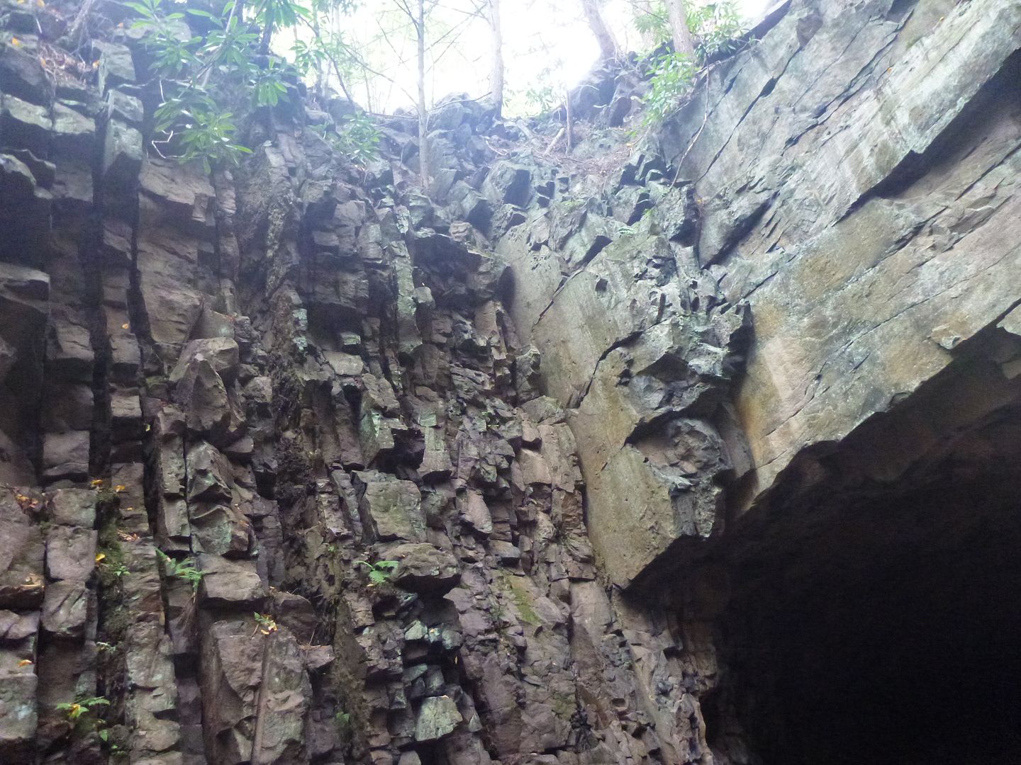
It was starting to get late into the afternoon, so we decided to head to Poe Valley State Park, we had seen it on the map, and that it was surrounding a little lake and offered camping, perfect. On the way there we stopped to look at an old abandoned railroad tunnel that had been cut through the rock. You can longer pass through it (so says the sign) because of falling rock.
We stopped to check it out a bit (didn't go through, forgot flashlights in the truck.
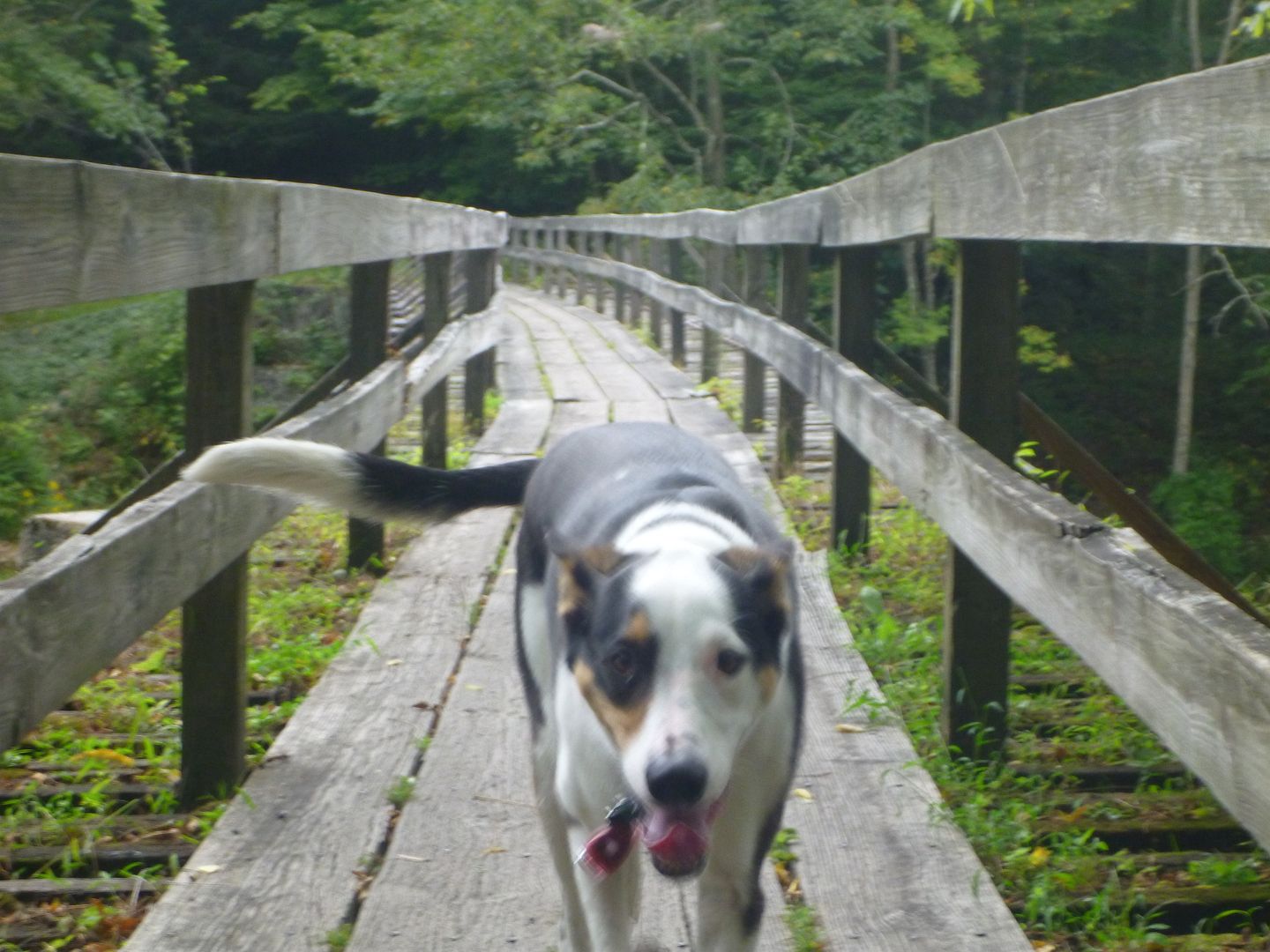
View from the old railroad bridge
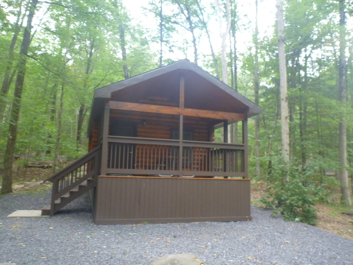
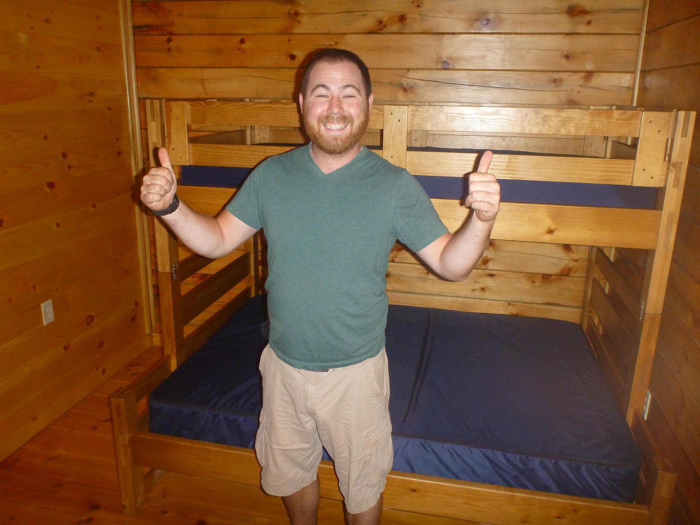
We got to Poe Valley expecting to camp, we had planned on camping the whole week, and had done so thus far on the trip. But it turns out they have some cabins for rent here, and it wasn't much more than a camping spot so we decided to get a cabin. Buddy hadn't been eating well so we figured this would give him a chance to feel more comfortable in a spot and eat, and it did work.
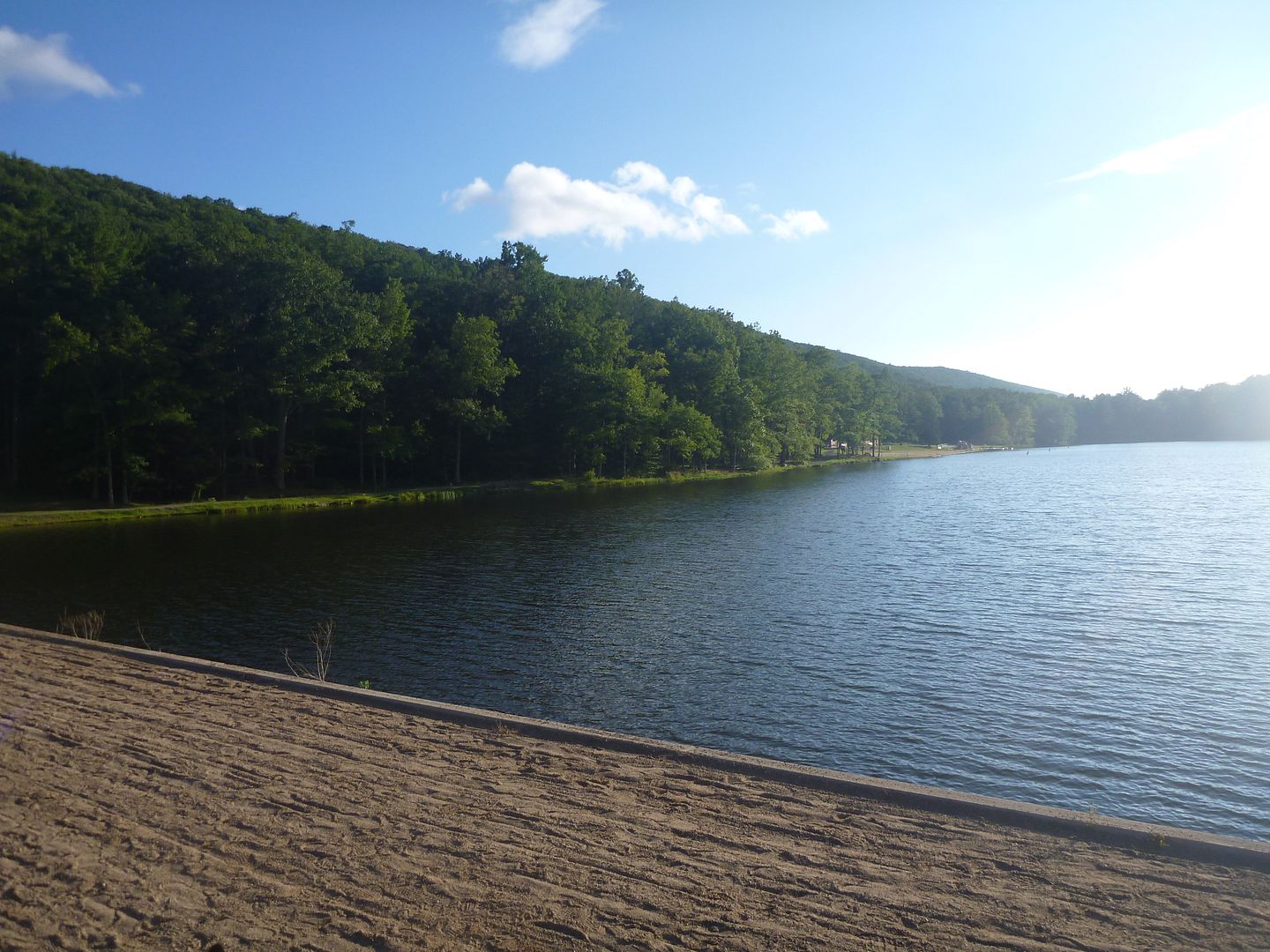
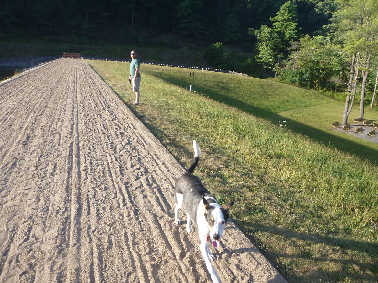
This place was gorgeous; there was no one around when we pulled up except a park ranger chasing geese away on the reservoir with a boat. He helped us get checked in and find the right cabin. It was so nice here we stayed for 2 nights and if it wasn't all booked up on the Thursday we would have stayed another. There is a beautiful beach and very clean washroom facilities (photos to follow, of the beach, not the washrooms). I would highly recommend staying here, especially after labour day as the rates drop. It seems like a very family friendly setting, especially if they don't want to spend the same amount of time exploring that you do, they could hang out by the beach all day.
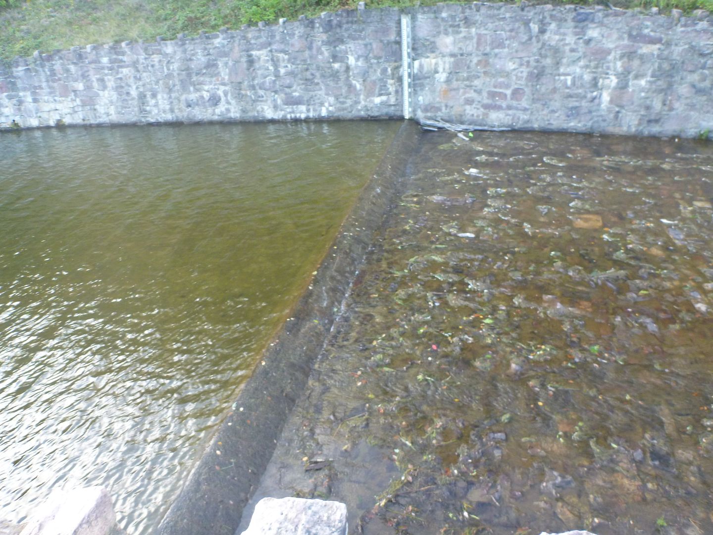
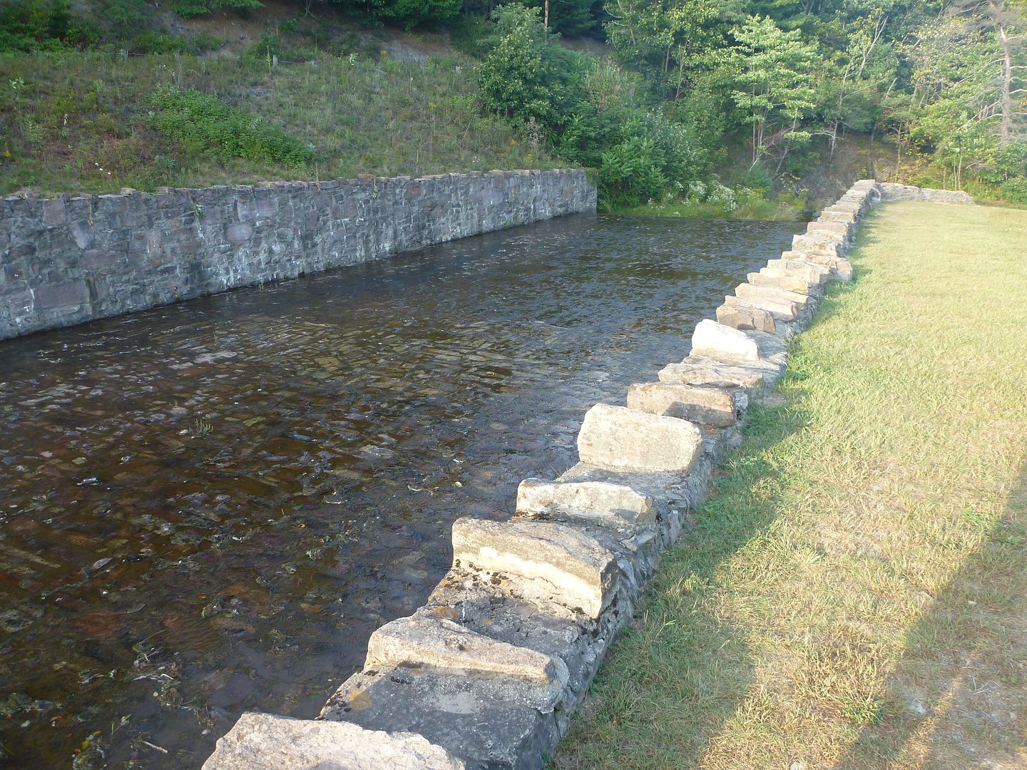
Here are a couple pictures of the weir that was setup by the Civilian Conservation Corps (CCC) in the 30s. This is how the water flows out of the reservoir and down the creek. This place was shut down for 3 years while they redid the dam that was originally built in the 1930s by the CCC
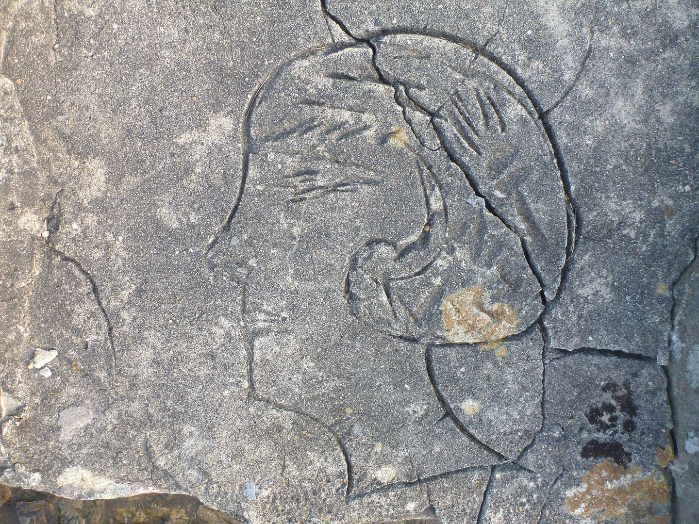
Cool picture that someone carved into the mortar while it was setting
Water draining out

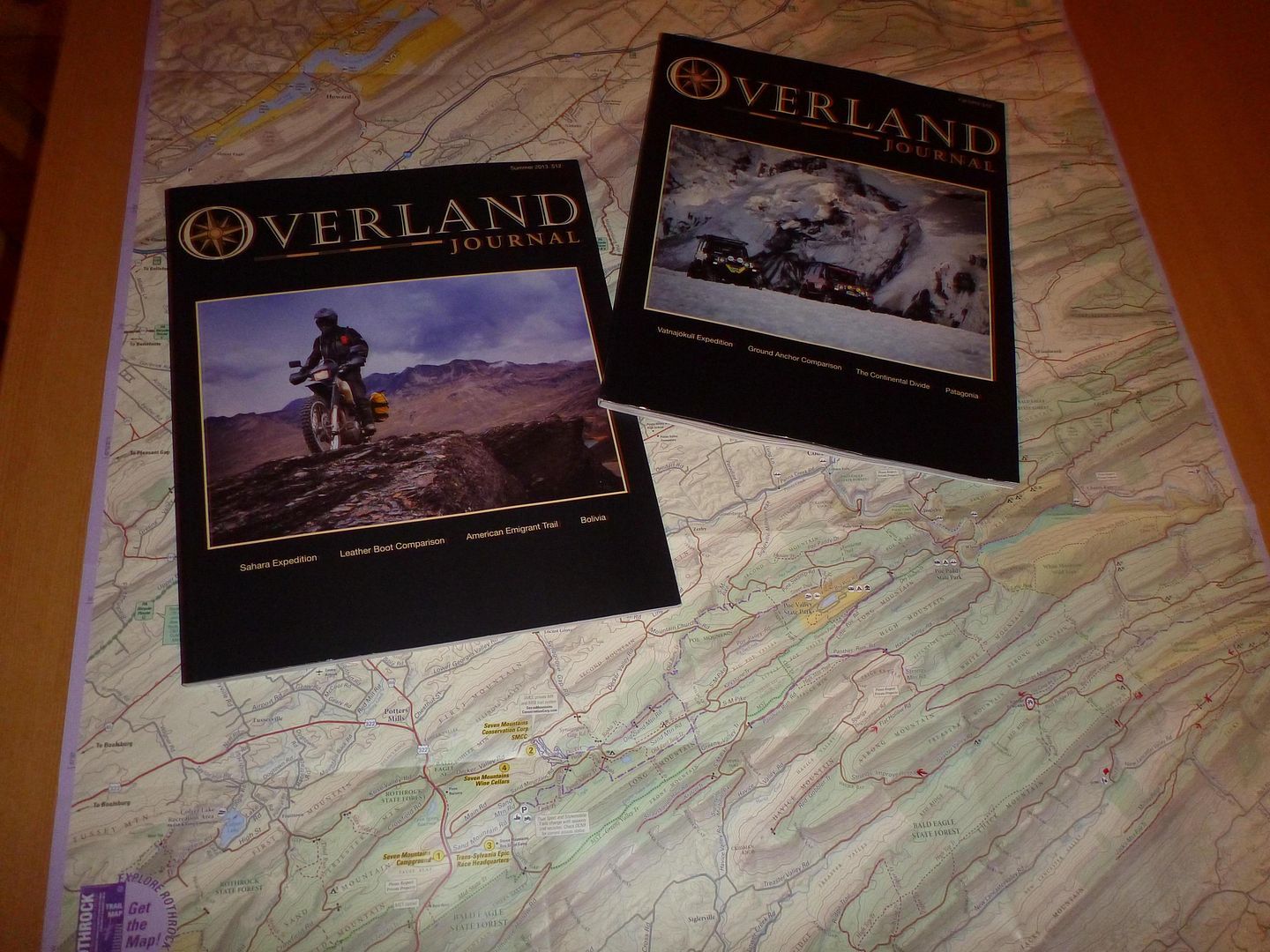
My brother and I share a subscription to Overland Journal, so we usually save them up for trips like these. Neither of us had read the spring or summer issues for this year so it provided some nice reading at night. It was nice having the light inside the cabin for reading and planning out the following days activities.
We were pretty tired from a long day of driving. It took us nearly six hours to get into Poe Valley State Park, which is definitely the long way ‘round!
Stay tuned for more!

We then took Flat Hollow Road, which was listed as a driveable trail, but was significantly easier going than knob ridge road.


Little bit of flex

It was starting to get late into the afternoon, so we decided to head to Poe Valley State Park, we had seen it on the map, and that it was surrounding a little lake and offered camping, perfect. On the way there we stopped to look at an old abandoned railroad tunnel that had been cut through the rock. You can longer pass through it (so says the sign) because of falling rock.
We stopped to check it out a bit (didn't go through, forgot flashlights in the truck.


View from the old railroad bridge


We got to Poe Valley expecting to camp, we had planned on camping the whole week, and had done so thus far on the trip. But it turns out they have some cabins for rent here, and it wasn't much more than a camping spot so we decided to get a cabin. Buddy hadn't been eating well so we figured this would give him a chance to feel more comfortable in a spot and eat, and it did work.
This place was gorgeous; there was no one around when we pulled up except a park ranger chasing geese away on the reservoir with a boat. He helped us get checked in and find the right cabin. It was so nice here we stayed for 2 nights and if it wasn't all booked up on the Thursday we would have stayed another. There is a beautiful beach and very clean washroom facilities (photos to follow, of the beach, not the washrooms). I would highly recommend staying here, especially after labour day as the rates drop. It seems like a very family friendly setting, especially if they don't want to spend the same amount of time exploring that you do, they could hang out by the beach all day.


Here are a couple pictures of the weir that was setup by the Civilian Conservation Corps (CCC) in the 30s. This is how the water flows out of the reservoir and down the creek. This place was shut down for 3 years while they redid the dam that was originally built in the 1930s by the CCC


Cool picture that someone carved into the mortar while it was setting

Water draining out

My brother and I share a subscription to Overland Journal, so we usually save them up for trips like these. Neither of us had read the spring or summer issues for this year so it provided some nice reading at night. It was nice having the light inside the cabin for reading and planning out the following days activities.

We were pretty tired from a long day of driving. It took us nearly six hours to get into Poe Valley State Park, which is definitely the long way ‘round!
Stay tuned for more!
Last edited:
zimm
Expedition Leader
You guys started your trip in our extended backyard. The ANF has become the "Land of the Gated Roads" over the last few years but if your willling to get out of your ride and lace up some hiking boots you can immerse yourself in some great scenery. There are also some damn fine trout streams winding through those hollers.
i recall driving through there a lot 15 years ago. when i started bear hunting again, i noticed it went from all roads upen unless marked closed, to all roads closed unless marked open. i understand the youths on the ridgeway side were just trashing the joint.
i did get lucky last year though, and they must have had the frack guys surveying the place during last years hunt. lotsa gates open. i wasnt sure if i permitted though, and was worried if i went deep id awake to being on the wrong side of a locked gate.
they dont have the cross country ski houses stocked with wood anymore either, i noticed. i was told the locals were stealing that too.
thank you for sharing this fun adventure!
Thanks for taking the time to read it!
mortonm
Expedition Leader
WEDNESDAY
We got up and lightened the load in the Xterra a little. We knew that we would be staying at the cabin again that night, so we removed all of the camp gear (tents, sleeping bags, camp kitchen etc). One of the main attractions of the cabin was that we were going to be stationary for two nights, and we could avoid an hour of work at night setting up and an hour of working in the morning packing up. We were really excited to get going this morning as we had seen some great looking Vistas on the map.
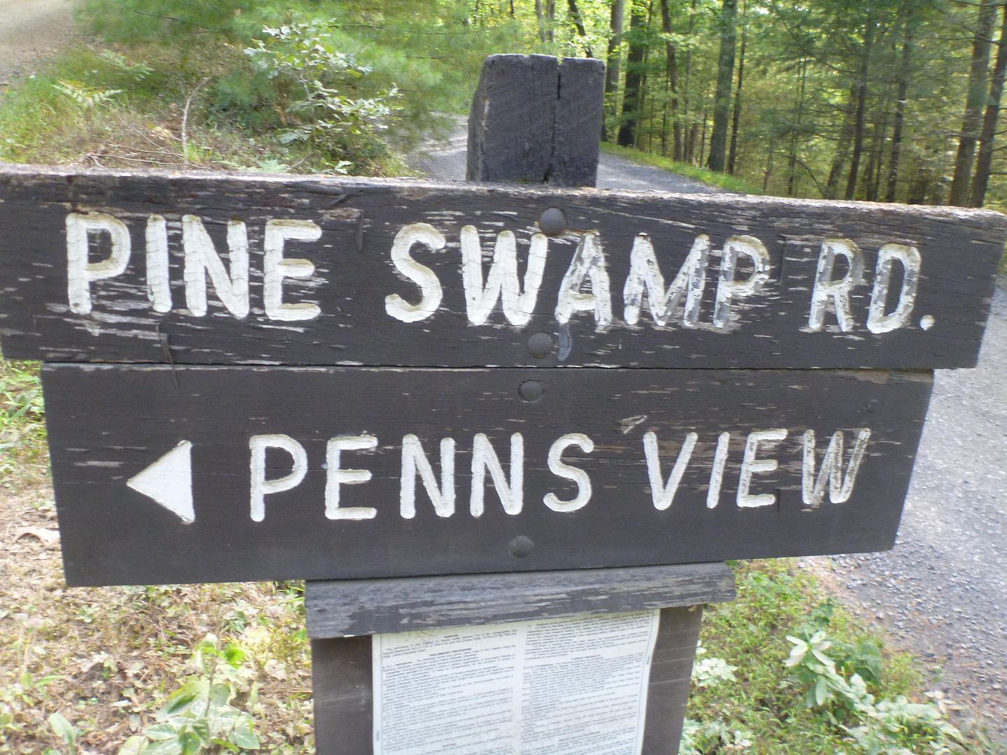
We headed out early, well it was 830 or so, but hey we are on vacation! We headed out of Poe Valley State Park north onto Pine Swamp Road. Pine Swamp Road is marked as having “Penn's View” which indeed was very nice.
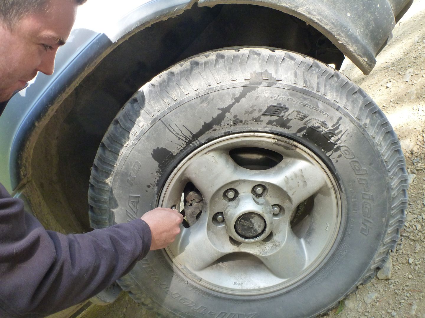
At the pull-off for Pine Swamp Road we stopped to air the tires down a little more, as we were heading to some of the more difficult trails today. As you can see a Coyote took a leak on my tire in the morning, it stunk, and my brother thought it was funny to get a picture of my misery.
There was a quick clearing of the trees which offered a nice view (not Penn's view)
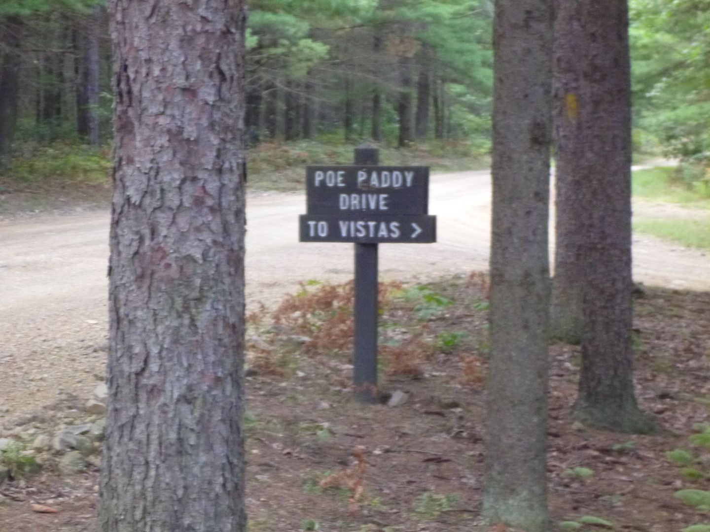
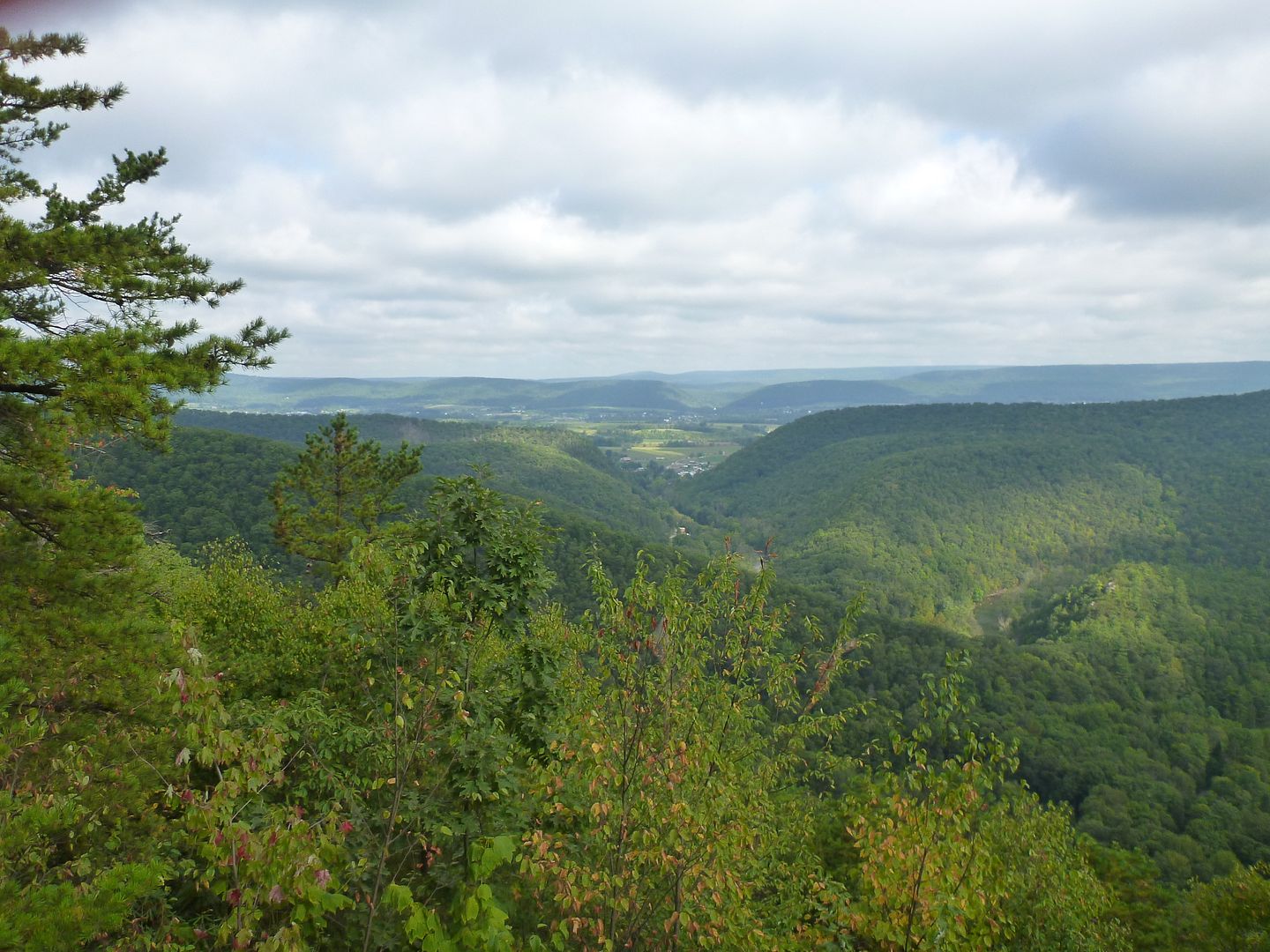
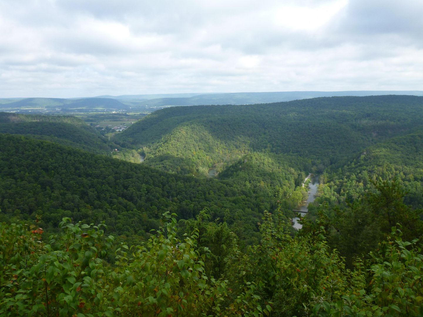
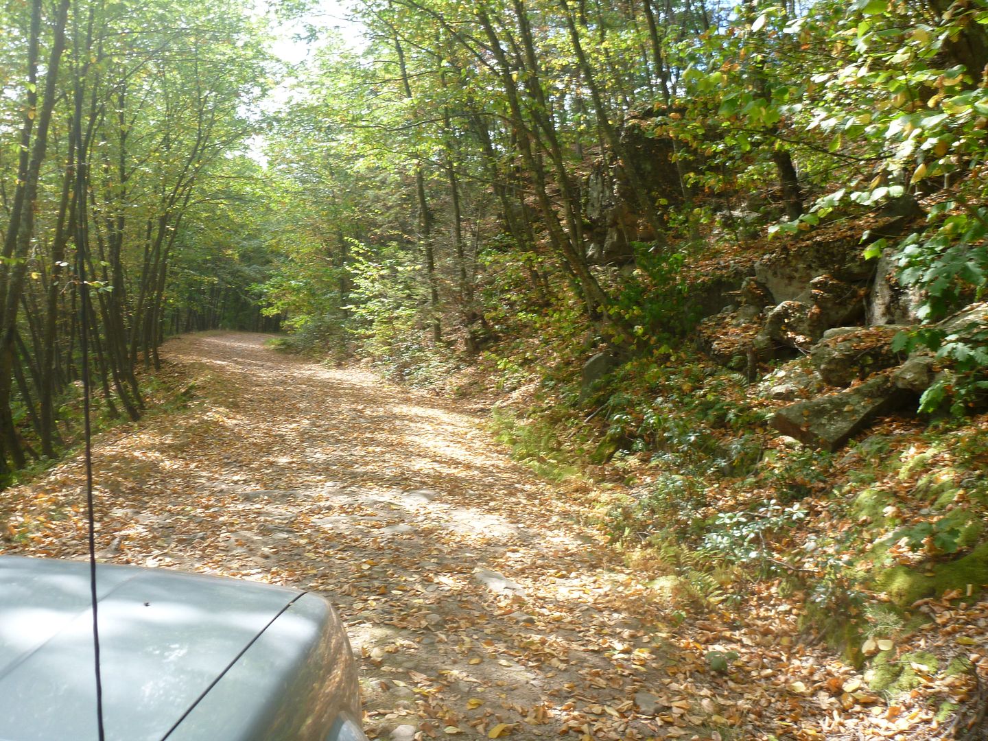
Not long after being on Pine Swamp road, which is just a dirt road we turned onto Poe Paddy Drive. We didn't know it at the time, but this would end up being our favorite driveable trail of the trip. It wasn't the longest, it wasn't the toughest, but it had an awesome combination of some technical driving and the best views we enjoyed the whole trip. We ended up driving the scenic section twice, it was that good. If anyone is going to make the trip, mark this down on your maps.
Penns View! It's the only marked one on this road but I don't think it is the best, you can be the judge. Looks like the rock cracked after the name was put on there…
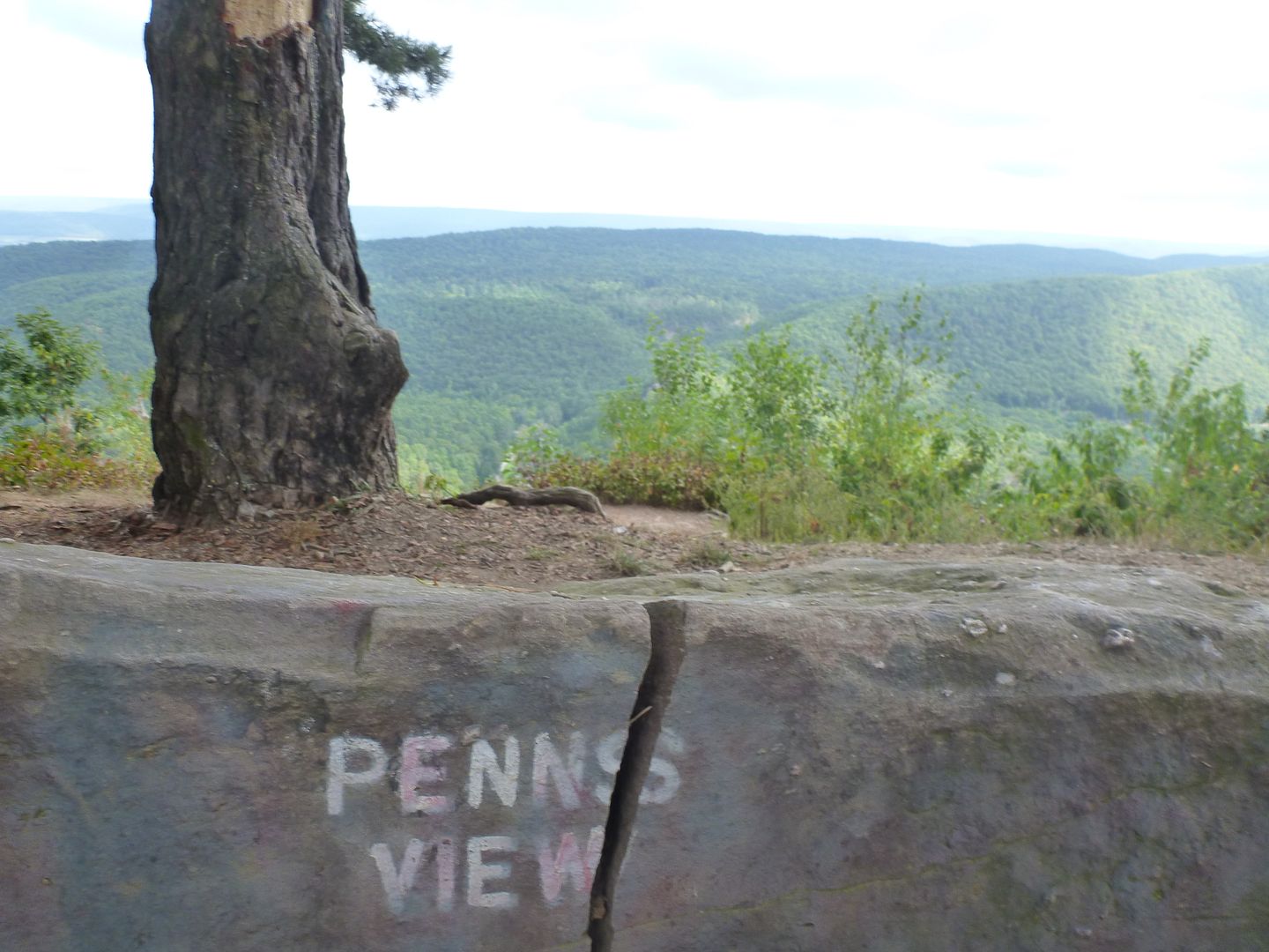
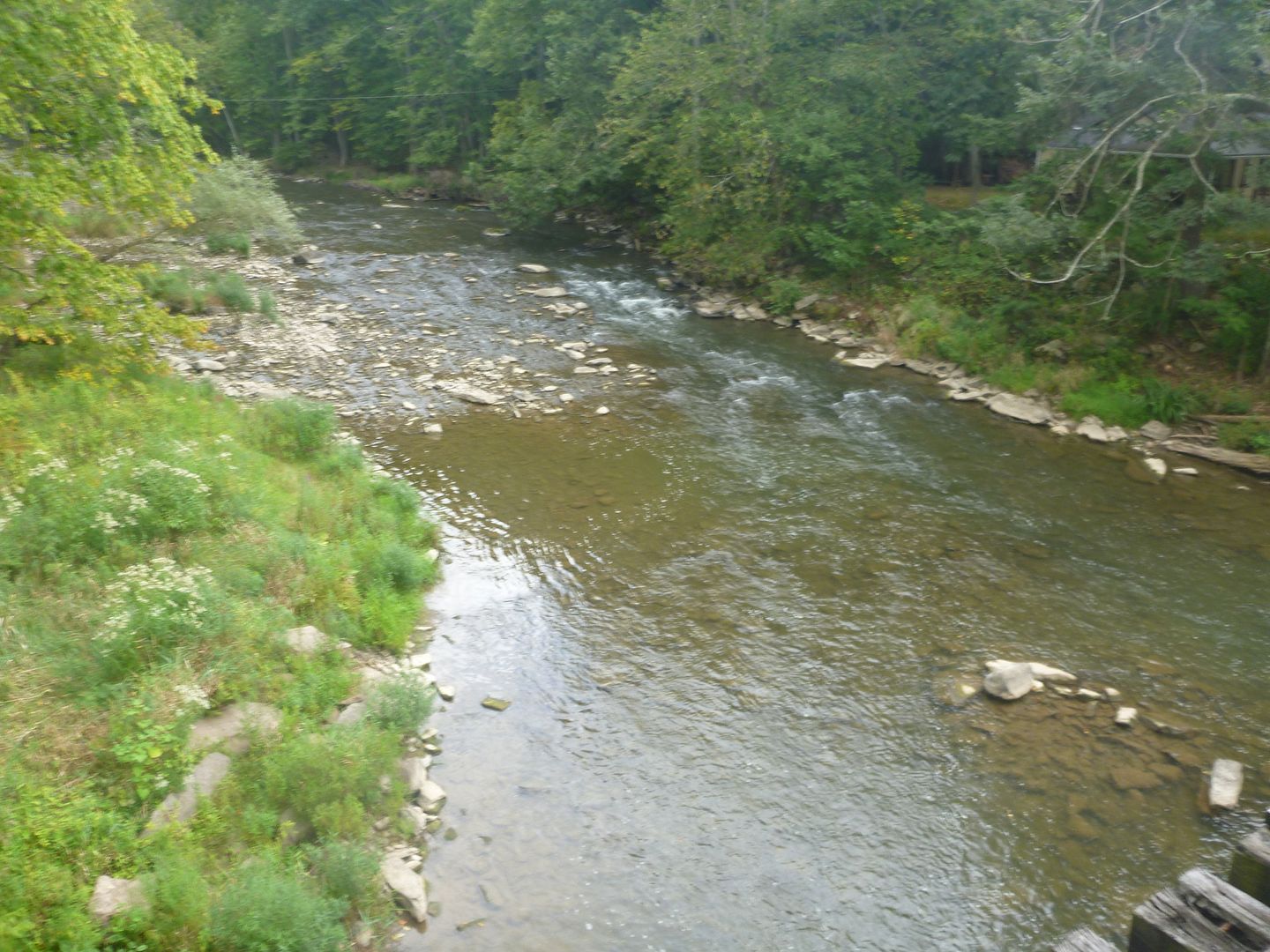
Remember that old railroad bridge we walked across earlier? Well that's not it in this picture haha, but if you follow it to the East (right in this picture) you will get to that tunnel ! The creek you see is Penn's Creek, which ends up being the name of a very good beer I had in Milheim, Penn's Creek Pilsner, but more on that later.
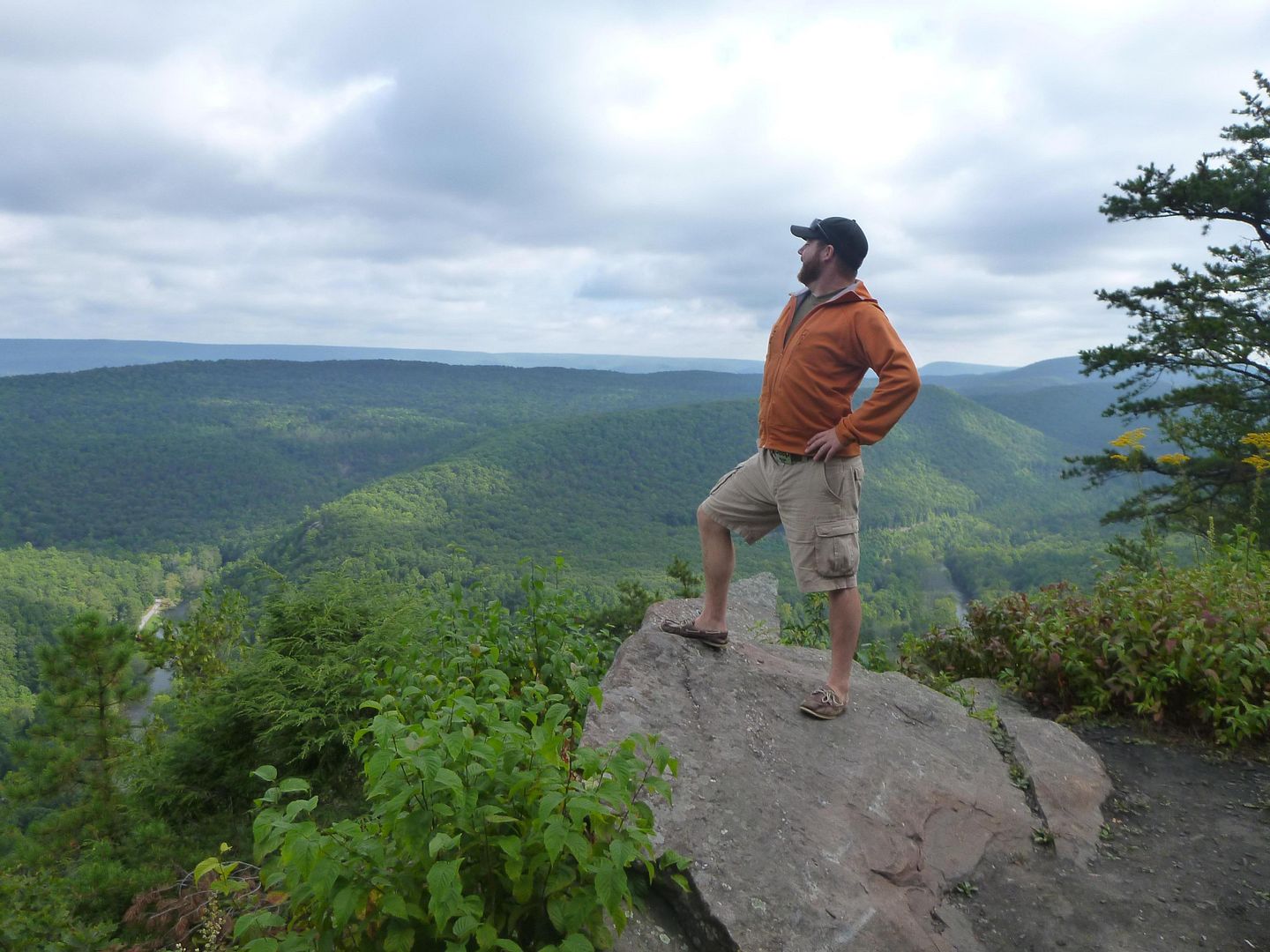
Two Intrepid Explores ! ?
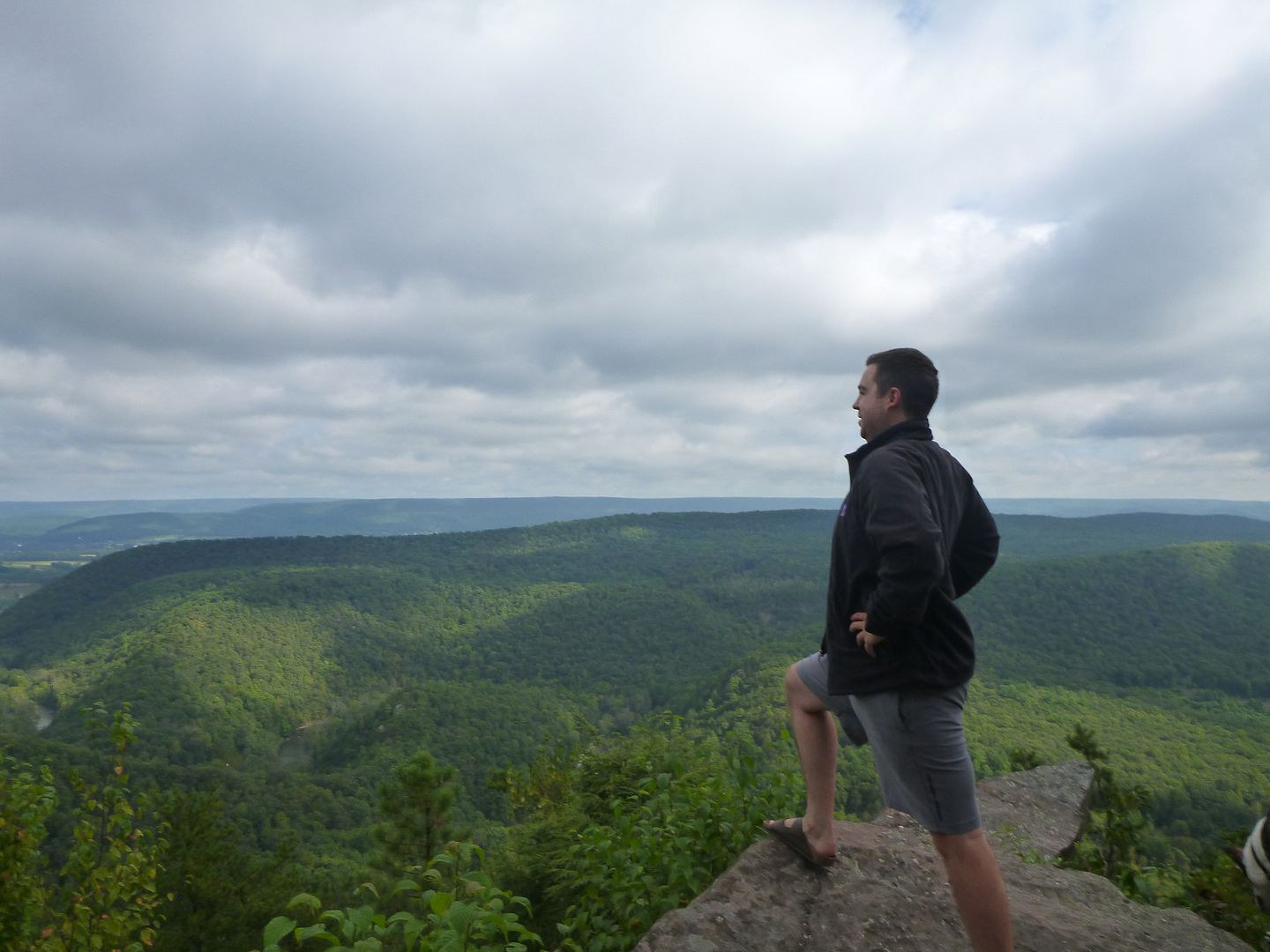
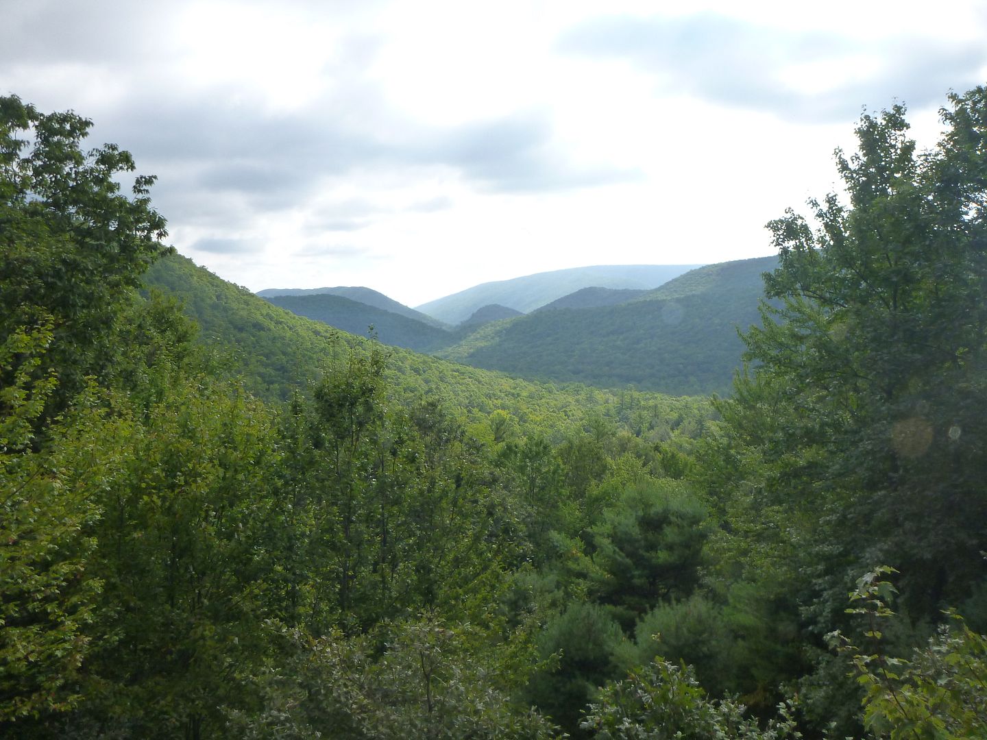
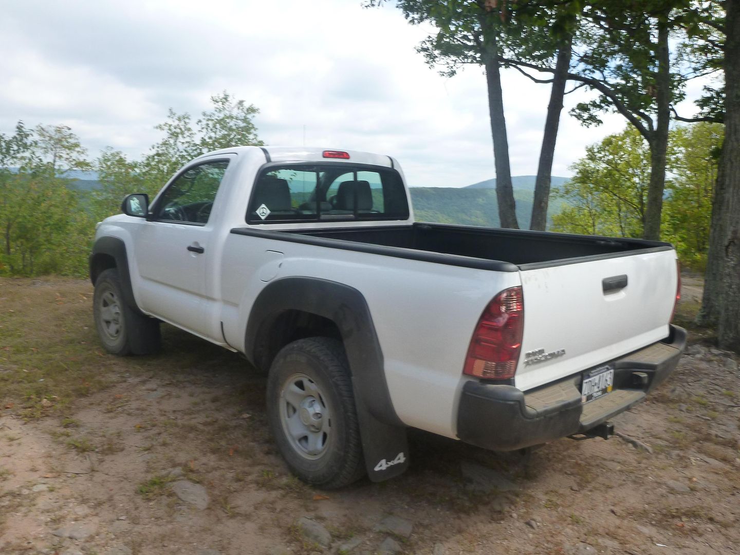
The next lookout East from Penn's View was the nicest we saw all week. There was a really nice pull off area. This day we didn't get any pictures of it, but when we came back we got a lot of really good ones. There was a guy and his dog hanging out there when we pulled up. We actually talked to him for about 30 minutes or so about his truck. Brand new 2013 Tacoma, 4cylinder, 5 speed, manual locks and windows, regular cab short bed 4WD. All of that wrapped in plastic fender flares and in expo white! This is a combo you cannot get in Canada (reg cab short bed) We thought it was awesome, so utilitarian and perfect for bombing around the park.
The rest of the road had a few nice views (not as nice as the first two) and a couple of switchbacks
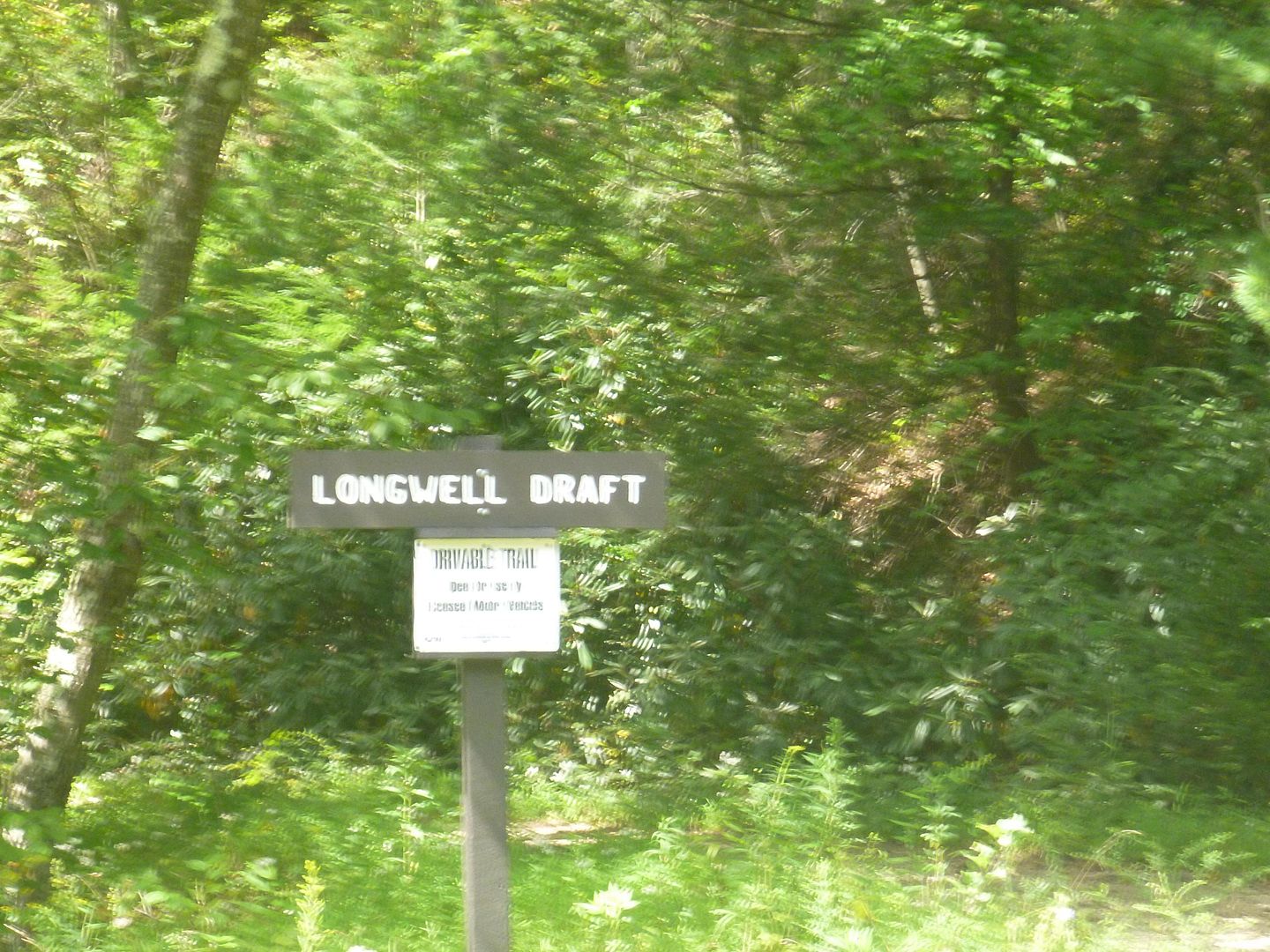
After finishing up Poe Paddy Drive, we took Havice Valley Road to Strongs Mountain Road. This is a 4WD driveable trail, but it is quite short and uneventful, but it is fairly rugged and a nice decent. From there we turned onto Longwell Draft Road, its fairly long and took about an hour in 4lo but not particularly difficult or notable, so no good pictures
After this we stopped for a quick lunch and to plan the rest of the afternoon. We (my brother) left the map on the hood of the truck and we (me) drove off with it still there. We realized after a couple miles and drove back to find it where we left it
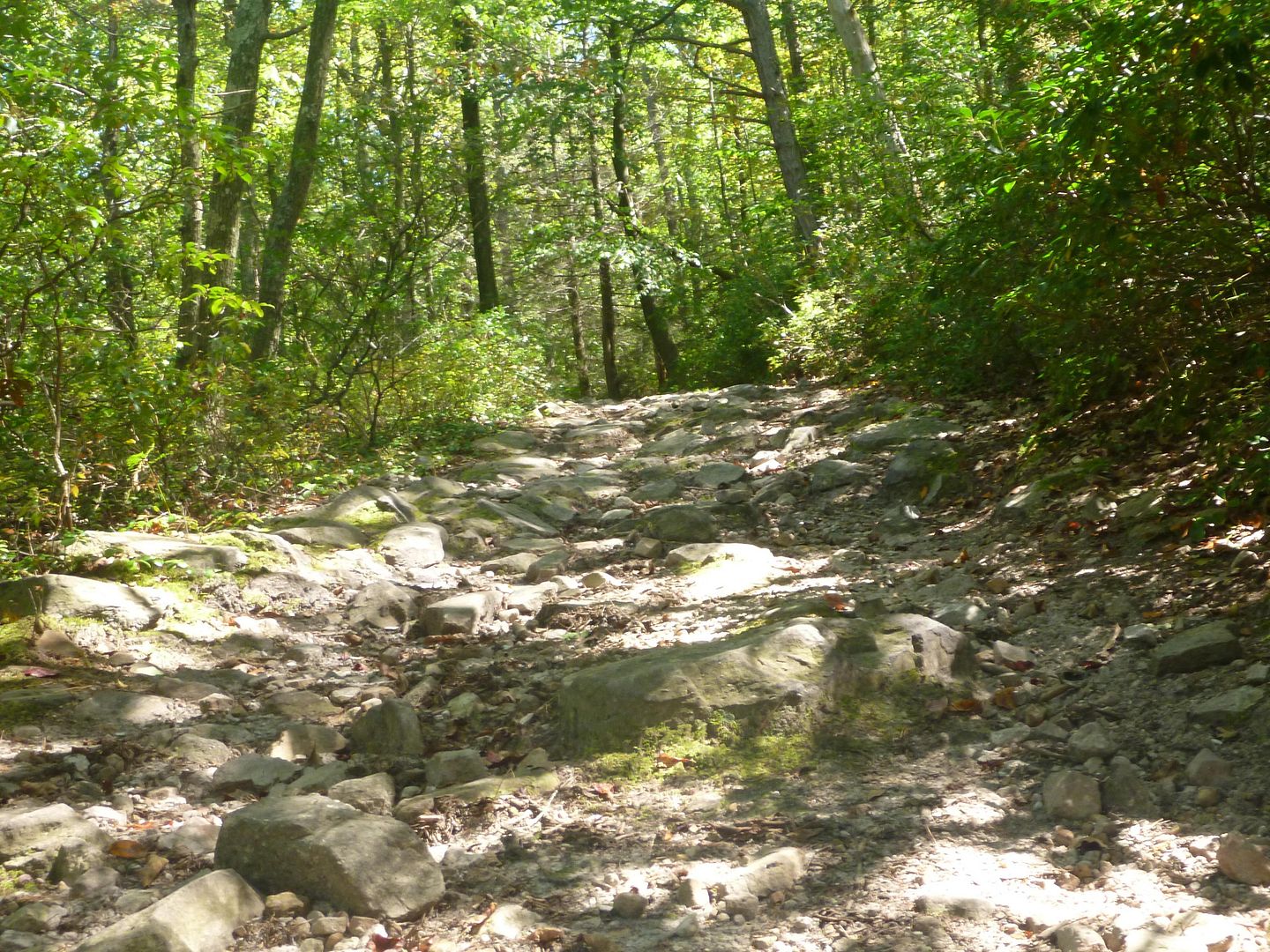
We then proceeded to Henstep Valley trail, this was probably one of the most difficult trails we did all week. It was also a little more overgrown than most, but not terrible. But there were still sections where you would be brushing trees and bushes with the truck.
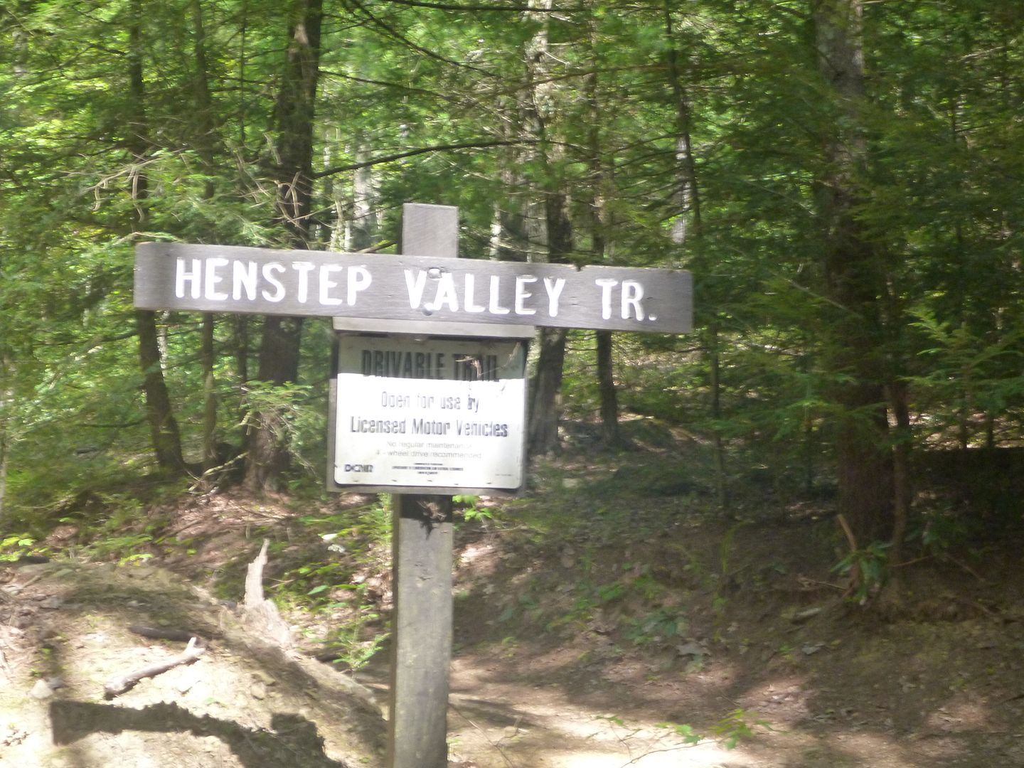
A lot, and I mean A LOT of rocks on this trail. It took us over 90 minutes and it was mostly rocks. They weren't particularly big or any thing difficult, but big enough that it was 4lo and first gear the whole time.
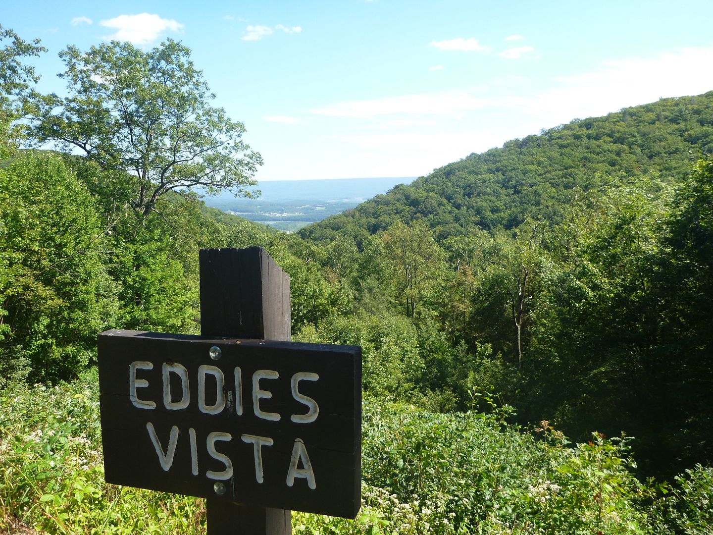
It was pretty tight so we didn't get a lot of pictures, but if you are going, this is worth a hit as one of the longer and more technical trails in the park. After finishing up henstep valley trail we turned south onto Hunter Rd. We came across Eddies Vista, not sure who Eddie was but he had a nice view.
We came down Brienniger Gap Road to Swift Run road to check out a “purple lizard” on the map. Purple Lizard maps have these markings all over them to denote a great view or something else significant. This one turned out to be a spring out of the rocks at ….you guessed it…Rock Springs Picnic area…not exactly an inventive name but aptly describes it.
We got up and lightened the load in the Xterra a little. We knew that we would be staying at the cabin again that night, so we removed all of the camp gear (tents, sleeping bags, camp kitchen etc). One of the main attractions of the cabin was that we were going to be stationary for two nights, and we could avoid an hour of work at night setting up and an hour of working in the morning packing up. We were really excited to get going this morning as we had seen some great looking Vistas on the map.
We headed out early, well it was 830 or so, but hey we are on vacation! We headed out of Poe Valley State Park north onto Pine Swamp Road. Pine Swamp Road is marked as having “Penn's View” which indeed was very nice.

At the pull-off for Pine Swamp Road we stopped to air the tires down a little more, as we were heading to some of the more difficult trails today. As you can see a Coyote took a leak on my tire in the morning, it stunk, and my brother thought it was funny to get a picture of my misery.

There was a quick clearing of the trees which offered a nice view (not Penn's view)

Not long after being on Pine Swamp road, which is just a dirt road we turned onto Poe Paddy Drive. We didn't know it at the time, but this would end up being our favorite driveable trail of the trip. It wasn't the longest, it wasn't the toughest, but it had an awesome combination of some technical driving and the best views we enjoyed the whole trip. We ended up driving the scenic section twice, it was that good. If anyone is going to make the trip, mark this down on your maps.

Penns View! It's the only marked one on this road but I don't think it is the best, you can be the judge. Looks like the rock cracked after the name was put on there…


Remember that old railroad bridge we walked across earlier? Well that's not it in this picture haha, but if you follow it to the East (right in this picture) you will get to that tunnel ! The creek you see is Penn's Creek, which ends up being the name of a very good beer I had in Milheim, Penn's Creek Pilsner, but more on that later.

Two Intrepid Explores ! ?


The next lookout East from Penn's View was the nicest we saw all week. There was a really nice pull off area. This day we didn't get any pictures of it, but when we came back we got a lot of really good ones. There was a guy and his dog hanging out there when we pulled up. We actually talked to him for about 30 minutes or so about his truck. Brand new 2013 Tacoma, 4cylinder, 5 speed, manual locks and windows, regular cab short bed 4WD. All of that wrapped in plastic fender flares and in expo white! This is a combo you cannot get in Canada (reg cab short bed) We thought it was awesome, so utilitarian and perfect for bombing around the park.

The rest of the road had a few nice views (not as nice as the first two) and a couple of switchbacks


After finishing up Poe Paddy Drive, we took Havice Valley Road to Strongs Mountain Road. This is a 4WD driveable trail, but it is quite short and uneventful, but it is fairly rugged and a nice decent. From there we turned onto Longwell Draft Road, its fairly long and took about an hour in 4lo but not particularly difficult or notable, so no good pictures

After this we stopped for a quick lunch and to plan the rest of the afternoon. We (my brother) left the map on the hood of the truck and we (me) drove off with it still there. We realized after a couple miles and drove back to find it where we left it

We then proceeded to Henstep Valley trail, this was probably one of the most difficult trails we did all week. It was also a little more overgrown than most, but not terrible. But there were still sections where you would be brushing trees and bushes with the truck.

A lot, and I mean A LOT of rocks on this trail. It took us over 90 minutes and it was mostly rocks. They weren't particularly big or any thing difficult, but big enough that it was 4lo and first gear the whole time.

It was pretty tight so we didn't get a lot of pictures, but if you are going, this is worth a hit as one of the longer and more technical trails in the park. After finishing up henstep valley trail we turned south onto Hunter Rd. We came across Eddies Vista, not sure who Eddie was but he had a nice view.

We came down Brienniger Gap Road to Swift Run road to check out a “purple lizard” on the map. Purple Lizard maps have these markings all over them to denote a great view or something else significant. This one turned out to be a spring out of the rocks at ….you guessed it…Rock Springs Picnic area…not exactly an inventive name but aptly describes it.

Last edited:
mortonm
Expedition Leader
It was growing late in the afternoon and we needed groceries. So we headed out of the bush and made a b-line for Millheim, which still took us a good 45 minutes to get to. You cant go anywhere fast here, have to go up and over or between the mountains.
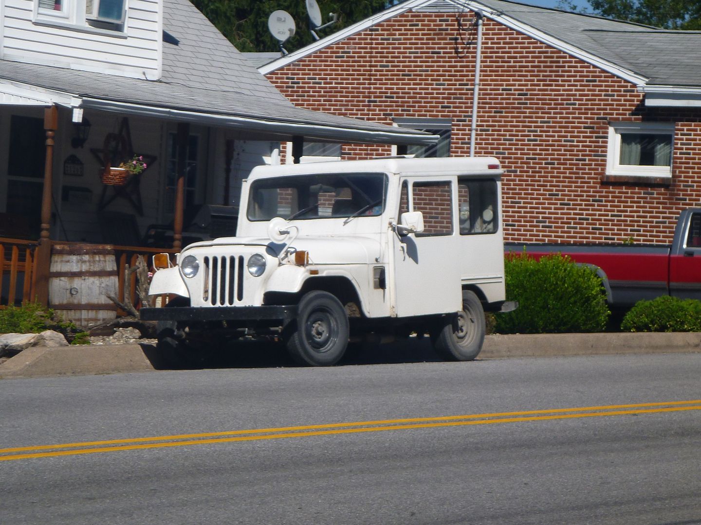
We found this Postal Jeep in Woodward, PA
We had see on the map that Milheim had a place called “Elk Creek Café and Aleworks”. Sounded pretty awesome and we hadn’t eaten out all week. So after we got our groceries at a little country grocer just out the west side of town we headed back for some dinner.
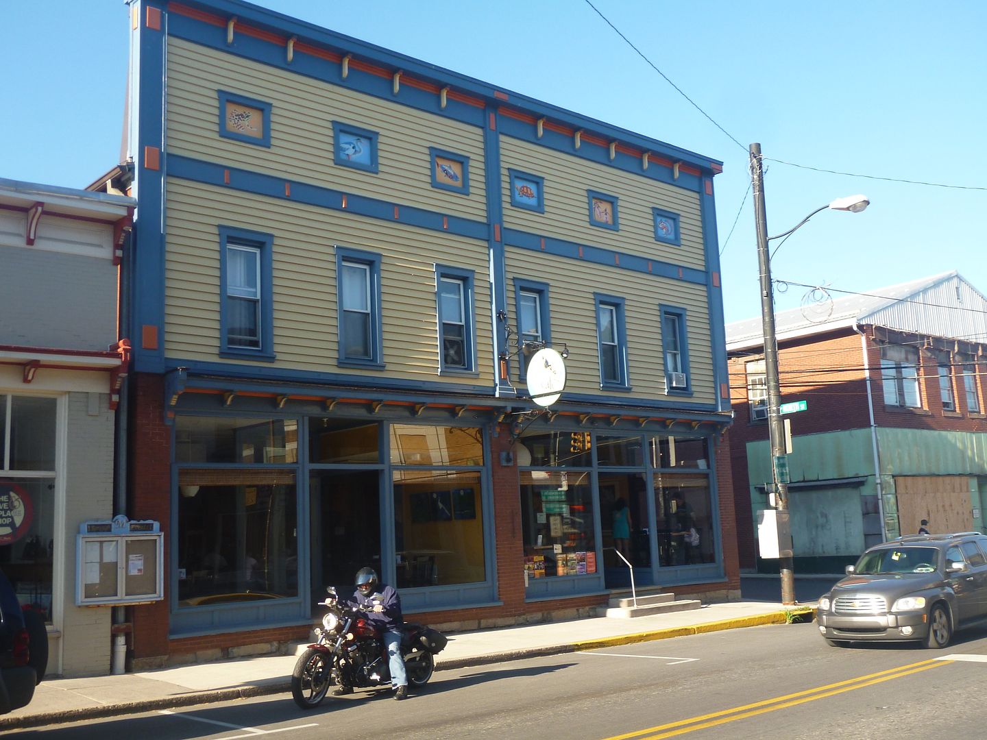
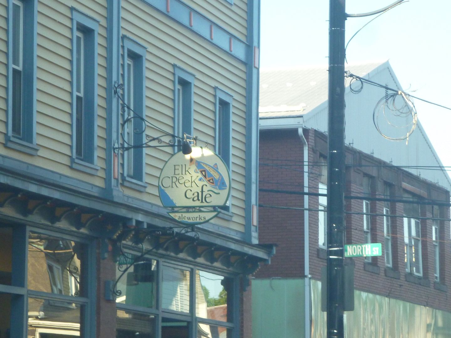
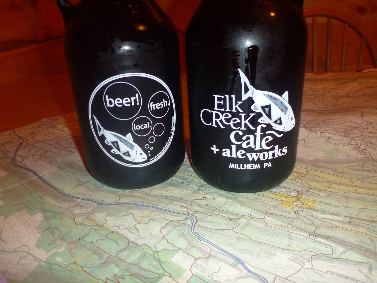
What a great little place! They brew their own beer. They have 6 Ale’s that are always on tap and a couple of specials. My brother tried the Double Rainbow IPA and I tried the Elk Creek Copper Ale, both VERY good. After, we both tried the specials, my brother the Milheim Fine Ale, and I had the Penn’s Creek Pilsner. This was my favorite of the bunch, but I am a lager/pilsner guy. We ended up each getting a growler of the pilsner to go. It’s actually in my fridge at home right now, awaiting my attention this Saturday.
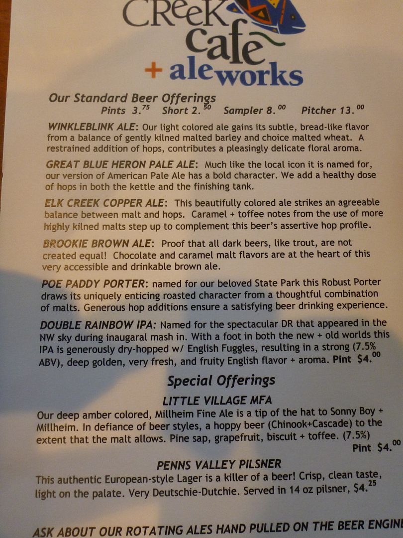
Great Prices!
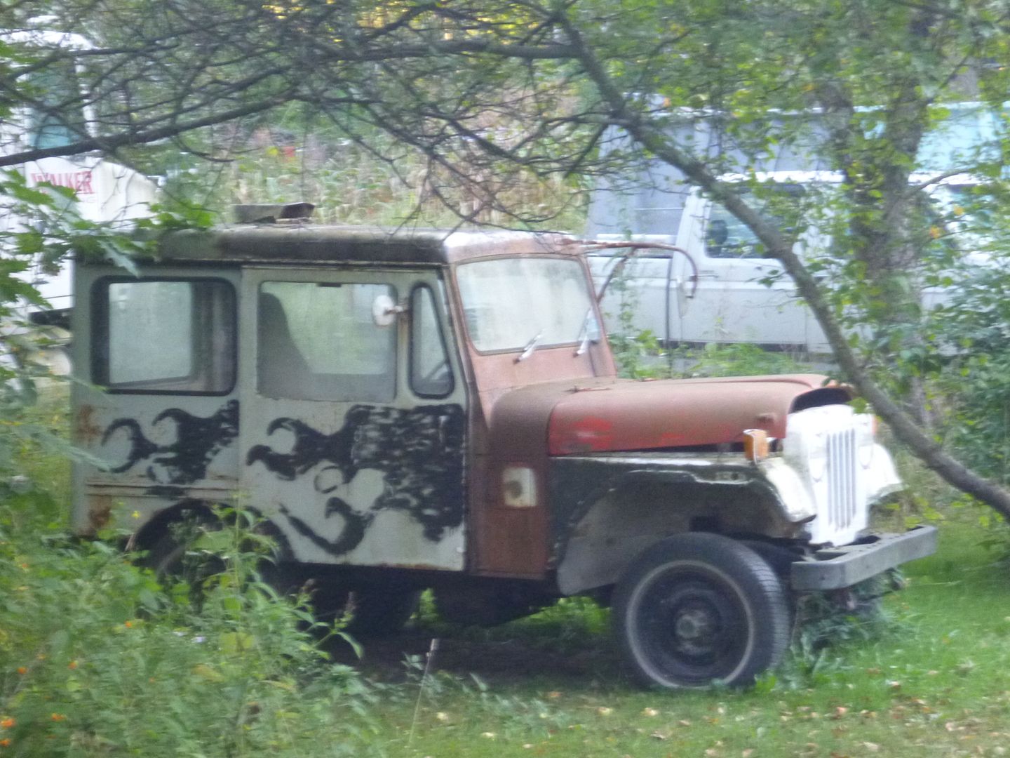
You cant miss the place, its right on the main drag through town (HWY 45). On the way back to Poe Valley State park we spotted another Postal Jeep, albeit in somewhat rougher condition
It took a lot of restraint not to bust open those growlers….
That was the end of Wednesday. We hit the bed early as we would have to pack up and move on out in the morning will all of our stuff. We were going to hit Negro Hollow Road in the morning, which was one of the more notable trails that we had read up on before embarking on this adventure. It was probably our second favorite trail, and certainly the wettest…..
We found this Postal Jeep in Woodward, PA

We had see on the map that Milheim had a place called “Elk Creek Café and Aleworks”. Sounded pretty awesome and we hadn’t eaten out all week. So after we got our groceries at a little country grocer just out the west side of town we headed back for some dinner.


What a great little place! They brew their own beer. They have 6 Ale’s that are always on tap and a couple of specials. My brother tried the Double Rainbow IPA and I tried the Elk Creek Copper Ale, both VERY good. After, we both tried the specials, my brother the Milheim Fine Ale, and I had the Penn’s Creek Pilsner. This was my favorite of the bunch, but I am a lager/pilsner guy. We ended up each getting a growler of the pilsner to go. It’s actually in my fridge at home right now, awaiting my attention this Saturday.
Great Prices!

You cant miss the place, its right on the main drag through town (HWY 45). On the way back to Poe Valley State park we spotted another Postal Jeep, albeit in somewhat rougher condition

It took a lot of restraint not to bust open those growlers….

That was the end of Wednesday. We hit the bed early as we would have to pack up and move on out in the morning will all of our stuff. We were going to hit Negro Hollow Road in the morning, which was one of the more notable trails that we had read up on before embarking on this adventure. It was probably our second favorite trail, and certainly the wettest…..
Last edited:
mortonm
Expedition Leader
Thank you for your interest!
Its coming! Hopefully tomorrow. Just ended up being really busy these last few days. Only two days left on the trip...but they have some of the toughest sections and most rewarding experiences.
daveh
Adventurer
Looking forward to the negro hollow installment. We were camping up in BESF this past weekend and checked out a couple of the trails that you listed here on the forum. Negro Hollow appeared almost impassable from the eastern side entrance. A narrow little 2 track that seemed more water than visible road.
Similar threads
- Replies
- 16
- Views
- 2K
- Replies
- 3
- Views
- 748