Canyon DeChelly/UT/AZ March 19-23rd 2008

Moody

Needs to get out more
The 'Official' Writeup:

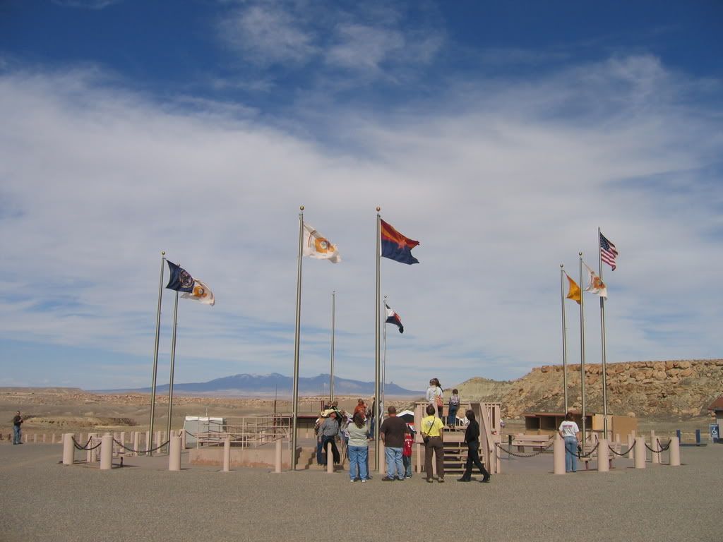
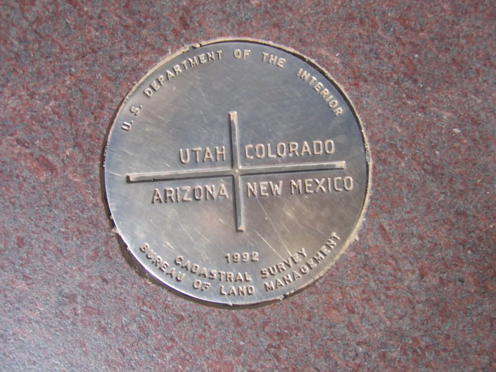
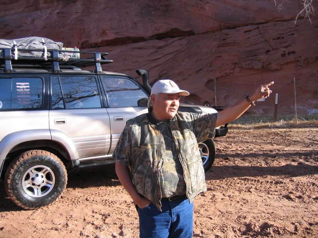
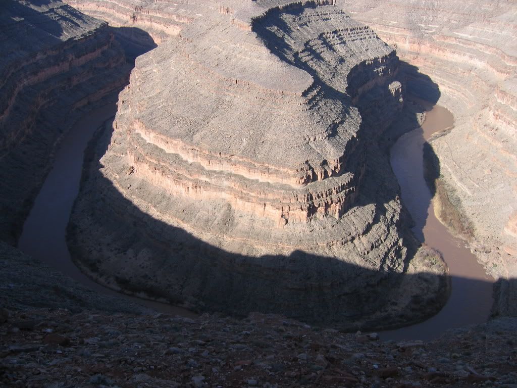
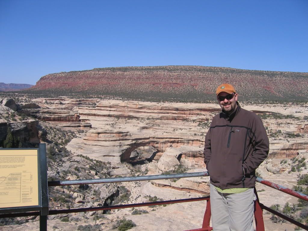
I am rich. I am filthy, filthy, rich actually. Not in the monetary sense, as I don’t really have an abundant supply of greenabcks, but rich in experience. Five days in Utah, Colorado, Arizona, and New Mexico, also known as “The Grand Circle” enables one to reflect on not only the ground underneath your feet, but the space that you call life. Planning for this trip took place over a series of weekends, including casual conversation with Kevin, my brother in law, and my father, John. We kept it loose, open, and uncluttered as to focus more on the experience, rather than being too rigid with our schedule. We even left a majority of the ‘excess’ behind, such as gps, tables, big stoves, and the like. What we did bring was a fond sense of adventure and good old fashioned paper maps.

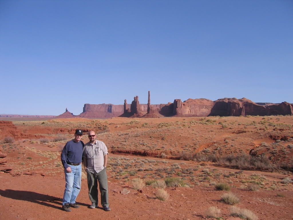
I have grown up in Utah, and I was lucky enough to see much of Utah’s best by the time I was 18. I attribute that to my parents and 3 brothers and the 1985 GMC van, affectionately known as the ‘Moody Mobile.’ My family vacations weren’t to Disneyland, Europe, or Mexico. The Moody family went camping at National Parks. Thank God I am so rich. Thanks to my Dad, who showed me the way. Despite his difficulty with sight, inability to drive, (legally at least) and the prospect of two twenty-somethings in a slow Landcruiser for five days, he came along. We haven’t always gotten along, and we haven’t always seen eye to eye on things, but one thing we both love, and I mean really love, is the natural world. I was very proud to have my pops along and attempt to, in the smallest way possible to ‘give back’ what he gave to me.


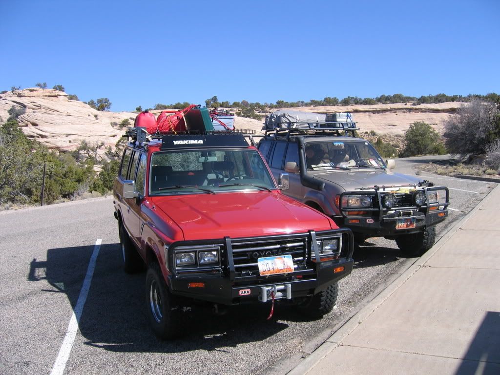
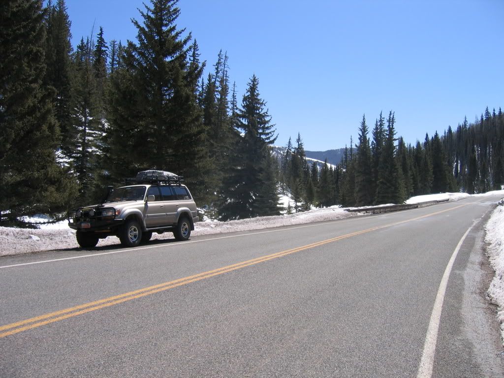
We left Salt Lake the afternoon of the 19th. After a quick gas stop, we were on the road towards Moab. We crossed paths with multiple trucks pulling trailers. On those trailers were modified Jeeps, Internationals, Toyotas, Land Rovers, and the like. I had forgotten that the annual Easter Jeep Safari was taking place the same time. “Good thing we aren’t going there!” I thought to myself. I have been to the EJS before, and found it to be too busy for my liking. We made it to Green River, and had a late dinner at Ray’s…”The Place For Everyone” including groups of 16+ looking for dinner. Good thing we were seated earlier.

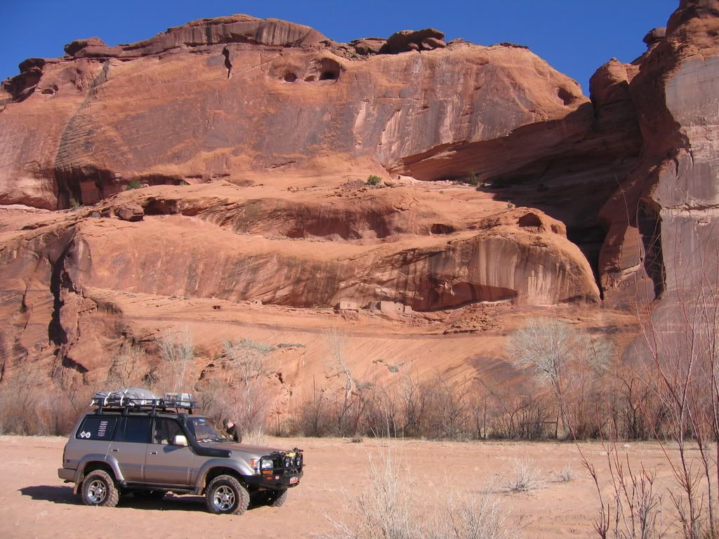
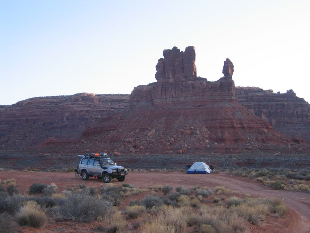
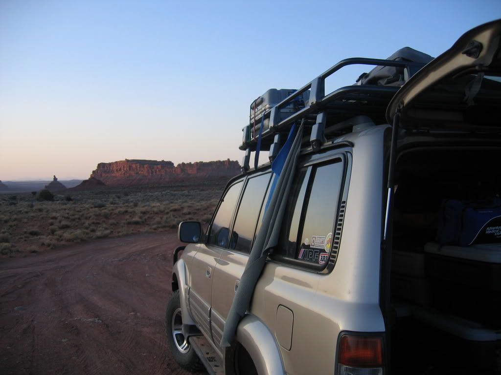
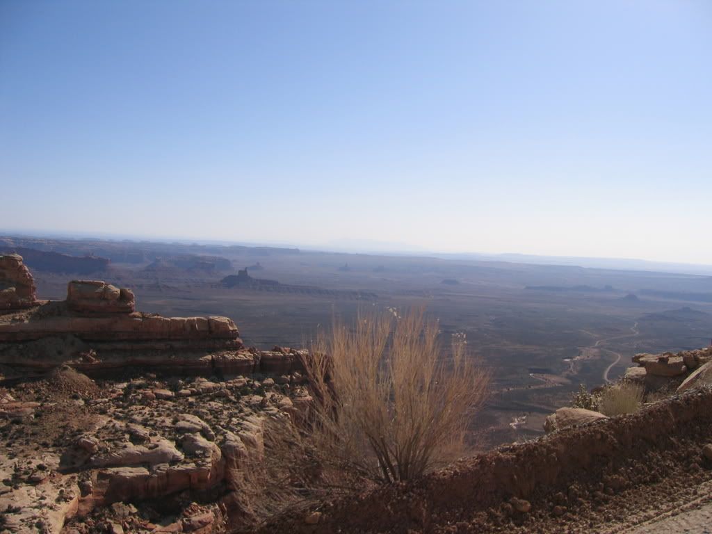
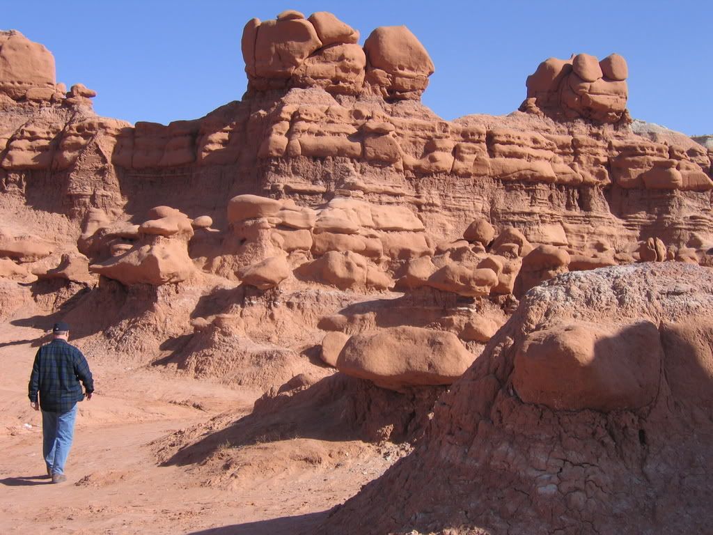
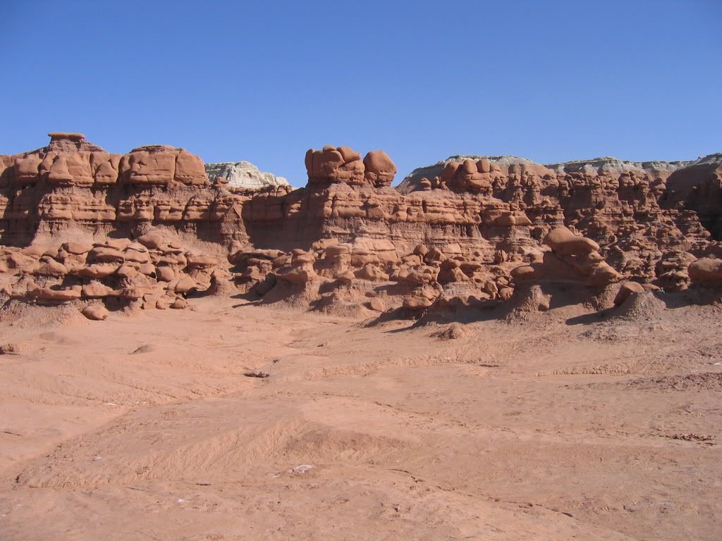
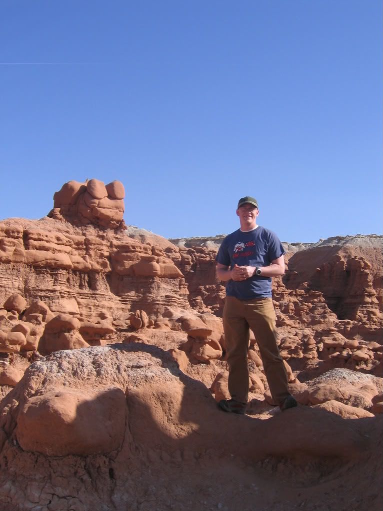
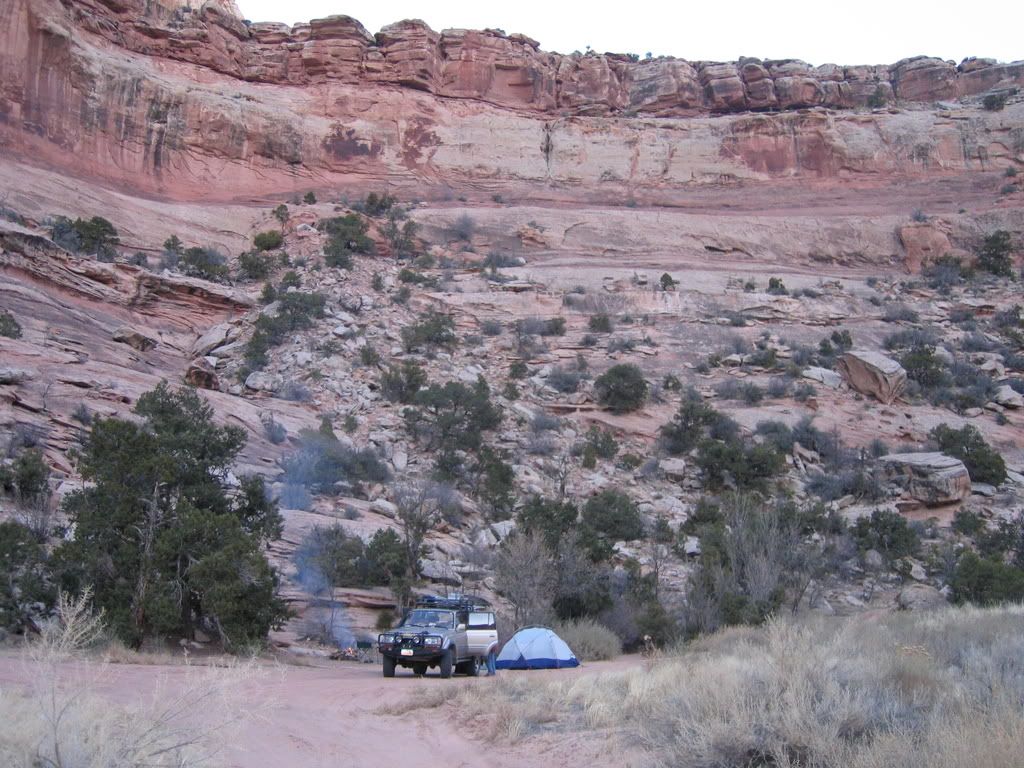
After a brief stop in Moab for gas and munchies, we decided to go ‘about an hour’ south of town and turn off a dirt road somewhere to camp for the night. We turned off towards Canyonlands not really sure where we would end up. Figuring we would just sleep on a tarp on the side of the road, we pulled into a turnoff, and unloaded the sleeping bags off of the rack. I realized at that point I had forgotten to throw in my winter sleeping pads. I usually bring a ‘Ridgerest’ closed-cell foam pad and a Thermarest pad when I camp in cold weather. Neither was resting up top in the cargo bag as I had anticipated. I raced through my options, thinking about sleeping in the car, pulling out the floor mats for a pad, etc. I decided that I would just use the tent as a makeshift pad, and trudge ahead…”Why else did I buy this fifteen degree Western Mountaineering bag?”
Needless to say, I had a cold night. I had to flip over every couple of hours to warm up the side that was against the ground. Made for a poor night’s sleep.
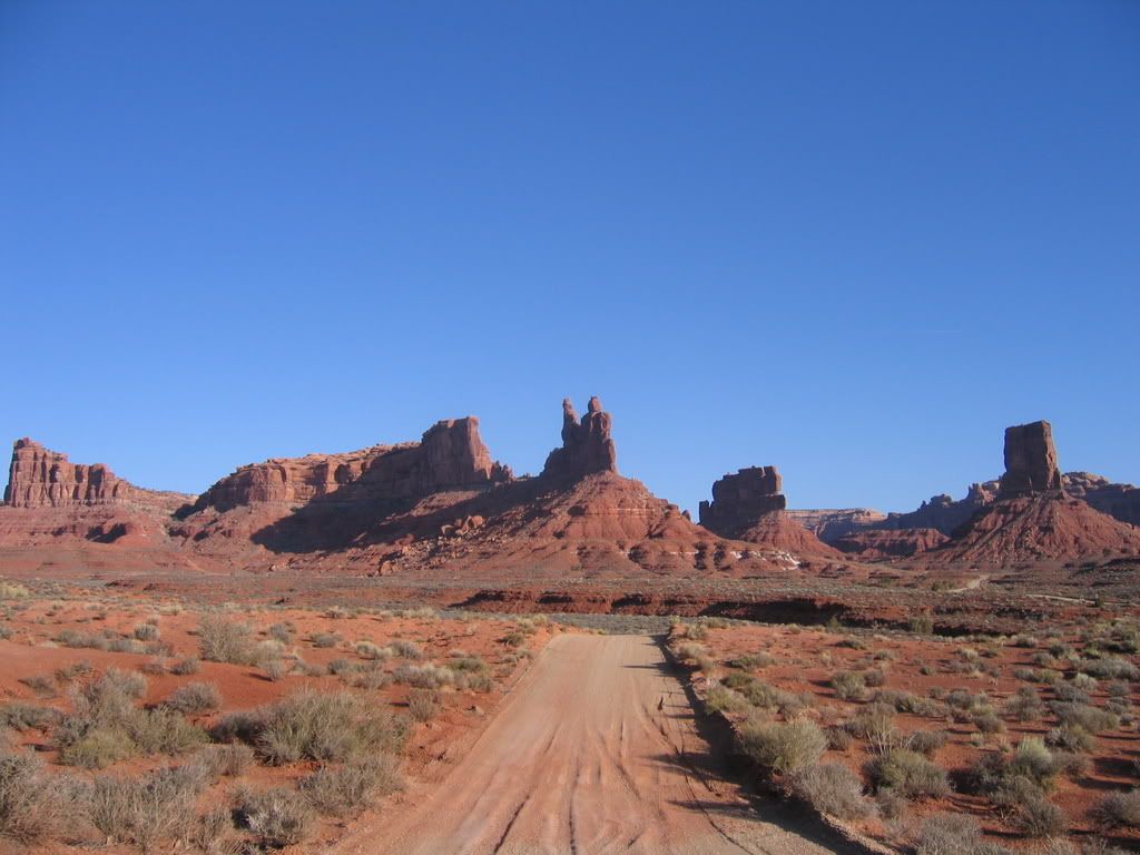
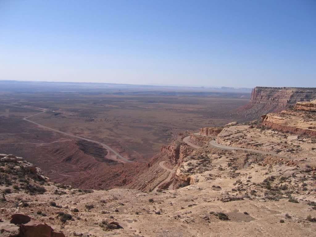
We did enjoy a bunch of wild turkeys and deer the next morning...
 
Last edited:

Moody

Needs to get out more
Part 2:The next morning, we were up and ready to go, breakfast and all by 8am. We stopped for a moment at Newspaper Rock. I had seen the rock before, so I made last minute adjustments to the audio selections, jumped out for a picture or two, and we were on our way to Mesa Verde National Park.
IMG_2781.jpg


IMG_2783.jpg


We were a little more than an hour away to the park, and upon arrival we all commented on the amount of snow that was on the ground. At the entrance station, we asked how much of the park was open due to the snow. We were informed that much of it was in fact closed, and no tours into the ruins were operating. We went on up the winding roads and we were able to see Farview Ruins and multiple pithouses up close, and the rest (that was open) from a distance. We spent most of the day there, and on our way out discussed the idea of heading to Canyon DeChelly then, instead of Valley of the Gods as we had originally planned. We went ahead and turned south towards Arizona instead of back to Utah. Gratefully, I was able to pick up a couple of cheap foam pads in Cortez before we were back on the road again.
IMG_2804.jpg

IMG_2818.jpg

IMG_2788.jpg
 
Last edited:

Moody

Needs to get out more
Part 3:

On the way, despite Kevin and I making snide remarks, we stopped at Four Corners, which is the only place in the US that four states borders meet. It was not much more than a simple monument with a little platform set up for people to take pictures of their kids in all 4 states at once. Surrounding the platform and the concrete monument are flags of the states, and all around the parking area one can buy varying wares from the locals. The highlight was when I offered to take a picture of a fellow traveler at the monument. He informed me he was going to “Do a little yoga” on the monument. He proceeded to stand on his hands almost effortlessly, and manage to turn his head enough for me to snap a quick photo. After the quick 20-minute stop, and Dad’s wallet nine dollars lighter, we were on our way. As my pops said, “At least you can say you have been there.”
IMG_2823.jpg

IMG_2821.jpg


As we cruised into Arizona, and we were on the Navajo Reservation, we couldn’t help but notice the number of both living and deceased animals on the sides of the road. Horses, cattle, and dogs were mulling around on the side of the road as we and the other travelers zipped by at 55 miles per hour. Dogs that had been hit by cars and left there regularly marked the shoulders. It wasn’t until later in the trip that we realized the reservation has a policy which allows animals to roam freely and graze.
 

Moody

Needs to get out more
Part 4:

IMG_2829-1.jpg

Once in Canyon DeChelly, we drove up to the overlooks that allow visitors to see down into the canyon. As it was getting late in the day, we were able to catch some amazing colors repainting the canyon walls, and giving us a fantastic view of Spider Rock. As soon as the sun was on its way out for the day, we thought about our camping for the night, and where we wanted to do so. We had driven by a locally run campground known as the Spider Rock Campground. We figured we would stay there, but then after more thought, we realized we would want to be closer to the park’s Visitor Center to pick up our guide the next morning. We decided to stay at the park’s free campground, which is very close to the visitor center. Aside from some dogs barking late into the night, it was nice to get such a restful sleep.


We awoke early, and before the sun had awoken and said hello, we had packed up the tent and sleeping gear. After our staple breakfast of instant oatmeal and fruit, we were off to the visitor center. Once we were in the parking lot, we spent a few minutes getting things together in the truck, knowing that we would have another person along with us.
We soon had made friends with James, a Navajo man that lived in the canyon during the summers when he was a child, along with a rather large number of his relatives. He made it clear up front that there was a lot of water in the canyon, and I must be okay with driving through the water. I must admit, he had me nervous, but I kept thinking to myself, “I didn’t do all these modifications for no reason, it is for exactly this type of situation.” After a few minutes, we were on our way up into the canyon. You get a sense real quick of the amount of water you will be driving through, and James once again asked, “You okay with the water?” I paused for a minute, took a look around, and smiled, responding with a contented nod of my head. Hell yeah I was okay. I was more than okay. As we made our way further into the canyon, and as James began sharing his experiences as a child, the history of his people within the canyon, -and most notable to me-, listening to him speak in his native tongue. I was overly pleased to be there, at that moment, at that time, at that place, with Kevin, James, and my Dad.

IMG_2850.jpg

IMG_2899.jpg

IMG_2867.jpg

IMG_2885.jpg

IMG_2832.jpg

IMG_2853.jpg
 

Moody

Needs to get out more
Part 5:

The next part of the journey led us towards Monument Valley. After a brief stop at the Kayenta Burger King to see the Windtalker Exhibit, (what can I say, I am a history teacher) and chatting with a couple in a very nice Sportsmobile, we continued on the road towards the border. We first went to the Goulding’s Lodge which is just outside of Monument Valley proper. They have a little museum there showcasing Hollywood’s impact on the area, and their use of the valley in movies with actors from John Wayne to Michael J. Fox. My Dad really wanted to go there and see where “The Duke” stayed. After a little breather there, we made our way into the valley itself, late in the afternoon. It was fairly busy, but we were all able to get plenty of photos and stop long enough to really enjoy the area. I even caught Kevin thumbing through the latest Overland Journal.
IMG_2902.jpg

IMG_2904.jpg

IMG_2934.jpg

IMG_2940.jpg


IMG_2926.jpg


IMG_2924.jpg

IMG_2919.jpg

IMG_2943.jpg
 
Last edited:

Moody

Needs to get out more
From Monument Valley, we turned towards Mexican Hat, UT. My Dad is employed by the University of Utah Hospital, and knows a fellow named Jess though work. Jess mentions that his parents have a little RV park down there, and we might be able to snag a shower there. After three days without a shower, that sounded fantastic. As we pulled up to the front, the ‘closed’ sign hung in the window. We were discouraged until we saw someone else walk in the door. We went inside to find Mr. And Mrs. Neff who own and operate Valle’s RV/Pizza/Beer. They were both very kind and after some time with introductions and discussing the area, we began asking about a shower. When we did, they offered up the keys stating, “Just leave the keys in the drop box in the front.” We then asked what we owed them, and they responded with “nothing.” “We don’t expect it to be free,” we said. Then, Mr. Neff replied, “If we thought you expected it, we would have charged you double!” The Neff’s closed up the store for the night, and we were off to take some much-needed showers. After getting cleaned up, we ate dinner on the San Juan River.
IMG_2947.jpg

IMG_2948.jpg


As the sun was setting, we snapped a few pictures of the rock formation that gives this population-40 town it’s name: Mexican Hat.
IMG_2949.jpg


After a brief 35-minute drive, we had reached the entrance to Valley of the Gods right near the beginning of the Moki Dugway. We turned into the valley where the gods reside, and did our best to make out side roads and turnouts and find a place to set up our ripstop house for the night. The moon was full, and it made it nice to set up camp. Dad was quickly off to bed, and Kevin and I sat around on chairs after we hung out our pack towels to dry and made a mess of our semi-organized cargo area. The next morning, we were in awe of what we saw. Pristine desert landscape lay out amongst us in all directions. After drooling for a few minutes, we grabbed our cameras and began foolishly to try and capture or surroundings on digital media. It didn’t work. You’ll just have to take my word for it and go see it yourself. Trust me, you will not be disappointed.
IMG_2967.jpg

After breaking camp, we retraced our path from the night before to see the entire Valley of the Gods loop. It was relatively quiet, with only a few RV’s and a lone Sportsmobile along the way. We made a quick stop at Goosenecks State Park, once again attempted to take some pictures, and went on or way, up the Moki Dugway towards Natural Bridges National Monument.
IMG_2982.jpg

IMG_2973.jpg

IMG_2972.jpg

STB_2956.jpg

IMG_2970.jpg
 

Moody

Needs to get out more
Part 6:

Moki Dugway is essentially an extreme switch backed road that gains over one thousand feet in elevation heading north, or drops the same elevation if one is heading south. Excellent views throughout the drive, though the diver gets the bunk end of the deal, as they must keep their eyes to the road.
Once we arrived at Natural Bridges, we checked in with the visitor center to show them our pass, and planned on hiking to at least one or two of the bridges while we were there. After the first stop, the wind was blowing, and there was visible snow on the ground in many places. Although the sun was shining, the wind chill made it uncomfortable. We visited all three of the bridges, though the cold kept us from hiking to any of them, and the only ‘hike’ (I use the term hike loosely here) was a brief half-mile jaunt to ‘Horsecollar Ruin,’ which is a viewpoint that allows a visitor to see ruins from a distance. Coming around one of the bends, I saw a very nicely equipped FJ62 in a picnic area parking spot. I used to own a FJ62 so I had to stop and take a picture. I sure liked that old truck.

IMG_2983.jpg

IMG_2988.jpg

IMG_2992.jpg

IMG_2991.jpg
 

Moody

Needs to get out more
Part 7: Yes, I know this is getting old...

From Natural Bridges, we continued north towards Lake Powell, as we had planned on camping at or near Blue Notch Canyon on the edge of the lake. We passed the turnoff for Blue Notch, but found another that looked promising. As we drove down the road, we saw a pit toilet, signs indicating the need of a portable toilet if you are further than 200 yards from the toilet, some tamarisk, fire pits, and everything indicating we were there, but no water could be seen. We went further down the road, which became not much more than a makeshift access to the canyon bottom, which was damp, at best. We discussed our options, and surveyed the map for other possible areas to spend the night. We decided to push further north and at least get into Hanksville before stopping again for the night. We pulled into town and gassed up at one of the more unique gas stations I have ever been to- it is situated inside a mountain of sandstone, carved out of the red rock. We made some phone calls, checking in with our lasses in Palm Springs and in Salt Lake. Just as I had begun enjoying my ice-cold fountain drink, I had a fellow standing at my door. I opened my door and he told me how he really liked my truck and such, and pointed his FJ60 out to me. As I was once again ogling his 60, he was looking at my truck with lustful eyes. I snapped a picture of ‘the cruiser guy’ with his dog, and we were on our way north to Goblin Valley.
IMG_3005.jpg


Once we arrived in Goblin Valley, we could go in almost any direction and camp…so we thought. It was like a little ant farm of RV’s, tents, dirt bikes, for wheelers, and hikers all over the area. We even went out to a spot I had camped at before and found it to be occupied. We decided to head over to the actual Goblin Valley State Park to go wander around. My Dad had taken me here a few times before when I was a kid, and I had just been back a little over a year ago. However, Kevin had not been to the park before, so it was a new experience for him. It was extremely busy, so we only spent a little more than 45 minutes in the valley itself, and we were on our way north once again.
IMG_3010.jpg

IMG_3007-1.jpg

IMG_3009.jpg
 

Moody

Needs to get out more
Part 8: The final cut:

We had some time to think about where we wanted to end up, and we all liked the idea of getting off of the blacktop for awhile, and decided to drive the dirt road from I-70 up to Huntington, known as the Buckhorn Draw. Kevin and I had just been out there a month before, but the road wasn’t open completely through. It was nice to get off of the road and away from all of the people. We found an open spot in one of the canyons, and set up camp for the night. As soon as the sun tucked itself behind one of the canyon walls, it became quite cold. It was by far the coldest night of the trip. We hadn’t had a fire any of the other nights, but that night, it was a necessity. Later that night, I even found myself tightening the draft collar on my sleeping bag, cinching the hood down tight around my face, sealing off all possible warmth into my sleeping bag. We all stayed in the tent well into the morning, hoping to catch the sun before we got moving. We were in no hurry, so we leisurely packed the gear, cleaned up breakfast, and made our way to the Buckhorn Wash Pictograph Panel. We left the wash and made a quick dash to the Wedge Overlook. Once again, Kevin and I were just there a month earlier, so it was mostly for the benefit of my Dad. After another dirt road jaunt back to the asphalt, we took a road over Huntington Canyon to highway 89 and continued home via 6 and stopped at the Wingers Restaurant for an early dinner. We were home by 5pm to reflect on our richness the remaining Easter Sunday.
IMG_3012.jpg

IMG_3015.jpg


The Grand Tour Crew:
IMG_2811.jpg

:safari-rig:
 

ttora4runner

Expedition Leader
Moody said:
IMG_2947.jpg
QUOTE]

HaHa I remember that place I live in mexican hat for about 3 months. Actually, behind the church in the corner of the picture. There's some fun roads done there, except in a flash flood.:smiley_drive:

Nice photo's and writeup, looked like a good trip.
 

kcowyo

ExPo Original
An excellent recap! :clapsmile

What a great trip through some of the best countryside the 4 corner region has to offer. Some really special places out there. Very cool you had family and great weather to enjoy it with.

Glad you had a fun and safe adventure. Thanks for remembering the rest of us and posting so many great pics.

:beer:
 

FurthurOnTheFly

Glamping Society
Mr. Moody, when you went through CDC did you tour the north rim, south rim, or both. I see on the website you linked us to on the first page that both take about 2 hours, so I'm curious how much time you spent there. Just trying to gauge out some kind of time plan for our trip in July.

Thanks.
 

Forum statistics

Threads
188,608
Messages
2,907,838
Members
230,758
Latest member
Tdavis8695
Top