Creating a Cross Canada Overland Route

deadly99

Explorer
Ted, how early do you think the non-technical sections can be travelled by truck? I know some of the more southerly technical sections (Lingham Lake) may be passable in April if you don't mind getting wet. But you WILL get wet. That's pretty much true almost year-round, but the water will be deeper until at least May, if not June.

But, I'm not sure about the routes of the non-technical sections. Are they mostly on graded, plowed, official roads? Therefore, passable and dry in March/April?

Big question and I am hesitant to reply. Some parts of the route are driveable in April....really depends on the snow pack that recorded the year before. Some of the mountain passes in BC are locked with snow until late June. Some of the trails in Quebec utilize snowmobile trails which get the snow packed all winter and can be slow to melt in the shady areas. We have designed it to go east to west and believe starting in Newfoundland in May-June would enable the route to be fully open and clear of snow.

You mentioned some particular trails in eastern Ontario in your post so I will assume your intended question is to just ride a section of the route? Last year we rode the entire section of eastern Ontario in April, the year before it wasn't good to go until May. Sorry I wish I cold be more precise but it's a mother nature thing.

We have a group of sixty people coming up from the states to pre ride the eastern Ontario section on May 27th.....fingers crossed the water levels are "doable" :ylsmoke:
 

deadly99

Explorer
Still needs one more chapter - "The North" for Yukon, Northwest Territiries and Nunavut...

This thread is about the TCAT......we are also working on a couple of other routes....True North East leaves the Maine-New Brunswick border and terminates at the end of the Trans Taiga highway. It will be complete this fall :ylsmoke: True North West? Indeed :victory:

Check our site next fall for more details (we are aiming to have the site up and running this fall).

Www.graveltravel.ca

Fall of 2012 we intend to have a collection of routes ready for distribution, of course at no cost :smiley_drive: The intent of the site is to make available multiple day overland routes. They will be distributed as gps files. Different people are contributing different routes but all will follow a common format (rating scale, gpx format, etc).
 

deadly99

Explorer
Well the winter blues are in full effect here in most parts of Canada.

David is still plugging away on the section of the TCAT across Vancouver Island while the rest of keep the snow shovel handy and dream of warmer weather.

Made it out today to do some more route work, here are a few teaser pics:
These are from the Nimpkish valley north of Woss.
IMG_1939.jpg


IMG_1941.jpg


IMG_1947.jpg


IMG_1948.jpg

For anyone wondering what BC stands for it's "Bring Chainsaw"
 
Last edited:

deadly99

Explorer
As a whole the poject is coming along nicely. The TCAT is on course to be completed in the fall of 2012. The True North east route should be completed this summer. A handful of folks are working on shorter "weekend" routes across various area's in Canada. Our new website, graveltravel.ca, should be up and running this fall and ready to begin distributing routes.

A very rough overview of Canada showing the TCAT is pink and the TNE in blue.

2975149_l.JPG


The logo for the TCAT is complete, thanks to Anthony for his grpahic design expertise. As he posted early the templates for the book are almost completed and I have spent too many hours typing away for it. Spring can't come soon enough, nothing like writing and researching bike/truck routes all winter to get a person twitching :ylsmoke:

2967229_l.png


A logo is underway for the TNE and the write up is almost complete for the new website. In May a friend and myself will be riding the sections that are left unridden and will have a finalized gps route in place for the launch of the web site this fall. The TNE looks like a great route, best guess is two weeks from the Maine/New Brunsiwck and return via paved roads. Some pretty diverse and remote country is included.


2967230_l.jpg


In May we have approximately 60 or so folks coming up from the states to pre ride a few days of the TCAT. Termed the Roaming Rally, it should be one heck of a fun couple of days. A real diverse crowd from beginners to expert racers, big bikes to little bikes to landrovers. This should give us a good idea as to how the different user groups feel about the terrain. The portion of the TCAT they will be riding/driving has about 6 optional technical sections which are sure to challenge the less experienced folks. Stay tuned as I'm sure some "interesting" stories will come out of this event :smiley_drive:
 

deadly99

Explorer
Tne

The True North east route utilizes two long remote gravel roads. The Rue Du Nord and the Trans Taiga. I am going to cross post from a thread we did a few years back when we rode these two roads. Where the North Road starts is the top half of the TNE. Very cool and remote country up there. Enjoy the read, it's a long one :smiley_drive:
 

deadly99

Explorer
Where to go for a week trip based out of Ottawa Canada?

The Trans Labrador highway was the plan but with its completion set for next year it seemed a shame to go and do it this year. So where to? Dan sends me an email with a link to the Trans Taiga from Wikipedia.

Trans-Taiga Road

From Wikipedia, the free encyclopedia

Jump to: navigation, search


The Transtaiga Road.
The Trans-Taiga Road (French: Route Transtaïga) is an extremely remote wilderness road in northern Quebec, Canada. It is 582 kilometers (362 mi) long to Centrale Brisay and another 84 kilometers (52 mi) along the Caniapiscau Reservoir, all of it unpaved.
The road's northeastern terminus is almost at the 55th parallel, making it the northernmost continuous road in Eastern North America. Though the terminus is also the furthest point from any town (745 km or 466 miles from Radisson) via road in North America, it is nonetheless relatively close - 190 kilometers (118 mi) - to Schefferville geographically. It does not, however, provide access to it, as the intervening terrain is unpassable even in an all-terrain vehicle. The road's end is also close to the southern limit of Nunavik, Quebec's Inuit region.
The Trans-Taiga Road branches off from the James Bay Road (French: Route de la Baie James) at kilometer 544. It was built as an access road to the hydro-electric generating stations of Hydro-Québec along the La Grande River and Caniapiscau River. Several outfitters are established along this road, providing wilderness hunting and fishing expeditions, and some may also provide fuel, food and lodging. Otherwise, there are no services along this road.
While the Trans-Taiga Road is reportedly drivable by ordinary passenger vehicles for its entire length, Hydro-Quebec recommends use of 4WD vehicles for the section between Brisay and Caniapiscau, which is of a rougher grade than the rest of the road.
As the name of the road indicates, this road winds its way through Quebec's vast boreal forest, characterized by stunted spruce and pine, bogs and rocky outcroppings. Taiga is the Russian term for the same type of forest.


Within minutes I had replied to Dan saying count me in one hundred percent. A few emails back and forth and we decided to invite some folks from advcanada.com
This website opened up a while back as a way for folks from our neck of the woods to meet like minded people and to share riding areas with. Basically it’s an email distribution list that you can use to find people to ride with or to share new areas. A group ride usually takes place once a month and can have as few as 2 to as many as 15 people show up. It’s turned out to be a great resource.

Within a few days Stephen replied and said he was definitely in. Chris responded that if his trip to Morocco falls threw he is in (it did fall threw and he was in). John joined later in the month with an “I’m in” and Maurizio emailed the gang a week before departure and confirmed he was in as his planned trip in the spring didn’t materialize. We didn’t expect this response thinking maybe we would get one or two people at best. So there we are with 6 of us committed and ready to go.

Many, many emails bounced around for a few weeks on routes, times, camp locations, sites to see, departure dates and what not. A meeting over pints at a local pub was set and logistics were sorted out. Most of us didn’t know each other to well other than a few off-road days during the summer so everyone kind of got a feeling for who each other were.

The trip was determined to be a 7-9 day ride with a few destinations as the goal. The first goal being to dip our tires into James Bay which is a part of the Arctic Ocean. The second goal was to ride the Rue Du Nord (The North Road) which is a 400+km gravel road and camp at the Rupert River. The Rupert is one of the last free flowing big rivers in Quebec and is destined to be damned up this fall (the way of the world I suppose). The third goal was to ride to the end of the Trans Taiga road and back. This road is 666 km long, so a total of 1332 km’s of gravel.

In total the plan was for approximately 1900 km of gravel roads and 2700 km’s of pavement in one week.
 

deadly99

Explorer
Here is our proposed route


2344318_l.JPG


After much packing and planning we are set to go. Typically I am the kind of guy who packs the morning before leaving, but on this trip we are heading to some pretty isolated areas where buying missing items may not be feasible. That being said I forgot to pack a few items even though they were on the “to pack list”, arg.
 

deadly99

Explorer
Day One


The plan is to meet at Chris's place downtown Ottawa at 4pm. A bit of a late start but a few of the guys had to work that day. The thing that best describes the mood of everyone is excitement. Getting to leave work and family behind for a week isn't always easy for us working stiffs. With all the planning, packing and anticipation I think everyone was raring to go.

A few introductions for those that hadn't met each other, a last minute pack and away we go. Our destination was somewhere in the Verendrye Park approximately 300-600 km from Ottawa.

The bikes loaded up and ready to go.

1 Ktm 950 adv
2 Bmw gs 1150
1 Bmw dakar650
1 Bmw Funduro 650
1 Kawasaki KLR 650


2369486_m.jpg


Happy campers ready to go. Big smiles and clean bikes.

2369538_m.jpg


2369639_m.jpg


And off we go, a bit of rush hour downtown traffic to deal with prior to hitting the open road.

2369512_l.jpg


2369533_m.jpg


Heading up highway 105

2369536_m.jpg


A quick stop for some gas, beers and chips before heading out into dusk to find a campground. I think it was around this point that I realized I didnt have any head or tail lights. A quick pull over revealed a melted fuse. Electrical gremlin or something I shorted while prepping the bike? Time will tell.

2369638_l.jpg


We checked in at the Lac Rapide campground and setup camp. A few brown bottles and small talk before hitting the hay. A great campsite on a lake, it cost 30 bucks per site but they let us put 6 tents on a site! Oh ya Chris I think I still owe ya 5 bucks from this night :thumb

Dan not used to me being in his face with a camera yet :evil

2369545_m.jpg


2369541_m.jpg


All in all a great first day, I think we only made about three or four hundred clicks.

You might notice we are all carrying gas canisters, a few of our days will have 600 + km days between gas stations. My KTM only gets about 300 km per tank on a good day (read easy throttle day which tend not to happen :D ) so I carried and extra 25 litres on my bike.
 

deadly99

Explorer
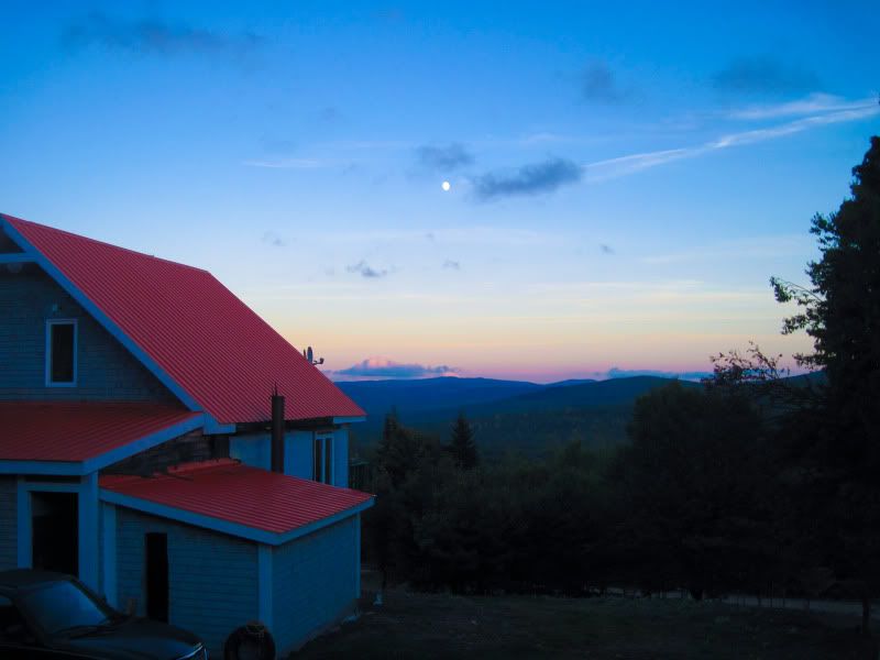
Woke up to an amazing sunrise.

2371304_l.jpg


2371305_l.jpg


2371307_l.jpg


A quick pack up and we were on the road by 8 am. This time seemed to be a compromise between the morning guys and the sleepers and became the norm for the week.

2371308_l.jpg


2371309_l.jpg


We jumped on the highway and did a few hundred km's before stopping in Sennetere for breakfast and some gas.

2371310_l.jpg


2371311_l.jpg


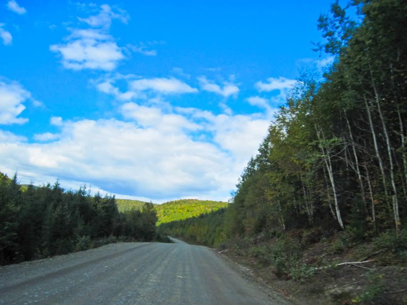
We did the next stretch of highway at speed. I think its about 300km to Chapais and we made it there in about 2 hours:huh Gotta love these remote roads, no police anywhere. Quotes from a KLR "my bike can't go any faster, its been pinned for the last hour" :clap .

2371317_l.jpg


In Chapais we were to meet our 7th companion for the trip. Mike was coming from Nova Scotia on a Transalp but had his clutch begin slipping to the point where he had to turn around a few hundred km's from Chapais. Mike ended up doing about 3200 km in 3 days and I am sure had a good ride although not the one he intended to take. Bummer Mike, you missed out on a good trip :cry

2371318_l.jpg


Downtown Chapais (wouldnt want to live here, bit of a desolate rundown feel to it). We topped up with gas and made our way to the next town of Chibougamau (your guess is as good as mine of how to pronounce it) to top up with supplies (SAQ the french version of a liquor store). Bikes packed with vino we were off to the start of the North Road. Our plan was to camp at the Rupert River which is about 258 km down the North Road.

2371321_l.jpg


2371320_l.jpg


A few quick cell calls to our significant others as this would be the last area with cell coverage for a while (note half of us had Rogers phones and they get no coverage for the better part of trip, something to consider of you head this way, Telus phones get coverage in all kinds of crazy and remote areas).

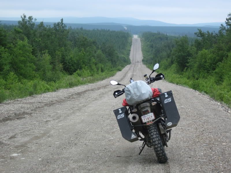
Looking down the North Road its hard not to grimace as the road has been freshly graded with maybe one set of tracks on it. Ah well its only 258 km. Funny how a trip like this starts, at first everyone is a bit apprehensive of the gravel and speeds are kept low and the pack close together. Well soon enough the dust forces everyone to spread out and within a short while everyone is hitting it Dakar style. This is truely one fun road. The surface changed from loose marbles of gravel, to oiled down almost pavement style road to a section about 50 km long of deep silty sandy terrain that guarantees pucker factors no matter what speed you were doing.

2371322_l.jpg


2371331_l.jpg


2371329_l.jpg


2371328_l.jpg


2371350_l.jpg


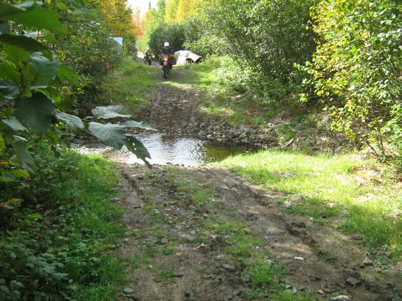
We stopped to regroup every 50+ km or so. Maurizio was the only one of us to not be riding on knobbies so he understandably had to go a bit slower. I wouldn't have wanted to have been riding his big bike with worn out tourances on it, kudo's to you :clap I am sure he must have had many more pucker moments than the rest of us, and we tallied up many of them for ourselves.

Reading the ridges in the road between tracks becomes an art that we were all mastering with an hour or so. Hammer the gas, lean back a bit and let the bike squirrel around under you. Seems easy, takes a bit of practise to feel comfy with it at speeds in excess of 130 km/h. But once you do....nothing but grins poking out from dusty faces :D

2371376_l.jpg


2371373_l.jpg


This is how you could tell how far you were from the guy in front, look for dust clouds as you come up over hills.

2371372_l.jpg


Chris looking a bit tired, this is after about 800 km for the day.

2371375_l.jpg


You know you are starting to get into Indian territory when the signs begin to read in Cree. They must be very devoted to Christmas as it constantly seemed as if half of their words consisted of candy canes :wink:

2371374_l.jpg
 

deadly99

Explorer
We made it to the Rupert just as the sun was going down, approximately 11 hours on the bikes and just over 800 km's for the day. We setup camp just before the river on the right hand side. A nice free lttle camp site Dan had read about on a ride report somewhere. Came with firewood and everything. When we first stopped the black flies were out in force but as soon as the sun began to set and temperatures began to fall they disappeared. I can't imagine what it would be like during summer when the nights are warm. Note: early September is a good time of year for this area as long as you dont mind cold nights.

2371379_l.jpg


2371380_l.jpg


2371381_l.jpg


Kicking back by the fire after a long day.

2371382_l.jpg


Dan damn proud of his new spork

2371383_l.jpg


And hence begins a cold night and frustration with my darn air matress. I normally travel with a thermarest but after a trip last year where everyone else had airbeds (large double bed sized air mattresses with a velour top) I picked one up for myself. Well after sleeping for about 2 hours I woke up with one hell of a cold hip from the large tent sized rock under me and no air in the matress. Toss, turn, screw this, I brought a small back up air matress (not planned just threw it in the pannier on my way out the door). 2 more hours and damn, this one leaks too. Toss turn where's the damn sun.
 

deadly99

Explorer
Cross post from Chris

Chibougamau outside the liquor store.. we stopped there by coincidence! really!

2372043_l.jpg


Oooh-la-la!! Small town Quebec always seems to have some interesting places..
2372022_l.jpg


A bit apprehensive about starting the gravel with a fully loaded bike..
2372023_l.jpg

2372024_l.jpg


The first encounter with a grader.. notice the almost concrete hard gravel on the left and the soft squishy gravel on the right.. a nice mix that randomly changed along the road, sometimes mid-corner, just to keep it interesting.
2372028_l.jpg


What's this? is someone hurt??
2372025_l.jpg


Nope.. Ted having a power nap!
2372027_l.jpg


Home for the night!
2372051_l.jpg

2372052_l.jpg
 

Forum statistics

Threads
189,369
Messages
2,916,005
Members
232,189
Latest member
Jonny Adventures
Top