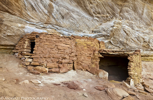
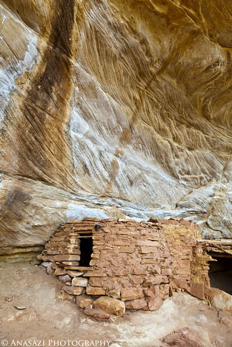
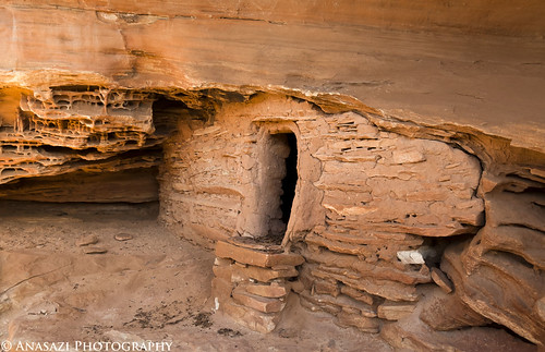
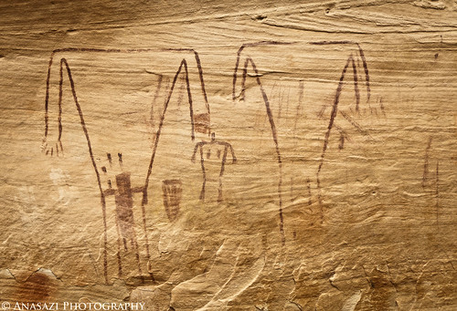
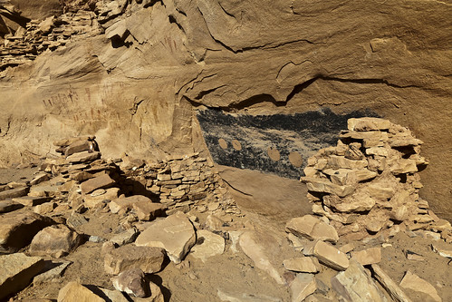
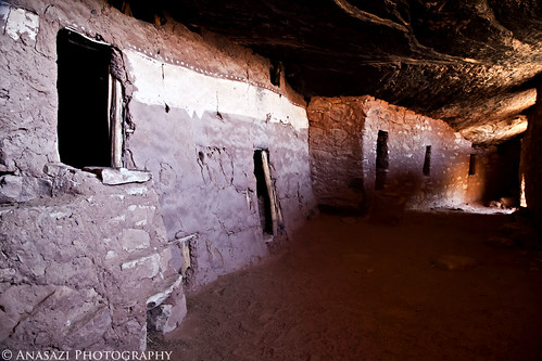
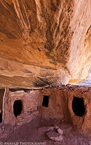
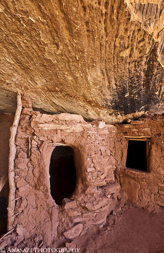
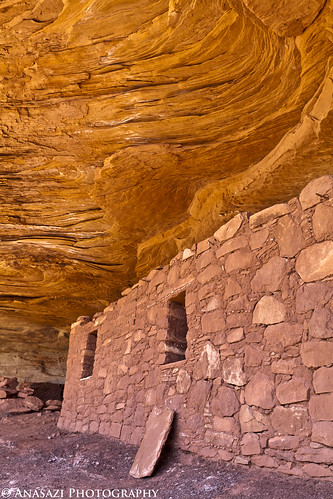
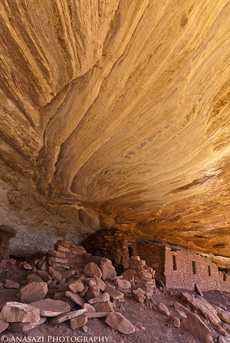
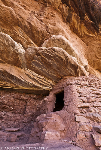
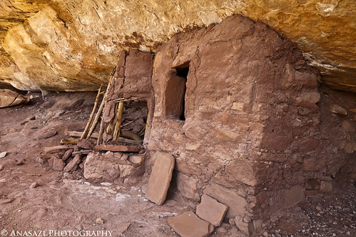
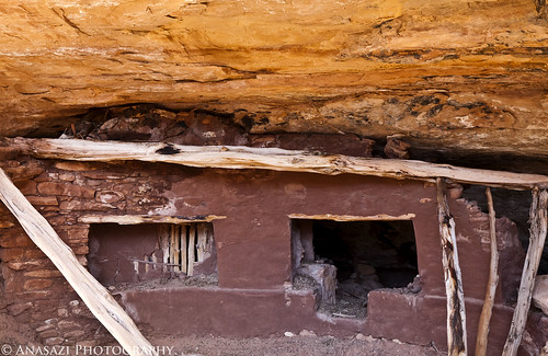
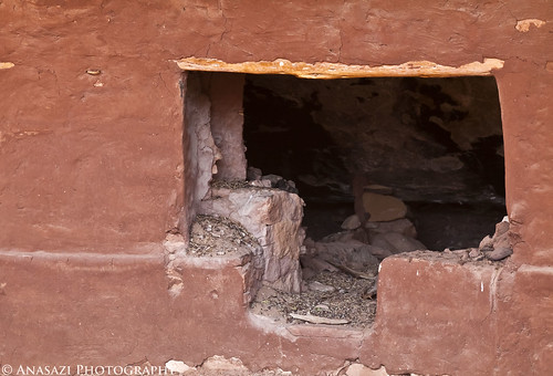
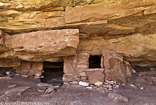
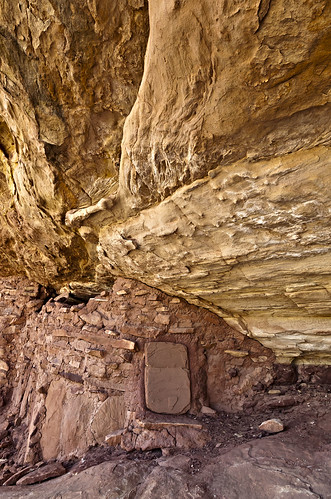
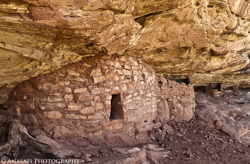
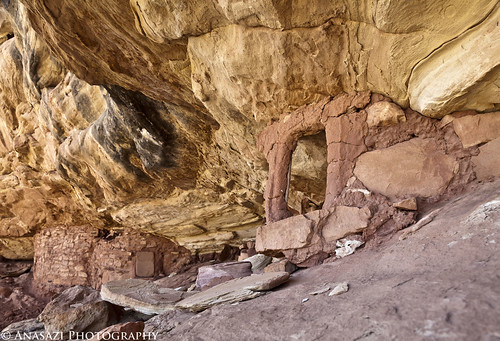
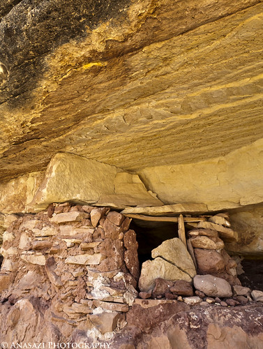
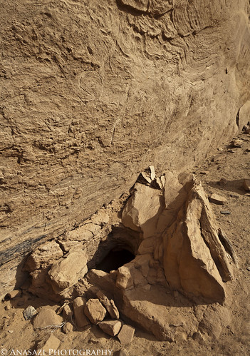
The Maze and the Mesa (April 2011)

Martinjmpr

Wiffleball Batter
Great trip report! I've only been to the Maze once and I stayed in the upper area (Orange Cliffs/Cleo's Chair/Panorama Point.)

Question: How do you get such vivid colors from your digital photos? Are you using a program to enhance them or is it just technique? Those pictures are fantastic!
 

IntrepidXJ

Explorer
Great trip report! I've only been to the Maze once and I stayed in the upper area (Orange Cliffs/Cleo's Chair/Panorama Point.)

Question: How do you get such vivid colors from your digital photos? Are you using a program to enhance them or is it just technique? Those pictures are fantastic!

Thank you!

A circular polarizer helps me get some of the vibrant colors in my photos (It also helps bring out the rock art better....my main use for the CP). I shoot everything in RAW and process them with Adobe CameraRAW (comes with Photoshop), there I make minor adjustments and add just a little saturation if needed....but I don't usually make big adjustments....just normal contrast, clarity and sharpening.

Hope that helps, I'm still learning post-processing and new techniques, so my process is constantly changing up as I learn more and get better.
 

IntrepidXJ

Explorer
Day 5: Sheiks Canyon & The Green Mask

Wednesday, April 13, 2011

We were up before sunrise on Wednesday for a quick breakfast so that we could get a quick hike down into Sheiks Canyon before Dave would have to head back home. First up in Sheiks Canyon was the Yellow House Ruin. The roof beams over part of this ruin still have the yucca lashings with knots tied to the roof beams. It's a pretty amazing site.


Yellow House by IntrepidXJ, on Flickr


Yellow House Alcove by IntrepidXJ, on Flickr


Yellow House Roof by IntrepidXJ, on Flickr

A good look at the very cool roof structure still intact.


Jared and the Yellow House by IntrepidXJ, on Flickr

Jared takes a photo into the Yellow House.

A little further down the canyon we came across another small ruin.


Welcome Mat by IntrepidXJ, on Flickr

This small structure has a unique step right in front of the doorway.


Ruin & Faint Pictographs by IntrepidXJ, on Flickr

It also has some faint white pictographs located just above, than you can see in this photo.

As we continued down-canyon were a couple of steep talus slopes we needed to descend to get around some big pour-overs.


Sheiks Canyon by IntrepidXJ, on Flickr

A view into Sheiks Canyon as we near Grand Gulch.


Dave and the Gulch by IntrepidXJ, on Flickr

Dave looking down into Grand Gulch from a viewpoint along our hike.


Tucked-Away Granary by IntrepidXJ, on Flickr

A small granary we passed by on our way to The Green Mask alcove.
 

IntrepidXJ

Explorer
Once we got near the confluence with Grand Gulch we spotted the Green Mask alcove with it’s ceiling filled with pictographs.


Ceiling Panels by IntrepidXJ, on Flickr

There were a lot of pictographs located near the ceiling of this alcove and out of reach. There are more in the photo below.


Ceiling Panels 2 by IntrepidXJ, on Flickr


Alcove Pictograph by IntrepidXJ, on Flickr

Here’s a closeup of one of the more interesting and unique pictographs located above us.

There were plenty of ruins and rock art around to explore.


Headless Torso Wall by IntrepidXJ, on Flickr

This area had a bunch of pictographs and handprints, including the Breech Birth Panel.


Handprints & Torsos by IntrepidXJ, on Flickr

A closer look at the left side.


Breech Birth Panel by IntrepidXJ, on Flickr

This section is called the Breech Birth Panel. Apparently, some people believe this scene represents a C-section birth.


Shooting Rock Art by IntrepidXJ, on Flickr

Jared takes a photo of some rock art.


Painted Walls by IntrepidXJ, on Flickr

The back of this ruin appears to have been painted.


Mud Spirals by IntrepidXJ, on Flickr

A closer look reveals that mud circles were applied to the back wall inside this ruin and then spirals were created. This is the first time I have come across this, and it was pretty cool.
 

IntrepidXJ

Explorer

Hidden Room by IntrepidXJ, on Flickr

The entrance to a small room or granary located along the back of the alcove.
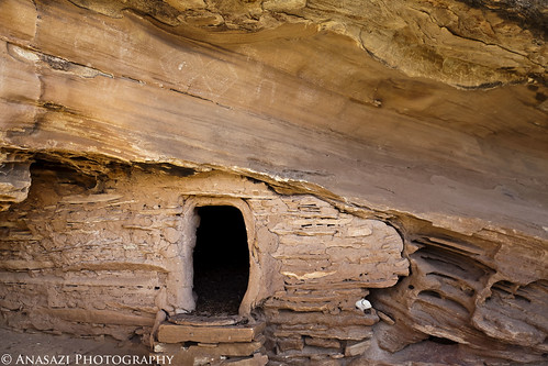
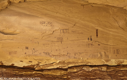
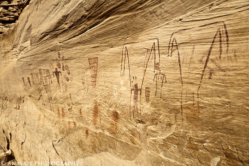
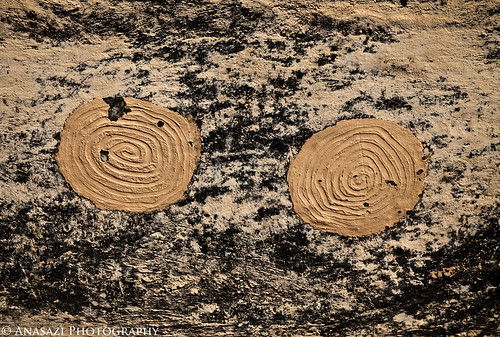
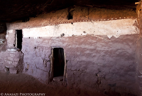
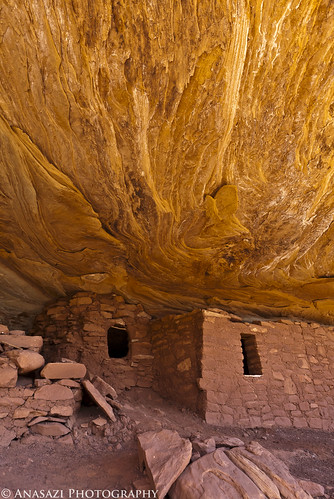
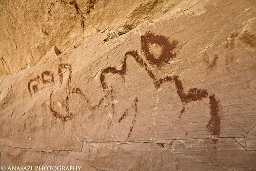
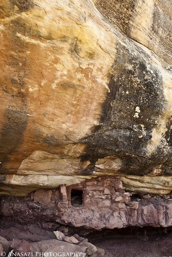
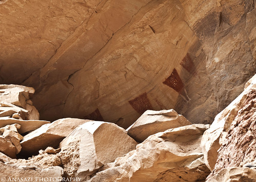

Upper Panel by IntrepidXJ, on Flickr

I was unable to climb up to these anthropomorphic pictographs located in a ruin on a ledge above us, so this is the best shot I was able to get.
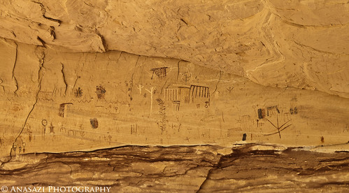
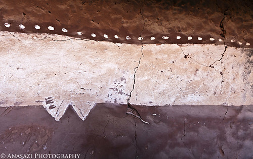
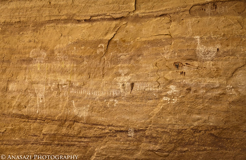

White Turkey Panel by IntrepidXJ, on Flickr

More faint white pictographs. The lower bird-like figure in white reminds me of a turkey, which is where my name comes from.


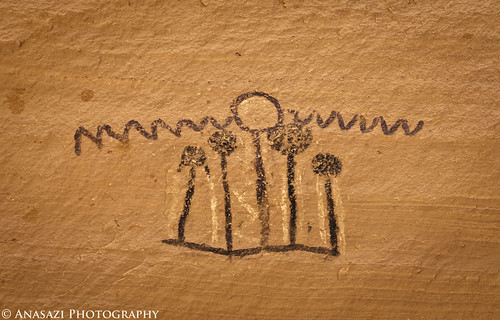
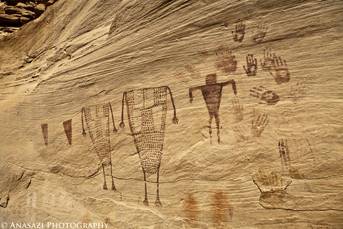
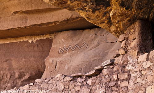
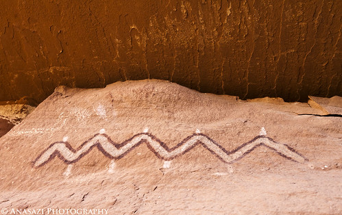
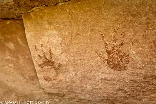
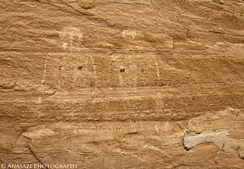
Faint Headress Figures by IntrepidXJ, on Flickr

Two faint anthropomorphic figures with headdress-like designs where their heads should be.

Of course, I had to get a photo of The Green Mask before we left.
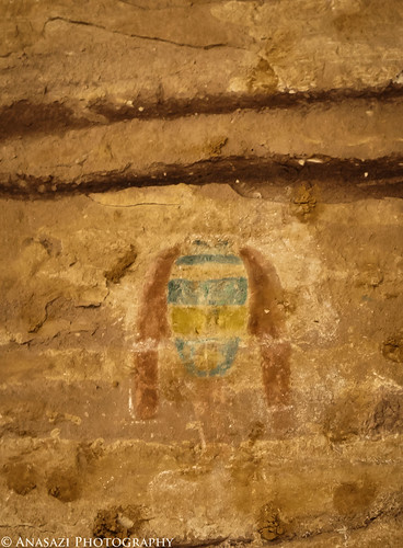

The Green Mask by IntrepidXJ, on Flickr

I wish I had dragged my 100-400mm lens along on this hike so I could have got a better shot of this, but here’s a cropped shot of The Green Mask.

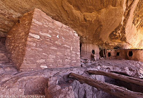
We spent plenty of time exploring and taking photos before turning around and heading back up canyon. When we reached camp, Dave made Jared and I some awesome breakfast burritos before he left us to head home. They were very delicious :)

After Dave had left, Jared and I headed to the Kane Gulch Ranger Station so I could pickup my annual Cedar Mesa hiking permit for the season. From there we headed over to the Lime Creek Towers, situated on top of a knoll near the head of Lime Creek Canyon.


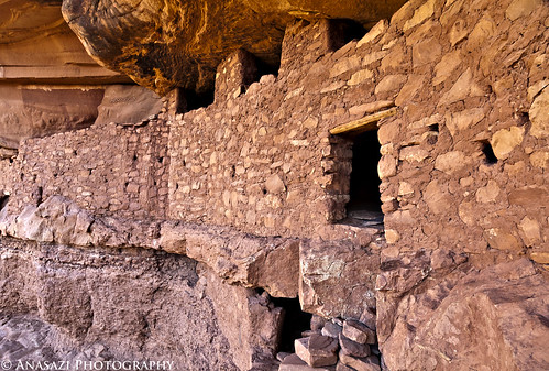
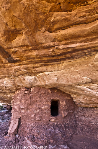
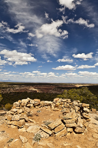
Lime Creek Tower Ruins by IntrepidXJ, on Flickr

Ruins of one of the towers at the head of Lime Creek Canyon.


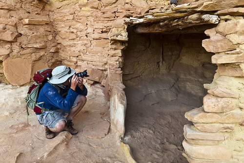
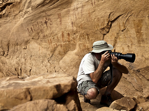
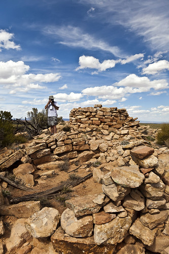
Photographing the Lime Creek Towers by IntrepidXJ, on Flickr

Jared photographs the ruins of the towers.

When we finished exploring those ruins we continued on down the road, unsure of where it would take us. After follwoing it for a few miles we reached a nice overlook of the Valley of the Gods.


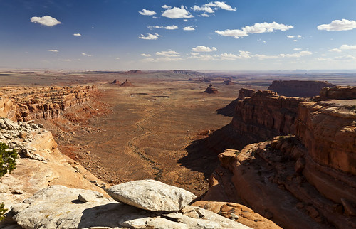
Valley of the Gods Overlook by IntrepidXJ, on Flickr

A nice overlook of Valley of the Gods.

While at the overlook I finally got cell phone signal for the first time since Saturday and was able to call Amanda, which was nice. I finished up my phone call and then we headed back to the highway and over to Muley Point for a quick stop.
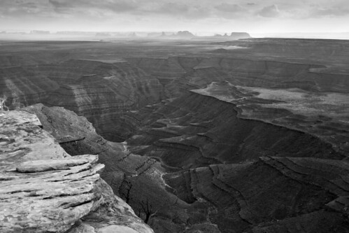

Muley Point View by IntrepidXJ, on Flickr

A view from Muley Point in black and white with Monument Valley in the background.

Is it ever not windy up there?
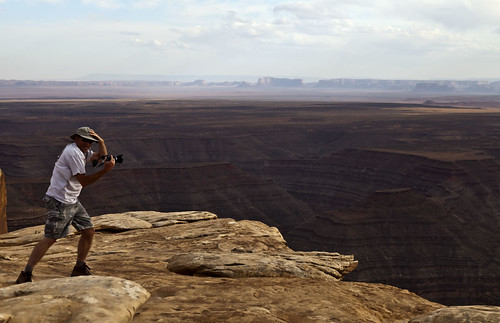

Windy by IntrepidXJ, on Flickr

Jared battles the wind to get a shot.

Then it was down the Moki Dugway and into Mexican Hat for some burgers at the Olde Bridge Grille and fuel for the Jeep.

Before heading back to camp we stopped at Mexican Hat Rock to see if there would be a break in the clouds during sunset for some photos, but there never was….so we returned to camp up on Cedar Mesa….and so did the strong winds!

Day 6 to be continued…
 

IntrepidXJ

Explorer
Day 6: Moon House & Upper Johns Canyon

Thursday, April 14, 2011

After another very windy and cold night, Jared and I had some breakfast and headed over to the Kane Gulch Ranger station again. We wanted to make this an easy day since we had done a bunch of hiking all week, so we decided to go check out the Moon House Ruins. We had attempted this hike a few years ago (before the permit system was started) but we were unable to find the way down and across McLoyd Canyon to the ruins, so we wanted to finally reach the ruins this time. We arrived at the ranger station at 8:00am and quickly obtained our permit. Then we were soon on our way down the Snow Flat Road to the trailhead.

This time we did end up reaching Moon House Ruins and spent about 2.5 hours exploring the area. We were lucky and had the place all to ourselves. On our way back across the canyon to the Jeep we did eventually meet two other groups of three who were hiking in to the ruins. I guess we got there at a good time :)


Outer Wall by IntrepidXJ, on Flickr

The outer wall of the main Moon House ruins.


Moon Snake by IntrepidXJ, on Flickr

What looks like a snake pictograph located above the ruins.


Behind the Wall by IntrepidXJ, on Flickr

A view from behind the outer wall. A very cool and unique place.


Painted by IntrepidXJ, on Flickr

The very unique stripe painted on an interior wall that the Moon House Ruins is known for.


Stripe by IntrepidXJ, on Flickr

A closer look at the paint on the interior wall.


Spiked Snake by IntrepidXJ, on Flickr

Here's a closer look at the snake-like pictograph from inside the outer wall.


Three Rooms by IntrepidXJ, on Flickr

Three structures next to the main Moon House ruins.


Moon House Rooms by IntrepidXJ, on Flickr

Many old structures make up the Moon House complex.


Striped Roof by IntrepidXJ, on Flickr

An interesting pattern and smoke-stained ceiling.


Round Room by IntrepidXJ, on Flickr

A small round structure found a little ways down canyon from the Moon House Ruins, but on the same ledge.
 

IntrepidXJ

Explorer

Finger Impressions by IntrepidXJ, on Flickr

I just love seeing the fingerprints of the builders still in the mortar. This section has a whole bunch of them if you look closely.


Open Window by IntrepidXJ, on Flickr

This long rectangular ruin was below a ceiling with a very cool pattern that was reflecting the light nicely with an orange glow. The next two photos are of the same area, just different perspectives/compositions.


End of the Row by IntrepidXJ, on Flickr


Golden Ceiling by IntrepidXJ, on Flickr


McLoyd Ruin by IntrepidXJ, on Flickr


Moon House Neighbor by IntrepidXJ, on Flickr


Plastered Kiva by IntrepidXJ, on Flickr

After heading up the canyon a little ways we came across a good sized kiva that still has some of the plaster on the interior.


Kiva-T by IntrepidXJ, on Flickr

A T-shaped door in the kiva.


McLoyd Anthropomorph by IntrepidXJ, on Flickr

Just beyond the kiva we climbed up to an alcove that had a few pictographs including this anthropomorphic figure.


McLoyd Canyon by IntrepidXJ, on Flickr

View inside McLoyd Canyon as we hike back across to my Jeep.
 

IntrepidXJ

Explorer
After we spent a while exploring the area we hiked back across the canyon to the Jeep and had some lunch while we decided where to go next. We decided to check out Upper Johns Canyon where we would search for some more ruins. It looked like this would be an easy hike, but apparently Jared and I have a hard time sticking to our plan for an ‘easy day.' When we were done searching Upper Johns Canyon we had hiked a few miles more than we had planned and climbed from the bottom to the top of the canyon a few more times than we had wanted to. We were pretty tired by the time we got back to the Jeep again!


Johns Petroglyphs by IntrepidXJ, on Flickr

A few petroglyphs we found while exploring the first set of ruins we visited.


Pot Shard by IntrepidXJ, on Flickr

We found a lot of pot shards throughout the week, but this is the only one I took a photo of. There were a whole bunch located near the ruins in this canyon….some pretty good sized, too.


Under the Ledge by IntrepidXJ, on Flickr


Scribbles by IntrepidXJ, on Flickr

On our way to the ‘Big Ruins' we passed these pictographs.


Johns Doorway by IntrepidXJ, on Flickr

There's a door stone in place on this structure.


Johns Canyon Ruins by IntrepidXJ, on Flickr

These are the ‘Big Ruins' located high up on the canyon wall. It was a little tricky finding the way up to them.


Window Frame by IntrepidXJ, on Flickr


Johns Hands by IntrepidXJ, on Flickr

We found a few faint handprints near another set of ruins that we passed as we made our way back to the Jeep.


Overhanging by IntrepidXJ, on Flickr

This small granary is build on an overhang.


Broken Doorway by IntrepidXJ, on Flickr

The door stone on this one is broken and missing a piece.

After our hike we headed over to nearby Muley Point so that I could call Amanda again. When I was done with my call we stopped to search for a nearby hill-top ruin. There was really no visible ruin to speak of (just a mound of dirt)….but the area surrounding the mound was littered with pot shards everywhere.

Next it was back to our camp on Coyote Flat for dinner and a campfire to keep warm. The wind was supposed to die down that evening, but it was also supposed to be a very cold night.

Day 7 to be continued…
 

1leglance

2007 Expedition Trophy Champion, Overland Certifie
amazing trip report!
Thanks
I am looking for places to take my son's boy scout troop in small groups..
places that include 5mi =/- hikes to see cool things and include camping

I really like your Day 2 segment, how long were your hikes that day?
 

IntrepidXJ

Explorer
amazing trip report!
Thanks
I am looking for places to take my son's boy scout troop in small groups..
places that include 5mi =/- hikes to see cool things and include camping

I really like your Day 2 segment, how long were your hikes that day?

Day 2 was our longest hike on the trip....over 11 miles round trip.
 

westyss

Explorer
excellent trip report, great pictures, especially liked the ones with the ceiling patterns, very nice. thanks.
 

Forum statistics

Threads
188,625
Messages
2,908,046
Members
230,800
Latest member
Mcoleman
Top