My Journey

Ace Brown

Retired Ol’ Fart
I have not been able to get on ExPo in many weeks so very nice to finally catch up with ”My Journey”.

That owl was beautiful. Neat catch. Your last few weeks of pictures were maybe the best ever.

My dog has exceptional long distance vision. She was growling and looking intently across a small lake on my last trip in Montana. She had spotted a moose about a 1/2 mile away. I could barely see it but my eyesight isn’t great. She actually IS my long distance eyesight. She points out stuff that i would probably never see without her direction.


Sent from my iPhone using Tapatalk
 
Ace.....welcome back.....I actually wondered where you were.....


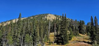
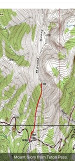
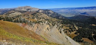
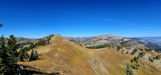
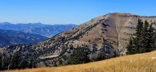
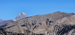
After a few days camped here, it was finally time to move on. We stopped in Jackson Hole, Wyoming and walked the streets through downtown. The dogs.....they love this.....easy walking and lots of back rubs & compliments from the other tourists......me not liking it so much.....so we moved on. We drove south, then west up the Teton Pass to climb another mountain.....Mount Glory (10,086').....

20240924_122715_copy_1600x747.jpg

Screenshot_20241012_080335_Gallery_copy_1200x2573.jpg

This was a short climb.....and a brutal one as well.....

20240924_122823_copy_349x747.jpg

We gained 1,669' of elevation in 0.9 miles.....it's no wonder that this is avalanche territory.....

20240924_131923_copy_349x747.jpg

The other thing that was noteworthy about this climb was its lack of switchbacks.....it literally went straight up that mountain.....

20240924_130847_copy_349x747.jpg

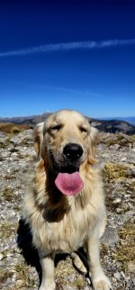
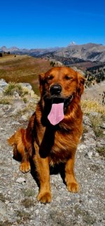
Once on the summit, I got my dog summit shots as I most always do before moving along.....

20240924_134223_copy_349x747.jpg

Screenshot_20241012_080521_Gallery_copy_1200x2573.jpg

If you take a look at the topographic map that I posted, you see that the trail continues on north into the Teton Mountain Range.....

20240924_140520_copy_1600x747.jpg

So we continued on.....to see what we could see.....

20240924_134311_copy_1600x747.jpg
 
Last edited:
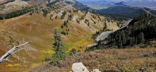
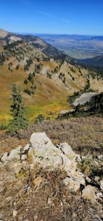
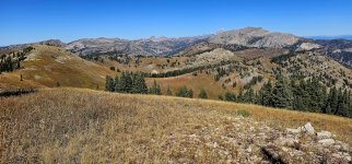
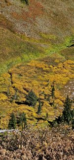
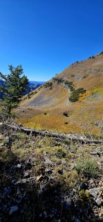
Again, if you look at the topographic map, you'll notice to the east (right side of the picture) that there's a bowl to look down into.....

20240924_141357_copy_1600x747.jpg

20240924_141352_copy_349x747.jpg

20240924_141415_copy_349x747.jpg

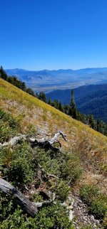
It was an awesome ridgeline that we hiked along now.....my eyes were constantly fixated on that bowl in hopes of spotting some wildlife.....

20240924_141428_copy_1600x747.jpg

20240924_142928_copy_1600x747.jpg

I suspect that we hiked a mile or two beyond the summit.....

20240924_140731_copy_1600x747.jpg

20240924_141412_copy_349x747.jpg

.....before finally turning around. My one concern was that we would enter the Grand Teton National Park.....where my dogs don't belong.....

20240924_140758_copy_1600x747.jpg

We spent that night camped along the highway on a fairly flat spot overlooking the Teton Valley.....and it was pretty darn nice.....minimal highway noise.....so we slept just fine.....

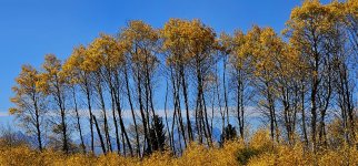
Well, it wasn't quite October.....it was late, late September.....but Fall does come early in the Tetons .....

Screenshot_20241004_200131_Gallery_copy_1600x746.jpg
 
Arjan.....I agree....."the Goldens on top".....certainly one of the best things about this thread are the many Golden pictures.....and the fact that you never see me.....

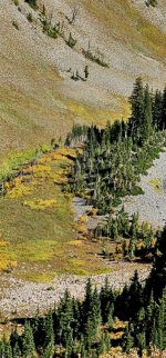
ITTOG.....it was like a river of colors looking down into that bowl.....very observant of you.....


Our next climb on this trip was up Taylor Mountain (10,386').....10 miles with 3,112' of elevation gain.....a bit of a challenge.....

20240925_082720_copy_1200x2570.jpg

The trailhead for this climb was just a short drive from our previous climb.....we drove no more than a mile east from Teton Pass.....down the mountain to start our climb.....

20240925_085529_copy_1200x560.jpg

20240925_085736_copy_1200x2570.jpg


I read online that this was a good trail to hike if you want to spot moose.....

20240925_083414_copy_1200x2570.jpg

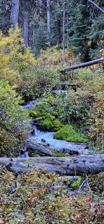
My thought was that the dense folage surrounding Coal Creek would have been a great spot for viewing moose but we saw not a single one.....

20240925_083125_copy_1200x2570.jpg

The truth is.....I didn't care.....

20240925_085001_copy_1200x560.jpg

20240925_084357_copy_1200x560.jpg

20240925_091100_copy_1200x2570.jpg

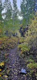
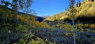
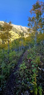
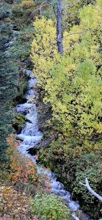
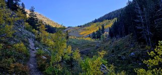
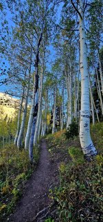
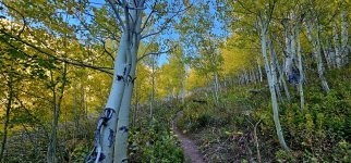
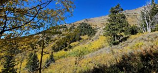
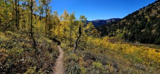
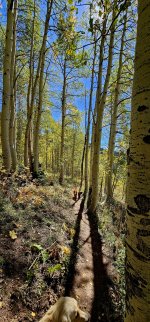
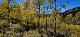
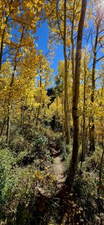
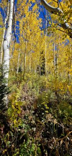
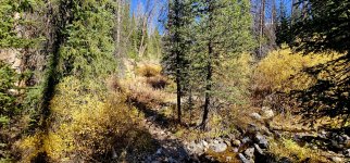
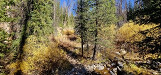
I was just so immersed in, and grateful for, the fall colors that were literally everywhere that I looked.....

20240925_090947_copy_1200x2570.jpg

Sometimes it's just hard to believe how beautiful Mother Nature can be.....

20240925_090536_copy_1200x560.jpg
 
Last edited:

the deputy

Well-known member
The first time I saw this pic it was just another beautiful pic that Jerry took. But this time I noticed the colors in the vegetation and the rock. To make it even better, the rock slide caused the colors to go down the mountain as well. All of it just adds to the beauty.
Same, studied this picture the longest, it's mesmerizing. Those spilled, colorful confluence of small tributaries gaining strength and flowing together as a mighty river into the valley below...seems like something Bob Ross would have attempted to paint.

I'm so glad they got the website straighten out, haven't been able to log on with my tablet for a week. And, viewing these pictures on a phone is criminal...actually, it makes me miss my old laptop.

And if l was a certified owl mind-reader authority...l'd say...that owl looks as though it's wondering what Jerry or Tanner or Trapper would taste like with a touch of Open Pit barbecue sauce...
 
Last edited:
the deputy.....I only see my pictures on my cell phone & I often wonder what they look like on a larger screen. I guess my saving grace is that I saw all of these things in real life.....


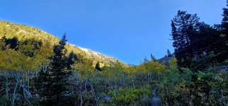
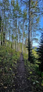
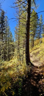
At approximately 8,800' above sea level we left the Quaking Aspen stands behind and hiked through a forest of pines.....

20240925_093053_copy_1200x560.jpg

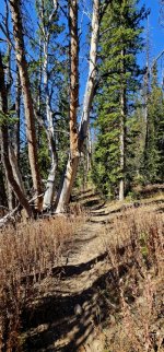
Still, much of the often overlooked forest floor was covered in fall colors.....

20240925_101441_copy_1200x2570.jpg

20240925_094433_copy_1200x2570.jpg

We continued upwards, came to a "Y" in the trail.....we turned east.....continuing our climb to the summit of Taylor Mountain (10,386').....

20240925_115725_copy_1200x2570.jpg

And finally.....after 5 miles of hiking & climbing.....we stood on the summit of that incredible mountain.....

20240925_115711_copy_1200x560.jpg

We kicked back in the rocks.....got as comfy as a man can get while kicking back in a pile of rocks.....

20240925_115743_copy_1200x560.jpg

.....consumed our lunch and dog treats.....and prepared for our descent.....

20240925_115559_copy_1200x2570.jpg

20240925_115701_copy_1200x2570.jpg

It seemed like 50 photographs on the way up would be plenty.....but now the late afternoon light shed a new look on the landscape.....so I continued to photograph Mother Nature the entire way down.....

20240925_133721_copy_1200x560.jpg

20240925_133026_copy_1200x560.jpg
 
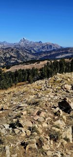
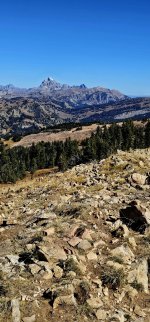
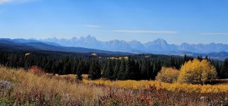
The Teton Mountains.....truly are some of the most remarkable mountains that I've ever seen.....and to be able to view them from a place such as this was a real treat.....just the dogs and I in the wilderness.....no one was here.....

20240925_115711_copy_1200x560.jpg

20240925_115725_copy_1200x2570.jpg

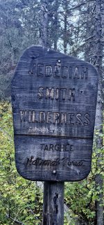
The return hike.....through the Jedediah Smith Wilderness Area was uneventful.....sadly we didn't see a single wild animal that entire day.....not even a single Grizzly Bear.....

20240925_082258_copy_1200x2570.jpg

But that solitude that we so relished.....was soon to change.....

20240925_133721_copy_1200x560.jpg

20240925_134612_copy_1200x560.jpg

20240925_133933_copy_1200x2570.jpg

.....as we would next return to the Teton Valley to view the fall colors in the GrandTeton National Park.....

20240925_134241_copy_1200x560.jpg

20240925_134821_copy_1200x2570.jpg

What a wonderful day that was.....hiking on a cool, crisp Fall day in the Teton Mountains.....

20240925_140302_copy_1200x2570.jpg

20240925_134804_copy_1200x2570.jpg
 

the deputy

Well-known member
I guess my saving grace is that I saw all of these things in real life...
In euchre terms...you just trumped my, and everyone's, ace.

Most-likely, few, probably a handful at most, have stood in so many beautiful places as you and your crew.

Funny, been looking closely at some of the trails in these recent post and thought..."l could walk that"...then you mentioned a 9% grade straight up a mountain side...and thought "l couldn't walk that"..."now, roll down at a high rate of speed"..."and get eaten by the grizzly you are so anxious to find"..."easily".
 

Trailboss

Senior Curmudgeon
Well Jerry, after following your thread for a decade or so, it looks like we were finally in the same vicinity but I didn't know it. I stayed a couple of days in the Bighorns and moved on 9/17 to a dispersed camp along Clark's Fork about 7 miles east of Cooke City. I woke up to the Bear's Tooth highway being closed for the year, and 4" of snow in Cooke City (which mostly melted that day). This is the only day I didn't ride one of my motorcycles. I visited Lamar Valley in the park for a couple of days then moved to a dispersed site south of West Yellowstone on 9/19 so I could do tourist things in the western part of the park for a couple of days.

20240918_084857.jpg

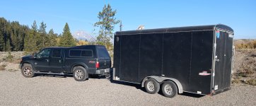
On 9/22, I moved to a Forest Service campground east of the Park on the road to Cody for a couple of days along the North Fork of the Shoshone River so I could come into the eastern park areas. I think there were only 4 campgrounds in the park still open, and they were booked solid, so I had to ride into the park each day on one of my two motorcycles. Since I was staying in my converted cargo trailer, I only paid $25 for 2 nights in this campground outside the East Gate over the entire 18-day trip.

20240926_085858_copy.jpg

On 9/24 I moved camp to a dispersed area near Moran Junction for 3 days and was taking the same Yellowstone and Teton photos as you were, as well as going over the Teton Pass on 9/25, eating lunch in Jackson and visiting the Mountain Man museum in Pinedale (an unexpected gem of a museum). I left Sept 27 for the 3-day, 2K mile journey back to Louisiana. My cellphone photos are nowhere near as good as yours, I must have the settings screwed up.

20240925_112032_crop.jpg

By the way, I believe the "Spire" on the Beartooth Byway in the photo in post #5360 on page 358 is the Beartooth peak for which the Scenic Byway is named. Apologize for the sidetrack, just wish I could have met the Golden kiddies. Oh, and you too!

20240926_104650.jpg
 
the deputy.....since I have no idea what your limitations are, the only suggestion that I might make to you is to give it a try. Many of these mountain hikes start off fairly easy and eventually get steep. I'd guess many (some) of them easily exceed 60% grades. Only you know your limitations.....I find that the real gifts are generally far off the roads.....

Trailboss.....sounds like we probably crossed paths at some point. Your timing was perfect for viewing the fall colors I think (as was mine). It must be hard to return to a home so far away after a trip like the one you just had. I would imagine that all you think about now is returning to those mountains.....that's how it is for me.....


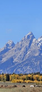
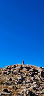
Leaving those mountains, the peaks, and heading back down into the valley was a bitter sweet moment for me. I felt like we wouldn't hike any more trails on this trip as I had come off that last mountain with big blisters on both feet.....the pain was significant (this sure was odd to me.....24 pairs of these same boots I've owned and never once have had this issue with these boots).....
Screenshot_20240925_164245_Gallery_copy_348x747.jpg

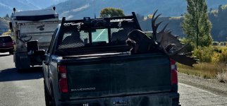
We made our way through Jackson Hole, Wyoming where we finally saw our first moose.....sadly the moose was dead.....taking a ride in a Wyoming DOT pick up truck.....I would suspect a victim of the highway.....
20240926_092303_copy_1600x747.jpg

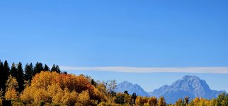
Now it appeared that the remainder of our trip would consist of driving (or would it ?).....mostly driving in Grand Teton National Park.....
20240926_140432_copy_1600x747.jpg

We tried it.....but the crowds.....it was just too much for me.....so I decided to head for the mountains east of town.....closer to Dubois, Wyoming.....
20240926_140531_copy_1600x747.jpg

20240926_140543_copy_1600x747.jpg

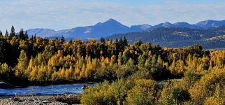
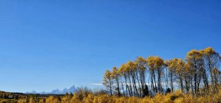
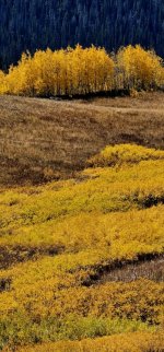
The fall colors along Highway 26 were absolutely stunning in the lower elevations.....yet there were no crowds along this highway.....just had to drive a few miles outside of the park.....
20240926_135012_copy_349x747.jpg

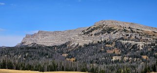
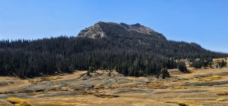
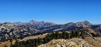
I found myself looking at the mountains on either side of the highway and yearning to get off that highway to see what I could see.....in the next photo you see Breccia Peak (11,010').....just north of Highway 26.....it sure did catch my eye.....hmmmm.....
20240926_122036_copy_1600x747.jpg

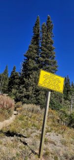
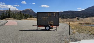
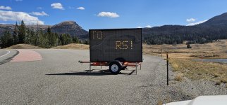
There are plenty of Forest Service roads departing the main highway.....but I really wanted to get into the backcountry.....again. We passed this sign along the highway.....
20240926_133721_copy_1600x747.jpg

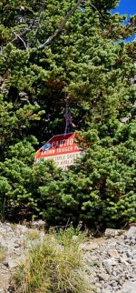
Which actually read "DON'T STOP ON THE HIGHWAY TO VIEW THE BEARS".....no idea why it doesn't show up that way in my pictures.....as it was quite clear from the highway.....
20240926_133720_copy_1600x747.jpg

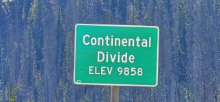
We continued on.....driving to the east.....climbing the mountain.....eventually reaching the Continental Divide.....
20240926_121801_copy_1600x747.jpg
 
Once here, at the Continental Divide, I thought what the heck.....let's give Breccia Peak (11,010') a go.....so we backtracked down the mountain to Togwotee Pass (9,659').....to the start of this hike.....and only a half mile, maybe less, from the bear warning sign.....
20240926_124101_copy_1600x747.jpg

20240926_125319_copy_349x747.jpg


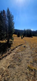
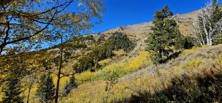
The hike took us through thick pine forests.....nearly void of all the wonderful fall colors at this higher elevation.....

20240926_124101_copy_1600x747.jpg

We crossed multiple creeks as we headed for the summit.....

20240926_124112_copy_349x747.jpg

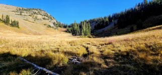
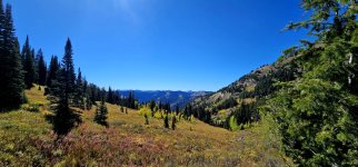
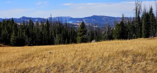
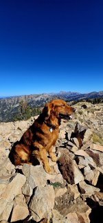
And passed through several beautiful meadows.....
20240926_124924_copy_1600x747.jpg

20240926_124937_copy_349x747.jpg

At some point in this hike.....with both of my feet giving me way too much pain.....and with the lack of amazing fall colors, we finally turned around. No pain.....no gain.....no summit.....there's always another day (hopefully).....
20240926_122212_copy_1600x747.jpg

Once the hike back to the truck was completed.....I decided it was time to go home. Time to heal.....time to shower.....time to relax in one of my favorite dog chairs.....

20240926_091129_copy_1600x747.jpg

20240926_134856_copy_1600x747.jpg

We drove down the mountain.....driving west back into the northern most sections of Grand Teton National Park.....

20240926_105913_copy_349x747.jpg
 

Ace Brown

Retired Ol’ Fart
Brautiful photos as usual. I may have misunderstood your comment about the moose. I read it to mean you’ve never seen a moose in all your travels. Really?

But they sure can be elusive. They say there is 400 of them up on Grand Mesa. Ive lived here for 12 years and get up on the mesa usually weekly yet I’ve never seen one up there. In fact i have seen only a handful in all my travels. Actually i just remembered seeing a small herd in Alaska.

I have a title for the book “you’re never going to write”.

“Just to See What We Can See”.


Sent from my iPhone using Tapatalk
 

the deputy

Well-known member
Safe travels home and enjoy your rest/recovery time...and well deserved shower. Even though, it selfishly saddens me...since your recent travels have 'scratched the itch'...that has been driving me absolutely crazy since l got home.

And yes, you sure timed your visit to prefection, colors were outstanding.

Edit: and thank you for the advice about getting to one of those mountain tops on foot.
 

Forum statistics

Threads
188,337
Messages
2,905,642
Members
229,959
Latest member
bdpkauai
Top