Clark White
Explorer
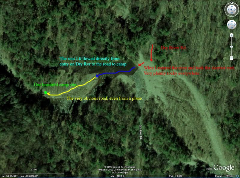
River crossing?
The red arrow was the "trail" that Clark was crossing to.
Which is the sensible crossing assuming there was a trail there?
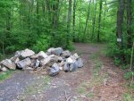
That picture is absolutely meaningless as it shows the same thing in far less efficient fashion then the pictures I have already posted. While you seam to make it seam there is nothing more there then that small rocky spot you can see, there is in fact a perfect little trail leading up that peninsula to an absolutely fabulous camping spot. As I know you are well aware, most every camping spot out there, and most every camping spot in the world, is at the end of a short little trail very much like that one. You can actually get there with far less river crossing by taking Dry River Rd., but that requires driving a very muddy and rutted trail so I cross the rocky creek so as not to further damage the already torn up trail (very plainly following the Tread Lightly Philosophy).
Here's your sign.
As stated, get real. That sign is nowhere near Dry River Rd., and if it were, then would you not be violating the very rules you are mad at me for violating by driving past thatsign in the first place?
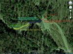
Here is the actual trail that is so hard for some people to find. Sorry for the crappy cell phone pic. Forgot my camera again.
No, I have no trouble finding that trail as that is Dry River Rd. As mentioned, I do NOT go that way to get to the camping site because it would require damaging the road further (not Dry River Rd., the side trail going to the camp site).
I am well aware that the side trails are not on the map, but MANY open and legal trails in that are are NOT on the maps. EVEN DRY RIVER RD. ITS SELF DOES NOT FOLLOW THE MAP! Does that mean that you can't drive the county road anymore? No! The maps were published before the damn and reservoir were made and the trail now takes a different rout, AND IS STILL A LEGAL TRAIL. If that TRAIL that I crossed to is illegal then it must be posted, which is is CLEARLY not. Saying that a VERY clear and for all rights maintained trail is by common knowledge closed and illegal is absolutely ludicrous.
The fact that crossing that pool is illegal is fine, I don't have a problem with that. I did not know it was such a sensitive land use issue in the area and as such, taking the shortest rout seamed perfectly reasonable as it would have no detrimental effect on the location (we all seam to have agreed on that fact!). I now know that for legal reasons I will cross 20yrds down stream, which is JUST FINE WITH ME. However, as yet you have not shown one tiny, even microscopic spec of evidence to even indicate no less prove that that trail on the peninsula is closed. My, or anyone elses driving that trail, even if it is only 100yrds long (which is kind of the point, its 100yrds long, it's limited access, and that makes it perfect for camping), has ABSOLUTELY no detrimental effect on that peninsula. If we were plowing over bushes, trees, shrubs, what have you to do so, then yes, that would be illegal and I should be shunned for it. BUT I DID NONE OF THAT. My driving a perfectly respectable, AND STAYING ON THAT TRAILS, is in no way related to why Tellico was closed.
Clark